The B67 6 postcode sector is within the county of West Midlands.
Did you know? According to the 2021 Census, the B67 6 postcode sector is home to a bustling 12,100 residents!
Given that each sector allows for 400 unique postcode combinations. Letters C, I, K, M, O and V are not allowed in the last two letters of a postcode. With 179 postcodes already in use, this leaves 221 units available.
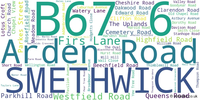
The B67 6 postal code covers the settlement of SMETHWICK.
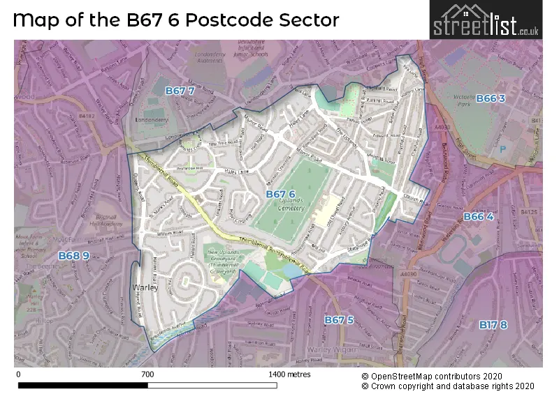
The B67 6 Postcode shares a border with B66 4 (SMETHWICK), B67 7 (SMETHWICK), B68 9 (OLDBURY), B66 3 (SMETHWICK, French Walls) and B67 5 (SMETHWICK).
The sector is within the post town of SMETHWICK.
B67 6 is a postcode sector within the B67 postcode district which is within the B Birmingham postcode area.
The Royal Mail delivery office for the B67 6 postal sector is the Smethwick Delivery Office.
The area of the B67 6 postcode sector is 0.59 square miles which is 1.52 square kilometres or 375.37 square acres.
Waterways within the B67 6 postcode sector include the Thimblemill Brook.

Map of the B67 6 Postcode Sector
Explore the B67 6 postcode sector by using our free interactive map.
| B | 6 | 7 | - | 6 | X | X |
| B | 6 | 7 | Space | 6 | Letter | Letter |
Official List of Streets
SMETHWICK (64 Streets)
Unofficial Streets or Alternative Spellings
Weather Forecast for B67 6
Press Button to Show Forecast for Londonderry (West Midlands)
| Time Period | Icon | Description | Temperature | Rain Probability | Wind |
|---|---|---|---|---|---|
| 09:00 to 12:00 | Heavy rain | 4.0°C (feels like -1.0°C) | 88.00% | NW 13 mph | |
| 12:00 to 15:00 | Heavy rain | 6.0°C (feels like 2.0°C) | 79.00% | WNW 13 mph | |
| 15:00 to 18:00 | Light rain | 8.0°C (feels like 5.0°C) | 47.00% | WNW 11 mph | |
| 18:00 to 21:00 | Cloudy | 9.0°C (feels like 7.0°C) | 7.00% | W 9 mph | |
| 21:00 to 00:00 | Clear night | 6.0°C (feels like 4.0°C) | 0.00% | SW 9 mph |
Press Button to Show Forecast for Londonderry (West Midlands)
| Time Period | Icon | Description | Temperature | Rain Probability | Wind |
|---|---|---|---|---|---|
| 00:00 to 03:00 | Clear night | 5.0°C (feels like 1.0°C) | 0.00% | SSW 9 mph | |
| 03:00 to 06:00 | Clear night | 4.0°C (feels like 0.0°C) | 2.00% | SSW 11 mph | |
| 06:00 to 09:00 | Sunny day | 5.0°C (feels like 1.0°C) | 1.00% | S 11 mph | |
| 09:00 to 12:00 | Partly cloudy (day) | 10.0°C (feels like 7.0°C) | 3.00% | S 13 mph | |
| 12:00 to 15:00 | Cloudy | 12.0°C (feels like 9.0°C) | 8.00% | S 16 mph | |
| 15:00 to 18:00 | Cloudy | 13.0°C (feels like 9.0°C) | 9.00% | S 18 mph | |
| 18:00 to 21:00 | Partly cloudy (day) | 11.0°C (feels like 9.0°C) | 5.00% | S 16 mph | |
| 21:00 to 00:00 | Partly cloudy (night) | 9.0°C (feels like 6.0°C) | 3.00% | SSE 13 mph |
Press Button to Show Forecast for Londonderry (West Midlands)
| Time Period | Icon | Description | Temperature | Rain Probability | Wind |
|---|---|---|---|---|---|
| 00:00 to 03:00 | Clear night | 8.0°C (feels like 5.0°C) | 3.00% | SSE 13 mph | |
| 03:00 to 06:00 | Clear night | 7.0°C (feels like 4.0°C) | 3.00% | SE 13 mph | |
| 06:00 to 09:00 | Sunny day | 7.0°C (feels like 4.0°C) | 3.00% | SE 13 mph | |
| 09:00 to 12:00 | Sunny day | 12.0°C (feels like 9.0°C) | 4.00% | SE 13 mph | |
| 12:00 to 15:00 | Partly cloudy (day) | 15.0°C (feels like 11.0°C) | 6.00% | SE 16 mph | |
| 15:00 to 18:00 | Partly cloudy (day) | 15.0°C (feels like 12.0°C) | 8.00% | SE 16 mph | |
| 18:00 to 21:00 | Partly cloudy (day) | 14.0°C (feels like 12.0°C) | 7.00% | SE 11 mph | |
| 21:00 to 00:00 | Cloudy | 11.0°C (feels like 9.0°C) | 9.00% | SE 9 mph |
Press Button to Show Forecast for Londonderry (West Midlands)
| Time Period | Icon | Description | Temperature | Rain Probability | Wind |
|---|---|---|---|---|---|
| 00:00 to 03:00 | Cloudy | 10.0°C (feels like 8.0°C) | 8.00% | ESE 9 mph | |
| 03:00 to 06:00 | Cloudy | 9.0°C (feels like 7.0°C) | 11.00% | E 7 mph | |
| 06:00 to 09:00 | Cloudy | 9.0°C (feels like 8.0°C) | 14.00% | E 7 mph | |
| 09:00 to 12:00 | Overcast | 12.0°C (feels like 11.0°C) | 17.00% | E 7 mph | |
| 12:00 to 15:00 | Cloudy | 14.0°C (feels like 13.0°C) | 15.00% | E 9 mph | |
| 15:00 to 18:00 | Light rain shower (day) | 15.0°C (feels like 14.0°C) | 36.00% | E 9 mph | |
| 18:00 to 21:00 | Cloudy | 15.0°C (feels like 13.0°C) | 17.00% | ESE 9 mph | |
| 21:00 to 00:00 | Cloudy | 12.0°C (feels like 11.0°C) | 14.00% | NE 9 mph |
Schools and Places of Education Within the B67 6 Postcode Sector
Annie Lennard Primary School
Community school
The Oval, Smethwick, West Midlands, B67 6LE
Head: Mrs Natalie Crozier
Ofsted Rating: Good
Inspection: 2019-07-03 (1761 days ago)
Website: Visit Annie Lennard Primary School Website
Phone: 01214294284
Number of Pupils: 222
Uplands Manor Primary School and Nursery
Community school
Addenbrooke Road, Smethwick, West Midlands, B67 6HT
Head: Mr Andrew Dickinson
Ofsted Rating: Good
Inspection: 2023-05-17 (347 days ago)
Website: Visit Uplands Manor Primary School and Nursery Website
Phone: 01215581602
Number of Pupils: 844
House Prices in the B67 6 Postcode Sector
| Type of Property | 2018 Average | 2018 Sales | 2017 Average | 2017 Sales | 2016 Average | 2016 Sales | 2015 Average | 2015 Sales |
|---|---|---|---|---|---|---|---|---|
| Detached | £101,000 | 1 | £0 | 0 | £241,833 | 3 | £242,993 | 7 |
| Semi-Detached | £160,033 | 36 | £137,041 | 54 | £136,196 | 24 | £128,348 | 30 |
| Terraced | £127,673 | 60 | £109,990 | 70 | £111,952 | 77 | £98,554 | 64 |
| Flats | £85,000 | 1 | £72,000 | 1 | £107,000 | 1 | £0 | 0 |
Important Postcodes B67 6 in the Postcode Sector
B67 6AL is the postcode for The Bridge Centre, Arden Road
B67 6HT is the postcode for Uplands Manor Primary School, Addenbrooke Road
B67 6LE is the postcode for Annie Lennard Infant School, The Oval, and Annie Lennard Primary School, The Oval
B67 6ND is the postcode for Community Centre, Hurst Road
| The B67 6 Sector is within these Local Authorities |
|
|---|---|
| The B67 6 Sector is within these Counties |
|
| The B67 6 Sector is within these Water Company Areas |
|