Map of Denbigh Crescent
| Postcodes | ||
|---|---|---|
| Icon | Postcodes for Denbigh Crescent | |
| Walking Distances | ||
| Distance Info | Green Circle = 10 Minutes Walk (800 metres) | |
About Denbigh Crescent
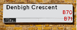
Denbigh Crescent is a street located in the town of West Bromwich. It uses the postcode B71 2RU. The street has a length of approximately 180 metres.
Denbigh Crescent is located within the Sandwell District (B) Council's jurisdiction. They provide various services, like refuse collection, and manage council tax collection. It's situated in the West Midlands region of the UK.
Denbigh Crescent has been assigned the Unique Street Reference Number of 33614560 in the National Street Gazetteer.
Denbigh Crescent is located within the county of West Midlands, situated in the West Midlands region of the UK. It's 107.96 miles North West from central London., 5.81 miles North West from Birmingham, 22.73 miles West from Coventry and 25.23 miles North from Worcester.

Do you know why this road is called Denbigh Crescent?
What's it like to live here?
Ask the community a question about Denbigh Crescent.
Do you have any questions, memories to share or know any facts about Denbigh Crescent? We'd love to know more.
Also on streetlist.co.uk, can you help?
Swing Swang Lane
28th April 2024
I am trying to find out why the lane is named Swing Swang?
It has been known known this since at least 1905 when hedge making contents used to be held here.
Swing Swang is often used to describe a fairground ride. I remember Swing Boats. Were they a bit like this or is Swing Swang another name for swings?
Swing Swangs are also mentioned in connection to orchards. Or were orchards just good places to have swings?
Estate Agents near Denbigh Crescent
| Name | Address | Website |
|---|---|---|
| PRS Property | 28 Sydney Close, West Bromwich,B70 0SR | |
| John Miller | 386 High Street, West Bromwich,B70 9LB | Visit Website |
| Support Move | 384 High Street, West Bromwich,B70 9LB | Visit Website |
We have found 1 postcode for Denbigh Crescent
Location Details
| Denbigh Crescent | |
|---|---|

| |
| Latitude | 52.533449 |
| Longitude | -2.006587 |
| OS Easting (X): | 399553 |
| OS Northing (Y): | 292882 |
| OS Grid Reference: | SO996929 |
Neighbourhood Policing |
| Police Force: West Midlands |
 View Neighbourhood Crime and Policing View Neighbourhood Crime and Policing |
| Find a Local Neighbourhood Watch Scheme |
Frequently asked Questions for Denbigh Crescent
What Council (Local Authority) is Denbigh Crescent in?
Denbigh Crescent is located within the local authority area of Sandwell Council which is a Metropolitan District.
What Parish Council is Denbigh Crescent in?
Denbigh Crescent is in an unparished area.
What Electoral Ward is Denbigh Crescent in?
Denbigh Crescent is located within the ward of Hateley Heath.
What County is Denbigh Crescent in?
Denbigh Crescent is located within the ceremonial county of West Midlands.
What Constituency is Denbigh Crescent in?
Denbigh Crescent is located within the constituency of West Bromwich East.
What Part of the UK is Denbigh Crescent in?
Denbigh Crescent is located within the West Midlands (England) region of the United Kingdom.
What County Council area is Denbigh Crescent in?
Denbigh Crescent is located within the West Midlands Council area.
What Police Force area is Denbigh Crescent in?
Denbigh Crescent is located within the West Midlands Police area.
Roads that have a Junction with Denbigh Crescent
| Street | Junction Type |
|---|---|
| Denbigh Drive | junction |
| Denbigh Drive | junction |
Sunset and Sunrise times for Denbigh Crescent , B71 2RU
| Sunrise | 05:13 |
|---|---|
| Sunset | 20:55 |
Latest Weather Conditions for Denbigh Crescent, B71 2RU
| Observed at Weather Station: | Coleshill 12 May 2024 at 22:00 (13.86 miles away) |
|---|---|
| Current Weather: | Clear night |
| Temperature and Humidity: | 16.7°C (83.5%) |
| Wind Direction and Speed: | S (8 mph) |
Population Statistics
| ONS Area Code | E00050547 |
|---|---|
| ONS Area Name | Private Renting Young Families |
| Average Age | 37.44 |
| Area Population | 2204.00 |
| Male Population | 1054.00 (48%) |
| Female Population | 1150.00 (52%) |
| Benefit Claimants | 80 (4%) |
| LSOA Code: | E01009991 |
|---|---|
| LSOA Name: | Sandwell 010A |
| SOA Code: | 7a |
| SOA Name: | |
| MSOA Code: | E02002052 |
| MSOA Name: | Sandwell 010 |
Nearest Supermarkets
| Asda Great Bridge |
|---|
| Brickhouse Lane, Tipton, DY4 7HW |
| 0121 521 5330 |
| Distance: 0.93 Miles |
| Directions from Denbigh Crescent to Asda Great Bridge |
| Tesco West Bromwich Extra |
|---|
| 46 New Square, West Bromwich, B70 7PR |
| 0345 610 2894 |
| Distance: 1.11 Miles |
| Directions from Denbigh Crescent to Tesco West Bromwich Extra |
| Tesco Sandwell Stone Cross Express |
|---|
| 247-249 Walsall Rd, Sandwell, West Bromwich, B71 3HS |
| 0345 026 9705 |
| Distance: 1.22 Miles |
| Directions from Denbigh Crescent to Tesco Sandwell Stone Cross Express |
| Iceland West Bromwich |
|---|
| 21/21a Kings Square, Sandwell Centre, West Bromwich, B70 7NN |
| 01215257475 |
| Distance: 1.23 Miles |
| Directions from Denbigh Crescent to Iceland West Bromwich |
Telephone Information
| Area Code |
|---|
| Area Code: 01384 - Dudley |
| Area Code: 01922 - Walsall |
| Area Code: 0121 - Birmingham |
| Area Code: 01902 - Wolverhampton |
Broadband Information
| Speed | Average Speed | Median Speed | Maximum Speed | Next-generation access (NGA) | Number of Connections |
|---|---|---|---|---|---|
| Less than 2 Mbps | 16 | 14.6 | >=30 | Y | 12 |
Local Government
| Local Council Details |
|---|
| Within the area of Sandwell |
| Visit the Council's Website |
| Sandwell Council House, PO Box 2374, Oldbury, West Midlands &B69 3DE |
| Send email |
| Telephone Number: 0845 358 2200 |
| Local Member of Parliament |
|---|
| Within the Westminster Parliamentary Constituency of West Bromwich East |
| The Member of Parliament is Nicola Richards |
| Details for the MP Nicola Richards on parliament.uk |
| Details for the MP Nicola Richards on theyworkforyou.com |
| In the 2019 General Election Nicola Richards won with a majority of 1,593 the result was Con gain from Lab. The total electorate was 62,046 |
| Wards, Parish Councils and County Councils |
|---|
| Ward: Hateley Heath Ward |
| Ceremonial County: West Midlands |
Nearest Schools
England Primary Schools
Eaton Valley Primary School
Address: Eaton Valley Primary School, Dagger Lane, West Bromwich, West Midlands, B71 4BU
Distance: 1.06 miles
Contact: 01215531593
St Mary Magdalene CofE Voluntary Controlled Primary School
Address: St Mary Magdalene CofE Voluntary Controlled Primary School, Stanway Road, West Bromwich, West Midlands, B71 1RP
Distance: 0.84 miles
Contact: 01215882371
Hall Green Primary School
Address: Hall Green Primary School, Westminster Road, West Bromwich, West Midlands, B71 2JQ
Distance: 1.02 miles
Contact: 01215882080
King George V Primary School
Address: King George V Primary School, Beeches Road, West Bromwich, West Midlands, B70 6JA
Distance: 1.32 miles
Contact: 01215530060
Pennyhill Primary School
Address: Pennyhill Primary School, Hollyhedge Road, Pennyhill Primary School, West Bromwich, West Midlands, B71 3BU
Distance: 1.20 miles
Contact: 01215882230
Hargate Primary School
Address: Hargate Primary School, Hargate Lane, West Bromwich, West Midlands, B71 1PG
Distance: 0.76 miles
Contact: 01215534178
Moorlands Primary School
Address: Moorlands Primary School, Winchester Road, West Bromwich, West Midlands, B71 2NZ
Distance: 0.72 miles
Contact: 01215560352
Harvills Hawthorn Primary School
Address: Harvills Hawthorn Primary School, Wolseley Road, Hill Top, West Bromwich, West Midlands, B70 0NG
Distance: 0.64 miles
Contact: 01215571034
St John Bosco Catholic Primary School
Address: St John Bosco Catholic Primary School, Monmouth Drive, West Bromwich, West Midlands, B71 2ST
Distance: 0.38 miles
Contact:
Hateley Heath Primary School
Address: Hateley Heath Primary School, Huntingdon Road, West Bromwich, West Midlands, B71 2RP
Distance: 0.21 miles
Contact:
Lyng Primary School
Address: Lyng Primary School, Horton Street, West Bromwich, West Midlands, B70 7SQ
Distance: 1.54 miles
Contact: 01215531480
Lodge Primary School
Address: Lodge Primary School, Oak Lane, West Bromwich, West Midlands, B70 8PN
Distance: 1.10 miles
Contact: 01215532389
All Saints CofE Primary School
Address: All Saints CofE Primary School, Wilford Road, West Bromwich, West Midlands, B71 1QN
Distance: 0.62 miles
Contact: 01215670033
Hanbury Primary School
Address: Hanbury Primary School, 2 Hanbury Road, West Bromwich, West Midlands, B70 9NT
Distance: 1.07 miles
Contact: 01215531427
St John's Church of England Primary Academy
Address: St John's Church of England Primary Academy, Addison Terrace, Wednesbury, West Midlands, WS10 9AR
Distance: 1.32 miles
Contact: 01215560269
Albert Pritchard Infant School
Address: Albert Pritchard Infant School, Crew Road, Wednesbury, West Midlands, WS10 9QG
Distance: 1.99 miles
Contact: 01215560858
Ryders Green Primary School
Address: Ryders Green Primary School, Claypit Lane, West Bromwich, West Midlands, B70 9UJ
Distance: 0.78 miles
Contact: 01215530658
Wood Green Junior School
Address: Wood Green Junior School, Hobs Road, Wednesbury, West Midlands, WS10 9BW
Distance: 1.88 miles
Contact: 01215560377
Newtown Primary School
Address: Newtown Primary School, Anne Close, Off Dunkirk Avenue, West Bromwich, West Midlands, B70 0ES
Distance: 1.32 miles
Contact:
St Mary's Catholic Primary School
Address: St Mary's Catholic Primary School, Manor House Road, Wednesbury, West Midlands, WS10 9PN
Distance: 1.76 miles
Contact:
Old Park Primary School
Address: Old Park Primary School, Old Park Road, Wednesbury, West Midlands, WS10 9LX
Distance: 2.04 miles
Contact: 01215262669
Kings Hill Primary School
Address: Kings Hill Primary School, Old Park Road, Wednesbury, West Midlands, WS10 9JG
Distance: 2.43 miles
Contact: 01215686301
Holyhead Primary Academy
Address: Holyhead Primary Academy, Holyhead Road, Wednesbury, West Midlands, WS10 7PZ
Distance: 1.73 miles
Contact: 01215560114
Holyhead Primary School
Address: Holyhead Primary School, Holyhead Road, Wednesbury, West Midlands, WS10 7PZ
Distance: 1.73 miles
Contact:
Great Bridge Primary School
Address: Great Bridge Primary School, Mount Street, Great Bridge, Great Bridge Junior & Infant School, Tipton, West Midlands, DY4 7DE
Distance: 1.37 miles
Contact: 01215571526
Ocker Hill Junior School
Address: Ocker Hill Junior School, Gospel Oak Road, Tipton, West Midlands, DY4 0DS
Distance: 1.69 miles
Contact:
Ocker Hill Infant School
Address: Ocker Hill Infant School, Gospel Oak Road, Tipton, West Midlands, DY4 0DS
Distance: 1.69 miles
Contact: 01215561119
Joseph Turner Primary School
Address: Joseph Turner Primary School, Powis Avenue, Tipton, West Midlands, DY4 0RN
Distance: 2.07 miles
Contact: 01215578733
Summerhill Primary Academy
Address: Summerhill Primary Academy, Upper Church Lane, Tipton, West Midlands, DY4 9PF
Distance: 2.14 miles
Contact: 01215573282
Summerhill Primary School
Address: Summerhill Primary School, Upper Church Lane, Tipton, West Midlands, DY4 9PF
Distance: 2.14 miles
Contact:
St Martin's CofE Primary School
Address: St Martin's CofE Primary School, Lower Church Lane, Tipton, West Midlands, DY4 7PG
Distance: 1.91 miles
Contact: 01215571543
England Higher Schools
Sandwell College
Address: Sandwell College, 1 Spon Lane, West Bromwich, West Midlands, B70 6AW
Distance: 1.41 miles
Contact: 01216675000
England Secondary Schools
Wodensborough Ormiston Academy
Address: Wodensborough Ormiston Academy, Hydes Road, Wednesbury, West Midlands, WS10 0DR
Distance: 1.03 miles
Contact: 01215064300
The Phoenix Collegiate
Address: The Phoenix Collegiate, Clarkes Lane, West Bromwich, West Midlands, B71 2BX
Distance: 0.58 miles
Contact: 01215888384
Shireland Biomedical Utc
Address: Shireland Biomedical Utc, 350 High Street, West Bromwich, West Midlands, B70 8DJ
Distance: 0.93 miles
Contact: 01218281123
George Salter Academy
Address: George Salter Academy, Davey Road, West Bromwich, West Midlands, B70 9UW
Distance: 0.58 miles
Contact: 01215534665
The ACE Academy
Address: The ACE Academy, Alexandra Road, Tipton, West Midlands, DY4 7NR
Distance: 1.83 miles
Contact:
Nearest Hospitals
| Name | Address | Postcode | Distance | Map |
|---|
Nearest Dentists
Dentists near Denbigh Crescent
| Name | Address | Postcode | Distance | Map |
|---|
Nearest GP Surgeries
Doctors near Denbigh Crescent
DR GUDI PV & PARTNER
Address: 68 HILL TOP, WEST BROMWICH, WEST MIDLANDS, B70 0PU
Distance: 0.24 miles
Contact: tel: 0121 5560455
NEW STREET SURGERY
Address: NEW STREET, HILL TOP, WEST BROMWICH, WEST MIDLANDS, B70 0HN
Distance: 0.35 miles
Contact: tel: 0121 5560190
SAI SURGERY BRANCH
Address: 1A CORDLEY STREET, WEST BROMWICH, WEST MIDLANDS, B70 9NQ
Distance: 0.64 miles
Contact: :
MALLING HEALTH CENTRE SANDWELL
Address: PARSONAGE STREET, WEST BROMWICH, B71 4DL
Distance: 0.82 miles
Contact: :
LYNDON PRIMARY CARE CENTRE
Address: LOWER LYNDON, WEST BROMWICH, B71 4HJ
Distance: 0.83 miles
Contact: :
DARTMOUTH MEDICAL CENTRE
Address: 1 RICHARD STREET, WEST BROMWICH, B70 9JL
Distance: 0.90 miles
Contact: :
Nearest Dispensing Chemists
Pharmacies near Denbigh Crescent
| Name | Address | Postcode | Telephone | Map | Distance in Km |
|---|
Nearest Opticians
Opticians near Denbigh Crescent
HILL TOP OPTICIANS
Address: 106 HILL TOP, WEST BROMWICH, WEST MIDLANDS, B70 0SH
Distance: 0.45 miles
Contact: :
STOKES OPTICIANS
Address: 2,4 & 6 CARTERS GREEN, WEST BROMWICH, WEST MIDLANDS, B70 9LW
Distance: 0.67 miles
Contact: :
4657 GREAT BRIDGE
Address: ASDA STORES LTD, BRICKHOUSE LANE SOUTH, GREAT BRIDGE, TIPTON, WEST MIDLANDS, DY4 7HW
Distance: 1.05 miles
Contact: :
S P H OPTICIANS
Address: 18 GREAT BRIDGE, TIPTON, WEST MIDLANDS, DY4 7HA
Distance: 1.09 miles
Contact: :
EYE STYLE OPTICIANS (MIDLANDS) LTD
Address: 71A GREAT BRIDGE, TIPTON, WEST MIDLANDS, DY4 7HF
Distance: 1.11 miles
Contact: :
WEST BROMWICH EXTRA
Address: 46 NEW SQUARE, WEST BROMWICH, WEST MIDLANDS, B70 7PR
Distance: 1.11 miles
Contact: :
Transport
Nearest Rail Stations
Sandwell & Dudley Station is 1.73 miles away.
Address: Sandwell & Dudley station, Bromford Road, West Bromwich, West Midlands, B70 7JD
Sandwell & Dudley is situated on the Rugby�Birmingham�Stafford line|West Coast Main Line.
Sandwell & Dudley Station is staffed on a full time basis.
Directions from Denbigh Crescent to Sandwell & Dudley Rail Station
Tame Bridge Parkway Station is 1.86 miles away.
Address: Tame Bridge Parkway station, Walsall Road, Friar Park, Wednesbury, WS10 0LD
Tame Bridge Parkway is situated on the Chase Line.
Tame Bridge Parkway Station is staffed on a part time basis.
Directions from Denbigh Crescent to Tame Bridge Parkway Rail Station