Map of Green Lanes
| Postcodes | ||
|---|---|---|
| Icon | Postcodes for Green Lanes | |
| Walking Distances | ||
| Distance Info | Green Circle = 10 Minutes Walk (800 metres) | |
About Green Lanes
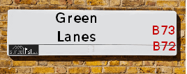
Green Lanes is a street located in the town of Royal Sutton Coldfield. The street has a length of approximately 1,382 metres.
Green Lanes is located within the Birmingham District (B) Council's jurisdiction. They provide various services, like refuse collection, and manage council tax collection. It's situated in the West Midlands region of the UK.
Green Lanes has been assigned the Unique Street Reference Number of 2707899 in the National Street Gazetteer.
Green Lanes is located within the county of West Midlands, situated in the West Midlands region of the UK. It's 102.77 miles North West from central London., 5.25 miles North East from Birmingham, 16.35 miles North West from Coventry and 29.21 miles North East from Worcester.

Do you know why this road is called Green Lanes?
What's it like to live here?
Ask the community a question about Green Lanes.
Do you have any questions, memories to share or know any facts about Green Lanes? We'd love to know more.
Also on streetlist.co.uk, can you help?
Swing Swang Lane
28th April 2024
I am trying to find out why the lane is named Swing Swang?
It has been known known this since at least 1905 when hedge making contents used to be held here.
Swing Swang is often used to describe a fairground ride. I remember Swing Boats. Were they a bit like this or is Swing Swang another name for swings?
Swing Swangs are also mentioned in connection to orchards. Or were orchards just good places to have swings?
Estate Agents near Green Lanes
| Name | Address | Website |
|---|---|---|
| Acres | 417 Birmingham Road, Wylde Green, Sutton Coldfield, B72 1AU | Visit Website |
| Belvoir | 170 Jockey Road, Sutton Coldfield, B73 5PN | Visit Website |
| Belvoir Sales | 170 Jockey Road, Sutton Coldfield, B73 5PN | Visit Website |
Location Details
| Green Lanes | |
|---|---|

| |
| Latitude | 52.541044 |
| Longitude | -1.828943 |
| OS Easting (X): | 411599 |
| OS Northing (Y): | 293741 |
| OS Grid Reference: | SP116937 |
Neighbourhood Policing |
| Police Force: West Midlands |
 View Neighbourhood Crime and Policing View Neighbourhood Crime and Policing |
| Find a Local Neighbourhood Watch Scheme |
Frequently asked Questions for Green Lanes
What Council (Local Authority) is Green Lanes in?
Green Lanes is located within the local authority area of Birmingham Council which is a Metropolitan District.
What Parish Council is Green Lanes in?
Green Lanes is in an unparished area.
What Electoral Ward is Green Lanes in?
Green Lanes is located within the ward of Sutton Wylde Green.
What County is Green Lanes in?
Green Lanes is located within the ceremonial county of West Midlands.
What Constituency is Green Lanes in?
Green Lanes is located within the constituency of Sutton Coldfield.
What Part of the UK is Green Lanes in?
Green Lanes is located within the West Midlands (England) region of the United Kingdom.
What County Council area is Green Lanes in?
Green Lanes is located within the West Midlands Council area.
What Police Force area is Green Lanes in?
Green Lanes is located within the West Midlands Police area.
Roads that have a Junction with Green Lanes
| Street | Junction Type |
|---|---|
| Birmingham Road (A5127) | junction |
| Henley Close | junction |
| Cambridge Avenue | junction |
| The Boulevard | junction |
| Little Green Lanes | junction |
| Lime Grove | junction |
| Chester Road (A452) | junction |
Sunset and Sunrise times for Green Lanes
| Sunrise | 05:12 |
|---|---|
| Sunset | 20:54 |
Latest Weather Conditions for Green Lanes
| Observed at Weather Station: | Coleshill 11 May 2024 at 23:00 (7.24 miles away) |
|---|---|
| Current Weather: | Clear night |
| Temperature and Humidity: | 14.6°C (79.9%) |
| Wind Direction and Speed: | ESE (3 mph) |
Population Statistics
| ONS Area Code | E00047955, E00047958, E00047948 & E00047939 |
|---|---|
| ONS Area Name | Multi-Ethnic Suburbia, Families in Terraces and Flats, Detached Retirement Living & Indian Tech Achievers |
| Average Age | 42.31 & 43.35 |
| Area Population | 1680.00 & 1649.00 |
| Male Population | 819.00 & 795.00 (48%) |
| Female Population | 861.00 & 854.00 (52%) |
| Benefit Claimants | 26 & 11 (1%) |
| LSOA Code: | E01009462 &E01009459 |
|---|---|
| LSOA Name: | Birmingham 018F &Birmingham 015B |
| SOA Code: | 3d &8a |
| SOA Name: | |
| MSOA Code: | E02001844 &E02001841 |
| MSOA Name: | Birmingham 018 &Birmingham 015 |
Nearest Supermarkets
| Sainsburys Wylde Green Local |
|---|
| 346 Birmingham Road, Sutton Coldfield, England, B72 1YH |
| 1213824675 |
| Distance: 0.3 Miles |
| Directions from Green Lanes to Sainsburys Wylde Green Local |
| Tesco Erdington Esso Express |
|---|
| 125 Sutton Rd, Erdington, Birmingham, B23 5TW |
| 0345 677 9781 |
| Distance: 0.51 Miles |
| Directions from Green Lanes to Tesco Erdington Esso Express |
| Tesco Boldmere Rd Express |
|---|
| 120 Boldmere Rd, Sutton Coldfield, B73 5UB |
| 0345 671 9618 |
| Distance: 0.65 Miles |
| Directions from Green Lanes to Tesco Boldmere Rd Express |
| Sainsburys Sutton Coldfield Boldmere Road Local |
|---|
| 36-38 Boldmere Road, Sutton Coldfield, England, B73 5TD |
| 1213551483 |
| Distance: 0.8 Miles |
| Directions from Green Lanes to Sainsburys Sutton Coldfield Boldmere Road Local |
Telephone Information
| Dialling Code | Telephone Exchange | Telephone Cabinet | Fibre to the Cabinet or Fibre to the Premises |
|---|---|---|---|
| 0121 | SUTTON COLDFIELD - CMSUT | P68 | FTTC |
Broadband Information
| Speed | Average Speed | Median Speed | Maximum Speed | Next-generation access (NGA) | Number of Connections |
|---|---|---|---|---|---|
| Less than 2 Mbps | 22.5 | 9.2 | >=30 | Y | 47 |
Local Government
| Local Council Details |
|---|
| Within the area of Birmingham |
| Visit the Council's Website |
| Council House, Victoria Square, Birmingham &B1 1BB |
| Send email |
| Telephone Number: 0121 303 1111 |
| Local Member of Parliament |
|---|
| Within the Westminster Parliamentary Constituency of Sutton Coldfield |
| The Member of Parliament is Andrew Mitchell |
| Details for the MP Andrew Mitchell on parliament.uk |
| Details for the MP Andrew Mitchell on theyworkforyou.com |
| In the 2019 General Election Andrew Mitchell won with a majority of 19,272 the result was Con hold. The total electorate was 75,638 |
| Wards, Parish Councils and County Councils |
|---|
| Ward: Sutton Wylde Green Ward |
| Ceremonial County: West Midlands |
Nearest Schools
England Primary Schools
Walmley Infant School
Address: Walmley Infant School, Walmley Ash Road, Walmley, Sutton Coldfield, West Midlands, B76 1JB
Distance: 1.64 miles
Contact: 01213511355
Walmley Junior School
Address: Walmley Junior School, Walmley Ash Road, Sutton Coldfield, West Midlands, B76 1JB
Distance: 1.64 miles
Contact: 01213511346
Paget Primary School
Address: Paget Primary School, Paget Road, Pype Hayes, Birmingham, West Midlands, B24 0JP
Distance: 1.34 miles
Contact: 01214643902
Gunter Primary School
Address: Gunter Primary School, Gunter Road, Birmingham, West Midlands, B24 0RU
Distance: 1.65 miles
Contact: 01214642367
Penns Primary School
Address: Penns Primary School, Berwood Road, Sutton Coldfield, West Midlands, B72 1BS
Distance: 0.76 miles
Contact: 01214648014
Maney Hill Primary School
Address: Maney Hill Primary School, Maney Hill Road, Sutton Coldfield, West Midlands, B72 1JU
Distance: 0.82 miles
Contact: 01214649673
Holland House Infant School and Nursery
Address: Holland House Infant School and Nursery, Holland Road, Sutton Coldfield, West Midlands, B72 1RE
Distance: 1.23 miles
Contact:
Saint Barnabas Church of England Primary School
Address: Saint Barnabas Church of England Primary School, Spring Lane, Erdington, Birmingham, West Midlands, B24 9BY
Distance: 1.37 miles
Contact:
Wylde Green Primary School
Address: Wylde Green Primary School, Green Lanes, Sutton Coldfield, West Midlands, B73 5JL
Distance: 0.27 miles
Contact: 01213732691
Abbey Catholic Primary School
Address: Abbey Catholic Primary School, Sutton Road, Erdington, Birmingham, West Midlands, B23 6QL
Distance: 0.89 miles
Contact:
Boldmere Infant School and Nursery
Address: Boldmere Infant School and Nursery, Cofield Road, Sutton Coldfield, West Midlands, B73 5SD
Distance: 0.63 miles
Contact: 01214642338
Boldmere Junior School
Address: Boldmere Junior School, Cofield Road, Boldmere, Sutton Coldfield, West Midlands, B73 5SD
Distance: 0.63 miles
Contact: 01214643656
Osborne Primary School
Address: Osborne Primary School, Osborne Road, Erdington, Birmingham, West Midlands, B23 6TY
Distance: 1.07 miles
Contact:
St Nicholas Catholic Primary School
Address: St Nicholas Catholic Primary School, Jockey Road, Sutton Coldfield, West Midlands, B73 5US
Distance: 0.79 miles
Contact:
Featherstone Primary School
Address: Featherstone Primary School, Glenville Drive, Birmingham, West Midlands, B23 6PR
Distance: 1.38 miles
Contact: 01216759740
Court Farm Primary School
Address: Court Farm Primary School, Tedbury Crescent, Erdington, Birmingham, West Midlands, B23 5NS
Distance: 1.12 miles
Contact: 01214641038
St Mary and St John Junior and Infant School
Address: St Mary and St John Junior and Infant School, Beaufort Road, Erdington, Birmingham, West Midlands, B23 7NB
Distance: 1.95 miles
Contact:
Marsh Hill Primary School
Address: Marsh Hill Primary School, Marsh Hill, Erdington, Birmingham, West Midlands, B23 7HY
Distance: 2.01 miles
Contact: 01214642920
St Margaret Mary RC Junior and Infant School
Address: St Margaret Mary RC Junior and Infant School, Perry Common Road, Erdington, Birmingham, West Midlands, B23 7AB
Distance: 1.56 miles
Contact: 01214646355
The Deanery Church of England Primary School
Address: The Deanery Church of England Primary School, Fox Hollies Road, Walmley, Sutton Coldfield, West Midlands, B76 2RD
Distance: 1.45 miles
Contact: 01213516441
Town Junior School
Address: Town Junior School, Ebrook Road, Sutton Coldfield, West Midlands, B72 1NX
Distance: 1.31 miles
Contact: 01214648738
Yenton Primary School
Address: Yenton Primary School, Chester Road, Erdington, Birmingham, West Midlands, B24 0ED
Distance: 0.78 miles
Contact:
St Nicholas Catholic Primary School
Address: St Nicholas Catholic Primary School, Jockey Road, Sutton Coldfield, West Midlands, B73 5US
Distance: 0.79 miles
Contact: 01213552649
Oasis Academy Short Heath
Address: Oasis Academy Short Heath, Streetly Road, Erdington, Birmingham, B23 5JP
Distance: 1.37 miles
Contact: 01213736056
England Secondary Schools
Sutton Coldfield Grammar School for Girls
Address: Sutton Coldfield Grammar School for Girls, Jockey Road, Sutton Coldfield, West Midlands, B73 5PT
Distance: 0.96 miles
Contact:
St Edmund Campion Catholic School & Sixth Form Centre
Address: St Edmund Campion Catholic School & Sixth Form Centre, Sutton Road, Erdington, Birmingham, West Midlands, B23 5XA
Distance: 0.69 miles
Contact:
Kingsbury School and Sports College
Address: Kingsbury School and Sports College, Kingsbury Road, Erdington, Birmingham, West Midlands, B24 8RE
Distance: 1.88 miles
Contact:
Bishop Walsh Catholic School
Address: Bishop Walsh Catholic School, Wylde Green Road, Sutton Coldfield, West Midlands, B76 1QT
Distance: 0.86 miles
Contact: 01213513215
Plantsbrook School
Address: Plantsbrook School, Upper Holland Road, Sutton Coldfield, West Midlands, B72 1RB
Distance: 1.30 miles
Contact: 01213627310
Sutton Coldfield Grammar School for Girls
Address: Sutton Coldfield Grammar School for Girls, Jockey Road, Sutton Coldfield, West Midlands, B73 5PT
Distance: 0.96 miles
Contact: 01213541479
Erdington Academy
Address: Erdington Academy, Kingsbury Road, Erdington, Birmingham, West Midlands, B24 8RE
Distance: 1.88 miles
Contact: 01213731080
Stockland Green School
Address: Stockland Green School, Slade Road, Erdington, Birmingham, West Midlands, B23 7JH
Distance: 1.78 miles
Contact: 01215664300
Nearest Hospitals
| Name | Address | Postcode | Distance | Map |
|---|
Nearest Dentists
Dentists near Green Lanes
| Name | Address | Postcode | Distance | Map |
|---|
Nearest GP Surgeries
Doctors near Green Lanes
THE HAWTHORNS SURGERY - COVID LOCAL VACCINATION SERVICE
Address: THE HAWTHORNS SURGERY, 331 BIRMINGHAM ROAD, SUTTON COLDFIELD, B72 1DL
Distance: 0.20 miles
Contact: :
THE HAWTHORNS SURGERY
Address: 331 BIRMINGHAM ROAD, SUTTON COLDFIELD, B72 1DL
Distance: 0.20 miles
Contact: tel: 0121 3732211
SUTTON ROAD SURGERY
Address: 122 SUTTON ROAD, ERDINGTON, BIRMINGHAM, WEST MIDLANDS, B23 5TJ
Distance: 0.47 miles
Contact: tel: 0121 3730056
DR SN CLAY AND PARTNERS
Address: 17 HOLLY LANE, ERDINGTON, BIRMINGHAM, WEST MIDLANDS, B24 9JN
Distance: 0.87 miles
Contact: tel: 0121 3772133
POPLARS SURGERY - COVID LOCAL VACCINATION SERVICE 2
Address: HOLLY LANE, ERDINGTON, BIRMINGHAM, B24 9JN
Distance: 0.87 miles
Contact: :
THE HIGH STREET SURGERY
Address: 26 HIGH STREET, ERDINGTON, BIRMINGHAM, WEST MIDLANDS, B23 6RN
Distance: 1.03 miles
Contact: :
Nearest Dispensing Chemists
Pharmacies near Green Lanes
| Name | Address | Postcode | Telephone | Map | Distance in Km |
|---|
Nearest Opticians
Opticians near Green Lanes
LAD & TURNER OPTICIANS
Address: 8 THE LANES SHOPPING CENTRE, BIRMINGHAM ROAD, SUTTON COLDFIELD, WEST MIDLANDS, B72 1YG
Distance: 0.27 miles
Contact: :
A B OPTICS LTD (SUTTON COLDFIELD)
Address: 358 BIRMINGHAM ROAD, WYLDE GREEN, SUTTON COLDFIELD, WEST MIDLANDS, B72 1YH
Distance: 0.33 miles
Contact: :
A B OPTICS LTD (WYLDE GREEN)
Address: 360 BIRMINGHAM ROAD, WYLDE GREEN, SUTTON COLDFIELD, WEST MIDLANDS, B72 1YH
Distance: 0.33 miles
Contact: :
C. CACOULLIS OPTICIANS - SUTTON COLDFIELD
Address: 573 CHESTER ROAD, SUTTON COLDFIELD, WEST MIDLANDS, B73 5HU
Distance: 0.43 miles
Contact: :
ANDREW MARTIN OPTOMETRIST (BOLDMERE)
Address: 66 BOLDMERE ROAD, BOLDMERE, SUTTON COLDFIELD, WEST MIDLANDS, B73 5TJ
Distance: 0.75 miles
Contact: :
EYELAND BOLDMERE LTD
Address: 23 BOLDMERE ROAD, SUTTON COLDFIELD, B73 5UY
Distance: 0.78 miles
Contact: :
Transport
Nearest Rail Stations
Wylde Green Station is 0.39 miles away.
Address: Wylde Green station, Station Road, Wylde Green, West Midlands, B73 5LA
Wylde Green is situated on the Bristol to Brimingham Line.
Wylde Green Station is staffed on a part time basis.
Chester Road Station is 0.40 miles away.
Address: Chester Road station, Station Approach, Chester Road, Sutton Coldfield, B73 5JS
Chester Road is situated on the Bristol to Brimingham Line.
Chester Road Station is staffed on a part time basis.