Map of Coppice Lane
| Postcodes | ||
|---|---|---|
| Icon | Postcodes for Coppice Lane | |
| Walking Distances | ||
| Distance Info | Green Circle = 10 Minutes Walk (800 metres) | |
About Coppice Lane
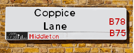
Coppice Lane is a street located near Carroway Head and in the village of Middleton and near the village of Middleton and near the town of Royal Sutton Coldfield. The street has a length of approximately 3,094 metres.
Coppice Lane is located within the North Warwickshire District (B) Council's jurisdiction. They provide various services, like refuse collection, and manage council tax collection. It's situated in the West Midlands region of the UK.
Coppice Lane has been assigned the Unique Street Reference Number of 28400238 in the National Street Gazetteer.
Coppice Lane is located within the county of Warwickshire, situated in the West Midlands region of the UK. It's 102.9 miles North West from central London., 9.54 miles North East from Birmingham, 16.24 miles North West from Coventry and 26.1 miles South West from Derby.

Do you know why this road is called Coppice Lane?
What's it like to live here?
Ask the community a question about Coppice Lane.
Do you have any questions, memories to share or know any facts about Coppice Lane? We'd love to know more.
Also on streetlist.co.uk, can you help?
Eldroth Road
15th April 2024
I wondered if anyone has any old pictures of Wenning Bank House in the 1940’s and also Lane Side before of the same era .. we visited today with my Mum in law as she used to live at both these properties. Also any photos of the schools around that time .. thank you.
Can You Help?Napps Way
15th April 2024
Why is the road called Napps Way (belonging to Napp, but minus an
apostrophe as is usual with such nomenclature)? Moreover, who or
what is, or was, “Napp” in the respective, possessive case?
Several years ago, I met an elderly man (probably in his late-eighties)
who lives on Bentham Drive, Liverpool 16, and during a conversation
with him whilst in a Northwest Passenger Transport Ambulance on the
way to the former RLUH (Royal Liverpool University Hospital), he told
me that he could remember (when he was a boy, living in Childwall,
Liverpool 16) that, “Where Napps Way is now, during WW2, there was
a two-man gun emplacement on the, then, open land to protect the
railway line passing over Childwall Valley Road - next to the railway
bridge - when suddenly, as they were loading a live “shell” into the gun’s
breach, the aforementioned “shell” accidentally exploded in the gun’s
breach killing both of the two soldiers, that had been manning the gun,
instantly! (Very sad, of course, but could - perhaps - two ghosts relating
to those two, very unfortunately and prematurely-killed soldiers have
haunted that place of their deaths ever since - and have any residents
of Napps Way - formerly and in its latest incarnation - seen two, WW2
(uniformed) soldiers unexpectedly appear in or near their homes?)
Mauritius Road
15th April 2024
Why is Mauritius Road so called, since when and by whom? Does Greenwich have any particular links with Mauritius? Very interested to know. 🤞🏼
Can You Help?Estate Agents near Coppice Lane
| Name | Address | Website |
|---|---|---|
| Green & Company | 1 Carlton House 18 Mere Green Road, Four Oaks Sutton Coldfield, B75 5BS | Visit Website |
| Preferential Properties Ltd | 224 Lichfield Road, Sutton Coldfield, West Midlands, B74 2UB | Visit Website |
| Bill Tandy & Co | 5 Mere Green Road, Four Oaks, Sutton Coldfield, B75 5BL | Visit Website |
Location Details
| Coppice Lane | |
|---|---|

| |
| Latitude | 52.586497 |
| Longitude | -1.758683 |
| OS Easting (X): | 416347 |
| OS Northing (Y): | 298810 |
| OS Grid Reference: | SP163988 |
Ordnance Survey Maps for Coppice Lane
If you purchase a map through the links below, we may earn an affiliate commission.
| Map Series | link | Ordnance Survey |
| Explorer 1:25,000 220 Birmingham, Walsall, Solihull and Redditch | Check Price on Amazon | |
| Explorer 1:25,000 232 Nuneaton and Tamworth | Check Price on Amazon | Buy Direct from the Ordnance Survey |
| Landranger 1:50,000 139 Birmingham and Wolverhampton | Check Price on Amazon |
Neighbourhood Policing |
| Police Force: Warwickshire |
 View Neighbourhood Crime and Policing View Neighbourhood Crime and Policing |
| Find a Local Neighbourhood Watch Scheme |
Frequently asked Questions for Coppice Lane
What Council (Local Authority) is Coppice Lane in?
Coppice Lane is located within the local authority area of North Warwickshire Council which is a District Council.
What Parish Council is Coppice Lane in?
Coppice Lane is located within the area of Middleton Parish Council.
What Electoral Ward is Coppice Lane in?
Coppice Lane is located within the ward of Curdworth.
What County is Coppice Lane in?
Coppice Lane is located within the ceremonial county of Warwickshire.
What Constituency is Coppice Lane in?
Coppice Lane is located within the constituency of North Warwickshire.
What Part of the UK is Coppice Lane in?
Coppice Lane is located within the West Midlands (England) region of the United Kingdom.
What County Council area is Coppice Lane in?
Coppice Lane is located within the Warwickshire Council area.
What Police Force area is Coppice Lane in?
Coppice Lane is located within the Warwickshire Police area.
Roads that have a Junction with Coppice Lane
| Street | Junction Type |
|---|---|
| Church Lane | junction |
| London Road (A446) | junction |
Sunset and Sunrise times for Coppice Lane
| Sunrise | 05:40 |
|---|---|
| Sunset | 20:29 |
Latest Weather Conditions for Coppice Lane
| Observed at Weather Station: | Coleshill 26 April 2024 at 23:00 (7.92 miles away) |
|---|---|
| Current Weather: | Overcast |
| Temperature and Humidity: | 5.5°C (86.4%) |
| Wind Direction and Speed: | NE (6 mph) |
Population Statistics
| ONS Area Code | E00158151 & E00158152 |
|---|---|
| ONS Area Name | Rural White-Collar Workers & Indian Tech Achievers |
| Average Age | 46.63 & 46.12 |
| Area Population | 1617.00 & 1578.00 |
| Male Population | 815.00 & 801.00 (51%) |
| Female Population | 802.00 & 777.00 (49%) |
| Benefit Claimants | 15 & 11 (1%) |
| LSOA Code: | E01031024 &E01031023 |
|---|---|
| LSOA Name: | North Warwickshire 004B &North Warwickshire 004A |
| SOA Code: | 2b |
| SOA Name: | |
| MSOA Code: | E02006471 |
| MSOA Name: | North Warwickshire 004 |
Nearest Supermarkets
| Tesco Coldfield Esso Express |
|---|
| Whitehouse Common Rd, Sutton Coldfield, B75 6HD |
| 0345 026 9423 |
| Distance: 2.12 Miles |
| Directions from Coppice Lane to Tesco Coldfield Esso Express |
| Sainsburys Mere Green |
|---|
| 30 Mere Green Road, Sutton Coldfield, England, B75 5BT |
| 0121 323 3213 |
| Distance: 2.81 Miles |
| Directions from Coppice Lane to Sainsburys Mere Green |
| Waitrose Four Oaks |
|---|
| 7 Highgate Centre, Belwell Lane, Sutton Coldfield, West Midlands, B74 4AB |
| 0121 3086006 |
| Distance: 3.05 Miles |
| Directions from Coppice Lane to Waitrose Four Oaks |
| Tesco Fazeley Express |
|---|
| 13a-15 Coleshill St, Fazeley, Tamworth, B78 3RB |
| 0345 026 9220 |
| Distance: 3.15 Miles |
| Directions from Coppice Lane to Tesco Fazeley Express |
Telephone Information
| Area Code |
|---|
| Area Code: 01827 - Tamworth |
| Area Code: 01675 - Coleshill |
| Area Code: 0121 - Birmingham |
| Area Code: 01922 - Walsall |
Broadband Information
| Speed | Average Speed | Median Speed | Maximum Speed | Next-generation access (NGA) | Number of Connections |
|---|---|---|---|---|---|
| Less than 2 Mbps | 1.5 | 1.4 | 2.3 | N | 4 |
Local Government
| Local Council Details |
|---|
| Within the area of North Warwickshire |
| Visit the Council's Website |
| South Street, Atherstone, Warwickshire &CV9 1DE |
| Send email |
| Telephone Number: 01827 715 341 |
| Local Member of Parliament |
|---|
| Within the Westminster Parliamentary Constituency of North Warwickshire |
| The Member of Parliament is Craig Tracey |
| Details for the MP Craig Tracey on parliament.uk |
| Details for the MP Craig Tracey on theyworkforyou.com |
| In the 2019 General Election Craig Tracey won with a majority of 17,956 the result was Con hold. The total electorate was 70,271 |
| Wards, Parish Councils and County Councils |
|---|
| Ward: Curdworth Ward |
| Ceremonial County: Warwickshire |
Nearest Schools
Nearest Hospitals
| Name | Address | Postcode | Distance | Map |
|---|
Nearest Dentists
Dentists near Coppice Lane
| Name | Address | Postcode | Distance | Map |
|---|
Nearest GP Surgeries
Doctors near Coppice Lane
FALCON MEDICAL CENTRE
Address: 93 CARHAMPTON ROAD, SUTTON COLDFIELD, WEST MIDLANDS, B75 7PG
Distance: 2.02 miles
Contact: :
SUTTON COLDFIELD GROUP PRACTICE
Address: 233 TAMWORTH ROAD, SUTTON COLDFIELD, WEST MIDLANDS, B75 6DX
Distance: 2.11 miles
Contact: tel: 01213 233235
DR MARTIN SC
Address: ASHFURLONG MEDICAL CENTRE, 233 TAMWORTH ROAD, SUTTON COLDFIELD, WEST MIDLANDS, B75 6DX
Distance: 2.11 miles
Contact: tel: 01213542032
FOUR OAKS MEDICAL CENTRE
Address: CARLTON HOUSE, 18 MERE GREEN ROAD, SUTTON COLDFIELD, WEST MIDLANDS, B75 5BS
Distance: 2.91 miles
Contact: :
SCGP LEY HILL SURGERY - COVID LOCAL VACCINATION SERVICE
Address: 228 LICHFIELD ROAD, SUTTON COLDFIELD, B74 2UE
Distance: 2.91 miles
Contact: :
LEY HILL SURGERY
Address: 228 LICHFIELD ROAD, SUTTON COLDFIELD, WEST MIDLANDS, B74 2UE
Distance: 2.91 miles
Contact: :
Nearest Dispensing Chemists
Pharmacies near Coppice Lane
| Name | Address | Postcode | Telephone | Map | Distance in Km |
|---|
Nearest Opticians
Opticians near Coppice Lane
EYE CENTRE OPTICIAN (REDDICAP HEATH)
Address: 53C REDDICAP HEATH ROAD, SUTTON COLDFIELD, WEST MIDLANDS, B75 7DX
Distance: 2.51 miles
Contact: :
ODSUK LTD
Address: 18 DOWER ROAD, SUTTON COLDFIELD, WEST MIDLANDS, B75 6UA
Distance: 2.66 miles
Contact: :
ANDREW MARTIN OPTOMETRIST (LICHFIELD)
Address: 244 LICHFIELD ROAD, SUTTON COLDFIELD, WEST MIDLANDS, B74 2UD
Distance: 2.93 miles
Contact: :
M.D. BAILEY OPTICIANS
Address: 244 LICHFIELD ROAD, SUTTON COLDFIELD, WEST MIDLANDS, B74 2UD
Distance: 2.93 miles
Contact: :
SPECSAVERS (MERE GREEN)
Address: UNIT 5K MULBERRY WALK, LICHFIELD ROAD, SUTTON COLDFIELD, WEST MIDLANDS, B74 2UG
Distance: 2.96 miles
Contact: :
BOOTS OPTICIANS (MERE GREEN)
Address: UNIT 4 MULBERRY WALK, 302 LICHFIELD ROAD, SUTTON COLDFIELD, WEST MIDLANDS, B74 2UG
Distance: 2.96 miles
Contact: :
Transport
Nearest Rail Stations
Four Oaks Station is 2.95 miles away.
Address: Four Oaks station, Lichfield Road, Sutton Coldfield, West Midlands, B74 2TD
Four Oaks is situated on the Bristol to Brimingham Line.
Four Oaks Station is staffed on a part time basis.
Sutton Coldfield Station is 3.15 miles away.
Address: Sutton Coldfield station, Railway Road, Sutton Coldfield, West Midlands, B73 6AY
Sutton Coldfield is situated on the Bristol to Brimingham Line.
Sutton Coldfield Station is staffed on a part time basis.
Directions from Coppice Lane to Sutton Coldfield Rail Station