Map of Shooters Hill
| Postcodes | ||
|---|---|---|
| Icon | Postcodes for Shooters Hill | |
| Walking Distances | ||
| Distance Info | Green Circle = 10 Minutes Walk (800 metres) | |
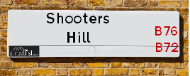
About Shooters Hill
Shooters Hill is a street located in the town of Royal Sutton Coldfield. The street has a length of approximately 260 metres.
Shooters Hill is located within the Birmingham District (B) Council's jurisdiction. They provide various services, like refuse collection, and manage council tax collection. It's situated in the West Midlands region of the UK.
Shooters Hill has been assigned the Unique Street Reference Number of 2708163 in the National Street Gazetteer.
Shooters Hill is located within the county of West Midlands, situated in the West Midlands region of the UK. It's 102.92 miles North West from central London., 6.19 miles North East from Birmingham, 16.36 miles North West from Coventry and 29.33 miles South West from Derby.

Do you know why this road is called Shooters Hill?
What's it like to live here?
Ask the community a question about Shooters Hill.
Do you have any questions, memories to share or know any facts about Shooters Hill? We'd love to know more.
Also on streetlist.co.uk, can you help?
Swing Swang Lane
28th April 2024
I am trying to find out why the lane is named Swing Swang?
It has been known known this since at least 1905 when hedge making contents used to be held here.
Swing Swang is often used to describe a fairground ride. I remember Swing Boats. Were they a bit like this or is Swing Swang another name for swings?
Swing Swangs are also mentioned in connection to orchards. Or were orchards just good places to have swings?
Estate Agents near Shooters Hill
| Name | Address | Website |
|---|---|---|
| Acres | 28 Beeches Walk, Sutton Coldfield, B73 6HN | Visit Website |
| Hunters | 32a Beeches Walk, Sutton Coldfield, B73 6HN | Visit Website |
| Newton Fallowell | 14 Beeches Walk Sutton Coldfield Birmingham B73 6HN | Visit Website |
Location Details
| Shooters Hill | |
|---|---|

| |
| Latitude | 52.552246 |
| Longitude | -1.816134 |
| OS Easting (X): | 412465 |
| OS Northing (Y): | 294989 |
| OS Grid Reference: | SP125950 |
Neighbourhood Policing |
| Police Force: West Midlands |
 View Neighbourhood Crime and Policing View Neighbourhood Crime and Policing |
| Find a Local Neighbourhood Watch Scheme |
Frequently asked Questions for Shooters Hill
What Council (Local Authority) is Shooters Hill in?
Shooters Hill is located within the local authority area of Birmingham Council which is a Metropolitan District.
What Parish Council is Shooters Hill in?
Shooters Hill is in an unparished area.
What Electoral Ward is Shooters Hill in?
Shooters Hill is located within the ward of Sutton Wylde Green.
What County is Shooters Hill in?
Shooters Hill is located within the ceremonial county of West Midlands.
What Constituency is Shooters Hill in?
Shooters Hill is located within the constituency of Sutton Coldfield.
What Part of the UK is Shooters Hill in?
Shooters Hill is located within the West Midlands (England) region of the United Kingdom.
What County Council area is Shooters Hill in?
Shooters Hill is located within the West Midlands Council area.
What Police Force area is Shooters Hill in?
Shooters Hill is located within the West Midlands Police area.
Roads that have a Junction with Shooters Hill
| Street | Junction Type |
|---|---|
| East View Road | junction |
| Corncrake Close | junction |
Sunset and Sunrise times for Shooters Hill
| Sunrise | 05:14 |
|---|---|
| Sunset | 20:53 |
Latest Weather Conditions for Shooters Hill
| Observed at Weather Station: | Coleshill 11 May 2024 at 10:00 (7.31 miles away) |
|---|---|
| Current Weather: | Sunny day |
| Temperature and Humidity: | 19.0°C (61.8%) |
| Wind Direction and Speed: | ESE (7 mph) |
Population Statistics
| ONS Area Code | E00047817 |
|---|---|
| ONS Area Name | Indian Tech Achievers |
| Average Age | 44.66 |
| Area Population | 1785.00 |
| Male Population | 851.00 (48%) |
| Female Population | 934.00 (52%) |
| Benefit Claimants | 11 (1%) |
| LSOA Code: | E01009437 |
|---|---|
| LSOA Name: | Birmingham 006C |
| SOA Code: | 3b |
| SOA Name: | |
| MSOA Code: | E02001832 |
| MSOA Name: | Birmingham 006 |
Nearest Supermarkets
| Iceland Sutton Cfield |
|---|
| Maney Corner, Birmingham Road, Sutton Coldfield, B72 1QL |
| 01213557665 |
| Distance: 0.53 Miles |
| Directions from Shooters Hill to Iceland Sutton Cfield |
| Tesco Birmingham Rd Sutton Express |
|---|
| 3 Maney Corner, Birmingham Rd, Sutton Coldfield, B72 1QL |
| 0345 675 7047 |
| Distance: 0.55 Miles |
| Directions from Shooters Hill to Tesco Birmingham Rd Sutton Express |
| Little Waitrose Sutton Coldfield |
|---|
| 83 The Parade, Sutton Coldfield, West Midlands, B72 1PL |
| 01213 553866 |
| Distance: 0.72 Miles |
| Directions from Shooters Hill to Little Waitrose Sutton Coldfield |
| Sainsburys Sutton Coldfield Boldmere Road Local |
|---|
| 36-38 Boldmere Road, Sutton Coldfield, England, B73 5TD |
| 1213551483 |
| Distance: 1.1 Miles |
| Directions from Shooters Hill to Sainsburys Sutton Coldfield Boldmere Road Local |
Telephone Information
| Area Code |
|---|
| Area Code: 0121 - Birmingham |
| Area Code: 01675 - Coleshill |
| Area Code: 01922 - Walsall |
| Area Code: 01827 - Tamworth |
Local Government
| Local Council Details |
|---|
| Within the area of Birmingham |
| Visit the Council's Website |
| Council House, Victoria Square, Birmingham &B1 1BB |
| Send email |
| Telephone Number: 0121 303 1111 |
| Local Member of Parliament |
|---|
| Within the Westminster Parliamentary Constituency of Sutton Coldfield |
| The Member of Parliament is Andrew Mitchell |
| Details for the MP Andrew Mitchell on parliament.uk |
| Details for the MP Andrew Mitchell on theyworkforyou.com |
| In the 2019 General Election Andrew Mitchell won with a majority of 19,272 the result was Con hold. The total electorate was 75,638 |
| Wards, Parish Councils and County Councils |
|---|
| Ward: Sutton Wylde Green Ward |
| Ceremonial County: West Midlands |
Nearest Schools
England Primary Schools
Walmley Infant School
Address: Walmley Infant School, Walmley Ash Road, Walmley, Sutton Coldfield, West Midlands, B76 1JB
Distance: 1.57 miles
Contact: 01213511355
Walmley Junior School
Address: Walmley Junior School, Walmley Ash Road, Sutton Coldfield, West Midlands, B76 1JB
Distance: 1.57 miles
Contact: 01213511346
Penns Primary School
Address: Penns Primary School, Berwood Road, Sutton Coldfield, West Midlands, B72 1BS
Distance: 1.27 miles
Contact: 01214648014
Maney Hill Primary School
Address: Maney Hill Primary School, Maney Hill Road, Sutton Coldfield, West Midlands, B72 1JU
Distance: 0.12 miles
Contact: 01214649673
Holland House Infant School and Nursery
Address: Holland House Infant School and Nursery, Holland Road, Sutton Coldfield, West Midlands, B72 1RE
Distance: 0.51 miles
Contact:
Wylde Green Primary School
Address: Wylde Green Primary School, Green Lanes, Sutton Coldfield, West Midlands, B73 5JL
Distance: 1.21 miles
Contact: 01213732691
Boldmere Infant School and Nursery
Address: Boldmere Infant School and Nursery, Cofield Road, Sutton Coldfield, West Midlands, B73 5SD
Distance: 1.22 miles
Contact: 01214642338
Boldmere Junior School
Address: Boldmere Junior School, Cofield Road, Boldmere, Sutton Coldfield, West Midlands, B73 5SD
Distance: 1.22 miles
Contact: 01214643656
St Nicholas Catholic Primary School
Address: St Nicholas Catholic Primary School, Jockey Road, Sutton Coldfield, West Midlands, B73 5US
Distance: 0.98 miles
Contact:
The Deanery Church of England Primary School
Address: The Deanery Church of England Primary School, Fox Hollies Road, Walmley, Sutton Coldfield, West Midlands, B76 2RD
Distance: 1.09 miles
Contact: 01213516441
Whitehouse Common Primary School
Address: Whitehouse Common Primary School, Cotysmore Road, Sutton Coldfield, West Midlands, B75 6BL
Distance: 1.32 miles
Contact: 01214641918
Hollyfield Primary School
Address: Hollyfield Primary School, Hollyfield Road, Sutton Coldfield, West Midlands, B75 7SG
Distance: 0.87 miles
Contact: 01213780672
St Joseph's Catholic Primary School
Address: St Joseph's Catholic Primary School, Little Sutton Lane, Sutton Coldfield, West Midlands, B75 6PB
Distance: 1.53 miles
Contact: 01213546270
St Joseph's RC Primary School
Address: St Joseph's RC Primary School, Little Sutton Lane, Sutton Coldfield, West Midlands, B75 6PB
Distance: 1.53 miles
Contact:
Town Junior School
Address: Town Junior School, Ebrook Road, Sutton Coldfield, West Midlands, B72 1NX
Distance: 0.44 miles
Contact: 01214648738
St Nicholas Catholic Primary School
Address: St Nicholas Catholic Primary School, Jockey Road, Sutton Coldfield, West Midlands, B73 5US
Distance: 0.98 miles
Contact: 01213552649
England Secondary Schools
Sutton Coldfield Grammar School for Girls
Address: Sutton Coldfield Grammar School for Girls, Jockey Road, Sutton Coldfield, West Midlands, B73 5PT
Distance: 0.58 miles
Contact:
Fairfax
Address: Fairfax, Fairfax Road, Sutton Coldfield, West Midlands, B75 7JT
Distance: 1.00 miles
Contact: 01213781288
John Willmott School
Address: John Willmott School, Reddicap Heath Road, Sutton Coldfield, West Midlands, B75 7DY
Distance: 1.03 miles
Contact: 01213781946
John Willmott School
Address: John Willmott School, Reddicap Heath Road, Sutton Coldfield, West Midlands, B75 7DY
Distance: 1.03 miles
Contact:
Bishop Walsh Catholic School
Address: Bishop Walsh Catholic School, Wylde Green Road, Sutton Coldfield, West Midlands, B76 1QT
Distance: 0.40 miles
Contact: 01213513215
Plantsbrook School
Address: Plantsbrook School, Upper Holland Road, Sutton Coldfield, West Midlands, B72 1RB
Distance: 0.46 miles
Contact: 01213627310
Bishop Vesey's Grammar School
Address: Bishop Vesey's Grammar School, Lichfield Road, Sutton Coldfield, West Midlands, B74 2NH
Distance: 1.18 miles
Contact: 01212505400
Sutton Coldfield Grammar School for Girls
Address: Sutton Coldfield Grammar School for Girls, Jockey Road, Sutton Coldfield, West Midlands, B73 5PT
Distance: 0.58 miles
Contact: 01213541479
Nearest Hospitals
| Name | Address | Postcode | Distance | Map |
|---|
Nearest Dentists
Dentists near Shooters Hill
| Name | Address | Postcode | Distance | Map |
|---|
Nearest GP Surgeries
Doctors near Shooters Hill
THE MANOR PRACTICE
Address: 61 HOLLAND ROAD, SUTTON COLDFIELD, WEST MIDLANDS, B72 1RL
Distance: 0.52 miles
Contact: tel: 0121 3542032
VESEY PRACTICE
Address: JAMES PRESTON HEALTH CENTRE, 61 HOLLAND ROAD, SUTTON COLDFIELD, WEST MIDLANDS, B72 1RL
Distance: 0.52 miles
Contact: :
THE HAWTHORNS SURGERY - COVID LOCAL VACCINATION SERVICE
Address: THE HAWTHORNS SURGERY, 331 BIRMINGHAM ROAD, SUTTON COLDFIELD, B72 1DL
Distance: 1.02 miles
Contact: :
THE HAWTHORNS SURGERY
Address: 331 BIRMINGHAM ROAD, SUTTON COLDFIELD, B72 1DL
Distance: 1.02 miles
Contact: tel: 0121 3732211
ASHFIELD SURGERY
Address: 8 WALMLEY ROAD, SUTTON COLDFIELD, B76 1QN
Distance: 1.05 miles
Contact: tel: 0121 3513238
SUTTON ROAD SURGERY
Address: 122 SUTTON ROAD, ERDINGTON, BIRMINGHAM, WEST MIDLANDS, B23 5TJ
Distance: 1.35 miles
Contact: tel: 0121 3730056
Nearest Dispensing Chemists
Pharmacies near Shooters Hill
| Name | Address | Postcode | Telephone | Map | Distance in Km |
|---|
Nearest Opticians
Opticians near Shooters Hill
NEIL BERRY OPTICIAN (SUTTON COLDFIELD)
Address: 6 HOLLAND STREET, SUTTON COLDFIELD, WEST MIDLANDS, B72 1RR
Distance: 0.58 miles
Contact: :
SCRIVENS OPTICIANS (SUTTON COLDFIELD)
Address: 115 PARADE, SUTTON COLDFIELD, WEST MIDLANDS, B72 1PU
Distance: 0.67 miles
Contact: :
BOOTS OPTICIANS (SUTTON COLDFIELD)
Address: 44-46 GRACECHURCH SHOPPING CENTRE, THE PARADE, SUTTON COLDFIELD, WEST MIDLANDS, B72 1PD
Distance: 0.77 miles
Contact: :
BOOTS OPTICIANS (SUTTON COLDFIELD)
Address: 24 THE PARADE, SUTTON COLDFIELD, WEST MIDLANDS, B72 1PD
Distance: 0.77 miles
Contact: :
SPECSAVERS (SUTTON COLDFIELD)
Address: UNIT 4, RED ROSE CENTRE, 57B LOWER PARADE, SUTTON COLDFIELD, WEST MIDLANDS, B72 1XX
Distance: 0.78 miles
Contact: :
VISION EXPRESS (GRACECHURCH)
Address: 198 GRACECHURCH SHOPPING CENTRE, SUTTON COLDFIELD, WEST MIDLANDS, B72 1PA
Distance: 0.78 miles
Contact: :
Transport
Nearest Rail Stations
Wylde Green Station is 0.77 miles away.
Address: Wylde Green station, Station Road, Wylde Green, West Midlands, B73 5LA
Wylde Green is situated on the Bristol to Brimingham Line.
Wylde Green Station is staffed on a part time basis.
Sutton Coldfield Station is 0.95 miles away.
Address: Sutton Coldfield station, Railway Road, Sutton Coldfield, West Midlands, B73 6AY
Sutton Coldfield is situated on the Bristol to Brimingham Line.
Sutton Coldfield Station is staffed on a part time basis.
Directions from Shooters Hill to Sutton Coldfield Rail Station