Map of Rush Lane
| Postcodes | ||
|---|---|---|
| Icon | Postcodes for Rush Lane | |
| Walking Distances | ||
| Distance Info | Green Circle = 10 Minutes Walk (800 metres) | |
About Rush Lane
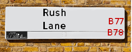
Rush Lane is a street located near the town of Tamworth. It uses the postcode B77 1LT. The street has a length of approximately 1,616 metres.
Rush Lane is located within the Tamworth District (B) and North Warwickshire District (B) Council's jurisdiction. They provide various services, like refuse collection, and manage council tax collection. It's situated in the West Midlands region of the UK.
Rush Lane has been assigned the Unique Street Reference Number of 39400682 and 28400748 in the National Street Gazetteer.
Rush Lane is located within the county of Warwickshire, situated in the West Midlands region of the UK. It's 100.79 miles North West from central London., 12.28 miles North East from Birmingham, 14.55 miles North West from Coventry and 23.1 miles West from Leicester.

Do you know why this road is called Rush Lane?
What's it like to live here?
Ask the community a question about Rush Lane.
Do you have any questions, memories to share or know any facts about Rush Lane? We'd love to know more.
Also on streetlist.co.uk, can you help?
Swing Swang Lane
28th April 2024
I am trying to find out why the lane is named Swing Swang?
It has been known known this since at least 1905 when hedge making contents used to be held here.
Swing Swang is often used to describe a fairground ride. I remember Swing Boats. Were they a bit like this or is Swing Swang another name for swings?
Swing Swangs are also mentioned in connection to orchards. Or were orchards just good places to have swings?
Estate Agents near Rush Lane
| Name | Address | Website |
|---|---|---|
| Next Place Property Agents Limited | 112 Glascote Road Glascote Tamworth B77 2AF | Visit Website |
| Bairstow Eves | 83 - 84 Bolebridge Street, Tamworth, Staffordshire, B79 7PD | Visit Website |
| Bairstow Eves Lettings | 83 - 84 Bolebridge Street, Tamworth, Staffordshire, B79 7PD | Visit Website |
We have found 1 postcode for Rush Lane
Location Details
| Rush Lane | |
|---|---|

| |
| Latitude | 52.591882 |
| Longitude | -1.675863 |
| OS Easting (X): | 421955 |
| OS Northing (Y): | 299431 |
| OS Grid Reference: | SP220994 |
Neighbourhood Policing |
| Police Force: Warwickshire |
 View Neighbourhood Crime and Policing View Neighbourhood Crime and Policing |
| Find a Local Neighbourhood Watch Scheme |
Frequently asked Questions for Rush Lane
What Council (Local Authority) is Rush Lane in?
Rush Lane is located within the local authority area of North Warwickshire Council which is a District Council.
What Parish Council is Rush Lane in?
Rush Lane is located within the area of Kingsbury Parish Council.
What Electoral Ward is Rush Lane in?
Rush Lane is located within the ward of Hurley and Wood End.
What County is Rush Lane in?
Rush Lane is located within the ceremonial county of Warwickshire.
What Constituency is Rush Lane in?
Rush Lane is located within the constituency of North Warwickshire.
What Part of the UK is Rush Lane in?
Rush Lane is located within the West Midlands (England) region of the United Kingdom.
What County Council area is Rush Lane in?
Rush Lane is located within the Warwickshire Council area.
What Police Force area is Rush Lane in?
Rush Lane is located within the Warwickshire Police area.
Roads that have a Junction with Rush Lane
| Street | Junction Type |
|---|---|
| Whateley Lane | junction |
| Tamworth Road (A51) | junction |
Sunset and Sunrise times for Rush Lane , B77 1LT
| Sunrise | 05:11 |
|---|---|
| Sunset | 20:54 |
Latest Weather Conditions for Rush Lane, B77 1LT
| Observed at Weather Station: | Coleshill 12 May 2024 at 04:00 (7.75 miles away) |
|---|---|
| Current Weather: | Mist |
| Temperature and Humidity: | 11.2°C (91.6%) |
| Wind Direction and Speed: | NNE (3 mph) |
Population Statistics
| ONS Area Code | E00168278 |
|---|---|
| ONS Area Name | White Suburban Communities |
| Average Age | 38.60 |
| Area Population | 2583.00 |
| Male Population | 1299.00 (50%) |
| Female Population | 1284.00 (50%) |
| Benefit Claimants | 21 (1%) |
| LSOA Code: | E01031031 |
|---|---|
| LSOA Name: | North Warwickshire 002D |
| SOA Code: | 5d |
| SOA Name: | |
| MSOA Code: | E02006469 |
| MSOA Name: | North Warwickshire 002 |
Nearest Supermarkets
| Tesco Dosthill Esso Express |
|---|
| High St, Dosthill, Tamworth, B77 1LE |
| 0345 675 7075 |
| Distance: 0.68 Miles |
| Directions from Rush Lane to Tesco Dosthill Esso Express |
| Morrisons Tamworth |
|---|
| Marlborough Way, Tamworth B77 2NY |
| 01827 284082 |
| Distance: 1.32 Miles |
| Directions from Rush Lane to Morrisons Tamworth |
| Tesco Fazeley Express |
|---|
| 13a-15 Coleshill St, Fazeley, Tamworth, B78 3RB |
| 0345 026 9220 |
| Distance: 1.81 Miles |
| Directions from Rush Lane to Tesco Fazeley Express |
| Asda Tamworth |
|---|
| Ventura Road, Tamworth, B78 3HB |
| 01827 302180 |
| Distance: 2.57 Miles |
| Directions from Rush Lane to Asda Tamworth |
Telephone Information
| Dialling Code | Telephone Exchange | Telephone Cabinet | Fibre to the Cabinet or Fibre to the Premises |
|---|---|---|---|
| 01827 | FAZELEY - EMFAZEL | P5 | FTTC |
Broadband Information
| Speed | Average Speed | Median Speed | Maximum Speed | Next-generation access (NGA) | Number of Connections |
|---|---|---|---|---|---|
| Less than 2 Mbps | 1.3 | 0.5 | 2.9 | Y | 3 |
Local Government
| Local Council Details |
|---|
| Within the area of North Warwickshire |
| Visit the Council's Website |
| South Street, Atherstone, Warwickshire &CV9 1DE |
| Send email |
| Telephone Number: 01827 715 341 |
| Local Member of Parliament |
|---|
| Within the Westminster Parliamentary Constituency of North Warwickshire |
| The Member of Parliament is Craig Tracey |
| Details for the MP Craig Tracey on parliament.uk |
| Details for the MP Craig Tracey on theyworkforyou.com |
| In the 2019 General Election Craig Tracey won with a majority of 17,956 the result was Con hold. The total electorate was 70,271 |
| Wards, Parish Councils and County Councils |
|---|
| Ward: Hurley and Wood End Ward |
| Ceremonial County: Warwickshire |
Nearest Schools
England Primary Schools
Heathfields Infant School
Address: Heathfields Infant School, Saxon Close, Wilnecote, Tamworth, Staffordshire, B77 5LU
Distance: 0.91 miles
Contact:
Dosthill Primary School
Address: Dosthill Primary School, High Street, Dosthill, Tamworth, Staffordshire, B77 1LQ
Distance: 0.52 miles
Contact:
Kingsbury Primary School
Address: Kingsbury Primary School, Bromage Avenue, Kingsbury, Tamworth, Staffordshire, B78 2HW
Distance: 1.71 miles
Contact: 01827872275
England Secondary Schools
Kingsbury School, A Specialist Science College with Mathematics
Address: Kingsbury School, A Specialist Science College with Mathematics, Tamworth Road, Kingsbury, Tamworth, Staffordshire, B78 2LF
Distance: 1.80 miles
Contact:
Nearest Hospitals
| Name | Address | Postcode | Distance | Map |
|---|
Nearest Dentists
Dentists near Rush Lane
| Name | Address | Postcode | Distance | Map |
|---|
Nearest GP Surgeries
Doctors near Rush Lane
DOSTHILL SURGERY
Address: CADOGAN ROAD, DOSTHILL, TAMWORTH, STAFFORDSHIRE, B77 1PQ
Distance: 0.51 miles
Contact: :
WILNECOTE SURGERY
Address: PARSON STREET, WILNECOTE, TAMWORTH, B77 5BD
Distance: 1.18 miles
Contact: :
WILNECOTE SURGERY
Address: PARSON STREET, WILNECOTE, TAMWORTH, STAFFORDSHIRE, B77 5BD
Distance: 1.18 miles
Contact: :
SREEHARI BRANCH 1
Address: TRI-LINKS BELGRAVE, THE BAPTIST MANSE, DERWENT, TAMWORTH, STAFFORDSHIRE, B77 2LD
Distance: 1.80 miles
Contact: :
PEAR TREE SURGERY
Address: 28 MEADOW CLOSE, KINGSBURY, TAMWORTH, STAFFORDSHIRE, B78 2NR
Distance: 1.96 miles
Contact: tel: 01827 872755
HARRISON PS & PARTNERS (BRANCH)
Address: FAZELEY SURGERY, ALBERT ROAD, FAZELEY, TAMWORTH, STAFFORDSHIRE, B78 3QJ
Distance: 1.99 miles
Contact: :
Nearest Dispensing Chemists
Pharmacies near Rush Lane
| Name | Address | Postcode | Telephone | Map | Distance in Km |
|---|
Nearest Opticians
Opticians near Rush Lane
MW PHILLIPS OPTICIANS
Address: 30 ELLERBECK, WILNECOTE, TAMWORTH, B77 4JA
Distance: 2.06 miles
Contact: :
BOOTS OPTICIANS (TAMWORTH - VENTURA PARK)
Address: UNIT A, VENTURA RETAIL PARK, VENTURA PARK ROAD, TAMWORTH, STAFFORDSHIRE, B78 3JD
Distance: 2.65 miles
Contact: :
BOOTS OPTICIANS (VENTURA RETAIL PARK - TAMWORTH)
Address: UNIT A, VENTURA RETAIL PARK, VENTURA PARK ROAD, BONEHILL, TAMWORTH, STAFFORDSHIRE, B78 3HB
Distance: 2.68 miles
Contact: :
4170 TAMWORTH
Address: ASDA STORES LTD, VENTURA ROAD, BITTERSCOTE RETAIL PARK, TAMWORTH, STAFFORDSHIRE, B78 3HB
Distance: 2.68 miles
Contact: :
TAMWORTH VENTURA SPECSAVERS LIMITED
Address: BITTERSCOTE DRIVE, BONEHILL, TAMWORTH, B78 3HD
Distance: 2.81 miles
Contact: :
SPECSAVERS (TAMWORTH)
Address: UNIT 19, 35, THE ANKERSIDE SHOPPING CENTRE, GEORGE STREET, TAMWORTH, STAFFORDSHIRE, B79 7LG
Distance: 2.91 miles
Contact: :
Transport
Nearest Rail Stations
Wilnecote (Staffs) Station is 1.32 miles away.
Address: Wilnecote station, Watling Street, Tamworth, Staffordshire, B77 5AL
Wilnecote (Staffs) is situated on the Birmingham to Nottingham Line.
Wilnecote (Staffs) Station is an unstaffed station.
Directions from Rush Lane to Wilnecote (Staffs) Rail Station
Tamworth Station is 3.16 miles away.
Address: Tamworth station, Victoria Road, Tamworth, Staffordshire, B79 7JT
Tamworth is situated on the Birmingham to Nottingham Line|Trent Valley line|West Coast Main Line and is managed by Grand Central North West.
Tamworth Station is staffed on a full time basis.