Map of Wells Road
| Postcodes | ||
|---|---|---|
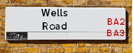
| Icon | Postcodes for Wells Road | |
| Walking Distances | ||
| Distance Info | Green Circle = 10 Minutes Walk (800 metres) | |
About Wells Road
Wells Road is a street located in the city of Bath. The street has a length of approximately 1,186 metres.
Wells Road is located within the Bath and North East Somerset Council's jurisdiction. They provide various services, like refuse collection, and manage council tax collection. It's situated in the South West region of the UK.
Wells Road has been assigned the Unique Street Reference Numbers of 47901430, 47900021 and 47950007 in the National Street Gazetteer.
Wells Road is located within the county of Somerset, situated in the South West region of the UK. It's 97.85 miles West from central London., 7.83 miles North West from Trowbridge, 11.24 miles South East from Bristol and 28.13 miles South West from Swindon.

Do you know why this road is called Wells Road?
What's it like to live here?
Ask the community a question about Wells Road.
Do you have any questions, memories to share or know any facts about Wells Road? We'd love to know more.
Also on streetlist.co.uk, can you help?
Swing Swang Lane
28th April 2024
I am trying to find out why the lane is named Swing Swang?
It has been known known this since at least 1905 when hedge making contents used to be held here.
Swing Swang is often used to describe a fairground ride. I remember Swing Boats. Were they a bit like this or is Swing Swang another name for swings?
Swing Swangs are also mentioned in connection to orchards. Or were orchards just good places to have swings?
Estate Agents near Wells Road
| Name | Address | Website |
|---|---|---|
| Bath Stone Property | 1 Hayes Place, Bath, BA2 4QW | Visit Website |
| Andrews Estate Agents | 9 Wellsway Bear Flat Bath BA2 4QL | Visit Website |
| Andrews Letting and Management | 3 Wellsway, Bath, BA2 4QL |
Location Details
| Wells Road | |
|---|---|

| |
| Latitude | 51.376400 |
| Longitude | -2.364919 |
| OS Easting (X): | 374604 |
| OS Northing (Y): | 164268 |
| OS Grid Reference: | ST746643 |
Neighbourhood Policing |
| Police Force: Avon And Somerset |
 View Neighbourhood Crime and Policing View Neighbourhood Crime and Policing |
| Find a Local Neighbourhood Watch Scheme |
Frequently asked Questions for Wells Road
What Council (Local Authority) is Wells Road in?
Wells Road is located within the local authority area of Bath and North East Somerset Council which is a Unitary Authority.
What Parish Council is Wells Road in?
Wells Road is in an unparished area.
What Electoral Ward is Wells Road in?
Wells Road is located within the ward of Widcombe & Lyncombe &Oldfield Park.
What County is Wells Road in?
Wells Road is located within the ceremonial county of Somerset.
What Constituency is Wells Road in?
Wells Road is located within the constituency of Bath.
What Part of the UK is Wells Road in?
Wells Road is located within the South West (England) region of the United Kingdom.
What County Council area is Wells Road in?
Wells Road is located within the Bath and North East Somerset Council area.
What Police Force area is Wells Road in?
Wells Road is located within the Avon and Somerset Police area.
Roads that have a Junction with Wells Road
| Street | Junction Type |
|---|---|
| Hayesfield Park | junction |
| Wellsway | junction |
| Oldfield Road (B3111) | junction |
| Upper Oldfield Park | junction |
| Lower Bristol Road (A36) | junction |
Sunset and Sunrise times for Wells Road
| Sunrise | 05:22 |
|---|---|
| Sunset | 20:48 |
Latest Weather Conditions for Wells Road
| Observed at Weather Station: | Lyneham 10 May 2024 at 20:00 (18.28 miles away) |
|---|---|
| Current Weather: | Clear night |
| Temperature and Humidity: | 19.0°C (62.3%) |
| Wind Direction and Speed: | (0 mph) |
Population Statistics
| ONS Area Code | E00072827, E00073137 & E00073128 |
|---|---|
| ONS Area Name | Communal Retirement, Students and Professionals & Student Communal Living |
| Average Age | 38.73 & 33.61 |
| Area Population | 2001.00 & 1445.00 |
| Male Population | 999.00 & 722.00 (50%) |
| Female Population | 1002.00 & 723.00 (50%) |
| Benefit Claimants | 7 & 9 (0%) |
| LSOA Code: | E01014415 &E01014481 |
|---|---|
| LSOA Name: | Bath and North East Somerset 017A &Bath and North East Somerset 012C |
| SOA Code: | 3c &1a |
| SOA Name: | |
| MSOA Code: | E02003001 &E02002996 |
| MSOA Name: | Bath and North East Somerset 017 &Bath and North East Somerset 012 |
Nearest Supermarkets
| Sainsburys Bath Southgate Local |
|---|
| 2-4 Dorchester Street, Bath, England, BA1 1SS |
| 1225443799 |
| Distance: 0.28 Miles |
| Directions from Wells Road to Sainsburys Bath Southgate Local |
| Tesco Bath Westgate Building Express |
|---|
| 4-5 Westgate Building, Bath, BA1 1EB |
| 0345 671 9609 |
| Distance: 0.34 Miles |
| Directions from Wells Road to Tesco Bath Westgate Building Express |
| Iceland Bath Ham Gdns |
|---|
| Bath Gardens, Bath, Avon, BA1 1PS |
| 01225461508 |
| Distance: 0.36 Miles |
| Directions from Wells Road to Iceland Bath Ham Gdns |
| Sainsburys Bath Local |
|---|
| 43 Monmouth Street, Bath, England, BA1 2AN |
| 1225429322 |
| Distance: 0.36 Miles |
| Directions from Wells Road to Sainsburys Bath Local |
Telephone Information
| Area Code |
|---|
| Area Code: 01225 - Bath |
| Area Code: 01761 - Temple Cloud |
Broadband Information
| Speed | Average Speed | Median Speed | Maximum Speed | Next-generation access (NGA) | Number of Connections |
|---|---|---|---|---|---|
| Greater than 2 Mbps | 14.2 | 16.1 | 19 | N | 16 |
Local Government
| Local Council Details |
|---|
| Within the area of Bath and North East Somerset |
| Visit the Council's Website |
| The Guildhall, High Street, Bath, Bath & North East Somerset &BA1 5AW |
| Send email |
| Telephone Number: 01225 477 000 |
| Local Member of Parliament |
|---|
| Within the Westminster Parliamentary Constituency of Bath |
| The Member of Parliament is Wera Hobhouse |
| Details for the MP Wera Hobhouse on parliament.uk |
| Details for the MP Wera Hobhouse on theyworkforyou.com |
| In the 2019 General Election Wera Hobhouse won with a majority of 12,322 the result was LD hold. The total electorate was 67,805 |
| Wards, Parish Councils and County Councils |
|---|
| Ward: Widcombe & Lyncombe &Oldfield Park Ward |
| Ceremonial County: Somerset |
Nearest Schools
England Secondary Schools
Beechen Cliff School
Address: Beechen Cliff School, Kipling Avenue, Bath, Somerset, BA2 4RE
Distance: 0.35 miles
Contact:
Hayesfield Girls School
Address: Hayesfield Girls School, Upper Oldfield Park, Bath, Somerset, BA2 3LA
Distance: 0.32 miles
Contact: 01225426151
The Bath Studio School
Address: The Bath Studio School, Frome Road, Bath, Somerset, BA2 5RF
Distance: 1.44 miles
Contact:
Saint Gregory's Catholic College
Address: Saint Gregory's Catholic College, Combe Hay Lane, Odd Down, Bath, Somerset, BA2 8PA
Distance: 1.75 miles
Contact: 01225832873
England Primary Schools
Widcombe Infant School
Address: Widcombe Infant School, Archway Street, Bath, Somerset, BA2 4JG
Distance: 0.52 miles
Contact: 01225421998
Widcombe CofE Junior School
Address: Widcombe CofE Junior School, Pulteney Road, Bath, Somerset, BA2 4JG
Distance: 0.52 miles
Contact:
Widcombe Infant School
Address: Widcombe Infant School, Archway Street, Bath, Somerset, BA2 4JG
Distance: 0.52 miles
Contact:
St John's Catholic Primary School
Address: St John's Catholic Primary School, Oldfield Lane, Bath, Somerset, BA2 3NR
Distance: 0.49 miles
Contact: 01225303990
Moorlands Junior School
Address: Moorlands Junior School, Chantry Mead Road, Bath, Somerset, BA2 2DE
Distance: 0.63 miles
Contact: 01225421912
Moorlands Junior School
Address: Moorlands Junior School, Chantry Mead Road, Bath, Somerset, BA2 2DE
Distance: 0.63 miles
Contact:
Moorlands Infant School
Address: Moorlands Infant School, Moorfields Road, Bath, Somerset, BA2 2DQ
Distance: 0.63 miles
Contact: 01225421912
Moorlands Infant School
Address: Moorlands Infant School, Moorfields Road, Bath, Somerset, BA2 2DQ
Distance: 0.63 miles
Contact:
Oldfield Park Junior School
Address: Oldfield Park Junior School, Lymore Terrace, Twerton, Bath, Somerset, BA2 2JL
Distance: 0.82 miles
Contact: 01225423477
Oldfield Park Junior School
Address: Oldfield Park Junior School, Lymore Terrace, Twerton, Bath, Somerset, BA2 2JL
Distance: 0.82 miles
Contact:
St Philip's CofE Primary School
Address: St Philip's CofE Primary School, Bloomfield Rise, Odd Down, Bath, Somerset, BA2 2BN
Distance: 1.22 miles
Contact: 01225837946
St Philip's CofE Primary School
Address: St Philip's CofE Primary School, Bloomfield Rise, Odd Down, Bath, Somerset, BA2 2BN
Distance: 1.22 miles
Contact:
Oldfield Park Infant School
Address: Oldfield Park Infant School, Dorset Close, Bath, Somerset, BA2 3RF
Distance: 0.63 miles
Contact: 01225422903
Oldfield Park Infant School
Address: Oldfield Park Infant School, Dorset Close, Bath, Somerset, BA2 3RF
Distance: 0.63 miles
Contact:
St Martin's Garden Primary School
Address: St Martin's Garden Primary School, Lympsham Green, Odd Down, Bath, Somerset, BA2 2UN
Distance: 1.41 miles
Contact: 01225832112
St Martin's Garden Primary School
Address: St Martin's Garden Primary School, Lympsham Green, Odd Down, Bath, Somerset, BA2 2UN
Distance: 1.41 miles
Contact:
England Higher Schools
Bath College
Address: Bath College, Avon Street, Bath, Avon, BA1 1UP
Distance: 0.25 miles
Contact: 01225312191
Nearest Hospitals
| Name | Address | Postcode | Distance | Map |
|---|
Nearest Dentists
Dentists near Wells Road
| Name | Address | Postcode | Distance | Map |
|---|
Nearest GP Surgeries
Doctors near Wells Road
JUNCTION ROAD SURGERY
Address: 8 JUNCTION ROAD, BATH, BA2 3NQ
Distance: 0.34 miles
Contact: :
HEART OF BATH
Address: 45 UPPER OLDFIELD PARK, BATH, AVON, BA2 3HT
Distance: 0.39 miles
Contact: tel: 01225 613100
HEART OF BATH, OLDFIELD CAMPUS - COVID LOCAL VACCINATION SERVICE
Address: 45 UPPER OLDFIELD PARK, BATH, BA2 3HT
Distance: 0.39 miles
Contact: :
WIDCOMBE SURGERY
Address: 3-4 WIDCOMBE PARADE, BATH, AVON, BA2 4JT
Distance: 0.46 miles
Contact: tel: 01225 310883
THE PULTENEY PRACTICE
Address: 35 GREAT PULTENEY STREET, BATH, AVON, BA2 4BY
Distance: 0.82 miles
Contact: tel: 01225 464187
ST JAMES'S SURGERY
Address: 8-9 NORTHAMPTON BUILDINGS, BATH, BA1 2SR
Distance: 0.91 miles
Contact: :
Nearest Dispensing Chemists
Pharmacies near Wells Road
| Name | Address | Postcode | Telephone | Map | Distance in Km |
|---|
Nearest Opticians
Opticians near Wells Road
VISION EXPRESS (BATH)
Address: 53 SOUTHGATE, BATH, AVON, BA1 1TG
Distance: 0.29 miles
Contact: :
BOOTS OPTICIANS (BATH)
Address: MSU 1 THE SOUTHGATE CENTRE, BATH, AVON, BA1 1AT
Distance: 0.31 miles
Contact: :
M&S OPTICIANS - BATH
Address: 16-18 STALL STREET, BATH, BA1 1QB
Distance: 0.33 miles
Contact: :
SPECSAVERS (BATH)
Address: 18 WESTGATE STREET, BATH, AVON, BA1 1EQ
Distance: 0.37 miles
Contact: :
KATHRYN ANTHONY OPTICIANS
Address: 16 PIERREPONT STREET, BATH, AVON, BA1 1LA
Distance: 0.42 miles
Contact: :
DAVID CLULOW OPTICIANS (BATH)
Address: 14 UNION STREET, BATH, BA1 1RR
Distance: 0.44 miles
Contact: :
Transport
Nearest Rail Stations
Bath Spa Station is 0.35 miles away.
Address: Bath Spa station, Dorchester Street, Bath Spa, Somerset, BA1 1SU
Bath Spa is situated on the Heart of Wessex Line|Wessex Main Line|Great Western Main Line and is managed by Great Western Railway.
Bath Spa Station is staffed on a full time basis.
Oldfield Park Station is 0.69 miles away.
Address: Oldfield Park station, Brook Road, Bath Spa, Somerset, BA2 3RS
Oldfield Park is situated on the Heart of Wessex Line|Wessex Main Line|Great Western Main Line and is managed by Great Western Railway.
Oldfield Park Station is staffed on a part time basis.