The SN13 0 postcode sector is within the county of Wiltshire.
Did you know? According to the 2021 Census, the SN13 0 postcode sector is home to a bustling 5,352 residents!
Given that each sector allows for 400 unique postcode combinations. Letters C, I, K, M, O and V are not allowed in the last two letters of a postcode. With 192 postcodes already in use, this leaves 208 units available.
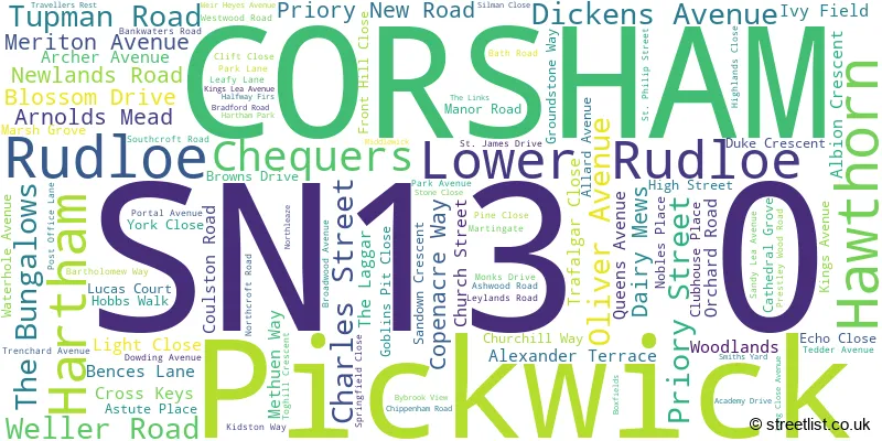
The largest settlement in the SN13 0 postal code is CORSHAM followed by Hawthorn, and Rudloe.
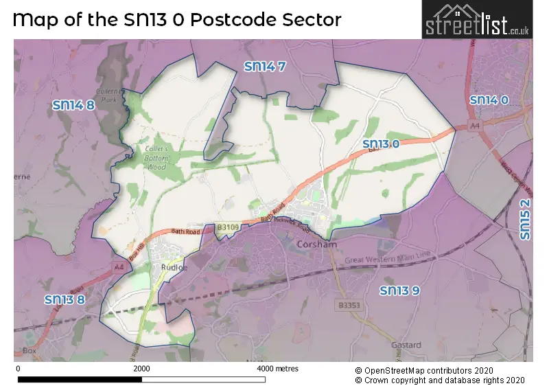
The SN13 0 Postcode shares a border with SN14 0 (CHIPPENHAM, Sheldon), SN13 8 (Box, Kingsdown, Box Hill), SN13 9 (CORSHAM, Neston, Gastard), SN14 7 (Yatton Keynell, Biddestone, Castle Combe) and SN14 8 (Colerne, Marshfield, North Colerne).
The sector is within the post town of CORSHAM.
SN13 0 is a postcode sector within the SN13 postcode district which is within the BA Bath postcode area.
The Royal Mail delivery office for the SN13 0 postal sector is the Corsham Delivery Office and Chippenham Delivery Office.
The area of the SN13 0 postcode sector is 5.40 square miles which is 13.98 square kilometres or 3,453.90 square acres.

Map of the SN13 0 Postcode Sector
Explore the SN13 0 postcode sector by using our free interactive map.
| S | N | 1 | 3 | - | 0 | X | X |
| S | N | 1 | 3 | Space | 0 | Letter | Letter |
Official List of Streets
CORSHAM (87 Streets)
Rudloe (2 Streets)
Hawthorn (3 Streets)
Unofficial Streets or Alternative Spellings
CORSHAM
CHESTNUT GRANGE PICKWICK ROAD SKYNET DRIVE ALDHELM CRESCENT BOX HILL BOXFIELDS ROAD CORSHAM SCIENCE PARK CROSS KEYS ROAD DOVECOTE DRIVE EVERLEY ROAD FIELD BARN LANE GUYERS LANE JUBILEE WOOD ROAD LANCEFIELD PLACE MIDDLEWICK LANE NEW PLACE PRESTLY WOOD PRESTLY WOOD ROAD PRIESTLY WOOD ROAD SOUTH AVENUE SPRING GARDENS VALLEY ROAD WHITE ENNOX LANEBiddestone
HARTHAM LANE WEAVERN LANEHawthorn
WESTWELLS ROADCHIPPENHAM,
BATH ROADBox Hill
BEECH ROAD QUARRY HILLSchools and Places of Education Within the SN13 0 Postcode Sector
The Corsham Regis Primary Academy
Academy sponsor led
Kings Avenue, Corsham, , SN13 0EG
Head: Mrs Abby Symons
Ofsted Rating: Good
Inspection: 2022-02-10 (833 days ago)
Website: Visit The Corsham Regis Primary Academy Website
Phone: 01249712294
Number of Pupils: 143
House Prices in the SN13 0 Postcode Sector
| Type of Property | 2018 Average | 2018 Sales | 2017 Average | 2017 Sales | 2016 Average | 2016 Sales | 2015 Average | 2015 Sales |
|---|---|---|---|---|---|---|---|---|
| Detached | £432,198 | 63 | £426,716 | 37 | £541,857 | 14 | £351,345 | 10 |
| Semi-Detached | £306,150 | 35 | £310,471 | 19 | £265,158 | 19 | £209,260 | 21 |
| Terraced | £212,627 | 37 | £206,750 | 30 | £218,605 | 30 | £171,212 | 26 |
| Flats | £149,516 | 16 | £131,646 | 24 | £130,482 | 22 | £114,654 | 13 |
Important Postcodes SN13 0 in the Postcode Sector
SN13 0BZ is the postcode for BASEMENT, EAST WING AND CENTRAL MANSION HOUSE, Corsham Court, Bath Spa University, Corsham Court, High Street, and BASEMENT, EAST WING AND CENTRAL HOUSE MANSION HOUSE, Corsham Court
SN13 0EG is the postcode for Corsham Regis School, Kings Avenue
SN13 0LX is the postcode for Corsham Primary School - Broadwood Site, Broadwood Avenue, and Corsham Primary School, Broadwood Avenue
| The SN13 0 Sector is within these Local Authorities |
|
|---|---|
| The SN13 0 Sector is within these Counties |
|
| The SN13 0 Sector is within these Water Company Areas |
|