Map of Higher Eanam
| Postcodes | ||
|---|---|---|
| Icon | Postcodes for Higher Eanam | |
| Walking Distances | ||
| Distance Info | Green Circle = 10 Minutes Walk (800 metres) | |
About Higher Eanam
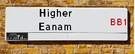
Higher Eanam is a street located in the town of Blackburn. It uses the postcode BB1 3AZ. The street has a length of approximately 332 metres.
Higher Eanam is located within the Blackburn with Darwen (B) Council's jurisdiction. They provide various services, like refuse collection, and manage council tax collection. It's situated in the North West region of the UK.
Higher Eanam has been assigned the Unique Street Reference Numbers of 2903814, 2914080 and 2903424 in the National Street Gazetteer.
Higher Eanam is located within the county of Lancashire, situated in the North West region of the UK. It's 184.47 miles North West from central London., 20.84 miles North West from Manchester, 24.56 miles South East from Lancaster and 31.79 miles North East from Liverpool.

Do you know why this road is called Higher Eanam?
What's it like to live here?
Ask the community a question about Higher Eanam.
Do you have any questions, memories to share or know any facts about Higher Eanam? We'd love to know more.
Also on streetlist.co.uk, can you help?
Swing Swang Lane
28th April 2024
I am trying to find out why the lane is named Swing Swang?
It has been known known this since at least 1905 when hedge making contents used to be held here.
Swing Swang is often used to describe a fairground ride. I remember Swing Boats. Were they a bit like this or is Swing Swang another name for swings?
Swing Swangs are also mentioned in connection to orchards. Or were orchards just good places to have swings?
Estate Agents near Higher Eanam
| Name | Address | Website |
|---|---|---|
| Mortimers Chartered Surveyors | 82 King William Street, Blackburn, BB1 7DT | |
| Your Move | 64 King William Street, Blackburn, BB1 7DT | Visit Website |
| Bridgfords | 9 Sudell Cross, Blackburn, Lancashire, BB1 7EB | Visit Website |
We have found 1 postcode for Higher Eanam
Location Details
| Higher Eanam | |
|---|---|

| |
| Latitude | 53.748917 |
| Longitude | -2.470588 |
| OS Easting (X): | 368970 |
| OS Northing (Y): | 428187 |
| OS Grid Reference: | SD690282 |
Neighbourhood Policing |
| Police Force: Lancashire |
 View Neighbourhood Crime and Policing View Neighbourhood Crime and Policing |
| Find a Local Neighbourhood Watch Scheme |
Frequently asked Questions for Higher Eanam
What Council (Local Authority) is Higher Eanam in?
Higher Eanam is located within the local authority area of Blackburn with Darwen Council which is a Unitary Authority.
What Parish Council is Higher Eanam in?
Higher Eanam is in an unparished area.
What Electoral Ward is Higher Eanam in?
Higher Eanam is located within the ward of Blackburn Central.
What County is Higher Eanam in?
Higher Eanam is located within the ceremonial county of Lancashire.
What Constituency is Higher Eanam in?
Higher Eanam is located within the constituency of Blackburn.
What Part of the UK is Higher Eanam in?
Higher Eanam is located within the North West (England) region of the United Kingdom.
What County Council area is Higher Eanam in?
Higher Eanam is located within the Blackburn with Darwen Council area.
What Police Force area is Higher Eanam in?
Higher Eanam is located within the Lancashire Police area.
Roads that have a Junction with Higher Eanam
| Street | Junction Type |
|---|---|
| Copy Nook (A678) | junction |
| Culshaw Street | junction |
| Dock Street | junction |
| Higher Barn Street (A6078) | junction |
| Eanam (A6078) | pseudo node |
Sunset and Sunrise times for Higher Eanam , BB1 3AZ
| Sunrise | 05:04 |
|---|---|
| Sunset | 21:07 |
Latest Weather Conditions for Higher Eanam, BB1 3AZ
| Observed at Weather Station: | Stonyhurst 15 May 2024 at 03:00 (6.99 miles away) |
|---|---|
| Current Weather: | Clear night |
| Temperature and Humidity: | 12.5°C (89.4%) |
| Wind Direction and Speed: | (0 mph) |
Population Statistics
| ONS Area Code | E00063403 |
|---|---|
| ONS Area Name | Pakistani Communities |
| Average Age | 37.09 |
| Area Population | 1284.00 |
| Male Population | 622.00 (48%) |
| Female Population | 662.00 (52%) |
| Benefit Claimants | 37 (3%) |
| LSOA Code: | E01012575 |
|---|---|
| LSOA Name: | Blackburn with Darwen 007D |
| SOA Code: | 7b |
| SOA Name: | |
| MSOA Code: | E02002621 |
| MSOA Name: | Blackburn with Darwen 007 |
Nearest Supermarkets
| Morrisons Blackburn |
|---|
| Railway Road, Blackburn BB1 5BE |
| 01254 682321 |
| Distance: 0.31 Miles |
| Directions from Higher Eanam to Morrisons Blackburn |
| Morrisons Blackburn |
|---|
| Railway Road, Blackburn BB1 5BE |
| 01254 682321 |
| Distance: 0.31 Miles |
| Directions from Higher Eanam to Morrisons Blackburn |
| Tesco Blackburn Superstore |
|---|
| Hill St, Blackburn, BB1 3HF |
| 0345 677 9059 |
| Distance: 0.48 Miles |
| Directions from Higher Eanam to Tesco Blackburn Superstore |
| Asda Blackburn |
|---|
| Lower Audley Re. Park Grimshaw Park Road, Blackburn, BB2 3DY |
| 01254 690104 |
| Distance: 0.61 Miles |
| Directions from Higher Eanam to Asda Blackburn |
Telephone Information
| Area Code |
|---|
| Area Code: 01254 - Blackburn |
| Area Code: 01200 - Clitheroe |
Broadband Information
| Speed | Average Speed | Median Speed | Maximum Speed | Next-generation access (NGA) | Number of Connections |
|---|---|---|---|---|---|
| Greater than 2 Mbps | 10.5 | 11.4 | 18.9 | N | 8 |
Local Government
| Local Council Details |
|---|
| Within the area of Blackburn with Darwen |
| Visit the Council's Website |
| King William Street, Town Hall, Blackburn, Lancashire &BB1 7DY |
| Send email |
| Telephone Number: 01254 585 585 |
| Local Member of Parliament |
|---|
| Within the Westminster Parliamentary Constituency of Blackburn |
| The Member of Parliament is Kate Hollern |
| Details for the MP Kate Hollern on parliament.uk |
| Details for the MP Kate Hollern on theyworkforyou.com |
| In the 2019 General Election Kate Hollern won with a majority of 18,304 the result was Lab hold. The total electorate was 71,234 |
| Wards, Parish Councils and County Councils |
|---|
| Ward: Blackburn Central Ward |
| Ceremonial County: Lancashire |
Nearest Schools
England Primary Schools
Knuzden St Oswald's CofE Voluntary Aided Primary School
Address: Knuzden St Oswald's CofE Voluntary Aided Primary School, Mount St James, Stanhill Road, Knuzden, Blackburn, Lancashire, BB1 2DR
Distance: 1.53 miles
Contact:
Shadsworth Junior School
Address: Shadsworth Junior School, Blackburn With Darwen, Shadsworth Junior School, Arran Avenue, Lancashire, BB1 2ET
Distance: 1.26 miles
Contact: 01254698016
St Antony's RC Primary School
Address: St Antony's RC Primary School, Shadsworth Road, Blackburn, Lancashire, BB1 2HP
Distance: 0.95 miles
Contact: 0125454686
Intack Primary School
Address: Intack Primary School, Whitebirk Road, Blackburn, Lancashire, BB1 3HY
Distance: 1.05 miles
Contact: 0125452815
Shadsworth Infant School
Address: Shadsworth Infant School, Rothesay Road, Blackburn, Lancashire, BB1 2EL
Distance: 1.12 miles
Contact: 01254698002
Audley Infant School
Address: Audley Infant School, Queens Park Road, Blackburn, Lancashire, BB1 1SE
Distance: 0.55 miles
Contact: 0125452065
Audley Junior School
Address: Audley Junior School, Queen's Park Road, Blackburn, Lancashire, BB1 1SE
Distance: 0.55 miles
Contact: 01254264294
Cedars Primary School
Address: Cedars Primary School, St. James's Road, Blackburn, Lancashire, BB1 8HQ
Distance: 0.88 miles
Contact: 01254261609
Blackburn St Thomas' Church of England Primary School
Address: Blackburn St Thomas' Church of England Primary School, Newton Street, Blackburn, Lancashire, BB1 1NE
Distance: 0.33 miles
Contact: 0125454706
Longshaw Infant School
Address: Longshaw Infant School, Crosby Road, Blackburn, Lancashire, BB2 3NF
Distance: 1.44 miles
Contact: 01254260534
Brookhouse Primary School
Address: Brookhouse Primary School, Troy Street, Blackburn, Lancashire, BB1 6NY
Distance: 0.70 miles
Contact: 01254666050
Daisyfield Primary School
Address: Daisyfield Primary School, Clinton Street, Blackburn, Lancashire, BB1 5LB
Distance: 0.53 miles
Contact: 0125452108
St James' Church of England Primary School
Address: St James' Church of England Primary School, Off Stopes Brow, Lower Darwen, Darwen, Lancashire, BB3 0QP
Distance: 1.76 miles
Contact: 01254698656
St Matthew's Church of England Primary School
Address: St Matthew's Church of England Primary School, Withers Street, Blackburn, Lancashire, BB1 1DF
Distance: 0.23 miles
Contact: 01254291250
St Mary's and St Joseph's Roman Catholic Primary School Blackburn
Address: St Mary's and St Joseph's Roman Catholic Primary School Blackburn, Bennington Street, Blackburn, Lancashire, BB2 3HP
Distance: 0.63 miles
Contact: 01254698301
St Stephen's Church of England Primary School
Address: St Stephen's Church of England Primary School, Robinson Street, Blackburn, Lancashire, BB1 5PE
Distance: 0.75 miles
Contact: 01254277350
St Alban's Roman Catholic Primary School Blackburn
Address: St Alban's Roman Catholic Primary School Blackburn, Trinity Street, Blackburn, Lancashire, BB1 5BN
Distance: 0.22 miles
Contact: 0125457582
Longshaw Community Junior School
Address: Longshaw Community Junior School, Park Lee Road, Blackburn, Lancashire, BB2 3NX
Distance: 1.16 miles
Contact: 01254296450
St Michael With St John CofE Primary School
Address: St Michael With St John CofE Primary School, Swallow Drive, Blackburn, Lancashire, BB1 6LE
Distance: 0.36 miles
Contact: 01254665190
St Anne's Roman Catholic Primary School Blackburn
Address: St Anne's Roman Catholic Primary School Blackburn, Feilden Street, Blackburn, Lancashire, BB2 1LQ
Distance: 0.67 miles
Contact: 01254580462
St Barnabas and St Paul's Church of England Voluntary Aided Primary School
Address: St Barnabas and St Paul's Church of England Voluntary Aided Primary School, Oakenhurst Road, Blackburn, Lancashire, BB2 1SN
Distance: 0.94 miles
Contact: 01254698413
St Luke and St Philips Church of England Primary School
Address: St Luke and St Philips Church of England Primary School, Hancock Street, Blackburn, Lancashire, BB2 2LZ
Distance: 1.18 miles
Contact: 0125454866
Roe Lee Park Primary School
Address: Roe Lee Park Primary School, Emerald Avenue, Blackburn, Lancashire, BB1 9RP
Distance: 1.56 miles
Contact: 0125456297
St James' Church of England Primary School Blackburn
Address: St James' Church of England Primary School Blackburn, Earl Street, Blackburn, Lancashire, BB1 8EG
Distance: 0.85 miles
Contact: 01254698335
Griffin Park Primary School
Address: Griffin Park Primary School, Cavendish Place, Blackburn, Lancashire, BB2 2PN
Distance: 1.44 miles
Contact: 0125457724
Sacred Heart Roman Catholic Primary School Blackburn
Address: Sacred Heart Roman Catholic Primary School Blackburn, Lynwood Road, Blackburn, Lancashire, BB2 6HQ
Distance: 1.36 miles
Contact: 0125454851
St Silas's CofE Primary School
Address: St Silas's CofE Primary School, St Silas Road, Blackburn, Lancashire, BB2 6JP
Distance: 1.38 miles
Contact:
Wensley Fold CofE Primary Academy
Address: Wensley Fold CofE Primary Academy, Manor Road, Blackburn, Lancashire, BB2 6LX
Distance: 1.50 miles
Contact: 01254667449
Wensley Fold (VC) Church of England Primary School
Address: Wensley Fold (VC) Church of England Primary School, Manor Road, Blackburn, Lancashire, BB2 6LX
Distance: 1.50 miles
Contact:
Lammack Primary School
Address: Lammack Primary School, Lammack Road, Blackburn, Lancashire, BB1 8LH
Distance: 1.63 miles
Contact: 01254698584
England Secondary Schools
Our Lady and St John Catholic College
Address: Our Lady and St John Catholic College, North Road, Blackburn, Lancashire, BB1 1PY
Distance: 0.87 miles
Contact: 01254588388
Blackburn Central High School
Address: Blackburn Central High School, Haslingden Road, Blackburn, Lancashire, BB2 3HJ
Distance: 0.77 miles
Contact:
Tauheedul Islam Boys' High School
Address: Tauheedul Islam Boys' High School, Sumner Street, Blackburn, BB2 2LD
Distance: 0.84 miles
Contact: 01254918670
Queen Elizabeth's Grammar School
Address: Queen Elizabeth's Grammar School, West Park Road, Blackburn, Lancashire, BB2 6DF
Distance: 1.08 miles
Contact: 01254686300
St Wilfrid's Church of England Academy
Address: St Wilfrid's Church of England Academy, Duckworth Street, Blackburn, Lancashire, BB2 2JR
Distance: 1.07 miles
Contact: 01254604000
Pleckgate High School
Address: Pleckgate High School, Pleckgate Road, Blackburn, Lancashire, BB1 8QA
Distance: 1.45 miles
Contact: 01254249134
Pleckgate High School Mathematics and Computing College
Address: Pleckgate High School Mathematics and Computing College, Pleckgate Road, Blackburn, Lancashire, BB1 8QA
Distance: 1.45 miles
Contact:
England Higher Schools
Blackburn College
Address: Blackburn College, Blackburn College, Harrison Centre, Feilden Street, Blackburn, Lancashire, BB2 1LH
Distance: 0.78 miles
Contact: 0125455144
Nearest Hospitals
| Name | Address | Postcode | Distance | Map |
|---|
Nearest Dentists
Dentists near Higher Eanam
| Name | Address | Postcode | Distance | Map |
|---|
Nearest GP Surgeries
Doctors near Higher Eanam
DR MARSHALL'S CORNERSTONE PRACTICE
Address: LAMBETH STREET, BLACKBURN, LANCASHIRE, BB1 1LZ
Distance: 0.27 miles
Contact: :
WILLIAM HOPWOOD STREET SURGERY
Address: WILLIAM HOPWOOD STREET, AUDLEY, BLACKBURN, LANCASHIRE, BB1 1LX
Distance: 0.29 miles
Contact: tel: 01254 52522
PRIMROSE BANK MEDICAL CENTRE
Address: PRIMROSE BANK, BLACKBURN, BB1 5ER
Distance: 0.32 miles
Contact: tel: 01254 672132
PRINGLE STREET SURGERY
Address: 216-218 PRINGLE STREET, BLACKBURN, LANCASHIRE, BB1 1SB
Distance: 0.49 miles
Contact: tel: 01254 617690
STEPPING STONE PRACTICE
Address: LONGTON CLOSE, BLACKBURN, LANCASHIRE, BB1 1XA
Distance: 0.58 miles
Contact: tel: 01254 617411
OLIVE MEDICAL CENTRE
Address: 3 LIME STREET, BLACKBURN, BB1 7EP
Distance: 0.60 miles
Contact: tel: 01254 287070
Nearest Dispensing Chemists
Pharmacies near Higher Eanam
| Name | Address | Postcode | Telephone | Map | Distance in Km |
|---|
Nearest Opticians
Opticians near Higher Eanam
VISION SERVE - BLACKBURN
Address: UNIT 1-2, MORRISON SUPERMARKET, RAILWAY ROAD, BLACKBURN, BB1 5AZ
Distance: 0.36 miles
Contact: :
UNIVISION EYE CENTRE
Address: 26 AUDLEY RANGE, BLACKBURN, LANCASHIRE, BB1 1TD
Distance: 0.37 miles
Contact: :
VISION EXPRESS (BLACKBURN)
Address: 237 COBDEN COURT, BLACKBURN SHOPPING CENTRE, BLACKBURN, LANCASHIRE, BB1 7JG
Distance: 0.48 miles
Contact: :
PETER WORDEN OPTICIANS (BLACKBURN)
Address: 61-63 JAMES STREET, BLACKBURN, LANCASHIRE, BB1 6BE
Distance: 0.49 miles
Contact: :
SPECSAVERS (LORD STREET MALL, BLACKBURN)
Address: 21 LORD STREET MALL, BLACKBURN, LANCASHIRE, BB1 7NQ
Distance: 0.49 miles
Contact: :
TYRRELLS AND EMBERY
Address: 64-66 DARWEN STREET, BLACKBURN, LANCASHIRE, BB2 2BL
Distance: 0.53 miles
Contact: :
Transport
Nearest Rail Stations
Blackburn Station is 0.39 miles away.
Address: Blackburn station, Railway Road, Blackburn, Lancashire, BB1 1EX
Blackburn is situated on the East Lancashire line|Ribble Valley line and is managed by Northern.
Blackburn Station is staffed on a full time basis.
Mill Hill (Lancs) Station is 1.58 miles away.
Address: Mill Hill station, Chapel Street, Mill Hill, Lancashire, BB2 2QY
Mill Hill (Lancs) is situated on the East Lancashire line and is managed by Northern.
Mill Hill (Lancs) Station is an unstaffed station.
Directions from Higher Eanam to Mill Hill (Lancs) Rail Station