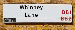
Map of Whinney Lane
| Postcodes | ||
|---|---|---|
| Icon | Postcodes for Whinney Lane | |
| Walking Distances | ||
| Distance Info | Green Circle = 10 Minutes Walk (800 metres) | |
About Whinney Lane
Whinney Lane is a street located in the town of Blackburn and near the town of Blackburn. The street has a length of approximately 1,839 metres.
Whinney Lane is located within the Ribble Valley District (B) and Blackburn with Darwen (B) Council's jurisdiction. They provide various services, like refuse collection, and manage council tax collection. It's situated in the North West region of the UK.
Whinney Lane has been assigned the Unique Street Reference Number of 31800067 and 2900017 in the National Street Gazetteer.
Whinney Lane is located within the county of Lancashire, situated in the North West region of the UK. It's 186.39 miles North West from central London., 22.66 miles South East from Lancaster, 22.7 miles North West from Manchester and 31.88 miles North East from Liverpool.

Do you know why this road is called Whinney Lane?
What's it like to live here?
Ask the community a question about Whinney Lane.
Do you have any questions, memories to share or know any facts about Whinney Lane? We'd love to know more.
Also on streetlist.co.uk, can you help?
Swing Swang Lane
28th April 2024
I am trying to find out why the lane is named Swing Swang?
It has been known known this since at least 1905 when hedge making contents used to be held here.
Swing Swang is often used to describe a fairground ride. I remember Swing Boats. Were they a bit like this or is Swing Swang another name for swings?
Swing Swangs are also mentioned in connection to orchards. Or were orchards just good places to have swings?
Eldroth Road
15th April 2024
I wondered if anyone has any old pictures of Wenning Bank House in the 1940’s and also Lane Side before of the same era .. we visited today with my Mum in law as she used to live at both these properties. Also any photos of the schools around that time .. thank you.
Can You Help?Napps Way
15th April 2024
Why is the road called Napps Way (belonging to Napp, but minus an
apostrophe as is usual with such nomenclature)? Moreover, who or
what is, or was, “Napp” in the respective, possessive case?
Several years ago, I met an elderly man (probably in his late-eighties)
who lives on Bentham Drive, Liverpool 16, and during a conversation
with him whilst in a Northwest Passenger Transport Ambulance on the
way to the former RLUH (Royal Liverpool University Hospital), he told
me that he could remember (when he was a boy, living in Childwall,
Liverpool 16) that, “Where Napps Way is now, during WW2, there was
a two-man gun emplacement on the, then, open land to protect the
railway line passing over Childwall Valley Road - next to the railway
bridge - when suddenly, as they were loading a live “shell” into the gun’s
breach, the aforementioned “shell” accidentally exploded in the gun’s
breach killing both of the two soldiers, that had been manning the gun,
instantly! (Very sad, of course, but could - perhaps - two ghosts relating
to those two, very unfortunately and prematurely-killed soldiers have
haunted that place of their deaths ever since - and have any residents
of Napps Way - formerly and in its latest incarnation - seen two, WW2
(uniformed) soldiers unexpectedly appear in or near their homes?)
Estate Agents near Whinney Lane
| Name | Address | Website |
|---|---|---|
| Pads Abroad Ltd. | Kennard 18 east park road Blackburn Lancashire BB1 8BB | Visit Website |
| Stones Young Estate and Letting Agents | The Old Post Office 740 Whalley New Road Blackburn BB1 9BA | |
| Lock and Key Estate Agent | 7 Hope Street, Blackburn,BB2 1DY | Visit Website |
Location Details
| Whinney Lane | |
|---|---|

| |
| Latitude | 53.768338 |
| Longitude | -2.505945 |
| OS Easting (X): | 366655 |
| OS Northing (Y): | 430364 |
| OS Grid Reference: | SD667304 |
Ordnance Survey Maps for Whinney Lane
If you purchase a map through the links below, we may earn an affiliate commission.
| Map Series | link | Ordnance Survey |
| Explorer 1:25,000 287 West Pennine Moors - Blackburn, Darwen and Accrington | Check Price on Amazon | |
| Landranger 1:50,000 103 Blackburn & Burnley | Check Price on Amazon | Buy Direct from the Ordnance Survey |
Neighbourhood Policing |
| Police Force: Lancashire |
 View Neighbourhood Crime and Policing View Neighbourhood Crime and Policing |
| Find a Local Neighbourhood Watch Scheme |
Frequently asked Questions for Whinney Lane
What Council (Local Authority) is Whinney Lane in?
Whinney Lane is located within the local authority area of Blackburn with Darwen &Ribble Valley Council which is a Unitary Authority &District Council.
What Parish Council is Whinney Lane in?
Whinney Lane is located within the area of Mellor Parish Council.
What Electoral Ward is Whinney Lane in?
Whinney Lane is located within the ward of Billinge & Beardwood &Mellor.
What County is Whinney Lane in?
Whinney Lane is located within the ceremonial county of Lancashire.
What Constituency is Whinney Lane in?
Whinney Lane is located within the constituency of Blackburn &Ribble Valley.
What Part of the UK is Whinney Lane in?
Whinney Lane is located within the North West (England) region of the United Kingdom.
What County Council area is Whinney Lane in?
Whinney Lane is located within the Blackburn with Darwen &Lancashire Council area.
What Police Force area is Whinney Lane in?
Whinney Lane is located within the Lancashire Police area.
Roads that have a Junction with Whinney Lane
| Street | Junction Type |
|---|---|
| Mellor Lane | junction |
| Entwistle Drive | junction |
| Well Lane | junction |
| Yew Tree Drive (A6119) | junction |
| Yew Tree Drive (A6119) | junction |
| Yew Tree Drive | junction |
| St Lawrence Avenue | junction |
| Montreal Road | junction |
| Montreal Road | junction |
| Lammack Road | junction |
Sunset and Sunrise times for Whinney Lane
| Sunrise | 05:30 |
|---|---|
| Sunset | 20:43 |
Latest Weather Conditions for Whinney Lane
| Observed at Weather Station: | Stonyhurst 1 May 2024 at 07:00 (5.86 miles away) |
|---|---|
| Current Weather: | Clear night |
| Temperature and Humidity: | 11.8°C (82.4%) |
| Wind Direction and Speed: | (0 mph) |
Population Statistics
| ONS Area Code | E00063443, E00063441 & E00128591 |
|---|---|
| ONS Area Name | Indian Tech Achievers, Multi-Ethnic Suburbia & Established Farming Communities |
| Average Age | 43.51, 42.93 & 46.75 |
| Area Population | 1243.00, 1642.00 & 1551.00 |
| Male Population | 628.00, 803.00 & 752.00 (49%) |
| Female Population | 615.00, 839.00 & 799.00 (51%) |
| Benefit Claimants | 10, 12 & 8 (1%) |
| LSOA Code: | E01012581, E01012583 &E01025337 |
|---|---|
| LSOA Name: | Blackburn with Darwen 002A, Blackburn with Darwen 002C &Ribble Valley 008E |
| SOA Code: | 8a, 8c &2b |
| SOA Name: | |
| MSOA Code: | E02002616 &E02005277 |
| MSOA Name: | Blackburn with Darwen 002 &Ribble Valley 008 |
Nearest Supermarkets
| Tesco Blackburn Roe Lee Express |
|---|
| 3 Roe Lee Retail Centre, Whalley New Rd, Blackburn, BB1 9AX |
| 0345 675 7088 |
| Distance: 1.14 Miles |
| Directions from Whinney Lane to Tesco Blackburn Roe Lee Express |
| Morrisons Blackburn |
|---|
| Railway Road, Blackburn BB1 5BE |
| 01254 682321 |
| Distance: 1.77 Miles |
| Directions from Whinney Lane to Morrisons Blackburn |
| Morrisons Blackburn |
|---|
| Railway Road, Blackburn BB1 5BE |
| 01254 682321 |
| Distance: 1.77 Miles |
| Directions from Whinney Lane to Morrisons Blackburn |
| Tesco Blackburn Bank Top Express |
|---|
| 71-73 Bank Top, Blackburn, BB2 1TN |
| 0345 026 9899 |
| Distance: 1.81 Miles |
| Directions from Whinney Lane to Tesco Blackburn Bank Top Express |
Telephone Information
| Area Code |
|---|
| Area Code: 01254 - Blackburn |
| Area Code: 01772 - Preston |
| Area Code: 01200 - Clitheroe |
Local Government
| Local Council Details |
|---|
| Within the area of Blackburn with Darwen &Ribble Valley |
| Visit the Council's Website |
| Visit the Council's Website |
| King William Street, Town Hall, Blackburn, Lancashire, BB1 7DY, Council Offices, Church Walk, Clitheroe, Lancashire &BB7 2RA |
| Send email |
| Telephone Number: 01254 585 585 &01200 425111 |
| Local Member of Parliament |
|---|
| Within the Westminster Parliamentary Constituency of Blackburn &Ribble Valley |
| The Member of Parliament is Kate Hollern &Nigel Evans |
| Details for the MP Kate Hollern &Nigel Evans on parliament.uk |
| Details for the MP Kate Hollern &Nigel Evans on theyworkforyou.com |
| In the 2019 General Election Kate Hollern &Nigel Evans won with a majority of 18,304 the result was Lab hold &Con hold. The total electorate was 71,234 |
| Wards, Parish Councils and County Councils |
|---|
| Ward: Billinge & Beardwood &Mellor Ward |
| Ceremonial County: Lancashire |
Nearest Schools
England Primary Schools
St Stephen's Church of England Primary School
Address: St Stephen's Church of England Primary School, Robinson Street, Blackburn, Lancashire, BB1 5PE
Distance: 1.81 miles
Contact: 01254277350
Roe Lee Park Primary School
Address: Roe Lee Park Primary School, Emerald Avenue, Blackburn, Lancashire, BB1 9RP
Distance: 1.36 miles
Contact: 0125456297
St James' Church of England Primary School Blackburn
Address: St James' Church of England Primary School Blackburn, Earl Street, Blackburn, Lancashire, BB1 8EG
Distance: 1.13 miles
Contact: 01254698335
Holy Souls Roman Catholic Primary School Blackburn
Address: Holy Souls Roman Catholic Primary School Blackburn, Wilworth Crescent, Blackburn, Lancashire, BB1 8QN
Distance: 0.88 miles
Contact: 01254249892
St Gabriel's Church of England Primary School
Address: St Gabriel's Church of England Primary School, Wilworth Crescent, Blackburn, Lancashire, BB1 8QN
Distance: 0.88 miles
Contact: 01254249462
Sacred Heart Roman Catholic Primary School Blackburn
Address: Sacred Heart Roman Catholic Primary School Blackburn, Lynwood Road, Blackburn, Lancashire, BB2 6HQ
Distance: 1.06 miles
Contact: 0125454851
St Silas's CofE Primary School
Address: St Silas's CofE Primary School, St Silas Road, Blackburn, Lancashire, BB2 6JP
Distance: 1.14 miles
Contact:
Wensley Fold CofE Primary Academy
Address: Wensley Fold CofE Primary Academy, Manor Road, Blackburn, Lancashire, BB2 6LX
Distance: 1.31 miles
Contact: 01254667449
Wensley Fold (VC) Church of England Primary School
Address: Wensley Fold (VC) Church of England Primary School, Manor Road, Blackburn, Lancashire, BB2 6LX
Distance: 1.31 miles
Contact:
The Olive School Blackburn
Address: The Olive School Blackburn, Meins Road, Blackburn, Lancashire, BB2 6QQ
Distance: 1.19 miles
Contact: 0125454070
Lammack Primary School
Address: Lammack Primary School, Lammack Road, Blackburn, Lancashire, BB1 8LH
Distance: 0.38 miles
Contact: 01254698584
Mellor St Mary Church of England Primary School
Address: Mellor St Mary Church of England Primary School, Brundhurst Fold, Mellor, Blackburn, Lancashire, BB2 7JT
Distance: 1.13 miles
Contact: 01254812581
St Mary's Roman Catholic Primary School, Osbaldeston
Address: St Mary's Roman Catholic Primary School, Osbaldeston, Longsight Road, Osbaldeston, Blackburn, Lancashire, BB2 7HX
Distance: 1.52 miles
Contact: 01254812543
England Secondary Schools
Pleckgate High School
Address: Pleckgate High School, Pleckgate Road, Blackburn, Lancashire, BB1 8QA
Distance: 0.78 miles
Contact: 01254249134
Pleckgate High School Mathematics and Computing College
Address: Pleckgate High School Mathematics and Computing College, Pleckgate Road, Blackburn, Lancashire, BB1 8QA
Distance: 0.78 miles
Contact:
Nearest Hospitals
| Name | Address | Postcode | Distance | Map |
|---|
Nearest Dentists
Dentists near Whinney Lane
| Name | Address | Postcode | Distance | Map |
|---|
Nearest GP Surgeries
Doctors near Whinney Lane
MELLOR SURGERY
Address: MELLOR SURGERY, ST MARY'S GARDENS, MELLOR, BLACKBURN, LANCASHIRE, BB2 7JW
Distance: 0.93 miles
Contact: tel: 01254 812810
BROWNHILL SURGERY
Address: 788-790 WHALLEY NEW ROAD, BLACKBURN, LANCASHIRE, BB1 9BA
Distance: 1.19 miles
Contact: tel: 01254 247477
LIMEFIELD SURGERY
Address: 293-295 PRESTON NEW ROAD, BLACKBURN, LANCASHIRE, BB2 6PL
Distance: 1.28 miles
Contact: tel: 01254 915740
BLAKEWATER HEALTHCARE
Address: 367 WHALLEY NEW ROAD, BLACKBURN, BB1 9SR
Distance: 1.33 miles
Contact: tel: 01254 360158
OLIVE MEDICAL CENTRE
Address: 3 LIME STREET, BLACKBURN, BB1 7EP
Distance: 1.42 miles
Contact: tel: 01254 287070
SHIFA SURGERY
Address: BANGOR STREET, BLACKBURN, LANCASHIRE, BB1 6DY
Distance: 1.44 miles
Contact: tel: 01254 617440
Nearest Dispensing Chemists
Pharmacies near Whinney Lane
| Name | Address | Postcode | Telephone | Map | Distance in Km |
|---|
Nearest Opticians
Opticians near Whinney Lane
OPTICAL CARE LTD
Address: 41 YEW TREE DRIVE, BLACKBURN, LANCASHIRE, BB2 7DW
Distance: 0.27 miles
Contact: :
HAROON AHMED LIMITED
Address: 11 MERLIN ROAD, BLACKBURN, BB2 7BA
Distance: 0.97 miles
Contact: :
NEW BANK OPTICAL
Address: 26 NEW BANK ROAD, BLACKBURN, LANCASHIRE, BB2 6JW
Distance: 1.14 miles
Contact: :
IDEAL EYECARE
Address: 775 WHALLEY NEW ROAD, BLACKBURN, LANCASHIRE, BB1 9BE
Distance: 1.36 miles
Contact: :
UNIVISION EYE CENTRE
Address: 40 LIMBRICK, BLACKBURN, LANCASHIRE, BB1 8AB
Distance: 1.37 miles
Contact: :
ON SIGHT CARE
Address: 24 BUNCER LANE, BLACKBURN, BB2 6SN
Distance: 1.46 miles
Contact: :
Transport
Nearest Rail Stations
Ramsgreave & Wilpshire Station is 1.37 miles away.
Address: Ramsgreave & Wilpshire station, Ramsgreave Road, Wilpshire, Lancashire, BB1 9BP
Ramsgreave & Wilpshire is situated on the Ribble Valley line and is managed by Northern.
Ramsgreave & Wilpshire Station is an unstaffed station.
Directions from Whinney Lane to Ramsgreave & Wilpshire Rail Station
Blackburn Station is 1.86 miles away.
Address: Blackburn station, Railway Road, Blackburn, Lancashire, BB1 1EX
Blackburn is situated on the East Lancashire line|Ribble Valley line and is managed by Northern.
Blackburn Station is staffed on a full time basis.