Map of Peel Street
| Postcodes | ||
|---|---|---|
| Icon | Postcodes for Peel Street | |
| Walking Distances | ||
| Distance Info | Green Circle = 10 Minutes Walk (800 metres) | |
About Peel Street
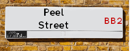
Peel Street is a street located in the town of Blackburn. It uses the postcode BB2 2QF. The street has a length of approximately 262 metres.
Peel Street is located within the Blackburn with Darwen (B) Council's jurisdiction. They provide various services, like refuse collection, and manage council tax collection. It's situated in the North West region of the UK.
Peel Street has been assigned the Unique Street Reference Number of 2900058 in the National Street Gazetteer.
Peel Street is located within the county of Lancashire, situated in the North West region of the UK. It's 184.39 miles North West from central London., 20.64 miles North West from Manchester, 24.71 miles South East from Lancaster and 30.39 miles North East from Liverpool.

Do you know why this road is called Peel Street?
What's it like to live here?
Ask the community a question about Peel Street.
Do you have any questions, memories to share or know any facts about Peel Street? We'd love to know more.
Also on streetlist.co.uk, can you help?
Swing Swang Lane
28th April 2024
I am trying to find out why the lane is named Swing Swang?
It has been known known this since at least 1905 when hedge making contents used to be held here.
Swing Swang is often used to describe a fairground ride. I remember Swing Boats. Were they a bit like this or is Swing Swang another name for swings?
Swing Swangs are also mentioned in connection to orchards. Or were orchards just good places to have swings?
Estate Agents near Peel Street
| Name | Address | Website |
|---|---|---|
| Ainsworth Lord Estates | 23 New Chapel Street, Blackburn, BB2 4DT | Visit Website |
| Plumlife | Shakespeare Way, Blackburn, BB2 1XL | Visit Website |
| Oak Leigh Sales & Lettings | Office 20, Blackburn Rovers Business Centre, Ewood Park, Blackburn,BB2 4JF | Visit Website |
We have found 1 postcode for Peel Street
Location Details
| Peel Street | |
|---|---|

| |
| Latitude | 53.736512 |
| Longitude | -2.498531 |
| OS Easting (X): | 367118 |
| OS Northing (Y): | 426820 |
| OS Grid Reference: | SD671268 |
Neighbourhood Policing |
| Police Force: Lancashire |
 View Neighbourhood Crime and Policing View Neighbourhood Crime and Policing |
| Find a Local Neighbourhood Watch Scheme |
Frequently asked Questions for Peel Street
What Council (Local Authority) is Peel Street in?
Peel Street is located within the local authority area of Blackburn with Darwen Council which is a Unitary Authority.
What Parish Council is Peel Street in?
Peel Street is in an unparished area.
What Electoral Ward is Peel Street in?
Peel Street is located within the ward of Mill Hill & Moorgate.
What County is Peel Street in?
Peel Street is located within the ceremonial county of Lancashire.
What Constituency is Peel Street in?
Peel Street is located within the constituency of Blackburn.
What Part of the UK is Peel Street in?
Peel Street is located within the North West (England) region of the United Kingdom.
What County Council area is Peel Street in?
Peel Street is located within the Blackburn with Darwen Council area.
What Police Force area is Peel Street in?
Peel Street is located within the Lancashire Police area.
Roads that have a Junction with Peel Street
| Street | Junction Type |
|---|---|
| Queen Victoria Street | pseudo node |
| Albert Street | junction |
| Dimmock Street | junction |
| Stancliffe Street (B6447) | junction |
Sunset and Sunrise times for Peel Street , BB2 2QF
| Sunrise | 05:11 |
|---|---|
| Sunset | 21:00 |
Latest Weather Conditions for Peel Street, BB2 2QF
| Observed at Weather Station: | Stonyhurst 11 May 2024 at 12:00 (7.95 miles away) |
|---|---|
| Current Weather: | Clear night |
| Temperature and Humidity: | 21.9°C (57.7%) |
| Wind Direction and Speed: | (0 mph) |
Population Statistics
| ONS Area Code | E00063633 |
|---|---|
| ONS Area Name | Hard-Pressed European Settlers |
| Average Age | 36.95 |
| Area Population | 1633.00 |
| Male Population | 821.00 (50%) |
| Female Population | 812.00 (50%) |
| Benefit Claimants | 37 (2%) |
| LSOA Code: | E01012625 |
|---|---|
| LSOA Name: | Blackburn with Darwen 009F |
| SOA Code: | 4b |
| SOA Name: | |
| MSOA Code: | E02002623 |
| MSOA Name: | Blackburn with Darwen 009 |
Nearest Supermarkets
| Tesco Blackburn Bank Top Express |
|---|
| 71-73 Bank Top, Blackburn, BB2 1TN |
| 0345 026 9899 |
| Distance: 0.42 Miles |
| Directions from Peel Street to Tesco Blackburn Bank Top Express |
| Iceland Blackburn Ewood |
|---|
| Bolton Rd/Livesey Rd, Ewood Mill, Blackburn, BB2 4LQ |
| 01254665476 |
| Distance: 0.61 Miles |
| Directions from Peel Street to Iceland Blackburn Ewood |
| Asda Blackburn |
|---|
| Lower Audley Re. Park Grimshaw Park Road, Blackburn, BB2 3DY |
| 01254 690104 |
| Distance: 0.9 Miles |
| Directions from Peel Street to Asda Blackburn |
| Sainsburys Blackburn Preston Old Road Local |
|---|
| 395 Preston Old Road, Blackburn, England, BB2 5LW |
| 01254 209433 |
| Distance: 0.93 Miles |
| Directions from Peel Street to Sainsburys Blackburn Preston Old Road Local |
Telephone Information
| Area Code |
|---|
| Area Code: 01254 - Blackburn |
| Area Code: 01772 - Preston |
Local Government
| Local Council Details |
|---|
| Within the area of Blackburn with Darwen |
| Visit the Council's Website |
| King William Street, Town Hall, Blackburn, Lancashire &BB1 7DY |
| Send email |
| Telephone Number: 01254 585 585 |
| Local Member of Parliament |
|---|
| Within the Westminster Parliamentary Constituency of Blackburn |
| The Member of Parliament is Kate Hollern |
| Details for the MP Kate Hollern on parliament.uk |
| Details for the MP Kate Hollern on theyworkforyou.com |
| In the 2019 General Election Kate Hollern won with a majority of 18,304 the result was Lab hold. The total electorate was 71,234 |
| Wards, Parish Councils and County Councils |
|---|
| Ward: Mill Hill & Moorgate Ward |
| Ceremonial County: Lancashire |
Nearest Schools
England Primary Schools
Audley Infant School
Address: Audley Infant School, Queens Park Road, Blackburn, Lancashire, BB1 1SE
Distance: 1.43 miles
Contact: 0125452065
Audley Junior School
Address: Audley Junior School, Queen's Park Road, Blackburn, Lancashire, BB1 1SE
Distance: 1.43 miles
Contact: 01254264294
Longshaw Infant School
Address: Longshaw Infant School, Crosby Road, Blackburn, Lancashire, BB2 3NF
Distance: 0.82 miles
Contact: 01254260534
Lower Darwen Primary School
Address: Lower Darwen Primary School, Milking Lane, Lower Darwen, Darwen, Lancashire, BB3 0RB
Distance: 1.75 miles
Contact: 0125455639
St James' Church of England Primary School
Address: St James' Church of England Primary School, Off Stopes Brow, Lower Darwen, Darwen, Lancashire, BB3 0QP
Distance: 1.63 miles
Contact: 01254698656
St Matthew's Church of England Primary School
Address: St Matthew's Church of England Primary School, Withers Street, Blackburn, Lancashire, BB1 1DF
Distance: 1.24 miles
Contact: 01254291250
St Mary's and St Joseph's Roman Catholic Primary School Blackburn
Address: St Mary's and St Joseph's Roman Catholic Primary School Blackburn, Bennington Street, Blackburn, Lancashire, BB2 3HP
Distance: 1.05 miles
Contact: 01254698301
Longshaw Community Junior School
Address: Longshaw Community Junior School, Park Lee Road, Blackburn, Lancashire, BB2 3NX
Distance: 0.65 miles
Contact: 01254296450
St Michael With St John CofE Primary School
Address: St Michael With St John CofE Primary School, Swallow Drive, Blackburn, Lancashire, BB1 6LE
Distance: 1.37 miles
Contact: 01254665190
Blackburn the Redeemer CofE Primary
Address: Blackburn the Redeemer CofE Primary, Jack Walker Way, Fernhurst Farm, Blackburn, Lancashire, BB2 4JJ
Distance: 1.05 miles
Contact: 01254296400
St Edward's Roman Catholic Primary School Blackburn
Address: St Edward's Roman Catholic Primary School Blackburn, Blackburn Road, Darwen, Lancashire, BB3 0AA
Distance: 1.99 miles
Contact: 01254701616
St Anne's Roman Catholic Primary School Blackburn
Address: St Anne's Roman Catholic Primary School Blackburn, Feilden Street, Blackburn, Lancashire, BB2 1LQ
Distance: 0.90 miles
Contact: 01254580462
St Barnabas and St Paul's Church of England Voluntary Aided Primary School
Address: St Barnabas and St Paul's Church of England Voluntary Aided Primary School, Oakenhurst Road, Blackburn, Lancashire, BB2 1SN
Distance: 0.72 miles
Contact: 01254698413
St Luke and St Philips Church of England Primary School
Address: St Luke and St Philips Church of England Primary School, Hancock Street, Blackburn, Lancashire, BB2 2LZ
Distance: 0.27 miles
Contact: 0125454866
St Peter's Roman Catholic Primary School, Blackburn
Address: St Peter's Roman Catholic Primary School, Blackburn, Hawkins Street, Blackburn, Lancashire, BB2 2RY
Distance: 0.32 miles
Contact: 01254691745
St Aidan's Primary School - A Church of England Academy
Address: St Aidan's Primary School - A Church of England Academy, Norfolk Street, Mill Hill, Blackburn, Lancashire, BB2 4EW
Distance: 0.16 miles
Contact: 0125453148
Griffin Park Primary School
Address: Griffin Park Primary School, Cavendish Place, Blackburn, Lancashire, BB2 2PN
Distance: 0.34 miles
Contact: 0125457724
Meadowhead Community Infant School and Nursery
Address: Meadowhead Community Infant School and Nursery, Shorrock Lane, BLACKBURN, Lancashire, BB2 4TT
Distance: 0.62 miles
Contact: 01254202600
Meadowhead Junior School
Address: Meadowhead Junior School, Anglesey Street, Blackburn, Lancashire, BB2 4QG
Distance: 0.68 miles
Contact: 01254209871
Sacred Heart Roman Catholic Primary School Blackburn
Address: Sacred Heart Roman Catholic Primary School Blackburn, Lynwood Road, Blackburn, Lancashire, BB2 6HQ
Distance: 1.16 miles
Contact: 0125454851
St Silas's CofE Primary School
Address: St Silas's CofE Primary School, St Silas Road, Blackburn, Lancashire, BB2 6JP
Distance: 1.09 miles
Contact:
Wensley Fold CofE Primary Academy
Address: Wensley Fold CofE Primary Academy, Manor Road, Blackburn, Lancashire, BB2 6LX
Distance: 0.97 miles
Contact: 01254667449
Wensley Fold (VC) Church of England Primary School
Address: Wensley Fold (VC) Church of England Primary School, Manor Road, Blackburn, Lancashire, BB2 6LX
Distance: 0.97 miles
Contact:
The Olive School Blackburn
Address: The Olive School Blackburn, Meins Road, Blackburn, Lancashire, BB2 6QQ
Distance: 1.29 miles
Contact: 0125454070
Livesey Saint Francis' Church of England School
Address: Livesey Saint Francis' Church of England School, Cherry Tree Lane, Cherry Tree, Blackburn, Lancashire, BB2 5NX
Distance: 1.23 miles
Contact: 01254201419
England Secondary Schools
Blackburn Central High School
Address: Blackburn Central High School, Haslingden Road, Blackburn, Lancashire, BB2 3HJ
Distance: 1.15 miles
Contact:
Tauheedul Islam Boys' High School
Address: Tauheedul Islam Boys' High School, Sumner Street, Blackburn, BB2 2LD
Distance: 0.60 miles
Contact: 01254918670
Darwen Vale High School
Address: Darwen Vale High School, Blackburn Road, Darwen, Lancashire, BB3 0AL
Distance: 1.59 miles
Contact: 01254223000
Queen Elizabeth's Grammar School
Address: Queen Elizabeth's Grammar School, West Park Road, Blackburn, Lancashire, BB2 6DF
Distance: 1.17 miles
Contact: 01254686300
St Wilfrid's Church of England Academy
Address: St Wilfrid's Church of England Academy, Duckworth Street, Blackburn, Lancashire, BB2 2JR
Distance: 0.45 miles
Contact: 01254604000
Witton Park Academy
Address: Witton Park Academy, Buncer Lane, Blackburn, Lancashire, BB2 6TD
Distance: 0.63 miles
Contact: 01254264551
St Bede's Roman Catholic High School, Blackburn
Address: St Bede's Roman Catholic High School, Blackburn, Green Lane, Blackburn, Lancashire, BB2 4SR
Distance: 0.81 miles
Contact: 01254202519
England Higher Schools
Blackburn College
Address: Blackburn College, Blackburn College, Harrison Centre, Feilden Street, Blackburn, Lancashire, BB2 1LH
Distance: 0.91 miles
Contact: 0125455144
Nearest Hospitals
| Name | Address | Postcode | Distance | Map |
|---|
Nearest Dentists
Dentists near Peel Street
| Name | Address | Postcode | Distance | Map |
|---|
Nearest GP Surgeries
Doctors near Peel Street
WITTON MEDICAL CENTRE
Address: PRESTON OLD RD, WITTON, BLACKBURN, LANCASHIRE, BB2 2SU
Distance: 0.45 miles
Contact: tel: 01254 457800
REDLAM SURGERY
Address: 62-64 REDLAM, BLACKBURN, LANCASHIRE, BB2 1UW
Distance: 0.47 miles
Contact: tel: 01254 260051
BENTHAM ROAD HEALTH CENTRE
Address: BENTHAM ROAD, BLACKBURN, LANCASHIRE, BB2 4QD
Distance: 0.52 miles
Contact: tel: 01254 617474
PRICHARD STREET BRANCH SURGERY
Address: 1A PRITCHARD STREET, BLACKBURN, LANCASHIRE, BB2 3PF
Distance: 0.56 miles
Contact: :
ST GEORGES SURGERY
Address: ST GEORGE'S SURGERY, 62 HASLINGDEN ROAD, BLACKBURN, LANCASHIRE, BB2 3HS
Distance: 0.94 miles
Contact: tel: 01254 584888
LIMEFIELD SURGERY
Address: 293-295 PRESTON NEW ROAD, BLACKBURN, LANCASHIRE, BB2 6PL
Distance: 0.95 miles
Contact: tel: 01254 915740
Nearest Dispensing Chemists
Pharmacies near Peel Street
| Name | Address | Postcode | Telephone | Map | Distance in Km |
|---|
Nearest Opticians
Opticians near Peel Street
EYECARE OPTICIANS (BLACKBURN)
Address: 372 PRESTON OLD ROAD, BLACKBURN, LANCASHIRE, BB2 5LL
Distance: 0.87 miles
Contact: :
ON SIGHT CARE
Address: 24 BUNCER LANE, BLACKBURN, BB2 6SN
Distance: 0.89 miles
Contact: :
OPTIHOME DIRECT LIMITED
Address: 99 BUNCER LANE, BLACKBURN, BB2 6SN
Distance: 0.89 miles
Contact: :
TYRRELLS AND EMBERY
Address: 64-66 DARWEN STREET, BLACKBURN, LANCASHIRE, BB2 2BL
Distance: 0.91 miles
Contact: :
SPECSAVERS (LORD STREET MALL, BLACKBURN)
Address: 21 LORD STREET MALL, BLACKBURN, LANCASHIRE, BB1 7NQ
Distance: 1.05 miles
Contact: :
NEW BANK OPTICAL
Address: 26 NEW BANK ROAD, BLACKBURN, LANCASHIRE, BB2 6JW
Distance: 1.08 miles
Contact: :
Transport
Nearest Rail Stations
Mill Hill (Lancs) Station is 0.15 miles away.
Address: Mill Hill station, Chapel Street, Mill Hill, Lancashire, BB2 2QY
Mill Hill (Lancs) is situated on the East Lancashire line and is managed by Northern.
Mill Hill (Lancs) Station is an unstaffed station.
Directions from Peel Street to Mill Hill (Lancs) Rail Station
Cherry Tree Station is 0.85 miles away.
Address: Cherry Tree station, Green Lane, Cherry Tree, Lancashire, BB2 2TZ
Cherry Tree is situated on the East Lancashire line and is managed by Northern.
Cherry Tree Station is an unstaffed station.