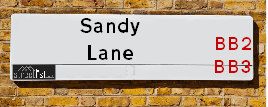
Map of Sandy Lane
| Postcodes | ||
|---|---|---|
| Icon | Postcodes for Sandy Lane | |
| Walking Distances | ||
| Distance Info | Green Circle = 10 Minutes Walk (800 metres) | |
About Sandy Lane
Sandy Lane is a street located in the town of Blackburn. The street has a length of approximately 739 metres.
Sandy Lane is located within the Blackburn with Darwen (B) Council's jurisdiction. They provide various services, like refuse collection, and manage council tax collection. It's situated in the North West region of the UK.
Sandy Lane has been assigned the Unique Street Reference Number of 2903819 and 2914090 in the National Street Gazetteer.
Sandy Lane is located within the county of Lancashire, situated in the North West region of the UK. It's 182.97 miles North West from central London., 19.22 miles North West from Manchester, 26.13 miles South East from Lancaster and 30.02 miles North East from Liverpool.

Do you know why this road is called Sandy Lane?
What's it like to live here?
Ask the community a question about Sandy Lane.
Do you have any questions, memories to share or know any facts about Sandy Lane? We'd love to know more.
Also on streetlist.co.uk, can you help?
Swing Swang Lane
28th April 2024
I am trying to find out why the lane is named Swing Swang?
It has been known known this since at least 1905 when hedge making contents used to be held here.
Swing Swang is often used to describe a fairground ride. I remember Swing Boats. Were they a bit like this or is Swing Swang another name for swings?
Swing Swangs are also mentioned in connection to orchards. Or were orchards just good places to have swings?
Eldroth Road
15th April 2024
I wondered if anyone has any old pictures of Wenning Bank House in the 1940’s and also Lane Side before of the same era .. we visited today with my Mum in law as she used to live at both these properties. Also any photos of the schools around that time .. thank you.
Can You Help?Napps Way
15th April 2024
Why is the road called Napps Way (belonging to Napp, but minus an
apostrophe as is usual with such nomenclature)? Moreover, who or
what is, or was, “Napp” in the respective, possessive case?
Several years ago, I met an elderly man (probably in his late-eighties)
who lives on Bentham Drive, Liverpool 16, and during a conversation
with him whilst in a Northwest Passenger Transport Ambulance on the
way to the former RLUH (Royal Liverpool University Hospital), he told
me that he could remember (when he was a boy, living in Childwall,
Liverpool 16) that, “Where Napps Way is now, during WW2, there was
a two-man gun emplacement on the, then, open land to protect the
railway line passing over Childwall Valley Road - next to the railway
bridge - when suddenly, as they were loading a live “shell” into the gun’s
breach, the aforementioned “shell” accidentally exploded in the gun’s
breach killing both of the two soldiers, that had been manning the gun,
instantly! (Very sad, of course, but could - perhaps - two ghosts relating
to those two, very unfortunately and prematurely-killed soldiers have
haunted that place of their deaths ever since - and have any residents
of Napps Way - formerly and in its latest incarnation - seen two, WW2
(uniformed) soldiers unexpectedly appear in or near their homes?)
Estate Agents near Sandy Lane
| Name | Address | Website |
|---|---|---|
| Oak Leigh Sales & Lettings | Office 20, Blackburn Rovers Business Centre, Ewood Park, Blackburn,BB2 4JF | Visit Website |
| Ainsworth Lord Estates | 23 New Chapel Street, Blackburn, BB2 4DT | Visit Website |
| Proctors Estate Agency | 238-240 Duckworth Street, Darwen, BB3 1PX | Visit Website |
Location Details
| Sandy Lane | |
|---|---|

| |
| Latitude | 53.719123 |
| Longitude | -2.480135 |
| OS Easting (X): | 368319 |
| OS Northing (Y): | 424877 |
| OS Grid Reference: | SD683249 |
Neighbourhood Policing |
| Police Force: Lancashire |
 View Neighbourhood Crime and Policing View Neighbourhood Crime and Policing |
| Find a Local Neighbourhood Watch Scheme |
Frequently asked Questions for Sandy Lane
What Council (Local Authority) is Sandy Lane in?
Sandy Lane is located within the local authority area of Blackburn with Darwen Council which is a Unitary Authority.
What Parish Council is Sandy Lane in?
Sandy Lane is in an unparished area.
What Electoral Ward is Sandy Lane in?
Sandy Lane is located within the ward of Blackburn South & Lower Darwen.
What County is Sandy Lane in?
Sandy Lane is located within the ceremonial county of Lancashire.
What Constituency is Sandy Lane in?
Sandy Lane is located within the constituency of Rossendale and Darwen.
What Part of the UK is Sandy Lane in?
Sandy Lane is located within the North West (England) region of the United Kingdom.
What County Council area is Sandy Lane in?
Sandy Lane is located within the Blackburn with Darwen Council area.
What Police Force area is Sandy Lane in?
Sandy Lane is located within the Lancashire Police area.
Roads that have a Junction with Sandy Lane
| Street | Junction Type |
|---|---|
| Blackburn Road (A666) | junction |
| Dominica Avenue | junction |
| Cross Street | junction |
| Sangara Drive | junction |
| Tottenham Road | junction |
| Branch Road | junction |
Sunset and Sunrise times for Sandy Lane
| Sunrise | 05:17 |
|---|---|
| Sunset | 20:55 |
Latest Weather Conditions for Sandy Lane
| Observed at Weather Station: | Stonyhurst 8 May 2024 at 12:00 (9.06 miles away) |
|---|---|
| Current Weather: | Clear night |
| Temperature and Humidity: | 15.7°C (75.1%) |
| Wind Direction and Speed: | (0 mph) |
Population Statistics
| ONS Area Code | E00063514 |
|---|---|
| ONS Area Name | White Suburban Communities |
| Average Age | 41.35 |
| Area Population | 1169.00 |
| Male Population | 596.00 (51%) |
| Female Population | 573.00 (49%) |
| Benefit Claimants | 11 (1%) |
| LSOA Code: | E01012599 |
|---|---|
| LSOA Name: | Blackburn with Darwen 013D |
| SOA Code: | 8c |
| SOA Name: | |
| MSOA Code: | E02002627 |
| MSOA Name: | Blackburn with Darwen 013 |
Nearest Supermarkets
| Iceland Blackburn Ewood |
|---|
| Bolton Rd/Livesey Rd, Ewood Mill, Blackburn, BB2 4LQ |
| 01254665476 |
| Distance: 0.82 Miles |
| Directions from Sandy Lane to Iceland Blackburn Ewood |
| Asda Blackburn |
|---|
| Lower Audley Re. Park Grimshaw Park Road, Blackburn, BB2 3DY |
| 01254 690104 |
| Distance: 1.53 Miles |
| Directions from Sandy Lane to Asda Blackburn |
| Iceland Darwen |
|---|
| School Street, Darwen, Lancashire, BB3 1BE |
| 01254701615 |
| Distance: 1.66 Miles |
| Directions from Sandy Lane to Iceland Darwen |
| Asda Darwen |
|---|
| School Street, Darwen, BB3 1BE |
| 01254 342600 |
| Distance: 1.67 Miles |
| Directions from Sandy Lane to Asda Darwen |
Telephone Information
| Area Code |
|---|
| Area Code: 01254 - Blackburn |
Broadband Information
| Speed | Average Speed | Median Speed | Maximum Speed | Next-generation access (NGA) | Number of Connections |
|---|---|---|---|---|---|
| Less than 2 Mbps | 26.6 | 20 | >=30 | Y | 19 |
Local Government
| Local Council Details |
|---|
| Within the area of Blackburn with Darwen |
| Visit the Council's Website |
| King William Street, Town Hall, Blackburn, Lancashire &BB1 7DY |
| Send email |
| Telephone Number: 01254 585 585 |
| Local Member of Parliament |
|---|
| Within the Westminster Parliamentary Constituency of Rossendale and Darwen |
| The Member of Parliament is Jake Berry |
| Details for the MP Jake Berry on parliament.uk |
| Details for the MP Jake Berry on theyworkforyou.com |
| In the 2019 General Election Jake Berry won with a majority of 9,522 the result was Con hold. The total electorate was 72,770 |
| Wards, Parish Councils and County Councils |
|---|
| Ward: Blackburn South & Lower Darwen Ward |
| Ceremonial County: Lancashire |
Nearest Schools
England Primary Schools
Our Lady of Perpetual Succour Roman Catholic Primary School Blackburn
Address: Our Lady of Perpetual Succour Roman Catholic Primary School Blackburn, Holmbrook Close, Blackburn, Lancashire, BB2 3UG
Distance: 0.54 miles
Contact: 0125459420
Lower Darwen Primary School
Address: Lower Darwen Primary School, Milking Lane, Lower Darwen, Darwen, Lancashire, BB3 0RB
Distance: 0.49 miles
Contact: 0125455639
St James' Church of England Primary School
Address: St James' Church of England Primary School, Off Stopes Brow, Lower Darwen, Darwen, Lancashire, BB3 0QP
Distance: 0.69 miles
Contact: 01254698656
St Mary's and St Joseph's Roman Catholic Primary School Blackburn
Address: St Mary's and St Joseph's Roman Catholic Primary School Blackburn, Bennington Street, Blackburn, Lancashire, BB2 3HP
Distance: 1.46 miles
Contact: 01254698301
Longshaw Community Junior School
Address: Longshaw Community Junior School, Park Lee Road, Blackburn, Lancashire, BB2 3NX
Distance: 1.03 miles
Contact: 01254296450
St Cuthbert's Church of England Primary School
Address: St Cuthbert's Church of England Primary School, St Albans Road, Darwen, Lancashire, BB3 0HY
Distance: 0.86 miles
Contact: 01254701336
Blackburn the Redeemer CofE Primary
Address: Blackburn the Redeemer CofE Primary, Jack Walker Way, Fernhurst Farm, Blackburn, Lancashire, BB2 4JJ
Distance: 0.52 miles
Contact: 01254296400
St Edward's Roman Catholic Primary School Blackburn
Address: St Edward's Roman Catholic Primary School Blackburn, Blackburn Road, Darwen, Lancashire, BB3 0AA
Distance: 0.66 miles
Contact: 01254701616
St Luke and St Philips Church of England Primary School
Address: St Luke and St Philips Church of England Primary School, Hancock Street, Blackburn, Lancashire, BB2 2LZ
Distance: 1.55 miles
Contact: 0125454866
St Aidan's Primary School - A Church of England Academy
Address: St Aidan's Primary School - A Church of England Academy, Norfolk Street, Mill Hill, Blackburn, Lancashire, BB2 4EW
Distance: 1.35 miles
Contact: 0125453148
Meadowhead Community Infant School and Nursery
Address: Meadowhead Community Infant School and Nursery, Shorrock Lane, BLACKBURN, Lancashire, BB2 4TT
Distance: 1.36 miles
Contact: 01254202600
Meadowhead Junior School
Address: Meadowhead Junior School, Anglesey Street, Blackburn, Lancashire, BB2 4QG
Distance: 1.29 miles
Contact: 01254209871
Darwen St James CofE Primary Academy
Address: Darwen St James CofE Primary Academy, St James Crescent, Darwen, Lancashire, BB3 0EY
Distance: 1.40 miles
Contact: 01254703260
Holy Trinity VC School
Address: Holy Trinity VC School, Bank Top, Darwen, Lancashire, BB3 2RW
Distance: 1.75 miles
Contact: 01254702119
Avondale Primary School
Address: Avondale Primary School, Durham Road, Darwen, Lancashire, BB3 1NN
Distance: 1.18 miles
Contact: 01254703449
England Secondary Schools
Blackburn Central High School
Address: Blackburn Central High School, Haslingden Road, Blackburn, Lancashire, BB2 3HJ
Distance: 1.35 miles
Contact:
Darwen Vale High School
Address: Darwen Vale High School, Blackburn Road, Darwen, Lancashire, BB3 0AL
Distance: 0.33 miles
Contact: 01254223000
Darwen Aldridge Community Academy
Address: Darwen Aldridge Community Academy, Sudell Road, Darwen, Lancashire, BB3 3HD
Distance: 1.82 miles
Contact: 01254819500
Darwen Aldridge Enterprise Studio
Address: Darwen Aldridge Enterprise Studio, Police Street, Darwen, Lancashire, BB3 1AF
Distance: 1.62 miles
Contact: 01254819567
Nearest Hospitals
| Name | Address | Postcode | Distance | Map |
|---|
Nearest Dentists
Dentists near Sandy Lane
| Name | Address | Postcode | Distance | Map |
|---|
Nearest GP Surgeries
Doctors near Sandy Lane
ROMAN ROAD HEALTH CENTRE
Address: OFF FISHMOOR DRIVE, BLACKBURN, LANCASHIRE, BB2 3UY
Distance: 0.72 miles
Contact: tel: 01254 282777
HOLLINS GROVE SURGERY
Address: 153 BLACKBURN ROAD, DARWEN, LANCASHIRE, BB3 1ET
Distance: 0.96 miles
Contact: tel: 01254 701961
PRICHARD STREET BRANCH SURGERY
Address: 1A PRITCHARD STREET, BLACKBURN, LANCASHIRE, BB2 3PF
Distance: 1.10 miles
Contact: :
BENTHAM ROAD HEALTH CENTRE
Address: BENTHAM ROAD, BLACKBURN, LANCASHIRE, BB2 4QD
Distance: 1.33 miles
Contact: tel: 01254 617474
ST GEORGES SURGERY
Address: ST GEORGE'S SURGERY, 62 HASLINGDEN ROAD, BLACKBURN, LANCASHIRE, BB2 3HS
Distance: 1.35 miles
Contact: tel: 01254 584888
DR A ALAM'S BRANCH PRACTICE
Address: 42 RAILWAY ROAD, DARWEN, LANCASHIRE, BB3 3EH
Distance: 1.55 miles
Contact: tel: 01254 772290
Nearest Dispensing Chemists
Pharmacies near Sandy Lane
| Name | Address | Postcode | Telephone | Map | Distance in Km |
|---|
Nearest Opticians
Opticians near Sandy Lane
EYEFUL TOWER
Address: 153 DUCKWORTH STREET, DARWEN, LANCASHIRE, BB3 1AT
Distance: 1.36 miles
Contact: :
PETER WORDEN OPTICIANS (DARWEN)
Address: 185 DUCKWORTH STREET, DARWEN, BB3 1AU
Distance: 1.57 miles
Contact: :
UNIVISION EYE CENTRE
Address: 26 AUDLEY RANGE, BLACKBURN, LANCASHIRE, BB1 1TD
Distance: 1.73 miles
Contact: :
SUSAN HILTON OPTICIANS - BRIDGE STREET
Address: 45 BRIDGE STREET, DARWEN, LANCASHIRE, BB3 2AA
Distance: 1.79 miles
Contact: :
TYRRELLS AND EMBERY
Address: 64-66 DARWEN STREET, BLACKBURN, LANCASHIRE, BB2 2BL
Distance: 1.83 miles
Contact: :
EYECARE OPTICIANS (BLACKBURN)
Address: 372 PRESTON OLD ROAD, BLACKBURN, LANCASHIRE, BB2 5LL
Distance: 1.89 miles
Contact: :
Transport
Nearest Rail Stations
Mill Hill (Lancs) Station is 1.43 miles away.
Address: Mill Hill station, Chapel Street, Mill Hill, Lancashire, BB2 2QY
Mill Hill (Lancs) is situated on the East Lancashire line and is managed by Northern.
Mill Hill (Lancs) Station is an unstaffed station.
Directions from Sandy Lane to Mill Hill (Lancs) Rail Station
Darwen Station is 1.58 miles away.
Address: Darwen station, Atlas Road, Darwen, Lancashire, BB3 0DE
Darwen is situated on the Ribble Valley line and is managed by Northern.
Darwen Station is an unstaffed station.