Map of Whalley Road
| Postcodes | ||
|---|---|---|
| Icon | Postcodes for Whalley Road | |
| Walking Distances | ||
| Distance Info | Green Circle = 10 Minutes Walk (800 metres) | |
About Whalley Road
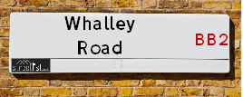
Whalley Road is a street located near the village of Samlesbury. It uses the postcode PR5 0UN. The street has a length of approximately 1,818 metres.
Whalley Road is located within the South Ribble District (B) and Ribble Valley District (B) Council's jurisdiction. They provide various services, like refuse collection, and manage council tax collection. It's situated in the North West region of the UK.
Whalley Road has been assigned the Unique Street Reference Numbers of 36404457, 31800609 and 36401372 in the National Street Gazetteer.
Whalley Road is located within the county of Lancashire, situated in the North West region of the UK. It's 188.52 miles North West from central London., 20.86 miles South East from Lancaster, 24.73 miles North West from Manchester and 30.01 miles North East from Liverpool.

Do you know why this road is called Whalley Road?
What's it like to live here?
Ask the community a question about Whalley Road.
Do you have any questions, memories to share or know any facts about Whalley Road? We'd love to know more.
Also on streetlist.co.uk, can you help?
Swing Swang Lane
28th April 2024
I am trying to find out why the lane is named Swing Swang?
It has been known known this since at least 1905 when hedge making contents used to be held here.
Swing Swang is often used to describe a fairground ride. I remember Swing Boats. Were they a bit like this or is Swing Swang another name for swings?
Swing Swangs are also mentioned in connection to orchards. Or were orchards just good places to have swings?
Eldroth Road
15th April 2024
I wondered if anyone has any old pictures of Wenning Bank House in the 1940’s and also Lane Side before of the same era .. we visited today with my Mum in law as she used to live at both these properties. Also any photos of the schools around that time .. thank you.
Can You Help?Napps Way
15th April 2024
Why is the road called Napps Way (belonging to Napp, but minus an
apostrophe as is usual with such nomenclature)? Moreover, who or
what is, or was, “Napp” in the respective, possessive case?
Several years ago, I met an elderly man (probably in his late-eighties)
who lives on Bentham Drive, Liverpool 16, and during a conversation
with him whilst in a Northwest Passenger Transport Ambulance on the
way to the former RLUH (Royal Liverpool University Hospital), he told
me that he could remember (when he was a boy, living in Childwall,
Liverpool 16) that, “Where Napps Way is now, during WW2, there was
a two-man gun emplacement on the, then, open land to protect the
railway line passing over Childwall Valley Road - next to the railway
bridge - when suddenly, as they were loading a live “shell” into the gun’s
breach, the aforementioned “shell” accidentally exploded in the gun’s
breach killing both of the two soldiers, that had been manning the gun,
instantly! (Very sad, of course, but could - perhaps - two ghosts relating
to those two, very unfortunately and prematurely-killed soldiers have
haunted that place of their deaths ever since - and have any residents
of Napps Way - formerly and in its latest incarnation - seen two, WW2
(uniformed) soldiers unexpectedly appear in or near their homes?)
Estate Agents near Whalley Road
| Name | Address | Website |
|---|---|---|
| Onward Living | Preston Road, Grimsargh, PR2 5JT | Visit Website |
| Duchy Homes - North West, Willbrook | Whittingham Lane, Grimsargh, Preston, PR2 5SL | Visit Website |
| Together Homes | Preston Road, Longridge, PR3 3BD |
We have found 1 postcode for Whalley Road
Location Details
| Whalley Road | |
|---|---|

| |
| Latitude | 53.771320 |
| Longitude | -2.591326 |
| OS Easting (X): | 361030 |
| OS Northing (Y): | 430739 |
| OS Grid Reference: | SD610307 |
Neighbourhood Policing |
| Police Force: Lancashire |
 View Neighbourhood Crime and Policing View Neighbourhood Crime and Policing |
| Find a Local Neighbourhood Watch Scheme |
Frequently asked Questions for Whalley Road
What Council (Local Authority) is Whalley Road in?
Whalley Road is located within the local authority area of South Ribble Council which is a District Council.
What Parish Council is Whalley Road in?
Whalley Road is located within the area of Samlesbury Parish Council.
What Electoral Ward is Whalley Road in?
Whalley Road is located within the ward of Samlesbury & Walton.
What County is Whalley Road in?
Whalley Road is located within the ceremonial county of Lancashire.
What Constituency is Whalley Road in?
Whalley Road is located within the constituency of Ribble Valley.
What Part of the UK is Whalley Road in?
Whalley Road is located within the North West (England) region of the United Kingdom.
What County Council area is Whalley Road in?
Whalley Road is located within the Lancashire Council area.
What Police Force area is Whalley Road in?
Whalley Road is located within the Lancashire Police area.
Roads that have a Junction with Whalley Road
| Street | Junction Type |
|---|---|
| Preston New Road (A59) | junction |
| Preston New Road (A59) | pseudo node |
| Myerscough Smithy Road (A59) | junction |
| Dean Lane | junction |
Sunset and Sunrise times for Whalley Road , PR5 0UN
| Sunrise | 05:15 |
|---|---|
| Sunset | 20:57 |
Latest Weather Conditions for Whalley Road, PR5 0UN
| Observed at Weather Station: | Stonyhurst 9 May 2024 at 07:00 (7.44 miles away) |
|---|---|
| Current Weather: | Clear night |
| Temperature and Humidity: | 11.4°C (88.7%) |
| Wind Direction and Speed: | (0 mph) |
Population Statistics
| ONS Area Code | E00129201 |
|---|---|
| ONS Area Name | Established Farming Communities |
| Average Age | 44.89 |
| Area Population | 1206.00 |
| Male Population | 585.00 (49%) |
| Female Population | 621.00 (51%) |
| Benefit Claimants | 7 (1%) |
| LSOA Code: | E01025456 |
|---|---|
| LSOA Name: | South Ribble 002C |
| SOA Code: | 2c |
| SOA Name: | |
| MSOA Code: | E02005288 |
| MSOA Name: | South Ribble 002 |
Nearest Supermarkets
| Tesco Ribbleton Express |
|---|
| 60-62 Longridge Rd, Ribbleton, Preston, PR2 6RJ |
| 0345 026 9363 |
| Distance: 2.78 Miles |
| Directions from Whalley Road to Tesco Ribbleton Express |
| Tesco Fulwood Express |
|---|
| 1 Longsands Ln, Fulwood, Preston, PR2 9PS |
| 0345 026 9153 |
| Distance: 3.52 Miles |
| Directions from Whalley Road to Tesco Fulwood Express |
| Morrisons Preston - Blackpool Road |
|---|
| 88-91 Blackpool Road, Preston PR1 6US |
| 01772 507380 |
| Distance: 3.59 Miles |
| Directions from Whalley Road to Morrisons Preston - Blackpool Road |
| Waitrose Preston, Walton-le-dale |
|---|
| Capitol Centre, Walton-Le-Dale, Preston, Lancashire, PR5 4AW |
| 01772 886066 |
| Distance: 3.86 Miles |
| Directions from Whalley Road to Waitrose Preston, Walton-le-dale |
Telephone Information
| Area Code |
|---|
| Area Code: 01772 - Preston |
| Area Code: 01254 - Blackburn |
Broadband Information
| Speed | Average Speed | Median Speed | Maximum Speed | Next-generation access (NGA) | Number of Connections |
|---|---|---|---|---|---|
| Less than 2 Mbps | 5.3 | 5.3 | 8.1 | N | 11 |
Local Government
| Local Council Details |
|---|
| Within the area of South Ribble |
| Visit the Council's Website |
| Civic Centre, West Paddock, Leyland &PR25 1DH |
| Send email |
| Telephone Number: 01772 421 491 |
| Local Member of Parliament |
|---|
| Within the Westminster Parliamentary Constituency of Ribble Valley |
| The Member of Parliament is Nigel Evans |
| Details for the MP Nigel Evans on parliament.uk |
| Details for the MP Nigel Evans on theyworkforyou.com |
| In the 2019 General Election Nigel Evans won with a majority of 18,439 the result was Con hold. The total electorate was 79,247 |
| Wards, Parish Councils and County Councils |
|---|
| Ward: Samlesbury & Walton Ward |
| Ceremonial County: Lancashire |
Nearest Schools
England Primary Schools
Mellor St Mary Church of England Primary School
Address: Mellor St Mary Church of England Primary School, Brundhurst Fold, Mellor, Blackburn, Lancashire, BB2 7JT
Distance: 2.41 miles
Contact: 01254812581
St Mary's Roman Catholic Primary School, Osbaldeston
Address: St Mary's Roman Catholic Primary School, Osbaldeston, Longsight Road, Osbaldeston, Blackburn, Lancashire, BB2 7HX
Distance: 2.31 miles
Contact: 01254812543
Samlesbury Church of England School
Address: Samlesbury Church of England School, Potters Lane, Samlesbury, Preston, Lancashire, PR5 0UE
Distance: 1.21 miles
Contact: 01772877200
Brockholes Wood Community Primary School and Nursery
Address: Brockholes Wood Community Primary School and Nursery, Brant Road, Preston, Lancashire, PR1 5TU
Distance: 2.53 miles
Contact: 01772792302
Nearest Hospitals
| Name | Address | Postcode | Distance | Map |
|---|
Nearest Dentists
Dentists near Whalley Road
| Name | Address | Postcode | Distance | Map |
|---|
Nearest GP Surgeries
Doctors near Whalley Road
MELLOR SURGERY
Address: MELLOR SURGERY, ST MARY'S GARDENS, MELLOR, BLACKBURN, LANCASHIRE, BB2 7JW
Distance: 2.60 miles
Contact: tel: 01254 812810
DR A HUSSAIN
Address: 200 MILLER ROAD, RIBBLETON, PRESTON, LANCASHIRE, PR2 6NH
Distance: 2.69 miles
Contact: tel: 01772 792864
RIBBLETON MEDICAL CENTRE
Address: 243 RIBBLETON AVENUE, RIBBLETON, PRESTON, LANCASHIRE, PR2 6RD
Distance: 2.87 miles
Contact: tel: 01772 529064
DR O'DONNELL
Address: PARK MEDICAL PRACTICE, 370 NEW HALL LANE, PRESTON, LANCASHIRE, PR1 4SX
Distance: 3.12 miles
Contact: tel: 01772794172
LONGSANDS MEDICAL CENTRE
Address: LONGSANDS LANE, FULWOOD, PRESTON, PR2 9PS
Distance: 3.58 miles
Contact: :
RIVERSIDE MEDICAL CENTRE
Address: 194 VICTORIA ROAD, WALTON-LE-DALE, PRESTON, LANCASHIRE, PR5 4AY
Distance: 3.68 miles
Contact: tel: 01772 201010
Nearest Dispensing Chemists
Pharmacies near Whalley Road
| Name | Address | Postcode | Telephone | Map | Distance in Km |
|---|
Nearest Opticians
Opticians near Whalley Road
EYE HD OPTICS LTD T/A BUBBLE EYECARE - HOME VISITING OPTICIAN
Address: LITTLE ACRE, BILLINGE END ROAD, BLACKBURN, BB2 6QB
Distance: 2.92 miles
Contact: :
EYECARE (N/W) LTD - PRESTON
Address: 268-270 NEW HALL LANE, PRESTON, LANCASHIRE, PR1 4ST
Distance: 3.42 miles
Contact: :
SUZANNE DENNIS OPTOMETRIST - BAMBER BRIDGE
Address: WALTON LE DALE ARTS CENTRE & SCH, BRINDLE ROAD, BAMBER BRIDGE, PRESTON, LANCASHIRE, PR5 6RN
Distance: 3.58 miles
Contact: :
HAROON AHMED LIMITED
Address: 11 MERLIN ROAD, BLACKBURN, BB2 7BA
Distance: 3.60 miles
Contact: :
CLARITY OPTICAL (PRESTON)
Address: 109 NEW HALL LANE, PRESTON, PR1 5PB
Distance: 3.66 miles
Contact: :
ON SIGHT CARE
Address: 24 BUNCER LANE, BLACKBURN, BB2 6SN
Distance: 3.70 miles
Contact: :
Transport
Nearest Rail Stations
Pleasington Station is 3.39 miles away.
Address: Pleasington station, Victoria Road, Pleasington, Lancashire, BB2 5JQ
Pleasington is situated on the East Lancashire line and is managed by Northern.
Pleasington Station is an unstaffed station.
Cherry Tree Station is 3.99 miles away.
Address: Cherry Tree station, Green Lane, Cherry Tree, Lancashire, BB2 2TZ
Cherry Tree is situated on the East Lancashire line and is managed by Northern.
Cherry Tree Station is an unstaffed station.