Map of Newhouse Road
| Postcodes | ||
|---|---|---|
| Icon | Postcodes for Newhouse Road | |
| Walking Distances | ||
| Distance Info | Green Circle = 10 Minutes Walk (800 metres) | |
About Newhouse Road
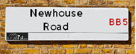
Newhouse Road is a street located in the town of Accrington. The street has a length of approximately 708 metres.
Newhouse Road is located within the Hyndburn District (B) Council's jurisdiction. They provide various services, like refuse collection, and manage council tax collection. It's situated in the North West region of the UK.
Newhouse Road has been assigned the Unique Street Reference Number of 17903071 in the National Street Gazetteer.
Newhouse Road is located within the county of Lancashire, situated in the North West region of the UK. It's 182.98 miles North West from central London., 20.42 miles North from Manchester, 26.45 miles South East from Lancaster and 33.36 miles West from Leeds.

Do you know why this road is called Newhouse Road?
What's it like to live here?
Ask the community a question about Newhouse Road.
Do you have any questions, memories to share or know any facts about Newhouse Road? We'd love to know more.
Also on streetlist.co.uk, can you help?
Swing Swang Lane
28th April 2024
I am trying to find out why the lane is named Swing Swang?
It has been known known this since at least 1905 when hedge making contents used to be held here.
Swing Swang is often used to describe a fairground ride. I remember Swing Boats. Were they a bit like this or is Swing Swang another name for swings?
Swing Swangs are also mentioned in connection to orchards. Or were orchards just good places to have swings?
Estate Agents near Newhouse Road
| Name | Address | Website |
|---|---|---|
| Eafield & Maple | 6 Blackburn Road Accrington BB5 1HD | |
| Mortimers Chartered Surveyors | 22 Blackburn Road, Accrington, BB5 1HD | Visit Website |
| Keenans Estate Agents | 7 Blackburn Road Accrington Lancashire BB5 1HF | Visit Website |
Location Details
| Newhouse Road | |
|---|---|

| |
| Latitude | 53.767069 |
| Longitude | -2.355630 |
| OS Easting (X): | 376560 |
| OS Northing (Y): | 430163 |
| OS Grid Reference: | SD766302 |
Neighbourhood Policing |
| Police Force: Lancashire |
 View Neighbourhood Crime and Policing View Neighbourhood Crime and Policing |
| Find a Local Neighbourhood Watch Scheme |
Frequently asked Questions for Newhouse Road
What Council (Local Authority) is Newhouse Road in?
Newhouse Road is located within the local authority area of Hyndburn Council which is a District Council.
What Parish Council is Newhouse Road in?
Newhouse Road is in an unparished area.
What Electoral Ward is Newhouse Road in?
Newhouse Road is located within the ward of Milnshaw.
What County is Newhouse Road in?
Newhouse Road is located within the ceremonial county of Lancashire.
What Constituency is Newhouse Road in?
Newhouse Road is located within the constituency of Hyndburn.
What Part of the UK is Newhouse Road in?
Newhouse Road is located within the North West (England) region of the United Kingdom.
What County Council area is Newhouse Road in?
Newhouse Road is located within the Lancashire Council area.
What Police Force area is Newhouse Road in?
Newhouse Road is located within the Lancashire Police area.
Roads that have a Junction with Newhouse Road
| Street | Junction Type |
|---|---|
| Bolton Avenue | junction |
Sunset and Sunrise times for Newhouse Road
| Sunrise | 05:11 |
|---|---|
| Sunset | 21:00 |
Latest Weather Conditions for Newhouse Road
| Observed at Weather Station: | Stonyhurst 11 May 2024 at 12:00 (7.31 miles away) |
|---|---|
| Current Weather: | Clear night |
| Temperature and Humidity: | 21.9°C (57.7%) |
| Wind Direction and Speed: | (0 mph) |
Population Statistics
| ONS Area Code | E00127182 |
|---|---|
| ONS Area Name | Multi-Ethnic Hardship |
| Average Age | 44.13 |
| Area Population | 1480.00 |
| Male Population | 665.00 (45%) |
| Female Population | 815.00 (55%) |
| Benefit Claimants | 32 (2%) |
| LSOA Code: | E01025059 |
|---|---|
| LSOA Name: | Hyndburn 004E |
| SOA Code: | 5a |
| SOA Name: | |
| MSOA Code: | E02005215 |
| MSOA Name: | Hyndburn 004 |
Nearest Supermarkets
| Iceland Accrington Food Warehouse |
|---|
| Unit 3, Eastgate Retail Park, Accrington, BB5 6PW |
| 01254372679 |
| Distance: 0.95 Miles |
| Directions from Newhouse Road to Iceland Accrington Food Warehouse |
| Iceland Accrington |
|---|
| Unit 28 Arndale Centre, Accrington, Lancashire, BB5 1EX |
| 01254398417 |
| Distance: 0.96 Miles |
| Directions from Newhouse Road to Iceland Accrington |
| Asda Accrington |
|---|
| Hyndburn Road, Accrington, BB5 1PY |
| 01254 301111 |
| Distance: 1.02 Miles |
| Directions from Newhouse Road to Asda Accrington |
| Tesco Accrington Abbey St Esso Express |
|---|
| 105 Abbey St, Accrington, BB5 1EW |
| 0345 026 9878 |
| Distance: 1.12 Miles |
| Directions from Newhouse Road to Tesco Accrington Abbey St Esso Express |
Telephone Information
| Area Code |
|---|
| Area Code: 01282 - Burnley |
| Area Code: 01254 - Blackburn |
| Area Code: 01200 - Clitheroe |
Broadband Information
| Speed | Average Speed | Median Speed | Maximum Speed | Next-generation access (NGA) | Number of Connections |
|---|---|---|---|---|---|
| Less than 2 Mbps | 5.7 | 5.1 | 14.6 | N | 9 |
Local Government
| Local Council Details |
|---|
| Within the area of Hyndburn |
| Visit the Council's Website |
| Scaitcliffe House, Ormerod Street, Accrington, Lancashire &BB5 0PF |
| Send email |
| Telephone Number: 01254 388 111 |
| Local Member of Parliament |
|---|
| Within the Westminster Parliamentary Constituency of Hyndburn |
| The Member of Parliament is Sara Britcliffe |
| Details for the MP Sara Britcliffe on parliament.uk |
| Details for the MP Sara Britcliffe on theyworkforyou.com |
| In the 2019 General Election Sara Britcliffe won with a majority of 2,951 the result was Con gain from Lab. The total electorate was 70,842 |
| Wards, Parish Councils and County Councils |
|---|
| Ward: Milnshaw Ward |
| Ceremonial County: Lancashire |
Nearest Schools
England Primary Schools
Accrington Huncoat Primary School
Address: Accrington Huncoat Primary School, Lynwood Road, Huncoat, Accrington, Lancashire, BB5 6LR
Distance: 0.62 miles
Contact:
Accrington Peel Park Primary School
Address: Accrington Peel Park Primary School, Alice Street, Accrington, Lancashire, BB5 6QR
Distance: 0.67 miles
Contact: 01254231583
Accrington St John with St Augustine Church of England Primary School
Address: Accrington St John with St Augustine Church of England Primary School, Maudsley Street, Accrington, Lancashire, BB5 6AD
Distance: 0.76 miles
Contact: 01254392717
Accrington St Mary Magdalen's Church of England Primary School
Address: Accrington St Mary Magdalen's Church of England Primary School, Devonshire Street, Accrington, Lancashire, BB5 1DW
Distance: 0.78 miles
Contact: 01254232329
Clayton-le-Moors Mount Pleasant Primary School
Address: Clayton-le-Moors Mount Pleasant Primary School, Earl Street, Clayton-le-Moors, Accrington, Lancashire, BB5 5NH
Distance: 1.14 miles
Contact: 01254232046
St Nicholas Church of England Primary School
Address: St Nicholas Church of England Primary School, St Nicholas Road, Church, Accrington, Lancashire, BB5 4DN
Distance: 1.33 miles
Contact: 01254381875
England Secondary Schools
Accrington Academy
Address: Accrington Academy, Queens Road West, Accrington, Lancashire, BB5 4FF
Distance: 0.79 miles
Contact: 01254304300
Accrington St Christopher's Church of England High School
Address: Accrington St Christopher's Church of England High School, Queen's Road West, Accrington, Lancashire, BB5 4AY
Distance: 0.98 miles
Contact: 01254232992
Nearest Hospitals
| Name | Address | Postcode | Distance | Map |
|---|
Nearest Dentists
Dentists near Newhouse Road
| Name | Address | Postcode | Distance | Map |
|---|
Nearest GP Surgeries
Doctors near Newhouse Road
PWE ACCRINGTON VICTORIA
Address: ACCRINGTON VICTORIA HOSPITAL, HAYWOOD ROAD, ACCRINGTON, LANCASHIRE, BB5 6AS
Distance: 0.69 miles
Contact: tel: 01254 770480
KING STREET MEDICAL CTR
Address: 43 KING STREET, ACCRINGTON, LANCASHIRE, BB5 1QE
Distance: 1.07 miles
Contact: tel: 01254 617664
MYRTLE HOUSE
Address: 154 BLACKBURN ROAD, ACCRINGTON, BB5 0AE
Distance: 1.18 miles
Contact: :
PEEL HOUSE MEDICAL CENTRE- COVID LOCAL VACCINATION SERVICE
Address: ACCRINGTON PALS PRIMARY CARE CENTRE, 1 PARADISE STREET, ACCRINGTON, BB5 2EJ
Distance: 1.20 miles
Contact: :
PEEL HOUSE MEDICAL PRACTICE
Address: ACCRINGTON PALS PHCC, 1 PARADISE STREET, ACCRINGTON, LANCASHIRE, BB5 2EJ
Distance: 1.20 miles
Contact: tel: 01254 282282
THE CLAYTON MEDICAL CTR.
Address: WELLINGTON STREET, CLAYTON LE MOORS, ACCRINGTON, LANCASHIRE, BB5 5HU
Distance: 1.26 miles
Contact: tel: 0844 4771761
Nearest Dispensing Chemists
Pharmacies near Newhouse Road
| Name | Address | Postcode | Telephone | Map | Distance in Km |
|---|
Nearest Opticians
Opticians near Newhouse Road
CHEC ACCRINGTON
Address: CASTLE HOUSE, EASTGATE, ACCRINGTON, LANCASHIRE, BB5 6EU
Distance: 0.90 miles
Contact: :
PUREVISION LTD
Address: 42 BROADWAY, ACCRINGTON, LANCASHIRE, BB5 1EW
Distance: 0.95 miles
Contact: :
PHILIP PRATT OPTICIANS
Address: 23 ABBEY STREET, ACCRINGTON, LANCASHIRE, BB5 1EN
Distance: 0.99 miles
Contact: :
BOOTS OPTICIANS (ACCRINGTON)
Address: UNIT 14, ARNDALE SHOPPING CENTRE, ACCRINGTON, LANCASHIRE, BB5 1PL
Distance: 1.00 miles
Contact: :
SPECSAVERS (ACCRINGTON)
Address: 7-8 BROADWAY, ACCRINGTON, LANCASHIRE, BB5 1EY
Distance: 1.01 miles
Contact: :
OPTICAL DIRECT CLM LTD
Address: LONGTON HOUSE, BURNLEY ROAD, CLAYTON LE MOORS, ACCRINGTON, LANCASHIRE, BB5 5TW
Distance: 1.02 miles
Contact: :
Transport
Nearest Rail Stations
Huncoat Station is 0.53 miles away.
Address: Huncoat station, Station Road, Huncoat, Lancashire, BB5 6LT
Huncoat is situated on the East Lancashire line and is managed by Northern.
Huncoat Station is an unstaffed station.
Accrington Station is 1.12 miles away.
Address: Accrington station, Eagle Street, Accrington, Lancashire, BB5 1LJ
Accrington is situated on the East Lancashire line and is managed by Northern.
Accrington Station is staffed on a part time basis.