Map of Stanley Street
| Postcodes | ||
|---|---|---|
| Icon | Postcodes for Stanley Street | |
| Walking Distances | ||
| Distance Info | Green Circle = 10 Minutes Walk (800 metres) | |
About Stanley Street
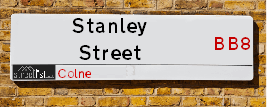
Stanley Street is a street located in the town of Colne. The street has a length of approximately 336 metres.
Stanley Street is located within the Pendle District (B) Council's jurisdiction. They provide various services, like refuse collection, and manage council tax collection. It's situated in the North West region of the UK.
Stanley Street has been assigned the Unique Street Reference Number of 29801798 in the National Street Gazetteer.
Stanley Street is located within the county of Lancashire, situated in the North West region of the UK. It's 184.6 miles North West from central London., 26.1 miles West from Leeds, 26.33 miles North from Manchester and 28.6 miles South East from Lancaster.

Do you know why this road is called Stanley Street?
What's it like to live here?
Ask the community a question about Stanley Street.
Do you have any questions, memories to share or know any facts about Stanley Street? We'd love to know more.
Also on streetlist.co.uk, can you help?
Swing Swang Lane
28th April 2024
I am trying to find out why the lane is named Swing Swang?
It has been known known this since at least 1905 when hedge making contents used to be held here.
Swing Swang is often used to describe a fairground ride. I remember Swing Boats. Were they a bit like this or is Swing Swang another name for swings?
Swing Swangs are also mentioned in connection to orchards. Or were orchards just good places to have swings?
Estate Agents near Stanley Street
| Name | Address | Website |
|---|---|---|
| Petty Estate Agents Ltd | 11 Albert Road, Colne, BB8 0RY | Visit Website |
| Reeds Rains | 31 Albert Road, Colne, BB8 0RY | Visit Website |
| Reeds Rains Lettings | 31 Albert Road, Colne, BB8 0RY | Visit Website |
Location Details
| Stanley Street | |
|---|---|

| |
| Latitude | 53.857747 |
| Longitude | -2.173073 |
| OS Easting (X): | 388617 |
| OS Northing (Y): | 440206 |
| OS Grid Reference: | SD886402 |
Neighbourhood Policing |
| Police Force: Lancashire |
 View Neighbourhood Crime and Policing View Neighbourhood Crime and Policing |
| Find a Local Neighbourhood Watch Scheme |
Frequently asked Questions for Stanley Street
What Council (Local Authority) is Stanley Street in?
Stanley Street is located within the local authority area of Pendle Council which is a District Council.
What Parish Council is Stanley Street in?
Stanley Street is located within the area of Colne Parish Council.
What Electoral Ward is Stanley Street in?
Stanley Street is located within the ward of Vivary Bridge.
What County is Stanley Street in?
Stanley Street is located within the ceremonial county of Lancashire.
What Constituency is Stanley Street in?
Stanley Street is located within the constituency of Pendle.
What Part of the UK is Stanley Street in?
Stanley Street is located within the North West (England) region of the United Kingdom.
What County Council area is Stanley Street in?
Stanley Street is located within the Lancashire Council area.
What Police Force area is Stanley Street in?
Stanley Street is located within the Lancashire Police area.
Roads that have a Junction with Stanley Street
| Street | Junction Type |
|---|---|
| Chapel Street | junction |
| Back Bond Street | junction |
| Bond Street | junction |
| Hartley Street | junction |
| Mitchell Street | junction |
| Clifton Street | junction |
| Wordsworth Road | junction |
Sunset and Sunrise times for Stanley Street
| Sunrise | 05:10 |
|---|---|
| Sunset | 21:00 |
Latest Weather Conditions for Stanley Street
| Observed at Weather Station: | Stonyhurst 11 May 2024 at 10:00 (11.99 miles away) |
|---|---|
| Current Weather: | Clear night |
| Temperature and Humidity: | 21.1°C (61.4%) |
| Wind Direction and Speed: | (0 mph) |
Population Statistics
| ONS Area Code | E00128016 |
|---|---|
| ONS Area Name | Deprived Blue-Collar Terraces |
| Average Age | 41.82 |
| Area Population | 1414.00 |
| Male Population | 691.00 (49%) |
| Female Population | 723.00 (51%) |
| Benefit Claimants | 26 (2%) |
| LSOA Code: | E01025223 |
|---|---|
| LSOA Name: | Pendle 005D |
| SOA Code: | 4b |
| SOA Name: | |
| MSOA Code: | E02005244 |
| MSOA Name: | Pendle 005 |
Nearest Supermarkets
| Tesco Colne Market St Express |
|---|
| 52 Market St, Colne, BB8 0HS |
| 0345 675 7024 |
| Distance: 0.29 Miles |
| Directions from Stanley Street to Tesco Colne Market St Express |
| Sainsburys Colne |
|---|
| Windy Bank, Colne, England, BB8 9HY |
| 01282 892333 |
| Distance: 0.32 Miles |
| Directions from Stanley Street to Sainsburys Colne |
| Asda Colne |
|---|
| Unit 1, Swinden Retail Park Corporation Street, Colne, BB8 8LU |
| 01282 870156 |
| Distance: 1.13 Miles |
| Directions from Stanley Street to Asda Colne |
| Morrisons Nelson |
|---|
| Pendle Street, Nelson BB9 7UZ |
| 01282 449196 |
| Distance: 2.25 Miles |
| Directions from Stanley Street to Morrisons Nelson |
Telephone Information
| Area Code |
|---|
| Area Code: 01282 - Burnley |
| Area Code: 01200 - Clitheroe |
Local Government
| Local Council Details |
|---|
| Within the area of Pendle |
| Visit the Council's Website |
| Market Street, Nelson, Lancashire &BB9 7LG |
| Send email |
| Telephone Number: 01282 661 661 |
| Local Member of Parliament |
|---|
| Within the Westminster Parliamentary Constituency of Pendle |
| The Member of Parliament is Andrew Stephenson |
| Details for the MP Andrew Stephenson on parliament.uk |
| Details for the MP Andrew Stephenson on theyworkforyou.com |
| In the 2019 General Election Andrew Stephenson won with a majority of 6,186 the result was Con hold. The total electorate was 65,292 |
| Wards, Parish Councils and County Councils |
|---|
| Ward: Vivary Bridge Ward |
| Ceremonial County: Lancashire |
Nearest Schools
England Primary Schools
Colne Christ Church Church of England Voluntary Aided Primary School
Address: Colne Christ Church Church of England Voluntary Aided Primary School, Bent Lane, Colne, Lancashire, BB8 7AA
Distance: 1.25 miles
Contact: 01282865398
Foulridge Saint Michael and All Angels CofE Voluntary Aided Primary School
Address: Foulridge Saint Michael and All Angels CofE Voluntary Aided Primary School, Skipton Road, Foulridge, Colne, Lancashire, BB8 7NN
Distance: 1.08 miles
Contact: 01282861338
Park Primary School
Address: Park Primary School, Rutland Street, Colne, Lancashire, BB8 0QJ
Distance: 0.59 miles
Contact: 01282863225
West Street Community Primary School
Address: West Street Community Primary School, West Street, Colne, Lancashire, BB8 0HW
Distance: 0.33 miles
Contact: 01282865840
Sacred Heart Roman Catholic Primary School, Colne
Address: Sacred Heart Roman Catholic Primary School, Colne, Red Lane, Colne, Lancashire, BB8 7JR
Distance: 0.67 miles
Contact:
Colne Lord Street School
Address: Colne Lord Street School, Lord Street, Colne, Lancashire, BB8 9AR
Distance: 0.24 miles
Contact:
Colne Primet Primary School
Address: Colne Primet Primary School, Tatton Street, Colne, Lancashire, BB8 8JE
Distance: 0.83 miles
Contact: 01282864607
Castercliff Primary School
Address: Castercliff Primary School, Marsden Hall Road North, Nelson, Lancashire, BB9 8JJ
Distance: 1.42 miles
Contact: 01282617627
Barrowford School
Address: Barrowford School, Rushton Street, Barrowford, Nelson, Lancashire, BB9 6EA
Distance: 1.88 miles
Contact: 01282615644
Bradley Primary School
Address: Bradley Primary School, Dover Street, Nelson, Lancashire, BB9 7RF
Distance: 1.83 miles
Contact: 01282615772
England Secondary Schools
Colne Park High School
Address: Colne Park High School, Venables Avenue, Colne, Lancashire, BB8 7DP
Distance: 0.83 miles
Contact:
Ss John Fisher and Thomas More Roman Catholic High School
Address: Ss John Fisher and Thomas More Roman Catholic High School, Gibfield Road, Colne, Lancashire, BB8 8JT
Distance: 1.07 miles
Contact: 01282865299
Colne Primet Academy
Address: Colne Primet Academy, Dent Street, Colne, Lancashire, BB8 8JF
Distance: 0.86 miles
Contact: 01282863970
Pendle Vale College
Address: Pendle Vale College, Oxford Road, Nelson, Lancashire, BB9 8LF
Distance: 1.30 miles
Contact: 01282682240
England Higher Schools
Nelson and Colne College
Address: Nelson and Colne College, Scotland Road, Nelson, Lancashire, BB9 7YT
Distance: 2.17 miles
Contact: 01282440200
Nearest Hospitals
| Name | Address | Postcode | Distance | Map |
|---|
Nearest Dentists
Dentists near Stanley Street
| Name | Address | Postcode | Distance | Map |
|---|
Nearest GP Surgeries
Doctors near Stanley Street
COLNE HEALTH CENTRE PHARMACY - COVID LOCAL VACCINATION SERVICE 2
Address: COLNE HEALTH CENTRE, CRADDOCK ROAD, COLNE, BB8 0JZ
Distance: 0.30 miles
Contact: :
COLNE HEALTH CENTRE PHARMACY - COVID LOCAL VACCINATION SERVICE
Address: COLNE HEALTH CENTRE, CRADDOCK ROAD, COLNE, BB8 0JZ
Distance: 0.30 miles
Contact: :
THE RICHMOND HILL PRACTICE
Address: COLNE HEALTH CENTRE, CRADDOCK ROAD, COLNE, BB8 0JZ
Distance: 0.30 miles
Contact: tel: 01282 731731
THE PENDLE MEDICAL PARTNERSHIP
Address: COLNE CORNER SURGERY, COLNE HEALTH CENTRE, CRADDOCK ROAD, COLNE, LANCASHIRE, BB8 0JZ
Distance: 0.30 miles
Contact: :
COLNE HEALTH CENTRE PHARMACY - COVID LOCAL VACCINATION SERVICE
Address: COLNE HEALTH CENTRE, CRADDOCK ROAD, COLNE, BB8 0JZ
Distance: 0.30 miles
Contact: :
HARAMBEE SURGERY
Address: 27 SKIPTON ROAD, TRAWDEN, COLNE, LANCASHIRE, BB8 8QU
Distance: 1.63 miles
Contact: tel: 01282 868482
Nearest Dispensing Chemists
Pharmacies near Stanley Street
| Name | Address | Postcode | Telephone | Map | Distance in Km |
|---|
Nearest Opticians
Opticians near Stanley Street
PLANIT OPTICIANS (COLNE)
Address: 60 ALBERT ROAD, COLNE, LANCASHIRE, BB8 0AD
Distance: 0.12 miles
Contact: :
COLNE OPTICIANS
Address: 6 CHURCH STREET, COLNE, LANCASHIRE, BB8 0LG
Distance: 0.15 miles
Contact: :
COLNE SPECSAVERS LIMITED
Address: SAINSBURY'S, WINDY BANK, COLNE, BB8 9HY
Distance: 0.24 miles
Contact: :
BOOTS OPTICIANS (COLNE)
Address: UNIT 3, MARKET HALL, MARKET STREET, COLNE, LANCASHIRE, BB8 0HS
Distance: 0.30 miles
Contact: :
PETER WORDEN OPTICIANS (COLNE)
Address: 27 SKIPTON ROAD, COLNE, LANCASHIRE, BB8 0NQ
Distance: 0.41 miles
Contact: :
4948 COLNE
Address: ASDA STORES LTD, CORPORATION STREET, COLNE, LANCASHIRE, BB8 8LU
Distance: 1.16 miles
Contact: :
Transport
Nearest Rail Stations
Colne Station is 0.39 miles away.
Address: Colne station, Primet Hill, Colne, Lancashire, BB8 9NX
Colne is situated on the East Lancashire line and is managed by Northern.
Colne Station is an unstaffed station.
Nelson Station is 2.28 miles away.
Address: Nelson station, Hibson Road, Nelson, Lancashire, BB9 9SF
Nelson is situated on the East Lancashire line and is managed by Northern.
Nelson Station is staffed on a part time basis.