Map of Fenwick Drive
| Postcodes | ||
|---|---|---|
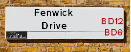
| Icon | Postcodes for Fenwick Drive | |
| Walking Distances | ||
| Distance Info | Green Circle = 10 Minutes Walk (800 metres) | |
About Fenwick Drive
Fenwick Drive is a street located in the city of Bradford. The street has a length of approximately 1,522 metres.
Fenwick Drive is located within the Bradford District (B) Council's jurisdiction. They provide various services, like refuse collection, and manage council tax collection. It's situated in the Yorkshire and The Humber region of the UK.
Fenwick Drive has been assigned the Unique Street Reference Number of 7727960 in the National Street Gazetteer.
Fenwick Drive is located within the county of West Yorkshire, situated in the Yorkshire and The Humber region of the UK. It's 171.15 miles North West from central London., 10.49 miles West from Leeds, 26.76 miles North East from Manchester and 29 miles North West from Sheffield.

Do you know why this road is called Fenwick Drive?
What's it like to live here?
Ask the community a question about Fenwick Drive.
Do you have any questions, memories to share or know any facts about Fenwick Drive? We'd love to know more.
Also on streetlist.co.uk, can you help?
Swing Swang Lane
28th April 2024
I am trying to find out why the lane is named Swing Swang?
It has been known known this since at least 1905 when hedge making contents used to be held here.
Swing Swang is often used to describe a fairground ride. I remember Swing Boats. Were they a bit like this or is Swing Swang another name for swings?
Swing Swangs are also mentioned in connection to orchards. Or were orchards just good places to have swings?
Estate Agents near Fenwick Drive
| Name | Address | Website |
|---|---|---|
| Robert Watts | 1-3 Carr House Road, Shelf, Bradford, HX3 7QY | Visit Website |
| WW Estates | 5-7 Beacon Road, Wibsey, Bradford, BD6 3HB | Visit Website |
| William H. Brown | 6 Fair Road, Wibsey, Bradford, BD6 1QN | Visit Website |
Location Details
| Fenwick Drive | |
|---|---|

| |
| Latitude | 53.755518 |
| Longitude | -1.787802 |
| OS Easting (X): | 413989 |
| OS Northing (Y): | 428840 |
| OS Grid Reference: | SE140288 |
Neighbourhood Policing |
| Police Force: West Yorkshire |
 View Neighbourhood Crime and Policing View Neighbourhood Crime and Policing |
| Find a Local Neighbourhood Watch Scheme |
Frequently asked Questions for Fenwick Drive
What Council (Local Authority) is Fenwick Drive in?
Fenwick Drive is located within the local authority area of Bradford Council which is a Metropolitan District.
What Parish Council is Fenwick Drive in?
Fenwick Drive is in an unparished area.
What Electoral Ward is Fenwick Drive in?
Fenwick Drive is located within the ward of Royds.
What County is Fenwick Drive in?
Fenwick Drive is located within the ceremonial county of West Yorkshire.
What Constituency is Fenwick Drive in?
Fenwick Drive is located within the constituency of Bradford South.
What Part of the UK is Fenwick Drive in?
Fenwick Drive is located within the Yorkshire and The Humber region of the United Kingdom.
What County Council area is Fenwick Drive in?
Fenwick Drive is located within the West Yorkshire Council area.
What Police Force area is Fenwick Drive in?
Fenwick Drive is located within the West Yorkshire Police area.
Roads that have a Junction with Fenwick Drive
| Street | Junction Type |
|---|---|
| Halifax Road (A6036) | junction |
| Halifax Road | junction |
| Whitehaven Close | junction |
| Moresby Road | junction |
| Allerby Green | junction |
| Allerby Green | junction |
| Eaglesfield Drive | junction |
| Collinfield Rise | junction |
| Egremont Crescent | junction |
| Meadway | junction |
| Howgill Green | junction |
| Angerton Way | junction |
| Lingdale Road | junction |
| Dunnington Walk | junction |
| Eaglesfield Drive | junction |
| Alder Holt Drive | junction |
| Trenholme Avenue | junction |
| Abb Scott Lane | junction |
| Abb Scott Lane | junction |
Sunset and Sunrise times for Fenwick Drive
| Sunrise | 05:07 |
|---|---|
| Sunset | 20:59 |
Latest Weather Conditions for Fenwick Drive
| Observed at Weather Station: | Bingley Samos 12 May 2024 at 14:00 (4.96 miles away) |
|---|---|
| Current Weather: | Partly cloudy (day) |
| Temperature and Humidity: | 20.1°C (64.0%) |
| Wind Direction and Speed: | ESE (7 mph) |
Population Statistics
| ONS Area Code | E00054789, E00054760, E00054782 & E00054784 |
|---|---|
| ONS Area Name | Hard-Pressed Ethnic Mix & Hard-Pressed European Settlers |
| Average Age | 35.14 & 40.74 |
| Area Population | 1468.00 & 1240.00 |
| Male Population | 724.00 & 564.00 (48%) |
| Female Population | 744.00 & 676.00 (52%) |
| Benefit Claimants | 47 & 49 (4%) |
| LSOA Code: | E01010867 &E01010874 |
|---|---|
| LSOA Name: | Bradford 059G &Bradford 059H |
| SOA Code: | 5b &4c |
| SOA Name: | |
| MSOA Code: | E02002241 |
| MSOA Name: | Bradford 059 |
Nearest Supermarkets
| Tesco Bradford Buttershaw Superstore |
|---|
| Halifax Rd, Bradford, BD6 2DW |
| 0345 677 9077 |
| Distance: 0.36 Miles |
| Directions from Fenwick Drive to Tesco Bradford Buttershaw Superstore |
| Tesco Low Moor Bradford Express |
|---|
| 159 Huddersfield Rd, Bradford, BD12 0TQ |
| 0345 674 6422 |
| Distance: 0.97 Miles |
| Directions from Fenwick Drive to Tesco Low Moor Bradford Express |
| Asda Wyke |
|---|
| Towngate, Wyke, BD12 9JF |
| 01274 476100 |
| Distance: 1.47 Miles |
| Directions from Fenwick Drive to Asda Wyke |
| Morrisons Bradford - Mayo Avenue |
|---|
| 110 Mayo Avenue, Bradford BD5 8HP |
| 01274 727676 |
| Distance: 1.6 Miles |
| Directions from Fenwick Drive to Morrisons Bradford - Mayo Avenue |
Telephone Information
| Dialling Code | Telephone Exchange | Telephone Cabinet | Fibre to the Cabinet or Fibre to the Premises |
|---|---|---|---|
| 01274 | LOW MOOR - MYLOW | P36 | FTTC |
Broadband Information
| Speed | Average Speed | Median Speed | Maximum Speed | Next-generation access (NGA) | Number of Connections |
|---|---|---|---|---|---|
| Greater than 2 Mbps | 24.2 | 20 | >=30 | Y | 9 |
Local Government
| Local Council Details |
|---|
| Within the area of Bradford |
| Visit the Council's Website |
| City Hall, Centenary Square, Bradford &BD1 1HY |
| Telephone Number: 01274 432111 |
| Local Member of Parliament |
|---|
| Within the Westminster Parliamentary Constituency of Bradford South |
| The Member of Parliament is Judith Cummins |
| Details for the MP Judith Cummins on parliament.uk |
| Details for the MP Judith Cummins on theyworkforyou.com |
| In the 2019 General Election Judith Cummins won with a majority of 2,346 the result was Lab hold. The total electorate was 69,046 |
| Wards, Parish Councils and County Councils |
|---|
| Ward: Royds Ward |
| Ceremonial County: West Yorkshire |
Nearest Schools
England Primary Schools
Low Moor CofE Primary School
Address: Low Moor CofE Primary School, Park House Road, Low Moor, Bradford, West Yorkshire, BD12 0NN
Distance: 1.24 miles
Contact: 01274600797
Hill Top CofE Primary School
Address: Hill Top CofE Primary School, Common Road, Low Moor, Bradford, West Yorkshire, BD12 0TL
Distance: 0.71 miles
Contact: 01274678386
St Winefride's Catholic Primary School, A Voluntary Academy
Address: St Winefride's Catholic Primary School, A Voluntary Academy, St Paul's Avenue, Wibsey, Bradford, West Yorkshire, BD6 1SR
Distance: 0.68 miles
Contact: 01274677705
St Winefride's Catholic Primary School
Address: St Winefride's Catholic Primary School, St Paul's Avenue, Wibsey, Bradford, West Yorkshire, BD6 1SR
Distance: 0.68 miles
Contact:
Woodside Academy
Address: Woodside Academy, Fenwick Drive, Bradford, West Yorkshire, BD6 2PG
Distance: 0.22 miles
Contact: 01274414350
Woodside Academy
Address: Woodside Academy, Fenwick Drive, Bradford, West Yorkshire, BD6 2PG
Distance: 0.22 miles
Contact:
St Paul's CofE Primary School
Address: St Paul's CofE Primary School, St Paul's Avenue, Buttershaw, Bradford, West Yorkshire, BD6 1ST
Distance: 0.64 miles
Contact: 01274679183
Wibsey Primary School
Address: Wibsey Primary School, North Road, Wibsey, Bradford, West Yorkshire, BD6 1RL
Distance: 0.97 miles
Contact: 01274678016
Farfield Primary and Nursery School
Address: Farfield Primary and Nursery School, Reevy Crescent, Bradford, West Yorkshire, BD6 2BS
Distance: 0.59 miles
Contact: 01274678545
Reevy Hill Primary School
Address: Reevy Hill Primary School, Bedale Drive, Buttershaw, Bradford, West Yorkshire, BD6 3ST
Distance: 0.94 miles
Contact: 01274677549
Reevy Hill Primary School
Address: Reevy Hill Primary School, Bedale Drive, Buttershaw, Bradford, West Yorkshire, BD6 3ST
Distance: 0.94 miles
Contact:
St Michael and All Angels CofE Primary & Pre School
Address: St Michael and All Angels CofE Primary & Pre School, Meadow Close, Greenacres Estate, Shelf, Halifax, West Yorkshire, HX3 7QU
Distance: 0.82 miles
Contact: 01274676246
Home Farm Primary School
Address: Home Farm Primary School, Home Farm Close, Bradford, West Yorkshire, BD6 3NR
Distance: 1.19 miles
Contact: 01274777020
England Secondary Schools
Appleton Academy
Address: Appleton Academy, Woodside Road, Wyke, Bradford, West Yorkshire, BD12 8AL
Distance: 1.12 miles
Contact:
Buttershaw Business & Enterprise College Academy
Address: Buttershaw Business & Enterprise College Academy, Reevy Road West, Buttershaw, Bradford, West Yorkshire, BD6 3PX
Distance: 0.71 miles
Contact: 01274676285
Buttershaw Business and Enterprise College
Address: Buttershaw Business and Enterprise College, Reevy Road West, Buttershaw, Bradford, West Yorkshire, BD6 3PX
Distance: 0.71 miles
Contact:
Nearest Hospitals
| Name | Address | Postcode | Distance | Map |
|---|
Nearest Dentists
Dentists near Fenwick Drive
| Name | Address | Postcode | Distance | Map |
|---|
Nearest GP Surgeries
Doctors near Fenwick Drive
PARKLANDS MEDICAL PRACTICE
Address: 30 BUTTERSHAW LANE, BRADFORD, WEST YORKSHIRE, BD6 2DD
Distance: 0.47 miles
Contact: tel: 01274 678464
LOW MOOR - COVID LOCAL VACCINATION SERVICE 3
Address: 29 THE PLANTATIONS, BRADFORD, BD12 0TH
Distance: 0.74 miles
Contact: :
LOW MOOR SURGERY
Address: 29 THE PLANTATIONS, BRADFORD, WEST YORKSHIRE, BD12 0TH
Distance: 0.74 miles
Contact: tel: 01274 697600
ROYDS HEALTH LIVING CENTRE
Address: 20 RIDINGS WAY, OFF THE CRESCENT, BUTTERSHAW, BRADFORD, WEST YORKSHIRE, BD6 3UD
Distance: 0.84 miles
Contact: :
WIBSEY & QUEENSBURY MED P
Address: FAIR ROAD, BRADFORD, WEST YORKSHIRE, BD6 1TD
Distance: 0.87 miles
Contact: tel: 01274 677457
CAVALIERE V
Address: THE RIDGE MEDICAL PRACTICE, 93, SMITH AVENUE, WIBSEY, BRADFORD, WEST YORKSHIRE, BD6 1HA
Distance: 0.97 miles
Contact: tel: 01274 676224
Nearest Dispensing Chemists
Pharmacies near Fenwick Drive
| Name | Address | Postcode | Telephone | Map | Distance in Km |
|---|
Nearest Opticians
Opticians near Fenwick Drive
ROY FOSTER OPTICIANS
Address: 22 FAIR ROAD, BRADFORD, WEST YORKSHIRE, BD6 1QN
Distance: 0.91 miles
Contact: :
ZAHRA ASGHAR LTD T/A WYKE OPTICIANS (TOWN GATE)
Address: 55 TOWN GATE, WYKE, BRADFORD, WEST YORKSHIRE, BD12 9JD
Distance: 1.37 miles
Contact: :
PREMIER VISION OPTICIANS (MAYO AVENUE)
Address: MORRISON SUPERMARKETS, MAYO AVENUE, BRADFORD, WEST YORKSHIRE, BD5 8HP
Distance: 1.56 miles
Contact: :
EYE CLINIC OPTICIANS - GREAT HORTON RD
Address: 738 GREAT HORTON ROAD, BRADFORD, WEST YORKSHIRE, BD7 4EE
Distance: 1.59 miles
Contact: :
SPECSALES EYECARE
Address: 846 MANCHESTER ROAD, BRADFORD, WEST YORKSHIRE, BD5 8DJ
Distance: 1.72 miles
Contact: :
OPTIVU EYECARE - GREAT HORTON ROAD
Address: 469 GREAT HORTON ROAD, BRADFORD, BD7 3DL
Distance: 1.74 miles
Contact: :
Transport
Nearest Rail Stations
Low Moor Station is 1.48 miles away.
Address: Low Moor station, New Works Road, Low Moor, West Yorkshire, BD12 7BD
Low Moor is situated on the Calder Valley line and is managed by Northern.
Low Moor Station is an unstaffed station.
Bradford Interchange Station is 2.91 miles away.
Address: Bradford Interchange station, Bridge Street, Bradford, West Yorkshire, BD1 1TU
Bradford Interchange is situated on the Calder Valley line and is managed by Northern.
Bradford Interchange Station is staffed on a full time basis.
Directions from Fenwick Drive to Bradford Interchange Rail Station