Map of Bradford Road
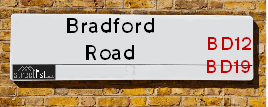
| Postcodes | ||
|---|---|---|
| Icon | Postcodes for Bradford Road | |
| Walking Distances | ||
| Distance Info | Green Circle = 10 Minutes Walk (800 metres) | |
About Bradford Road
Bradford Road is a street located in the town of Brighouse. The street has a length of approximately 3,389 metres.
Bradford Road is located within the Calderdale District (B) Council's jurisdiction. They provide various services, like refuse collection, and manage council tax collection. It's situated in the Yorkshire and The Humber region of the UK.
Bradford Road has been assigned the Unique Street Reference Numbers of 5301997, 5301907, 5307370, 5302104 and 5307373 in the National Street Gazetteer.
Bradford Road is located within the county of West Yorkshire, situated in the Yorkshire and The Humber region of the UK. It's 168.42 miles North West from central London., 11.31 miles South West from Leeds, 25.1 miles North East from Manchester and 26.32 miles North West from Sheffield.

Do you know why this road is called Bradford Road?
What's it like to live here?
Ask the community a question about Bradford Road.
Do you have any questions, memories to share or know any facts about Bradford Road? We'd love to know more.
Also on streetlist.co.uk, can you help?
Eldroth Road
15th April 2024
I wondered if anyone has any old pictures of Wenning Bank House in the 1940’s and also Lane Side before of the same era .. we visited today with my Mum in law as she used to live at both these properties. Also any photos of the schools around that time .. thank you.
Can You Help?Napps Way
15th April 2024
Why is the road called Napps Way (belonging to Napp, but minus an
apostrophe as is usual with such nomenclature)? Moreover, who or
what is, or was, “Napp” in the respective, possessive case?
Several years ago, I met an elderly man (probably in his late-eighties)
who lives on Bentham Drive, Liverpool 16, and during a conversation
with him whilst in a Northwest Passenger Transport Ambulance on the
way to the former RLUH (Royal Liverpool University Hospital), he told
me that he could remember (when he was a boy, living in Childwall,
Liverpool 16) that, “Where Napps Way is now, during WW2, there was
a two-man gun emplacement on the, then, open land to protect the
railway line passing over Childwall Valley Road - next to the railway
bridge - when suddenly, as they were loading a live “shell” into the gun’s
breach, the aforementioned “shell” accidentally exploded in the gun’s
breach killing both of the two soldiers, that had been manning the gun,
instantly! (Very sad, of course, but could - perhaps - two ghosts relating
to those two, very unfortunately and prematurely-killed soldiers have
haunted that place of their deaths ever since - and have any residents
of Napps Way - formerly and in its latest incarnation - seen two, WW2
(uniformed) soldiers unexpectedly appear in or near their homes?)
Mauritius Road
15th April 2024
Why is Mauritius Road so called, since when and by whom? Does Greenwich have any particular links with Mauritius? Very interested to know. 🤞🏼
Can You Help?Estate Agents near Bradford Road
| Name | Address | Website |
|---|---|---|
| McField Residential | 647 Bradford Road Bailiff Bridge Brighouse HD6 4DY | Visit Website |
| Daniel & Hirst | 110 Commercial Street, Brighouse, Yorkshire, HD6 1AQ | Visit Website |
| Linsey Champion | 116 Commercial Street, Brighouse, HD6 1AQ | Visit Website |
We have found 19 postcodes for Bradford Road
Location Details
| Bradford Road | |
|---|---|

| |
| Latitude | 53.714404 |
| Longitude | -1.778532 |
| OS Easting (X): | 414614 |
| OS Northing (Y): | 424268 |
| OS Grid Reference: | SE146243 |
Ordnance Survey Maps for Bradford Road
If you purchase a map through the links below, we may earn an affiliate commission.
| Map Series | link | Ordnance Survey |
| Explorer 1:25,000 288 Bradford and Huddersfield | Check Price on Amazon | Buy Direct from the Ordnance Survey |
| Landranger 1:50,000 104 Leeds & Bradford | Check Price on Amazon | Buy Direct from the Ordnance Survey |
Neighbourhood Policing |
| Police Force: West Yorkshire |
 View Neighbourhood Crime and Policing View Neighbourhood Crime and Policing |
| Find a Local Neighbourhood Watch Scheme |
Frequently asked Questions for Bradford Road
What Council (Local Authority) is Bradford Road in?
Bradford Road is located within the local authority area of Calderdale Council which is a Metropolitan District.
What Parish Council is Bradford Road in?
Bradford Road is in an unparished area.
What Electoral Ward is Bradford Road in?
Bradford Road is located within the ward of Brighouse &Hipperholme and Lightcliffe.
What County is Bradford Road in?
Bradford Road is located within the ceremonial county of West Yorkshire.
What Constituency is Bradford Road in?
Bradford Road is located within the constituency of Calder Valley.
What Part of the UK is Bradford Road in?
Bradford Road is located within the Yorkshire and The Humber region of the United Kingdom.
What County Council area is Bradford Road in?
Bradford Road is located within the West Yorkshire Council area.
What Police Force area is Bradford Road in?
Bradford Road is located within the West Yorkshire Police area.
Roads that have a Junction with Bradford Road
| Street | Junction Type |
|---|---|
| Huddersfield Road (A641) | junction |
| King Street | junction |
| Ganny Road | junction |
| Martin Street | pseudo node |
| High Street | junction |
| New Street | junction |
| Beechwood Park | junction |
| Summerfield Avenue | junction |
| Brookroyd Avenue | junction |
| Russell Way | junction |
| Cross Street | junction |
| Smithy Carr Lane | junction |
| Rayner Road | junction |
| Hey Street | junction |
| Thornhill Bridge Lane | junction |
| Oddfellows Street | junction |
| Industrial Street | junction |
| Gathorne Street | junction |
| Hardy Street | junction |
| Houghton Street | junction |
| Wellholme | junction |
| Rookery Place | junction |
| Bonegate Road | junction |
| Upper Bonegate | junction |
| Water Street | junction |
| Ludenscheid Link (A643) | roundabout |
| Huddersfield Road (A641) | roundabout |
| Mayfield Grove | junction |
| Huddersfield Road (A641) | pseudo node |
| Victoria Chase | junction |
| Highfield Avenue | junction |
| Highfield Avenue | junction |
| Wyke Old Lane | junction |
| Co-Operative Buildings | junction |
| Birkby Lane (A649) | junction |
| Victoria Road | junction |
Sunset and Sunrise times for Bradford Road
| Sunrise | 05:38 |
|---|---|
| Sunset | 20:30 |
Latest Weather Conditions for Bradford Road
| Observed at Weather Station: | Bingley Samos 26 April 2024 at 07:00 (7.55 miles away) |
|---|---|
| Current Weather: | Overcast |
| Temperature and Humidity: | 2.3°C (89.2%) |
| Wind Direction and Speed: | N (5 mph) |
Population Statistics
| ONS Area Code | E00054825, E00055201, E00055203, E00054814, E00054817, E00168681, E00168668, E00054986, E00054978 & E00168685 |
|---|---|
| ONS Area Name | Hampered Aspiration, White Professionals, Communal Retirement, Rural White-Collar Workers & White Suburban Communities |
| Average Age | 40.71, 40.86, 39.73, 40.83 & 41.70 |
| Area Population | 1756.00, 1545.00, 1482.00, 2086.00 & 1865.00 |
| Male Population | 900.00, 763.00, 718.00, 1041.00 & 882.00 (49%) |
| Female Population | 856.00, 782.00, 764.00, 1045.00 & 983.00 (51%) |
| Benefit Claimants | 50, 44, 71, 20 & 14 (2%) |
| LSOA Code: | E01010878, E01010949, E01010880, E01010908 &E01010905 |
|---|---|
| LSOA Name: | Calderdale 015A, Calderdale 019E, Calderdale 019D, Calderdale 015D &Calderdale 015C |
| SOA Code: | 4b, 5b, 4a &8c |
| SOA Name: | |
| MSOA Code: | E02002258 &E02002262 |
| MSOA Name: | Calderdale 015 &Calderdale 019 |
Nearest Supermarkets
| Tesco Brighouse Bradford Rd Superstore |
|---|
| Huddersfield Rd, Brighouse, HD6 1RZ |
| 0345 677 9783 |
| Distance: 0.74 Miles |
| Directions from Bradford Road to Tesco Brighouse Bradford Rd Superstore |
| Sainsburys Brighouse |
|---|
| Mill Lane, Brighouse, England, HD6 1PQ |
| 01484 711251 |
| Distance: 0.94 Miles |
| Directions from Bradford Road to Sainsburys Brighouse |
| Waitrose At Harts Head Moor West Services |
|---|
| M62 motorway, Junction 25/26, Clifton, Brighouse, Yorks |
| HD6 4JX |
| Distance: 1.3 Miles |
| Directions from Bradford Road to Waitrose At Harts Head Moor West Services |
| Tesco Leeds Rd Express |
|---|
| Leeds Rd, Hipperholme, HX3 8HQ |
| 0345 610 2875 |
| Distance: 1.53 Miles |
| Directions from Bradford Road to Tesco Leeds Rd Express |
Telephone Information
| Dialling Code | Telephone Exchange | Telephone Cabinet | Fibre to the Cabinet or Fibre to the Premises |
|---|---|---|---|
| 01484 | BRIGHOUSE - MYBRG | P3 | FTTP |
Broadband Information
| Speed | Average Speed | Median Speed | Maximum Speed | Next-generation access (NGA) | Number of Connections |
|---|---|---|---|---|---|
| Less than 2 Mbps | 6.5 | 4.7 | >=30 | Y | 15 |
Local Government
| Local Council Details |
|---|
| Within the area of Calderdale |
| Visit the Council's Website |
| Town Hall, Crossley Street, Halifax &HX1 1UJ |
| Send email |
| Telephone Number: 0845 245 6000 |
| Local Member of Parliament |
|---|
| Within the Westminster Parliamentary Constituency of Calder Valley |
| The Member of Parliament is Craig Whittaker |
| Details for the MP Craig Whittaker on parliament.uk |
| Details for the MP Craig Whittaker on theyworkforyou.com |
| In the 2019 General Election Craig Whittaker won with a majority of 5,774 the result was Con hold. The total electorate was 79,287 |
| Wards, Parish Councils and County Councils |
|---|
| Ward: Brighouse &Hipperholme and Lightcliffe Ward |
| Ceremonial County: West Yorkshire |
Nearest Schools
England Primary Schools
St John's (CofE) Primary Academy, Clifton
Address: St John's (CofE) Primary Academy, Clifton, Towngate, Clifton, Brighouse, West Yorkshire, HD6 4HP
Distance: 1.18 miles
Contact: 01484713036
Worthinghead Primary School
Address: Worthinghead Primary School, Wyke Lane, Wyke, Wyke Lane, Bradford, West Yorkshire, BD12 9EL
Distance: 1.92 miles
Contact: 01274414904
Woodhouse Primary School
Address: Woodhouse Primary School, Daisy Road, Brighouse, West Yorkshire, HD6 3SX
Distance: 1.45 miles
Contact: 01484714750
Longroyde Primary School
Address: Longroyde Primary School, Longroyde Road, Rastrick, Brighouse, West Yorkshire, HD6 3AS
Distance: 1.27 miles
Contact: 01484715300
Shirley Manor Primary School
Address: Shirley Manor Primary School, Methuen Oval, Wyke, Bradford, West Yorkshire, BD12 8SA
Distance: 1.33 miles
Contact: 01274679320
Bailiffe Bridge Junior and Infant School
Address: Bailiffe Bridge Junior and Infant School, Victoria Road, Bailiff Bridge, Brighouse, West Yorkshire, HD6 4DY
Distance: 0.62 miles
Contact: 01484713039
Cliffe Hill Community Primary School
Address: Cliffe Hill Community Primary School, Stoney Lane, Lightcliffe, Halifax, West Yorkshire, HX3 8TW
Distance: 0.60 miles
Contact: 01422202086
St Andrew's Church of England (VA) Infant School
Address: St Andrew's Church of England (VA) Infant School, Lightcliffe Road, Brighouse, West Yorkshire, HD6 2HH
Distance: 0.48 miles
Contact: 01484714964
St Andrew's CofE (VA) Junior School
Address: St Andrew's CofE (VA) Junior School, Waterloo Road, Brighouse, West Yorkshire, HD6 2AN
Distance: 0.73 miles
Contact: 01484712895
St Joseph's Catholic Primary School, Brighouse
Address: St Joseph's Catholic Primary School, Brighouse, Finkil Street, Hove Edge, Brighouse, West Yorkshire, HD6 2NT
Distance: 0.71 miles
Contact:
St Chad's CofE (VA) Primary School
Address: St Chad's CofE (VA) Primary School, Upper Green Lane, Hove Edge, Brighouse, West Yorkshire, HD6 2PA
Distance: 0.88 miles
Contact:
Lightcliffe C of E Primary School
Address: Lightcliffe C of E Primary School, Wakefield Road, Lightcliffe, Halifax, West Yorkshire, HX3 8SH
Distance: 1.16 miles
Contact: 01422202235
Lightcliffe CofE VA Primary School
Address: Lightcliffe CofE VA Primary School, Wakefield Road, Lightcliffe, Halifax, West Yorkshire, HX3 8SH
Distance: 1.16 miles
Contact:
England Secondary Schools
Lightcliffe Academy
Address: Lightcliffe Academy, Stoney Lane, Lightcliffe, Halifax, West Yorkshire, HX3 8TL
Distance: 0.72 miles
Contact: 01422201028
Brighouse High School
Address: Brighouse High School, Finkil Street, Brighouse, West Yorkshire, HD6 2NY
Distance: 0.73 miles
Contact: 01484710408
Rastrick High School
Address: Rastrick High School, Field Top Road, Rastrick, Brighouse, West Yorkshire, HD6 3XB
Distance: 1.36 miles
Contact: 01484710235
Nearest Hospitals
| Name | Address | Postcode | Distance | Map |
|---|
Nearest Dentists
Dentists near Bradford Road
| Name | Address | Postcode | Distance | Map |
|---|
Nearest GP Surgeries
Doctors near Bradford Road
RYDINGS HALL SURGERY
Address: RYDINGS HALL, CHURCH LANE, BRIGHOUSE, WEST YORKSHIRE, HD6 1AT
Distance: 0.80 miles
Contact: tel: 01484 715324
CHURCH LANE SURGERY
Address: 24 CHURCH LANE, BRIGHOUSE, WEST YORKSHIRE, HD6 1AT
Distance: 0.80 miles
Contact: tel: 01484 714349
DR CHIN AND PARTNERS
Address: KOS CLINIC, 4 ROYDLANDS STREET, HIPPERHOLME, HALIFAX, WEST YORKSHIRE, HX3 8AF
Distance: 1.47 miles
Contact: tel: 01422 205154
LONGROYDE SURGERY
Address: 38 CASTLE AVENUE, RASTRICK, BRIGHOUSE, WEST YORKSHIRE, HD6 3HT
Distance: 1.49 miles
Contact: tel: 01484 721102
SUNNYBANK & COWGILL MEDICAL PRACTICE
Address: TOWN GATE, WYKE, BRADFORD, WEST YORKSHIRE, BD12 9NG
Distance: 1.68 miles
Contact: tel: 01274 424111
RASTRICK HEALTH CENTRE
Address: CHAPEL CROFT, RASTRICK, BRIGHOUSE, BRIGHOUSE, WEST YORKSHIRE, HD6 3NA
Distance: 1.85 miles
Contact: tel: 01484 710853
Nearest Dispensing Chemists
Pharmacies near Bradford Road
| Name | Address | Postcode | Telephone | Map | Distance in Km |
|---|
Nearest Opticians
Opticians near Bradford Road
SPECSAVERS (BRIGHOUSE)
Address: 57 COMMERCIAL STREET, BRIGHOUSE, WEST YORKSHIRE, HD6 1AF
Distance: 0.85 miles
Contact: :
OPTIVU EYECARE (BRIGHOUSE)
Address: 11 CHAPEL COURT, PARK STREET, BRIGHOUSE, HD6 1JL
Distance: 0.89 miles
Contact: :
DONOVAN SMITH OPTOMETRIST
Address: 7 BETHEL STREET, BRIGHOUSE, WEST YORKSHIRE, HD6 1JR
Distance: 0.93 miles
Contact: :
THORNTON OPTOMETRY & CO
Address: CO-OPERATIVE SHOPPING PARADE, DENHOLME GATE ROAD, HIPPERHOLME, HALIFAX, WEST YORKSHIRE, HX3 8LT
Distance: 1.63 miles
Contact: :
ZAHRA ASGHAR LTD T/A WYKE OPTICIANS (TOWN GATE)
Address: 55 TOWN GATE, WYKE, BRADFORD, WEST YORKSHIRE, BD12 9JD
Distance: 1.77 miles
Contact: :
VUELITE OPHTHALMIC LENSES (HALIFAX)
Address: TANNERY BUSINESS PARK, 13 BRADFORD ROAD, HALIFAX, WEST YORKSHIRE, HX3 7HR
Distance: 2.73 miles
Contact: :
Transport
Nearest Rail Stations
Brighouse Station is 1.12 miles away.
Address: Brighouse station, Railway Street, Brighouse, West Yorkshire, HD6 1LE
Brighouse is situated on the Calder Valley line and is managed by Northern.
Brighouse Station is an unstaffed station.
Low Moor Station is 2.68 miles away.
Address: Low Moor station, New Works Road, Low Moor, West Yorkshire, BD12 7BD
Low Moor is situated on the Calder Valley line and is managed by Northern.
Low Moor Station is an unstaffed station.