Map of Hill End Lane
| Postcodes | ||
|---|---|---|
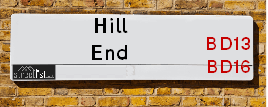
| Icon | Postcodes for Hill End Lane | |
| Walking Distances | ||
| Distance Info | Green Circle = 10 Minutes Walk (800 metres) | |
About Hill End Lane
Hill End Lane is a street located in the village of Harden. It uses the postcode BD16 1DE. The street has a length of approximately 1,208 metres.
Hill End Lane is located within the Bradford District (B) Council's jurisdiction. They provide various services, like refuse collection, and manage council tax collection. It's situated in the Yorkshire and The Humber region of the UK.
Hill End Lane has been assigned the Unique Street Reference Numbers of 7746540, 7796037, 7796170 and 7738500 in the National Street Gazetteer.
Hill End Lane is located within the county of West Yorkshire, situated in the Yorkshire and The Humber region of the UK. It's 177.9 miles North West from central London., 14.24 miles West from Leeds, 28.74 miles North East from Manchester and 33.93 miles West from York.

Do you know why this road is called Hill End Lane?
What's it like to live here?
Ask the community a question about Hill End Lane.
Do you have any questions, memories to share or know any facts about Hill End Lane? We'd love to know more.
Also on streetlist.co.uk, can you help?
Swing Swang Lane
28th April 2024
I am trying to find out why the lane is named Swing Swang?
It has been known known this since at least 1905 when hedge making contents used to be held here.
Swing Swang is often used to describe a fairground ride. I remember Swing Boats. Were they a bit like this or is Swing Swang another name for swings?
Swing Swangs are also mentioned in connection to orchards. Or were orchards just good places to have swings?
Estate Agents near Hill End Lane
| Name | Address | Website |
|---|---|---|
| Alan Slater Property Services | 143 Main Street, Wilsden, Bradford, BD15 0AQ | |
| Holroyds | 146 Main Street, Bingley, BD16 2HL | |
| Linley & Simpson | 51-53 Main Street, Bingley, BD16 2HZ | Visit Website |
We have found 1 postcode for Hill End Lane
Location Details
| Hill End Lane | |
|---|---|

| |
| Latitude | 53.836278 |
| Longitude | -1.884986 |
| OS Easting (X): | 407567 |
| OS Northing (Y): | 437809 |
| OS Grid Reference: | SE076378 |
Neighbourhood Policing |
| Police Force: West Yorkshire |
 View Neighbourhood Crime and Policing View Neighbourhood Crime and Policing |
| Find a Local Neighbourhood Watch Scheme |
Frequently asked Questions for Hill End Lane
What Council (Local Authority) is Hill End Lane in?
Hill End Lane is located within the local authority area of Bradford Council which is a Metropolitan District.
What Parish Council is Hill End Lane in?
Hill End Lane is located within the area of Harden Parish Council.
What Electoral Ward is Hill End Lane in?
Hill End Lane is located within the ward of Bingley Rural.
What County is Hill End Lane in?
Hill End Lane is located within the ceremonial county of West Yorkshire.
What Constituency is Hill End Lane in?
Hill End Lane is located within the constituency of Shipley.
What Part of the UK is Hill End Lane in?
Hill End Lane is located within the Yorkshire and The Humber region of the United Kingdom.
What County Council area is Hill End Lane in?
Hill End Lane is located within the West Yorkshire Council area.
What Police Force area is Hill End Lane in?
Hill End Lane is located within the West Yorkshire Police area.
Roads that have a Junction with Hill End Lane
| Street | Junction Type |
|---|---|
| Ryecroft Road | junction |
| Long Lane (B6429) | junction |
| Leech Lane | junction |
| Bingley Road (B6429) | pseudo node |
Sunset and Sunrise times for Hill End Lane , BD16 1DE
| Sunrise | 05:07 |
|---|---|
| Sunset | 21:00 |
Latest Weather Conditions for Hill End Lane, BD16 1DE
| Observed at Weather Station: | Bingley Samos 12 May 2024 at 01:00 (1.93 miles away) |
|---|---|
| Current Weather: | Mist |
| Temperature and Humidity: | 10.1°C (94.7%) |
| Wind Direction and Speed: | ESE (7 mph) |
Population Statistics
| ONS Area Code | E00053439 |
|---|---|
| ONS Area Name | Rural White-Collar Workers |
| Average Age | 45.58 |
| Area Population | 1600.00 |
| Male Population | 790.00 (49%) |
| Female Population | 810.00 (51%) |
| Benefit Claimants | 11 (1%) |
| LSOA Code: | E01010586 |
|---|---|
| LSOA Name: | Bradford 022A |
| SOA Code: | 8c |
| SOA Name: | |
| MSOA Code: | E02002204 |
| MSOA Name: | Bradford 022 |
Nearest Supermarkets
| Sainsburys Bingley Main Street Local |
|---|
| 117 Main Street, Bingley, England, BD16 1AJ |
| 1274552098 |
| Distance: 2.08 Miles |
| Directions from Hill End Lane to Sainsburys Bingley Main Street Local |
| Morrisons Keighley |
|---|
| Worth Way, Keighley BD21 5AE |
| 01535 607554 |
| Distance: 2.14 Miles |
| Directions from Hill End Lane to Morrisons Keighley |
| Iceland Keighley |
|---|
| Gresley Road, Keighley, West Yorkshire, BD21 5JG |
| 01535691096 |
| Distance: 2.19 Miles |
| Directions from Hill End Lane to Iceland Keighley |
| Asda Keighley |
|---|
| Bingley Street, Keighley, BD21 3ER |
| 01535 613900 |
| Distance: 2.37 Miles |
| Directions from Hill End Lane to Asda Keighley |
Telephone Information
| Dialling Code | Telephone Exchange | Telephone Cabinet | Fibre to the Cabinet or Fibre to the Premises |
|---|---|---|---|
| 01535 | CULLINGWORTH - MYCUL | P2 | FTTC |
Broadband Information
| Speed | Average Speed | Median Speed | Maximum Speed | Next-generation access (NGA) | Number of Connections |
|---|---|---|---|---|---|
| Greater than 2 Mbps | 28.1 | 6.7 | >=30 | Y | 8 |
Local Government
| Local Council Details |
|---|
| Within the area of Bradford |
| Visit the Council's Website |
| City Hall, Centenary Square, Bradford &BD1 1HY |
| Telephone Number: 01274 432111 |
| Local Member of Parliament |
|---|
| Within the Westminster Parliamentary Constituency of Shipley |
| The Member of Parliament is Philip Davies |
| Details for the MP Philip Davies on parliament.uk |
| Details for the MP Philip Davies on theyworkforyou.com |
| In the 2019 General Election Philip Davies won with a majority of 6,242 the result was Con hold. The total electorate was 74,029 |
| Wards, Parish Councils and County Councils |
|---|
| Ward: Bingley Rural Ward |
| Ceremonial County: West Yorkshire |
Nearest Schools
England Primary Schools
Wilsden Primary School
Address: Wilsden Primary School, Tweedy Street, Wilsden, Bradford, West Yorkshire, BD15 0AE
Distance: 1.33 miles
Contact:
Long Lee Primary School
Address: Long Lee Primary School, Cherry Tree Rise, Long Lee, Keighley, West Yorkshire, BD21 4RU
Distance: 1.78 miles
Contact: 01535603986
Cullingworth Village Primary School
Address: Cullingworth Village Primary School, New School Lane, Off Halifax Road, Cullingworth, Bradford, West Yorkshire, BD13 5DA
Distance: 1.01 miles
Contact:
Wilsden Primary School
Address: Wilsden Primary School, Tweedy Street, Wilsden, Bradford, West Yorkshire, BD15 0AE
Distance: 1.33 miles
Contact: 01535272263
Harden Primary School
Address: Harden Primary School, Long Lane, Harden, Bingley, West Yorkshire, BD16 1LJ
Distance: 0.61 miles
Contact: 01535273847
England Secondary Schools
Parkside School
Address: Parkside School, Parkside Terrace, Cullingworth, Bradford, West Yorkshire, BD13 5AD
Distance: 0.73 miles
Contact:
Nearest Hospitals
| Name | Address | Postcode | Distance | Map |
|---|
Nearest Dentists
Dentists near Hill End Lane
| Name | Address | Postcode | Distance | Map |
|---|
Nearest GP Surgeries
Doctors near Hill End Lane
BROWN GM
Address: CULLINGWORTH MEDICAL CENTRE, 12 MILL STREET, CULLINGWORTH, BRADFORD, WEST YORKSHIRE, BD13 5HA
Distance: 0.86 miles
Contact: :
THE WILSDEN MEDICAL PRACTICE
Address: 2 LINGBOB COURT, WILSDEN, BRADFORD, WEST YORKSHIRE, BD15 0NJ
Distance: 1.57 miles
Contact: tel: 01535 273227
MODALITY PARTNERSHIP (AWC)
Address: LONG LEE SURGERY, LONG LEE LANE, LONG LEE, KEIGHLEY, BD21 4TT
Distance: 1.58 miles
Contact: tel: 01535 606415
DR PRESHAW AND PARTNERS
Address: 172A LONG LEE LANE, LONG LEE, KEIGHLEY, WEST YORKSHIRE, BD21 4TT
Distance: 1.58 miles
Contact: tel: 01535 609249
COTTINGLEY SURGERY
Address: 10 CANON PINNINGTON MEWS, BINGLEY, BD16 1AQ
Distance: 2.23 miles
Contact: :
HOLYCROFT SURGERY
Address: OAKWORTH ROAD, KEIGHLEY, BD21 1SA
Distance: 2.25 miles
Contact: :
Nearest Dispensing Chemists
Pharmacies near Hill End Lane
| Name | Address | Postcode | Telephone | Map | Distance in Km |
|---|
Nearest Opticians
Opticians near Hill End Lane
SARAH FARRAR LTD
Address: 160 MAIN STREET, WILSDEN, BRADFORD, WEST YORKSHIRE, BD15 0HX
Distance: 1.50 miles
Contact: :
DAVID HOWARTH OPTOMETRISTS
Address: 158 MAIN STREET, BINGLEY, WEST YORKSHIRE, BD16 2HR
Distance: 2.07 miles
Contact: :
DAVID KENYON OPTICIANS
Address: 139 MAIN STREET, BINGLEY, WEST YORKSHIRE, BD16 1AJ
Distance: 2.10 miles
Contact: :
SPECSAVERS OPTICIANS (BINGLEY)
Address: 155 MAIN STREET, BINGLEY, WEST YORKSHIRE, BD16 1AJ
Distance: 2.10 miles
Contact: :
SPECSAVERS (KEIGHLEY)
Address: 11 QUEENSWAY, AIREDALE SHOPPING CENTRE, KEIGHLEY, WEST YORKSHIRE, BD21 3PX
Distance: 2.28 miles
Contact: :
VISION EXPRESS (KEIGHLEY)
Address: 25 COLLEGE WALK, AIREDALE CENTRE, KEIGHLEY, WEST YORKSHIRE, BD21 3QA
Distance: 2.31 miles
Contact: :
Transport
Nearest Rail Stations
Bingley Station is 2.13 miles away.
Address: Bingley station, Wellington Street, Bingley, West Yorkshire, BD16 2NA
Bingley is situated on the Leeds to Morecambe line and is managed by Northern.
Bingley Station is staffed on a full time basis.
Crossflatts Station is 2.24 miles away.
Address: Crossflatts station, Keighley Road, Crossflatts, West Yorkshire, BD16 2RZ
Crossflatts is situated on the Leeds to Morecambe line and is managed by Northern.
Crossflatts Station is an unstaffed station.