Map of Queen Street
| Postcodes | ||
|---|---|---|
| Icon | Postcodes for Queen Street | |
| Walking Distances | ||
| Distance Info | Green Circle = 10 Minutes Walk (800 metres) | |
About Queen Street
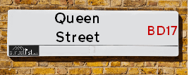
Queen Street is a street located in the town of Baildon. It uses the postcode BD17 6AA. The street has a length of approximately 55 metres.
Queen Street is located within the Bradford District (B) Council's jurisdiction. They provide various services, like refuse collection, and manage council tax collection. It's situated in the Yorkshire and The Humber region of the UK.
Queen Street has been assigned the Unique Street Reference Number of 7761820 in the National Street Gazetteer.
Queen Street is located within the county of West Yorkshire, situated in the Yorkshire and The Humber region of the UK. It's 176.17 miles North West from central London., 9.66 miles West from Leeds, 29.25 miles West from York and 31.7 miles North East from Manchester.

Do you know why this road is called Queen Street?
What's it like to live here?
Ask the community a question about Queen Street.
Do you have any questions, memories to share or know any facts about Queen Street? We'd love to know more.
Also on streetlist.co.uk, can you help?
Swing Swang Lane
28th April 2024
I am trying to find out why the lane is named Swing Swang?
It has been known known this since at least 1905 when hedge making contents used to be held here.
Swing Swang is often used to describe a fairground ride. I remember Swing Boats. Were they a bit like this or is Swing Swang another name for swings?
Swing Swangs are also mentioned in connection to orchards. Or were orchards just good places to have swings?
Estate Agents near Queen Street
| Name | Address | Website |
|---|---|---|
| Hunters | 7-9 Briggate Shipley BD17 7BP | Visit Website |
| Hamilton Bower | 33 Otley Road, Saltaire, Shipley, BD17 7DE | Visit Website |
| Incommunities | The Quays Victoria Street, Shipley, BD17 7BN | Visit Website |
We have found 1 postcode for Queen Street
Location Details
| Queen Street | |
|---|---|

| |
| Latitude | 53.840626 |
| Longitude | -1.768274 |
| OS Easting (X): | 415245 |
| OS Northing (Y): | 438312 |
| OS Grid Reference: | SE152383 |
Neighbourhood Policing |
| Police Force: West Yorkshire |
 View Neighbourhood Crime and Policing View Neighbourhood Crime and Policing |
| Find a Local Neighbourhood Watch Scheme |
Frequently asked Questions for Queen Street
What Council (Local Authority) is Queen Street in?
Queen Street is located within the local authority area of Bradford Council which is a Metropolitan District.
What Parish Council is Queen Street in?
Queen Street is located within the area of Baildon Parish Council.
What Electoral Ward is Queen Street in?
Queen Street is located within the ward of Baildon.
What County is Queen Street in?
Queen Street is located within the ceremonial county of West Yorkshire.
What Constituency is Queen Street in?
Queen Street is located within the constituency of Shipley.
What Part of the UK is Queen Street in?
Queen Street is located within the Yorkshire and The Humber region of the United Kingdom.
What County Council area is Queen Street in?
Queen Street is located within the West Yorkshire Council area.
What Police Force area is Queen Street in?
Queen Street is located within the West Yorkshire Police area.
Roads that have a Junction with Queen Street
| Street | Junction Type |
|---|---|
| Baildon Road (B6151) | junction |
| Otley Road (A6038) | junction |
Sunset and Sunrise times for Queen Street , BD17 6AA
| Sunrise | 05:06 |
|---|---|
| Sunset | 21:00 |
Latest Weather Conditions for Queen Street, BD17 6AA
| Observed at Weather Station: | Bingley Samos 12 May 2024 at 12:00 (4.44 miles away) |
|---|---|
| Current Weather: | Mist |
| Temperature and Humidity: | 17.5°C (68.6%) |
| Wind Direction and Speed: | ESE (8 mph) |
Population Statistics
| ONS Area Code | E00053384 |
|---|---|
| ONS Area Name | Families in Terraces and Flats |
| Average Age | 39.99 |
| Area Population | 1649.00 |
| Male Population | 815.00 (49%) |
| Female Population | 834.00 (51%) |
| Benefit Claimants | 53 (3%) |
| LSOA Code: | E01010571 |
|---|---|
| LSOA Name: | Bradford 016C |
| SOA Code: | 3d |
| SOA Name: | |
| MSOA Code: | E02002198 |
| MSOA Name: | Bradford 016 |
Nearest Supermarkets
| Tesco Baildon Express |
|---|
| Otley Rd, Baildon, BD17 7HE |
| 0345 671 9344 |
| Distance: 0.16 Miles |
| Directions from Queen Street to Tesco Baildon Express |
| Iceland Shipley |
|---|
| 30 Market Place, Shipley, West Yorkshire, BD18 3QB |
| 01274557525 |
| Distance: 0.64 Miles |
| Directions from Queen Street to Iceland Shipley |
| Asda Shipley |
|---|
| Manor Lane, Shipley, BD18 3RY |
| 01274 589399 |
| Distance: 0.73 Miles |
| Directions from Queen Street to Asda Shipley |
| Morrisons Bradford - Enterprise 5 |
|---|
| 275 Bradford Road, Idle, Bradford BD10 8EG |
| 01274 615496 |
| Distance: 1.84 Miles |
| Directions from Queen Street to Morrisons Bradford - Enterprise 5 |
Telephone Information
| Area Code |
|---|
| Area Code: 01274 - Bradford |
| Area Code: 01943 - Guiseley |
| Area Code: 01535 - Keighley |
| Area Code: 01422 - Halifax |
Local Government
| Local Council Details |
|---|
| Within the area of Bradford |
| Visit the Council's Website |
| City Hall, Centenary Square, Bradford &BD1 1HY |
| Telephone Number: 01274 432111 |
| Local Member of Parliament |
|---|
| Within the Westminster Parliamentary Constituency of Shipley |
| The Member of Parliament is Philip Davies |
| Details for the MP Philip Davies on parliament.uk |
| Details for the MP Philip Davies on theyworkforyou.com |
| In the 2019 General Election Philip Davies won with a majority of 6,242 the result was Con hold. The total electorate was 74,029 |
| Wards, Parish Councils and County Councils |
|---|
| Ward: Baildon Ward |
| Ceremonial County: West Yorkshire |
Nearest Schools
England Primary Schools
Frizinghall Primary School
Address: Frizinghall Primary School, Salisbury Road, Frizinghall, Bradford, West Yorkshire, BD9 4HP
Distance: 1.36 miles
Contact: 01274543072
Baildon CofE Primary School
Address: Baildon CofE Primary School, Coverdale Way, Baildon, Shipley, West Yorkshire, BD17 6TE
Distance: 1.15 miles
Contact:
Hoyle Court Primary School
Address: Hoyle Court Primary School, Fyfe Grove, Baildon, Shipley, West Yorkshire, BD17 6DN
Distance: 0.64 miles
Contact: 01274581898
St Anthony's Catholic Primary School
Address: St Anthony's Catholic Primary School, High Busy Lane, Shipley, West Yorkshire, BD18 1HD
Distance: 0.73 miles
Contact:
High Crags Primary Leadership Academy
Address: High Crags Primary Leadership Academy, Crag Road, Shipley, West Yorkshire, BD18 2ES
Distance: 0.82 miles
Contact: 01274584068
High Crags Primary School
Address: High Crags Primary School, Crag Road, Shipley, West Yorkshire, BD18 2ES
Distance: 0.82 miles
Contact:
Low Ash Primary School
Address: Low Ash Primary School, Wrose Road, Wrose, Shipley, West Yorkshire, BD18 1AA
Distance: 0.90 miles
Contact: 01274582927
Sandal Primary School
Address: Sandal Primary School, West Lane, Baildon, Shipley, West Yorkshire, BD17 5DH
Distance: 0.66 miles
Contact: 01274598115
Glenaire Primary School
Address: Glenaire Primary School, Thompson Lane, Baildon, Shipley, West Yorkshire, BD17 7LY
Distance: 0.72 miles
Contact:
Christ Church Church of England Academy
Address: Christ Church Church of England Academy, Wrose Brow Road, Shipley, West Yorkshire, BD18 2NT
Distance: 0.52 miles
Contact: 01274410349
Shipley CofE Primary School
Address: Shipley CofE Primary School, Otley Road, Shipley, West Yorkshire, BD18 2PT
Distance: 0.91 miles
Contact:
Wycliffe CofE Primary School
Address: Wycliffe CofE Primary School, Saltaire Road, Shipley, West Yorkshire, BD18 3HZ
Distance: 0.79 miles
Contact:
St Walburga's Catholic Primary School, A Voluntary Academy
Address: St Walburga's Catholic Primary School, A Voluntary Academy, Victoria Park, Shipley, West Yorkshire, BD18 4RL
Distance: 0.99 miles
Contact: 01274531102
St Walburga's Catholic Primary School
Address: St Walburga's Catholic Primary School, Victoria Park, Shipley, West Yorkshire, BD18 4RL
Distance: 0.99 miles
Contact:
Saltaire Primary School
Address: Saltaire Primary School, Albert Road, Shipley, West Yorkshire, BD18 4NR
Distance: 1.08 miles
Contact: 01274584093
England Secondary Schools
Titus Salt School
Address: Titus Salt School, Higher Coach Road, Baildon, Shipley, Bradford, West Yorkshire, BD17 5RH
Distance: 1.06 miles
Contact: 01274258969
England Higher Schools
Shipley College
Address: Shipley College, Exhibition Road, Victoria Road, Leeds, West Yorkshire, BD18 3JW
Distance: 0.86 miles
Contact: 01274327222
Nearest Hospitals
| Name | Address | Postcode | Distance | Map |
|---|
Nearest Dentists
Dentists near Queen Street
| Name | Address | Postcode | Distance | Map |
|---|
Nearest GP Surgeries
Doctors near Queen Street
THE SALTAIRE & WINDHILL MEDICAL P'SHIP
Address: WINDHILL GREEN MEDIC PRAC, 2 THACKLEY OLD ROAD, SHIPLEY, BD18 1QB
Distance: 0.39 miles
Contact: tel: 01274 584223
WINDHILL GREEN MEDICAL PRACTICE
Address: 2 THACKLEY OLD ROAD, SHIPLEY, BD18 1QB
Distance: 0.39 miles
Contact: :
WINDHILL GREEN EMERALD SUITE - COVID LOCAL VACCINATION SERVICE
Address: 2 THACKLEY OLD ROAD, SHIPLEY, BD18 1QB
Distance: 0.39 miles
Contact: :
DR BIBBY
Address: CLIFFE AVENUE SURGERY, CLIFFE AVENUE, BAILDON, SHIPLEY, WEST YORKSHIRE, BD17 6NT
Distance: 0.56 miles
Contact: :
SHIPLEY HEALTH CENTRE - COVID LOCAL VACCINATION SERVICE
Address: SHIPLEY MEDICAL PRACTICE, ALEXANDRA ROAD, SHIPLEY, BD18 3EG
Distance: 0.77 miles
Contact: :
SHIPLEY MEDICAL PRACTICE-AFFINITY CARE
Address: SHIPLEY MEDICAL PRACTICE, ALEXANDRA ROAD, SHIPLEY, BD18 3EG
Distance: 0.77 miles
Contact: tel: 01274 531153
Nearest Dispensing Chemists
Pharmacies near Queen Street
| Name | Address | Postcode | Telephone | Map | Distance in Km |
|---|
Nearest Opticians
Opticians near Queen Street
ORACLE OPTICIANS (SHIPLEY)
Address: 9 WESTGATE, SHIPLEY, WEST YORKSHIRE, BD18 3QX
Distance: 0.59 miles
Contact: :
SPECSAVERS (SHIPLEY)
Address: 29 MARKET SQUARE, SHIPLEY, WEST YORKSHIRE, BD18 3QJ
Distance: 0.64 miles
Contact: :
4621 SHIPLEY
Address: ASDA STORES LTD, MANOR LANE, SHIPLEY, WEST YORKSHIRE, BD18 3RY
Distance: 0.71 miles
Contact: :
OPTICALL YORKSHIRE
Address: 19 GLEN RISE, BAILDON, SHIPLEY, BD17 5DD
Distance: 0.90 miles
Contact: :
OPTIMA EYECARE
Address: 71 BRADFORD ROAD, SHIPLEY, WEST YORKSHIRE, BD18 3DT
Distance: 0.92 miles
Contact: :
VISION EXPRESS (BAILDON)
Address: 14 NORTHGATE, BAILDON, SHIPLEY, WEST YORKSHIRE, BD17 6JX
Distance: 0.92 miles
Contact: :
Transport
Nearest Rail Stations
Shipley (Yorks) Station is 0.58 miles away.
Address: Shipley station, Station Road, Shipley, West Yorkshire, BD18 2JL
Shipley (Yorks) is situated on the Leeds to Morecambe line|Wharfedale Line|Leeds to Bradford lines and is managed by Northern.
Shipley (Yorks) Station is staffed on a full time basis.
Directions from Queen Street to Shipley (Yorks) Rail Station
Baildon Station is 0.86 miles away.
Address: Baildon station, Station Road, Baildon, West Yorkshire, BD17 6HS
Baildon is situated on the Wharfedale Line and is managed by Northern.
Baildon Station is an unstaffed station.