Map of West View
| Postcodes | ||
|---|---|---|
| Icon | Postcodes for West View | |
| Walking Distances | ||
| Distance Info | Green Circle = 10 Minutes Walk (800 metres) | |
About West View
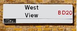
West View is a street located in the town of Silsden. It uses the postcode BD20 9JY. The street has a length of approximately 59 metres.
West View is located within the Bradford District (B) Council's jurisdiction. They provide various services, like refuse collection, and manage council tax collection. It's situated in the Yorkshire and The Humber region of the UK.
West View has been assigned the Unique Street Reference Number of 7781280 in the National Street Gazetteer.
West View is located within the county of West Yorkshire, situated in the Yorkshire and The Humber region of the UK. It's 183.76 miles North West from central London., 18.09 miles North West from Leeds, 32.59 miles North East from Manchester and 35.19 miles West from York.

Do you know why this road is called West View?
What's it like to live here?
Ask the community a question about West View.
Do you have any questions, memories to share or know any facts about West View? We'd love to know more.
Also on streetlist.co.uk, can you help?
Swing Swang Lane
28th April 2024
I am trying to find out why the lane is named Swing Swang?
It has been known known this since at least 1905 when hedge making contents used to be held here.
Swing Swang is often used to describe a fairground ride. I remember Swing Boats. Were they a bit like this or is Swing Swang another name for swings?
Swing Swangs are also mentioned in connection to orchards. Or were orchards just good places to have swings?
Estate Agents near West View
| Name | Address | Website |
|---|---|---|
| Knowles by Zenko Properties | 1-3 Briggate, Silsden, BD20 9JS | Visit Website |
| Wilman & Lodge | 84 Kirkgate Silsden Keighley BD20 0PA | Visit Website |
| Skipton Properties Ltd | Bolton Road Silsden Keighley BD20 0NR | Visit Website |
We have found 1 postcode for West View
Location Details
| West View | |
|---|---|

| |
| Latitude | 53.914755 |
| Longitude | -1.939828 |
| OS Easting (X): | 403951 |
| OS Northing (Y): | 446535 |
| OS Grid Reference: | SE040465 |
Neighbourhood Policing |
| Police Force: West Yorkshire |
 View Neighbourhood Crime and Policing View Neighbourhood Crime and Policing |
| Find a Local Neighbourhood Watch Scheme |
Frequently asked Questions for West View
What Council (Local Authority) is West View in?
West View is located within the local authority area of Bradford Council which is a Metropolitan District.
What Parish Council is West View in?
West View is located within the area of Silsden Parish Council.
What Electoral Ward is West View in?
West View is located within the ward of Craven.
What County is West View in?
West View is located within the ceremonial county of West Yorkshire.
What Constituency is West View in?
West View is located within the constituency of Keighley.
What Part of the UK is West View in?
West View is located within the Yorkshire and The Humber region of the United Kingdom.
What County Council area is West View in?
West View is located within the West Yorkshire Council area.
What Police Force area is West View in?
West View is located within the West Yorkshire Police area.
Roads that have a Junction with West View
| Street | Junction Type |
|---|---|
| Skipton Road | junction |
Sunset and Sunrise times for West View , BD20 9JY
| Sunrise | 05:07 |
|---|---|
| Sunset | 21:01 |
Latest Weather Conditions for West View, BD20 9JY
| Observed at Weather Station: | Bingley Samos 12 May 2024 at 16:00 (7.79 miles away) |
|---|---|
| Current Weather: | Partly cloudy (day) |
| Temperature and Humidity: | 22.2°C (55.8%) |
| Wind Direction and Speed: | ESE (9 mph) |
Population Statistics
| ONS Area Code | E00053714 |
|---|---|
| ONS Area Name | Families in Terraces and Flats |
| Average Age | 38.57 |
| Area Population | 1691.00 |
| Male Population | 812.00 (48%) |
| Female Population | 879.00 (52%) |
| Benefit Claimants | 22 (1%) |
| LSOA Code: | E01010640 |
|---|---|
| LSOA Name: | Bradford 004C |
| SOA Code: | 5b |
| SOA Name: | |
| MSOA Code: | E02002186 |
| MSOA Name: | Bradford 004 |
Nearest Supermarkets
| Sainsburys Keighley |
|---|
| 1 Sainsburys Centre, Cavendish Street, Keighley, England, BD21 3RU |
| 01535 603117 |
| Distance: 3.48 Miles |
| Directions from West View to Sainsburys Keighley |
| Asda Keighley |
|---|
| Bingley Street, Keighley, BD21 3ER |
| 01535 613900 |
| Distance: 3.51 Miles |
| Directions from West View to Asda Keighley |
| Iceland Keighley |
|---|
| Gresley Road, Keighley, West Yorkshire, BD21 5JG |
| 01535691096 |
| Distance: 3.68 Miles |
| Directions from West View to Iceland Keighley |
| Morrisons Keighley |
|---|
| Worth Way, Keighley BD21 5AE |
| 01535 607554 |
| Distance: 3.72 Miles |
| Directions from West View to Morrisons Keighley |
Telephone Information
| Area Code |
|---|
| Area Code: 01535 - Keighley |
| Area Code: 01756 - Skipton |
Broadband Information
| Speed | Average Speed | Median Speed | Maximum Speed | Next-generation access (NGA) | Number of Connections |
|---|---|---|---|---|---|
| Greater than 2 Mbps | 16.8 | 14.2 | >=30 | Y | 7 |
Local Government
| Local Council Details |
|---|
| Within the area of Bradford |
| Visit the Council's Website |
| City Hall, Centenary Square, Bradford &BD1 1HY |
| Telephone Number: 01274 432111 |
| Local Member of Parliament |
|---|
| Within the Westminster Parliamentary Constituency of Keighley |
| The Member of Parliament is Robbie Moore |
| Details for the MP Robbie Moore on parliament.uk |
| Details for the MP Robbie Moore on theyworkforyou.com |
| In the 2019 General Election Robbie Moore won with a majority of 2,218 the result was Con gain from Lab. The total electorate was 72,778 |
| Wards, Parish Councils and County Councils |
|---|
| Ward: Craven Ward |
| Ceremonial County: West Yorkshire |
Nearest Schools
England Primary Schools
Silsden Primary School
Address: Silsden Primary School, Hawber Cote Lane, Silsden, Keighley, West Yorkshire, BD20 0JJ
Distance: 0.38 miles
Contact: 01535653290
Steeton Primary School
Address: Steeton Primary School, Market Street, Steeton, Keighley, West Yorkshire, BD20 6NN
Distance: 1.39 miles
Contact: 01535653315
Kildwick Church of England Voluntary Controlled Primary School
Address: Kildwick Church of England Voluntary Controlled Primary School, Priest Bank Road, Kildwick, Keighley, West Yorkshire, BD20 9BH
Distance: 1.82 miles
Contact: 01535633682
Nearest Hospitals
| Name | Address | Postcode | Distance | Map |
|---|
Nearest Dentists
Dentists near West View
| Name | Address | Postcode | Distance | Map |
|---|
Nearest GP Surgeries
Doctors near West View
SILSDEN & STEETON MEDICAL PRACTICE
Address: ELLIOTT STREET, SILSDEN, KEIGHLEY, BD20 0DG
Distance: 0.27 miles
Contact: :
SILSDEN SURGERY - COVID LOCAL VACCINATION SERVICE 2
Address: ELLIOTT STREET, SILSDEN, KEIGHLEY, BD20 0DG
Distance: 0.27 miles
Contact: :
DR FONTANA AND PARTNERS
Address: CHAPEL ROAD, STEETON, KEIGHLEY, BD20 6NU
Distance: 1.48 miles
Contact: :
CROSS HILLS GROUP PRACTICE
Address: HOLME LANE, CROSS HILLS, KEIGHLEY, BD20 7LG
Distance: 2.31 miles
Contact: :
ADDINGHAM SURGERY
Address: ADDINGHAM MEDICAL CENTRE, 151A MAIN STREET, ADDINGHAM, ILKLEY, WEST YORKSHIRE, LS29 0LZ
Distance: 3.11 miles
Contact: tel: 01943 830367
LING HOUSE MEDICAL CENTRE
Address: 49 SCOTT STREET, KEIGHLEY, WEST YORKSHIRE, BD21 2JH
Distance: 3.42 miles
Contact: tel: 01535 605747
Nearest Dispensing Chemists
Pharmacies near West View
| Name | Address | Postcode | Telephone | Map | Distance in Km |
|---|
Nearest Opticians
Opticians near West View
SILSDEN OPTICIANS
Address: 17 BRIGGATE, SILSDEN, KEIGHLEY, WEST YORKSHIRE, BD20 9JS
Distance: 0.04 miles
Contact: tel: 01535 658330
AIREDALE EYE CARE
Address: 37 MAIN STREET, CROSS HILLS, KEIGHLEY, WEST YORKSHIRE, BD20 8TA
Distance: 2.28 miles
Contact: :
BRADFORD 2 DOMICILIARY SPECSAVERS LIMITED
Address: KIRK HILL HOUSE, KIRK HILL FOLD, GLUSBURN, KEIGHLEY, BD20 8RD
Distance: 2.85 miles
Contact: :
KNOWLE PARK OPTICIANS
Address: 42 DEVONSHIRE STREET, KEIGHLEY, WEST YORKSHIRE, BD21 2AU
Distance: 3.45 miles
Contact: :
CLARUS OPTICIANS (KEIGHLEY)
Address: 46 CAVENDISH STREET, KEIGHLEY, WEST YORKSHIRE, BD21 3RL
Distance: 3.50 miles
Contact: :
AIREDALE OPTICIANS
Address: 50 TOWNGATE, KEIGHLEY, WEST YORKSHIRE, BD21 3QE
Distance: 3.52 miles
Contact: :
Transport
Nearest Rail Stations
Steeton & Silsden Station is 1.02 miles away.
Address: Steeton & Silsden station, Station Road, Steeton, West Yorkshire, BD20 6RY
Steeton & Silsden is situated on the Leeds to Morecambe line and is managed by Northern.
Steeton & Silsden Station is an unstaffed station.
Cononley Station is 2.91 miles away.
Address: Cononley station, Cononley Lane, Cononley, West Yorkshire, BD20 8HY
Cononley is situated on the Leeds to Morecambe line and is managed by Northern.
Cononley Station is an unstaffed station.