Map of Bradford Road
| Postcodes | ||
|---|---|---|
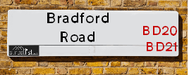
| Icon | Postcodes for Bradford Road | |
| Walking Distances | ||
| Distance Info | Green Circle = 10 Minutes Walk (800 metres) | |
About Bradford Road
Bradford Road is a street located in the town of Keighley. The street has a length of approximately 4,409 metres.
Bradford Road is located within the Bradford District (B) Council's jurisdiction. They provide various services, like refuse collection, and manage council tax collection. It's situated in the Yorkshire and The Humber region of the UK.
Bradford Road has been assigned the Unique Street Reference Numbers of 7700423, 7796031, 7712105, 7797291, 7712100, 7796003, 7796074, 7796145, 7796146, 7796353, 7796877, 7796878, 7797247, 7700252, 7796015 and 7724920 in the National Street Gazetteer.
Bradford Road is located within the county of West Yorkshire, situated in the Yorkshire and The Humber region of the UK. It's 180.08 miles North West from central London., 14.71 miles West from Leeds, 31 miles North East from Manchester and 33.2 miles West from York.

Do you know why this road is called Bradford Road?
What's it like to live here?
Ask the community a question about Bradford Road.
Do you have any questions, memories to share or know any facts about Bradford Road? We'd love to know more.
Also on streetlist.co.uk, can you help?
Swing Swang Lane
28th April 2024
I am trying to find out why the lane is named Swing Swang?
It has been known known this since at least 1905 when hedge making contents used to be held here.
Swing Swang is often used to describe a fairground ride. I remember Swing Boats. Were they a bit like this or is Swing Swang another name for swings?
Swing Swangs are also mentioned in connection to orchards. Or were orchards just good places to have swings?
Estate Agents near Bradford Road
| Name | Address | Website |
|---|---|---|
| Quick Move Estates | 25A Bradford Road, Keighley, Riddlesden,BD21 4ET | Visit Website |
| Property Professionals | 28 Cavendish Street, Keighley, BD21 3RG | |
| Martin & Co | 2 North Street, Keighley, BD21 3SE | Visit Website |
We have found 37 postcodes for Bradford Road
Location Details
| Bradford Road | |
|---|---|

| |
| Latitude | 53.872402 |
| Longitude | -1.880564 |
| OS Easting (X): | 407852 |
| OS Northing (Y): | 441829 |
| OS Grid Reference: | SE079418 |
Neighbourhood Policing |
| Police Force: West Yorkshire |
 View Neighbourhood Crime and Policing View Neighbourhood Crime and Policing |
| Find a Local Neighbourhood Watch Scheme |
Frequently asked Questions for Bradford Road
What Council (Local Authority) is Bradford Road in?
Bradford Road is located within the local authority area of Bradford Council which is a Metropolitan District.
What Parish Council is Bradford Road in?
Bradford Road is located within the area of Keighley Parish Council.
What Electoral Ward is Bradford Road in?
Bradford Road is located within the ward of Keighley East.
What County is Bradford Road in?
Bradford Road is located within the ceremonial county of West Yorkshire.
What Constituency is Bradford Road in?
Bradford Road is located within the constituency of Keighley.
What Part of the UK is Bradford Road in?
Bradford Road is located within the Yorkshire and The Humber region of the United Kingdom.
What County Council area is Bradford Road in?
Bradford Road is located within the West Yorkshire Council area.
What Police Force area is Bradford Road in?
Bradford Road is located within the West Yorkshire Police area.
Roads that have a Junction with Bradford Road
Sunset and Sunrise times for Bradford Road
| Sunrise | 05:03 |
|---|---|
| Sunset | 21:04 |
Latest Weather Conditions for Bradford Road
| Observed at Weather Station: | Bingley Samos 14 May 2024 at 06:00 (4.29 miles away) |
|---|---|
| Current Weather: | Light rain |
| Temperature and Humidity: | 12.9°C (96.8%) |
| Wind Direction and Speed: | E (8 mph) |
Population Statistics
| ONS Area Code | E00053986, E00054017, E00054019, E00176202, E00053987, E00053994, E00054022, E00053989, E00053991, E00054020 & E00053983 |
|---|---|
| ONS Area Name | Achieving Minorities, Families in Terraces and Flats, Multi-Ethnic Suburbia, White Suburban Communities, Older Workers and Retirement & Pakistani Communities |
| Average Age | 38.21, 39.84, 29.90 & 39.74 |
| Area Population | 1642.00, 2663.00, 1533.00 & 1656.00 |
| Male Population | 770.00, 1301.00, 771.00 & 812.00 (49%) |
| Female Population | 872.00, 1362.00, 762.00 & 844.00 (51%) |
| Benefit Claimants | 31, 17, 79 & 28 (2%) |
| LSOA Code: | E01010703, E01010709, E01010700 &E01010708 |
|---|---|
| LSOA Name: | Bradford 008D, Bradford 006D, Bradford 008A &Bradford 006C |
| SOA Code: | 3d, 8c &7b |
| SOA Name: | |
| MSOA Code: | E02002190 &E02002188 |
| MSOA Name: | Bradford 008 &Bradford 006 |
Nearest Supermarkets
| Asda Keighley |
|---|
| Bingley Street, Keighley, BD21 3ER |
| 01535 613900 |
| Distance: 0.91 Miles |
| Directions from Bradford Road to Asda Keighley |
| Sainsburys Keighley |
|---|
| 1 Sainsburys Centre, Cavendish Street, Keighley, England, BD21 3RU |
| 01535 603117 |
| Distance: 1.01 Miles |
| Directions from Bradford Road to Sainsburys Keighley |
| Iceland Keighley |
|---|
| Gresley Road, Keighley, West Yorkshire, BD21 5JG |
| 01535691096 |
| Distance: 1.04 Miles |
| Directions from Bradford Road to Iceland Keighley |
| Morrisons Keighley |
|---|
| Worth Way, Keighley BD21 5AE |
| 01535 607554 |
| Distance: 1.22 Miles |
| Directions from Bradford Road to Morrisons Keighley |
Telephone Information
| Area Code |
|---|
| Area Code: 01535 - Keighley |
| Area Code: 01943 - Guiseley |
| Area Code: 01274 - Bradford |
| Area Code: 01756 - Skipton |
Local Government
| Local Council Details |
|---|
| Within the area of Bradford |
| Visit the Council's Website |
| City Hall, Centenary Square, Bradford &BD1 1HY |
| Telephone Number: 01274 432111 |
| Local Member of Parliament |
|---|
| Within the Westminster Parliamentary Constituency of Keighley |
| The Member of Parliament is Robbie Moore |
| Details for the MP Robbie Moore on parliament.uk |
| Details for the MP Robbie Moore on theyworkforyou.com |
| In the 2019 General Election Robbie Moore won with a majority of 2,218 the result was Con gain from Lab. The total electorate was 72,778 |
| Wards, Parish Councils and County Councils |
|---|
| Ward: Keighley East Ward |
| Ceremonial County: West Yorkshire |
Nearest Schools
England Primary Schools
East Morton CofE Primary School
Address: East Morton CofE Primary School, Street Lane, East Morton, Keighley, West Yorkshire, BD20 5SE
Distance: 1.07 miles
Contact:
Crossflatts Primary School
Address: Crossflatts Primary School, Morton Lane, Crossflatts, Bingley, West Yorkshire, BD16 2EP
Distance: 1.42 miles
Contact: 01274782070
Long Lee Primary School
Address: Long Lee Primary School, Cherry Tree Rise, Long Lee, Keighley, West Yorkshire, BD21 4RU
Distance: 0.91 miles
Contact: 01535603986
Riddlesden St Mary's CofE Primary School
Address: Riddlesden St Mary's CofE Primary School, Grange Road, Riddlesden, Keighley, West Yorkshire, BD20 5AB
Distance: 0.51 miles
Contact: 01535210002
Parkwood Primary School
Address: Parkwood Primary School, Parkwood Street, Keighley, West Yorkshire, BD21 4QH
Distance: 1.02 miles
Contact:
Eastwood Community School
Address: Eastwood Community School, Victoria Avenue, Keighley, West Yorkshire, BD21 3JL
Distance: 0.90 miles
Contact:
Victoria Primary School
Address: Victoria Primary School, Cartmel Road, Keighley, West Yorkshire, BD21 2RD
Distance: 1.56 miles
Contact:
Parkwood Primary School
Address: Parkwood Primary School, Parkwood Street, Keighley, West Yorkshire, BD21 4QH
Distance: 1.02 miles
Contact: 01535603832
St Anne's Catholic Primary School
Address: St Anne's Catholic Primary School, North Street, Keighley, West Yorkshire, BD21 3AD
Distance: 1.21 miles
Contact: 01535210600
Victoria Primary School
Address: Victoria Primary School, Cartmel Road, Keighley, West Yorkshire, BD21 2RD
Distance: 1.56 miles
Contact: 01535210110
England Secondary Schools
The Holy Family Catholic School
Address: The Holy Family Catholic School, Spring Gardens Lane, Keighley, West Yorkshire, BD20 6LH
Distance: 1.48 miles
Contact:
Carlton Keighley
Address: Carlton Keighley, Green Head Road, Utley, Keighley, West Yorkshire, BD20 6EB
Distance: 1.43 miles
Contact: 01535210333
Nearest Hospitals
| Name | Address | Postcode | Distance | Map |
|---|
Nearest Dentists
Dentists near Bradford Road
| Name | Address | Postcode | Distance | Map |
|---|
Nearest GP Surgeries
Doctors near Bradford Road
MODALITY PARTNERSHIP (AWC)
Address: LONG LEE SURGERY, LONG LEE LANE, LONG LEE, KEIGHLEY, BD21 4TT
Distance: 1.00 miles
Contact: tel: 01535 606415
DR PRESHAW AND PARTNERS
Address: 172A LONG LEE LANE, LONG LEE, KEIGHLEY, WEST YORKSHIRE, BD21 4TT
Distance: 1.00 miles
Contact: tel: 01535 609249
LING HOUSE MEDICAL CENTRE
Address: 49 SCOTT STREET, KEIGHLEY, WEST YORKSHIRE, BD21 2JH
Distance: 1.25 miles
Contact: tel: 01535 605747
FARFIELD GROUP PRACTICE
Address: ST. ANDREW'S SURGERIES, WEST LANE, KEIGHLEY, BD21 2LD
Distance: 1.41 miles
Contact: :
CROSSFLATTS SURGERY
Address: THOMPSON COURT, MORTON LANE, CROSSFLATTS, BINGLEY, WEST YORKSHIRE, BD16 2EP
Distance: 1.42 miles
Contact: :
HOLYCROFT SURGERY
Address: OAKWORTH ROAD, KEIGHLEY, BD21 1SA
Distance: 1.50 miles
Contact: :
Nearest Dispensing Chemists
Pharmacies near Bradford Road
| Name | Address | Postcode | Telephone | Map | Distance in Km |
|---|
Nearest Opticians
Opticians near Bradford Road
CLARUS OPTICIANS (KEIGHLEY)
Address: 46 CAVENDISH STREET, KEIGHLEY, WEST YORKSHIRE, BD21 3RL
Distance: 1.08 miles
Contact: :
AIREDALE OPTICIANS
Address: 50 TOWNGATE, KEIGHLEY, WEST YORKSHIRE, BD21 3QE
Distance: 1.14 miles
Contact: :
BOOTS OPTICIANS (KEIGHLEY)
Address: 30 BOW STREET, KEIGHLEY, WEST YORKSHIRE, BD21 3QD
Distance: 1.15 miles
Contact: :
SPECSAVERS (KEIGHLEY)
Address: 11 QUEENSWAY, AIREDALE SHOPPING CENTRE, KEIGHLEY, WEST YORKSHIRE, BD21 3PX
Distance: 1.19 miles
Contact: :
VISION EXPRESS (KEIGHLEY)
Address: 25 COLLEGE WALK, AIREDALE CENTRE, KEIGHLEY, WEST YORKSHIRE, BD21 3QA
Distance: 1.19 miles
Contact: :
KNOWLE PARK OPTICIANS
Address: 42 DEVONSHIRE STREET, KEIGHLEY, WEST YORKSHIRE, BD21 2AU
Distance: 1.30 miles
Contact: :
Transport
Nearest Rail Stations
Keighley Station is 0.89 miles away.
Address: Keighley station, Station Bridge, Keighley, West Yorkshire, BD21 4HP
Keighley is situated on the Leeds to Morecambe line and is managed by Northern.
Keighley Station is staffed on a part time basis.
Crossflatts Station is 1.74 miles away.
Address: Crossflatts station, Keighley Road, Crossflatts, West Yorkshire, BD16 2RZ
Crossflatts is situated on the Leeds to Morecambe line and is managed by Northern.
Crossflatts Station is an unstaffed station.