Map of Redlands
| Postcodes | ||
|---|---|---|
| Icon | Postcodes for Redlands | |
| Walking Distances | ||
| Distance Info | Green Circle = 10 Minutes Walk (800 metres) | |
About Redlands
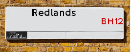
Redlands is a street located in the town of Poole. It uses the postcode BH12 1DN. The street has a length of approximately 346 metres.
Redlands is located within the Bournemouth, Christchurch and Poole Council's jurisdiction. They provide various services, like refuse collection, and manage council tax collection. It's situated in the South West region of the UK.
Redlands has been assigned the Unique Street Reference Number of 30302670 in the National Street Gazetteer.
Redlands is located within the county of Dorset, situated in the South West region of the UK. It's 95.2 miles South West from central London., 2.54 miles West from Bournemouth, 22.56 miles East from Dorchester and 24.14 miles South from Salisbury.

Do you know why this road is called Redlands?
What's it like to live here?
Ask the community a question about Redlands.
Do you have any questions, memories to share or know any facts about Redlands? We'd love to know more.
Also on streetlist.co.uk, can you help?
Swing Swang Lane
28th April 2024
I am trying to find out why the lane is named Swing Swang?
It has been known known this since at least 1905 when hedge making contents used to be held here.
Swing Swang is often used to describe a fairground ride. I remember Swing Boats. Were they a bit like this or is Swing Swang another name for swings?
Swing Swangs are also mentioned in connection to orchards. Or were orchards just good places to have swings?
Estate Agents near Redlands
| Name | Address | Website |
|---|---|---|
| Move On | 420 Poole Road, Branksome, Branksome Park, Poole, BH12 1DF | Visit Website |
| Property Shop | 161 Alder Road, Poole, BH12 4AA | Visit Website |
| Clearwater Real Estate | 133 Penn Hill Avenue Lower Parkstone Poole BH14 9LY | Visit Website |
We have found 1 postcode for Redlands
Location Details
| Redlands | |
|---|---|

| |
| Latitude | 50.728897 |
| Longitude | -1.921848 |
| OS Easting (X): | 405515 |
| OS Northing (Y): | 92208 |
| OS Grid Reference: | SZ055922 |
Neighbourhood Policing |
| Police Force: Dorset |
 View Neighbourhood Crime and Policing View Neighbourhood Crime and Policing |
| Find a Local Neighbourhood Watch Scheme |
Frequently asked Questions for Redlands
What Council (Local Authority) is Redlands in?
Redlands is located within the local authority area of Bournemouth &Christchurch and Poole Council which is a Unitary Authority.
What Parish Council is Redlands in?
Redlands is in an unparished area.
What Electoral Ward is Redlands in?
Redlands is located within the ward of Alderney & Bourne Valley.
What County is Redlands in?
Redlands is located within the ceremonial county of Dorset.
What Constituency is Redlands in?
Redlands is located within the constituency of Poole.
What Part of the UK is Redlands in?
Redlands is located within the Array region of the United Kingdom.
What County Council area is Redlands in?
Redlands is located within the Poole Council area.
What Police Force area is Redlands in?
Redlands is located within the Dorset Police area.
Roads that have a Junction with Redlands
| Street | Junction Type |
|---|
Sunset and Sunrise times for Redlands , BH12 1DN
| Sunrise | 05:20 |
|---|---|
| Sunset | 20:47 |
Latest Weather Conditions for Redlands, BH12 1DN
| Observed at Weather Station: | Bournemouth Airport 12 May 2024 at 15:00 (5.14 miles away) |
|---|---|
| Current Weather: | Sunny day |
| Temperature and Humidity: | 18.6°C (68.8%) |
| Wind Direction and Speed: | SSE (8 mph) |
Population Statistics
| ONS Area Code | E00077827 |
|---|---|
| ONS Area Name | White Professionals |
| Average Age | 39.28 |
| Area Population | 1591.00 |
| Male Population | 779.00 (49%) |
| Female Population | 812.00 (51%) |
| Benefit Claimants | 7 (0%) |
| LSOA Code: | E01015394 |
|---|---|
| LSOA Name: | Poole 010E |
| SOA Code: | 3a |
| SOA Name: | |
| MSOA Code: | E02003203 |
| MSOA Name: | Poole 010 |
Nearest Supermarkets
| Tesco Poole Branksome Superstore |
|---|
| Poole Rd, Branksome, Poole, BH12 1AU |
| 0345 677 9554 |
| Distance: 0.46 Miles |
| Directions from Redlands to Tesco Poole Branksome Superstore |
| Iceland Poole |
|---|
| 362 Ashley Road, Parkstone, Poole Dorset, BH14 9DQ |
| 01202748414 |
| Distance: 0.7 Miles |
| Directions from Redlands to Iceland Poole |
| Tesco Parkstone Bournemouth Rd Express |
|---|
| 131 Bournemouth Rd, Parkstone, Poole, BH14 9HR |
| 0345 675 7046 |
| Distance: 0.72 Miles |
| Directions from Redlands to Tesco Parkstone Bournemouth Rd Express |
| Sainsburys Bournemouth Road Local |
|---|
| 104-106 Bournemouth Road, Poole, England, BH14 9HY |
| 1202747062 |
| Distance: 0.76 Miles |
| Directions from Redlands to Sainsburys Bournemouth Road Local |
Telephone Information
| Dialling Code | Telephone Exchange | Telephone Cabinet | Fibre to the Cabinet or Fibre to the Premises |
|---|---|---|---|
| 01202 | WESTBOURNE - STWSTBN | P33 | FTTC |
Broadband Information
| Speed | Average Speed | Median Speed | Maximum Speed | Next-generation access (NGA) | Number of Connections |
|---|---|---|---|---|---|
| Less than 2 Mbps | 5.4 | 5.9 | 11.2 | Y | 8 |
Local Government
| Local Council Details |
|---|
| Within the area of Bournemouth &Christchurch and Poole |
| Local Member of Parliament |
|---|
| Within the Westminster Parliamentary Constituency of Poole |
| The Member of Parliament is Robert Syms |
| Details for the MP Robert Syms on parliament.uk |
| Details for the MP Robert Syms on theyworkforyou.com |
| In the 2019 General Election Robert Syms won with a majority of 19,116 the result was Con hold. The total electorate was 73,989 |
| Wards, Parish Councils and County Councils |
|---|
| Ward: Alderney & Bourne Valley Ward |
| Ceremonial County: Dorset |
Nearest Schools
England Primary Schools
Bishop Aldhelm's Church of England Voluntary Aided Primary School
Address: Bishop Aldhelm's Church of England Voluntary Aided Primary School, Winston Avenue, Branksome, Poole, Dorset, BH12 1PG
Distance: 0.62 miles
Contact:
Talbot Primary School
Address: Talbot Primary School, Talbot Drive, Wallisdown, Poole, Dorset, BH12 5ED
Distance: 1.20 miles
Contact:
St Joseph's Catholic Primary School, Poole
Address: St Joseph's Catholic Primary School, Poole, Sancreed Road, Parkstone, Poole, Dorset, BH12 4DZ
Distance: 0.57 miles
Contact: 01202741932
Heatherlands Primary School
Address: Heatherlands Primary School, Library Road, Parkstone, Poole, Dorset, BH12 2BG
Distance: 0.29 miles
Contact:
Lilliput Church of England Infant School
Address: Lilliput Church of England Infant School, Lilliput Road, Parkstone, Poole, Dorset, BH14 8JX
Distance: 1.60 miles
Contact: 01202709013
Lilliput Church of England Voluntary Controlled Infant School
Address: Lilliput Church of England Voluntary Controlled Infant School, Lilliput Road, Parkstone, Poole, Dorset, BH14 8JX
Distance: 1.60 miles
Contact:
Courthill Infant School
Address: Courthill Infant School, Courthill Road, Parkstone, Poole, Dorset, BH14 9HL
Distance: 0.65 miles
Contact: 01202747381
Courthill Infant School
Address: Courthill Infant School, Courthill Road, Parkstone, Poole, Dorset, BH14 9HL
Distance: 0.65 miles
Contact:
Livingstone Road Infant School
Address: Livingstone Road Infant School, Livingstone Road, Parkstone, Poole, Dorset, BH12 3DT
Distance: 0.98 miles
Contact: 01202806806
Sylvan Infant School
Address: Sylvan Infant School, Livingstone Road, Parkstone, Poole, Dorset, BH12 3DT
Distance: 0.98 miles
Contact:
Livingstone Road Junior School
Address: Livingstone Road Junior School, Livingstone Road, Parkstone, Poole, Dorset, BH12 3DX
Distance: 1.14 miles
Contact: 012027806806
Branksome Heath Junior School
Address: Branksome Heath Junior School, Livingstone Road, Parkstone, Poole, Dorset, BH12 3DX
Distance: 1.14 miles
Contact:
Ocean Academy Poole
Address: Ocean Academy Poole, Constitution Hill Road, Parkstone, Poole, Dorset, BH14 0PZ
Distance: 1.83 miles
Contact: 01202606888
England Secondary Schools
St Aldhelm's Academy
Address: St Aldhelm's Academy, Herbert Avenue, Poole, Dorset, BH12 4HS
Distance: 1.07 miles
Contact: 01202732500
England Higher Schools
The Bournemouth and Poole College
Address: The Bournemouth and Poole College, North Road, Poole, Dorset, BH14 0LS
Distance: 1.77 miles
Contact: 01202747600
Nearest Hospitals
| Name | Address | Postcode | Distance | Map |
|---|
Nearest Dentists
Dentists near Redlands
| Name | Address | Postcode | Distance | Map |
|---|
Nearest GP Surgeries
Doctors near Redlands
HEATHERVIEW MEDICAL CENTRE
Address: 2 ALDER HILLS INDUSTRIAL ESTATE, ALDER PARK, POOLE, BH12 4AY
Distance: 0.84 miles
Contact: :
HEATHERVIEW MEDICAL CENTRE - COVID LOCAL VACCINATION SERVICE 2
Address: 2 ALDER HILLS INDUSTRIAL ESTATE, ALDER PARK, POOLE, BH12 4AY
Distance: 0.84 miles
Contact: :
HEATHERVIEW MEDICAL CENTRE - COVID LOCAL VACCINATION SERVICE
Address: 2 ALDER HILLS INDUSTRIAL ESTATE, ALDER PARK, POOLE, BH12 4AY
Distance: 0.84 miles
Contact: :
WESTBOURNE MEDICAL CENTRE
Address: MILBURN ROAD, WESTBOURNE, BOURNEMOUTH, DORSET, BH4 9HJ
Distance: 0.89 miles
Contact: tel: 01202 752550
WESTBOURNE MEDICAL CENTRE - COVID LOCAL VACCINATION SERVICE 2
Address: MILBURN ROAD, WESTBOURNE, BOURNEMOUTH, BH4 9HJ
Distance: 0.89 miles
Contact: :
SHORE MEDICAL
Address: SHORE MEDICAL, MANSFIELD ROAD, PARKSTONE, POOLE, BH14 0DJ
Distance: 0.90 miles
Contact: tel: 01202 741370
Nearest Dispensing Chemists
Pharmacies near Redlands
| Name | Address | Postcode | Telephone | Map | Distance in Km |
|---|
Nearest Opticians
Opticians near Redlands
KELLY EYECARE (PARKSTONE)
Address: 279 ASHLEY ROAD, PARKSTONE, POOLE, DORSET, BH14 9DS
Distance: 0.64 miles
Contact: :
TALBOT HEATH SPECSAVERS LIMITED
Address: 4 ALDER PARK, ALDER ROAD, POOLE, BH12 4BA
Distance: 0.80 miles
Contact: :
PERRY OPTOMETRISTS (PARKSTONE)
Address: 434 ASHLEY ROAD, PARKSTONE, POOLE, DORSET, BH14 0AA
Distance: 0.83 miles
Contact: :
FORSPEX OPTICAL
Address: 414 ASHLEY ROAD, POOLE, BH14 0AA
Distance: 0.83 miles
Contact: :
TREW EYECARE (WESTBOURNE)
Address: 118 POOLE ROAD, WESTBOURNE, BOURNEMOUTH, DORSET, BH4 9EF
Distance: 0.85 miles
Contact: :
CHEC WESTBOURNE
Address: 97 POOLE ROAD, BOURNEMOUTH, BH4 9BB
Distance: 0.90 miles
Contact: :
Transport
Nearest Rail Stations
Branksome Station is 0.15 miles away.
Address: Branksome station, Poole Road, Branksome, Dorset, BH12 1DF
Branksome is situated on the Portsmouth Direct line|South Western Main Line and is managed by South Western Railway.
Branksome Station is staffed on a part time basis.
Parkstone (Dorset) Station is 1.25 miles away.
Address: Parkstone station, Station Road, Parkstone, Dorset, BH14 8UD
Parkstone (Dorset) is situated on the Portsmouth Direct line|South Western Main Line and is managed by South Western Railway.
Parkstone (Dorset) Station is staffed on a part time basis.