BH15 4NL is a postal code used within the United Kingdom for delivering mail.
Postcodes are made up of two parts. The part before the space (BH15) is called the outward code. The part after the space (4NL) is called the inward code. The letters C, I, K, M, O and V are not allowed in the inward code. In addition to the inward and outward code, the postcode can be broken up into four parts:
- Postal Area. In our case BH which means Bournemouth.
- Postal District. In our case BH15.
- Postal Sector. In our case BH15 4.
- Postcode Unit. The last two letters. In our case NL.
The regional mail center for the post area BH is the South West Distribution Centre, which is located at Western Approach, Distribution Park, Severn Beach, BRISTOL, BS35 4GG.
The final port of call for any post addressed to the BH15 4NL postcode is the local delivery office (DO) which is POOLE DO. Here the post will be sorted ready for delivery.
The properties in the BH15 4NL postcode have the street address of Samson Road
Did you know? According to the 2021 Census, the BH15 4NL postcode is home to a bustling 60 residents!
It is situated within the post town of POOLE within the old postal county of Dorset.
BH15 4NL is within the town of Poole.
The BH15 4NL postcode area is composed of 100% residential properties, 0% commercial properties, and 0% public properties.
According to our data. Most dwellings in BH15 4NL are houses. The remainder of residential properties consist of bungalows. Of these houses, most are semi-detached. The remainder are detached. Of these bungalows, most are detached.
Most properties in BH15 4NL are owned by the occupiers with the rest being newly built and awaiting an owner.

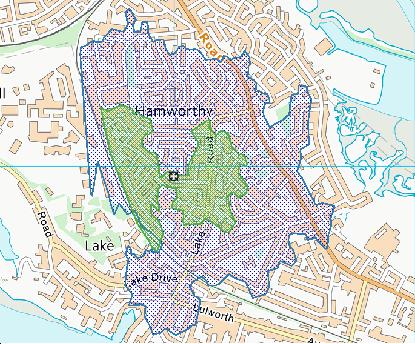
Interactive Mapping Showing UPRNs within the BH15 4NL Postcode Boundaries
Use the search box to search for other postcodes or places.
| Property Type | Percentage |
|---|---|
| Residential | 100% |
| Commercial | 0% |
| Public | 0% |
Telephone Area Code for BH15 4NL
The telephone area code for BH15 4NL is 01425 Ringwood.
Map Coordinates for BH15 4NL
| Latitude | 50.7182483591 |
|---|---|
| Longitude | -2.01554360712 |
Ordnance Survey Maps for BH15 4NL
| Map Series | Amazon | Ordnance Survey |
| Explorer 1:25,000 118 Shaftesbury, Cranbourne Chase, Poole, Wimbourne Minster and Blandford | Check Price on Amazon | Buy Direct from the Ordnance Survey |
| Landranger 1:50,000 195 Bournemouth & Purbeck | Check Price on Amazon | Buy Direct from the Ordnance Survey |
Weather Forecast for BH15 4NL
Tue 30th Apr
Press Button to Show Forecast for Poole - Harbour Lake (Beach)
| Time Period | Icon | Description | Temperature | Rain Probability | Wind |
|---|---|---|---|---|---|
| 09:00 to 12:00 | Sunny day | 12.0°C (feels like 10.0°C) | 5.00% | SSE 16 mph | |
| 12:00 to 15:00 | Cloudy | 13.0°C (feels like 11.0°C) | 12.00% | SSE 13 mph | |
| 15:00 to 18:00 | Light rain shower (day) | 13.0°C (feels like 11.0°C) | 38.00% | SSE 13 mph | |
| 18:00 to 21:00 | Light rain | 12.0°C (feels like 10.0°C) | 52.00% | S 9 mph | |
| 21:00 to 00:00 | Cloudy | 11.0°C (feels like 9.0°C) | 19.00% | S 7 mph |
Wed 1st May
Press Button to Show Forecast for Poole - Harbour Lake (Beach)
| Time Period | Icon | Description | Temperature | Rain Probability | Wind |
|---|---|---|---|---|---|
| 00:00 to 03:00 | Cloudy | 10.0°C (feels like 9.0°C) | 10.00% | S 4 mph | |
| 03:00 to 06:00 | Cloudy | 9.0°C (feels like 8.0°C) | 6.00% | S 4 mph | |
| 06:00 to 09:00 | Cloudy | 10.0°C (feels like 9.0°C) | 7.00% | ESE 4 mph | |
| 09:00 to 12:00 | Cloudy | 12.0°C (feels like 11.0°C) | 9.00% | SSE 4 mph | |
| 12:00 to 15:00 | Overcast | 13.0°C (feels like 13.0°C) | 18.00% | SSW 4 mph | |
| 15:00 to 18:00 | Cloudy | 14.0°C (feels like 13.0°C) | 21.00% | WSW 7 mph | |
| 18:00 to 21:00 | Light rain | 12.0°C (feels like 11.0°C) | 55.00% | WNW 7 mph | |
| 21:00 to 00:00 | Light rain | 11.0°C (feels like 9.0°C) | 49.00% | NW 9 mph |
Thu 2nd May
Press Button to Show Forecast for Poole - Harbour Lake (Beach)
| Time Period | Icon | Description | Temperature | Rain Probability | Wind |
|---|---|---|---|---|---|
| 00:00 to 03:00 | Cloudy | 11.0°C (feels like 8.0°C) | 20.00% | NW 11 mph | |
| 03:00 to 06:00 | Light rain | 10.0°C (feels like 8.0°C) | 49.00% | NNW 11 mph | |
| 06:00 to 09:00 | Light rain | 11.0°C (feels like 9.0°C) | 49.00% | NNW 9 mph | |
| 09:00 to 12:00 | Cloudy | 13.0°C (feels like 11.0°C) | 18.00% | NNW 9 mph | |
| 12:00 to 15:00 | Overcast | 15.0°C (feels like 13.0°C) | 18.00% | NNW 9 mph | |
| 15:00 to 18:00 | Cloudy | 15.0°C (feels like 14.0°C) | 16.00% | NW 11 mph | |
| 18:00 to 21:00 | Cloudy | 15.0°C (feels like 13.0°C) | 17.00% | WNW 11 mph | |
| 21:00 to 00:00 | Partly cloudy (night) | 13.0°C (feels like 11.0°C) | 9.00% | WNW 11 mph |
What are the Broadband Speeds like in the BH15 4NL Postcode?
Download Speeds For BH15 4NL

| Average Mbps | 111.000 |
|---|---|
| Median Mbps | 107.000 |
| Maximum Mbps | 593.000 |
BH15 4NL has an average download speed of 111 Megabits per second (Mbps).
712 other postcode units have the same broadband speed.
74% of postcodes (876,013) have slower broadband speeds.
26% of postcodes (307,916) have faster broadband speeds.
Upload Speeds For BH15 4NL

| Average Mbps | 10.900 |
|---|---|
| Median Mbps | 10.000 |
| Maximum Mbps | 39.000 |
BH15 4NL has an average upload speed of 10.9 Megabits per second (Mbps).
7,130 other postcode units have the same upload speed.
29% of postcodes (340,326) have slower upload speeds.
71% of postcodes (837,185) have faster upload speeds.
Schools within a five minute drive of BH15 4NL Postcode
England Primary Schools
Hamworthy Park Junior School
Address: Hamworthy Park Junior School, Ashmore Crescent, Hamworthy, Poole, Dorset, BH15 4DG
Distance: 0.61 miles
Contact: 01202677870
Turlin Moor Community School
Address: Turlin Moor Community School, Turlin Road, Turlin Moor, Poole, Dorset, BH16 5AH
Distance: 0.64 miles
Contact:
Twin Sails Infant and Nursery School
Address: Twin Sails Infant and Nursery School, Blandford Road, Hamworthy, Poole, Dorset, BH15 4AX
Distance: 0.60 miles
Contact: 01202672377
Hamworthy Park Junior School
Address: Hamworthy Park Junior School, Ashmore Crescent, Hamworthy, Poole, Dorset, BH15 4DG
Distance: 0.61 miles
Contact:
Twin Sails Infant School
Address: Twin Sails Infant School, Blandford Road, Hamworthy, Poole, Dorset, BH15 4AX
Distance: 0.60 miles
Contact:
England Secondary Schools
The Cornerstone Academy
Address: The Cornerstone Academy, Blandford Close, Hamworthy, Poole, Dorset, BH15 4BQ
Distance: 0.57 miles
Contact: 01202676789
Nearest Dentists
Dentists near BH15 4NL
HAMWORTHY DENTAL PRACTICE
Address: 324 BLANDFORD ROAD, POOLE, DORSET, BH15 4JH
Distance: 0.38 miles
Contact: :
DENTAL CENTRE
Address: HAMWORTHY, POOLE, DORSET, BH15 4NQ
Distance: 0.46 miles
Contact: :
201-203 BLANDFORD ROAD
Address: 201 -203 BLANDFORD ROAD, HAMWORTHY, POOLE, DORSET, BH15 4AX
Distance: 0.60 miles
Contact: :
DORSET DENTAL CLINIC
Address: 3 LONGFLEET ROAD, POOLE, BH15 2HN
Distance: 1.65 miles
Contact: :
DENISTRY @ 68
Address: 68 WIMBORNE ROAD, POOLE, DORSET, BH15 2BZ
Distance: 1.68 miles
Contact: :
MOONLIGHT SURGERY
Address: BIRCHWOOD MEDICAL CENTRE, NORTHMEAD DRIVE, CREEKMOOR, POOLE, DORSET, BH17 7XW
Distance: 1.69 miles
Contact: :
Nearest Chemists
Pharmacies near BH15 4NL
BOOTS
Address: 300-302 BLANDFORD ROAD, HAMWORTHY, POOLE, DORSET, BH15 4JQ
Distance: 0.28 miles
Contact: tel: 01202 678001
ASDA PHARMACY
Address: WEST QUAY ROAD, POOLE, DORSET, BH15 1JQ
Distance: 1.30 miles
Contact: tel: 01202 207010
BOOTS
Address: 190-196 HIGH STREET, POOLE, DORSET, BH15 1SX
Distance: 1.51 miles
Contact: tel: 01202 681377
ROWLANDS PHARMACY
Address: UNIT 2,1 DORCHESTER ROAD, UPTON, POOLE, DORSET, BH16 5NJ
Distance: 1.55 miles
Contact: tel: 01202 622239
ROWLANDS PHARMACY
Address: BIRCHWOOD MEDICAL CENTRE, NORTHMEAD DRIVE, CREEKMOOR, POOLE, DORSET, BH17 7XW
Distance: 1.69 miles
Contact: tel: 01202 600171
ROWLANDS PHARMACY
Address: 14 PARKSTONE ROAD, POOLE, DORSET, BH15 2PG
Distance: 1.76 miles
Contact: tel: 01202 677932
Nearest Opticians
Opticians near BH15 4NL
5840 POOLE
Address: ASDA STORES LTD, WEST QUAY ROAD, POOLE, DORSET, BH15 1JQ
Distance: 1.30 miles
Contact: :
LEIGHTONS OPTICIANS (POOLE)
Address: 157 HIGH STREET, POOLE, DORSET, BH15 1AU
Distance: 1.45 miles
Contact: :
SPECSAVERS (POOLE)
Address: 32-34 KINGLAND CRESCENT, POOLE, DORSET, BH15 1TB
Distance: 1.51 miles
Contact: :
BOOTS OPTICIANS (HIGH ST, POOLE)
Address: 190-196 HIGH STREET, POOLE, DORSET, BH15 1SX
Distance: 1.51 miles
Contact: :
SITE NAME VISION EXPRESS POOLE
Address: 37-38 DOLPHIN CENTRE, KINGLAND ROAD, POOLE, BH15 1ST
Distance: 1.55 miles
Contact: :
WHIFFEN OPTICIANS LTD
Address: 2 BOURNEMOUTH ROAD, POOLE, DORSET, BH14 0ES
Distance: 2.92 miles
Contact: :
Nearest GP Surgeries
Doctors near BH15 4NL
THE ADAM PRACTICE
Address: 306 BLANDFORD ROAD, HAMWORTHY, POOLE, BH15 4JQ
Distance: 0.28 miles
Contact: tel: 01202 679234
THE ADAM PRACTICE - HAMWORTHY SURGERY
Address: 306 BLANDFORD ROAD, POOLE, DORSET, BH15 4JQ
Distance: 0.28 miles
Contact: :
POOLE FERRY PORT - NORTH LOUNGE PASSENGER TERMINAL - COVID LOCAL VACCINATION SERVICE
Address: NEW HARBOUR ROAD, POOLE, BH15 4AQ
Distance: 0.91 miles
Contact: :
LIFEBOAT QUAY MEDICAL CENTRE
Address: UNIT A, LIFEBOAT QUAY, POOLE, BH15 1AE
Distance: 1.34 miles
Contact: :
LIFEBOAT QUAY MEDICAL CENTRE
Address: UNIT A, LIFEBOAT QUAY, POOLE, BH15 1AE
Distance: 1.34 miles
Contact: tel: 08444 773324
CARLISLE HOUSE SURGERY - DOLPHIN CENTRE CONSULTING ROOM
Address: BOOTS THE CHEMISTS LTD, DOLPHIN CENTRE, 190-196 HIGH STREET, POOLE, DORSET, BH15 1SX
Distance: 1.51 miles
Contact: :
Transport Links near BH15 4NL
Train Stations
Nearest stations for postcode: BH15 4NL
- Hamworthy
Hamworthy station, Junction Road, Hamworthy, Dorset, BH16 5AADistance: 1.23 milesDriving Time: 3.29 minutes - Poole
Poole station, Serpentine Road, Poole, Dorset, BH15 2BQDistance: 5.62 milesDriving Time: 10.89 minutes - Holton Heath
Holton Heath station, Station Road, Holton Heath, Dorset, BH16 6JTDistance: 5.87 milesDriving Time: 10.36 minutes - Parkstone (Dorset)
Parkstone station, Station Road, Parkstone, Dorset, BH14 8UDDistance: 6.12 milesDriving Time: 12.86 minutes - Branksome
Branksome station, Poole Road, Branksome, Dorset, BH12 1DFDistance: 8.06 milesDriving Time: 15.13 minutes
Distances represent the quickest route by car.
Motorway Junctions near BH15 4NL
Train Stations
Motorway Junctions near BH15 4NL
Distances represent the quickest route by car.
Who are my Elected Representatives in the BH15 4NL Postcode?
| Westminster Constituency | Poole Boro Const |
|---|---|
| Member or Parliament |  |
| Contact Details | Contact Sir Robert Syms |
| Political Party | Conservative |
What Council is the BH15 4NL Postcode in?
The Council for this Postcode is Bournemouth, Christchurch and Poole Council, who are a Unitary authority. This means that they are responsible for providing education, libraries and maintaining highways as well as normal council duties such as council tax, rubbish collection, housing, environmental health and planning.
You can visit the website for Bournemouth, Christchurch and Poole at the following link Bournemouth, Christchurch and Poole.How much is the Council Tax?
Bournemouth, Christchurch and Poole Council is responsible for collecting council tax. This will vary depending on which council tax band the property falls within. You can check the council tax band at the gov.uk website.
Once you know the council tax band you can view how much Bournemouth, Christchurch and Poole charge for that band by visiting the The Council Tax section of their website.
Planning Applications
When moving house to a new post code it is worth checking out what will be built in the neighbourhood.
Few people want to live next door to a building site, have their garden overlooked or have the views from their property ruined.
Visit the local planning department and search for planning applications in this postcode granted within the last three years or still awaiting a decision. This will give an indication of what could still be built.
Where can I find out where the nearest Library to the BH15 4NL Postcode is?
Libraries are the responsibility of Bournemouth, Christchurch and Poole council
Visit the link for more information. Please note that some councils outsource library services to private companies and community groups ran by volunteers.
LibrariesHouse Sales in BH15 4NL
| Year | High | Low | Average | Sales |
|---|---|---|---|---|
| 2010 | £218,000 | £218,000 | £218,000 | 1 |
| 2014 | £250,000 | £250,000 | £250,000 | 2 |
| 2016 | £236,000 | £295,000 | £265,333 | 3 |
| 2017 | £294,000 | £294,000 | £294,000 | 1 |
| 2019 | £310,000 | £375,000 | £342,500 | 2 |
| 2020 | £268,000 | £268,000 | £268,000 | 1 |
| 2021 | £360,000 | £375,000 | £367,500 | 2 |
| 2022 | £360,500 | £510,000 | £435,250 | 2 |
| 2023 | £540,000 | £540,000 | £540,000 | 1 |
Contains HM Land Registry data © Crown copyright and database right 2024. This data is licensed under the Open Government Licence v3.0.
Postcodes near the BH15 4NL Postcode
What Popular Supermarkets are near the BH15 4NL Postcode?
| Supermarket | Distance | Directions |
|---|---|---|
| Asda, West Quay Road, POOLE, BH15 1JQ | 2.09 miles | Directions from BH15 4NL to Asda |
| Iceland, High Street, POOLE, BH15 1DF | 2.25 miles | Directions from BH15 4NL to Iceland |
| Aldi, Pitwines Close, POOLE, BH15 1XU | 2.60 miles | Directions from BH15 4NL to Aldi |
| Sainsburys, Pitwines Close, POOLE, BH15 1XU | 2.60 miles | Directions from BH15 4NL to Sainsburys |
| Aldi, Blandford Road North, Upton, Poole, BH16 6AA | 2.90 miles | Directions from BH15 4NL to Aldi |
What Popular Restaurants are near the BH15 4NL Postcode?
| Burger King | Distance | Directions |
|---|---|---|
| 48 Waterloo Road Poole, Poole, BH17 7LG | 2.19 miles | Directions from BH15 4NL to 48 Waterloo Road Poole |
| Tower Park, Poole, BH12 4NY | 3.43 miles | Directions from BH15 4NL to Tower Park |
| 34 Commercial Road, Bournemouth, BH2 5LP | 5.85 miles | Directions from BH15 4NL to 34 Commercial Road |
| 741-743 Castle Lane East, Bournemouth, BH7 7DP | 8.55 miles | Directions from BH15 4NL to 741-743 Castle Lane East |
| Mcdonald's | Distance | Directions |
|---|---|---|
| McDonald's, Wessex Gate Retail Park, Broadstone Way, POOLE, BH15 3TE | 1.52 miles | Directions from BH15 4NL to McDonald's, Wessex Gate Retail Park, Broadstone Way, POOLE, BH15 3TE |
| McDonald's, Yarrow Road, POOLE, BH12 4QY | 3.13 miles | Directions from BH15 4NL to McDonald's, Yarrow Road, POOLE, BH12 4QY |
| McDonald's, Alder Road, POOLE, BH12 4AX | 4.51 miles | Directions from BH15 4NL to McDonald's, Alder Road, POOLE, BH12 4AX |
| McDonald's, Old Christchurch Road, BOURNEMOUTH, BH1 1DS | 6.03 miles | Directions from BH15 4NL to McDonald's, Old Christchurch Road, BOURNEMOUTH, BH1 1DS |
| Restaurant | Distance | Directions |
|---|---|---|
| KFC, Wessex Gate Retail Park, Broadstone Way, POOLE, BH15 3TE | 1.52 miles | Directions from BH15 4NL to KFC Poole - Wessex Gate Retail Park |
| KFC, Dolphin Centre, POOLE, BH15 1SZ | 1.57 miles | Directions from BH15 4NL to KFC Poole - The Dolphin Centre |
| KFC, Ashley Road, POOLE, BH14 0AX | 3.19 miles | Directions from BH15 4NL to KFC Poole - Ashley Road |
| KFC, Tower Park, POOLE, BH12 4NY | 3.40 miles | Directions from BH15 4NL to KFC Poole - Tower Park |
| KFC, Commercial Road, BOURNEMOUTH, BH2 5RH | 5.79 miles | Directions from BH15 4NL to KFC Bournemouth - The Triangle |