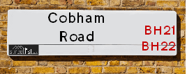
Map of Cobham Road
| Postcodes | ||
|---|---|---|
| Icon | Postcodes for Cobham Road | |
| Walking Distances | ||
| Distance Info | Green Circle = 10 Minutes Walk (800 metres) | |
About Cobham Road
Cobham Road is a street located in the town of Ferndown. The street has a length of approximately 2,404 metres.
Cobham Road is located within the Dorset Council's jurisdiction. They provide various services, like refuse collection, and manage council tax collection. It's situated in the South West region of the UK.
Cobham Road has been assigned the Unique Street Reference Numbers of 12200233, 12201032 and 12205045 in the National Street Gazetteer.
Cobham Road is located within the county of Dorset, situated in the South West region of the UK. It's 91.72 miles South West from central London., 6.61 miles North from Bournemouth, 18.45 miles South from Salisbury and 23.17 miles West from Southampton.

Do you know why this road is called Cobham Road?
What's it like to live here?
Ask the community a question about Cobham Road.
Do you have any questions, memories to share or know any facts about Cobham Road? We'd love to know more.
Also on streetlist.co.uk, can you help?
Eldroth Road
15th April 2024
I wondered if anyone has any old pictures of Wenning Bank House in the 1940’s and also Lane Side before of the same era .. we visited today with my Mum in law as she used to live at both these properties. Also any photos of the schools around that time .. thank you.
Can You Help?Napps Way
15th April 2024
Why is the road called Napps Way (belonging to Napp, but minus an
apostrophe as is usual with such nomenclature)? Moreover, who or
what is, or was, “Napp” in the respective, possessive case?
Several years ago, I met an elderly man (probably in his late-eighties)
who lives on Bentham Drive, Liverpool 16, and during a conversation
with him whilst in a Northwest Passenger Transport Ambulance on the
way to the former RLUH (Royal Liverpool University Hospital), he told
me that he could remember (when he was a boy, living in Childwall,
Liverpool 16) that, “Where Napps Way is now, during WW2, there was
a two-man gun emplacement on the, then, open land to protect the
railway line passing over Childwall Valley Road - next to the railway
bridge - when suddenly, as they were loading a live “shell” into the gun’s
breach, the aforementioned “shell” accidentally exploded in the gun’s
breach killing both of the two soldiers, that had been manning the gun,
instantly! (Very sad, of course, but could - perhaps - two ghosts relating
to those two, very unfortunately and prematurely-killed soldiers have
haunted that place of their deaths ever since - and have any residents
of Napps Way - formerly and in its latest incarnation - seen two, WW2
(uniformed) soldiers unexpectedly appear in or near their homes?)
Mauritius Road
15th April 2024
Why is Mauritius Road so called, since when and by whom? Does Greenwich have any particular links with Mauritius? Very interested to know. 🤞🏼
Can You Help?Estate Agents near Cobham Road
| Name | Address | Website |
|---|---|---|
| Connaught Real Estates Ltd. | 12 Haviland Ferndown Industrial Park Wimborne BH21 7RG | |
| Bliss Homes | Haviland House, 17 Cobham Road, Wimborne, BH21 7PE | Visit Website |
| Connells | 37 Victoria Road Ferndown BH22 9HT | Visit Website |
We have found 28 postcodes for Cobham Road
Location Details
| Cobham Road | |
|---|---|

| |
| Latitude | 50.812577 |
| Longitude | -1.913354 |
| OS Easting (X): | 406103 |
| OS Northing (Y): | 101513 |
| OS Grid Reference: | SU061015 |
Ordnance Survey Maps for Cobham Road
If you purchase a map through the links below, we may earn an affiliate commission.
| Map Series | link | Ordnance Survey |
| Explorer 1:25,000 118 Shaftesbury, Cranbourne Chase, Poole, Wimbourne Minster and Blandford | Check Price on Amazon | Buy Direct from the Ordnance Survey |
| Explorer 1:25,000 ol22 New Forest, Southampton, Ringwood, Ferndown, Lymington, Christchurch and Bournemouth | Check Price on Amazon | Buy Direct from the Ordnance Survey |
| Landranger 1:50,000 195 Bournemouth & Purbeck | Check Price on Amazon | Buy Direct from the Ordnance Survey |
Neighbourhood Policing |
| Police Force: Dorset |
 View Neighbourhood Crime and Policing View Neighbourhood Crime and Policing |
| Find a Local Neighbourhood Watch Scheme |
Frequently asked Questions for Cobham Road
What Council (Local Authority) is Cobham Road in?
Cobham Road is located within the local authority area of Dorset Council which is a Unitary Authority.
What Parish Council is Cobham Road in?
Cobham Road is in an unparished area.
What Electoral Ward is Cobham Road in?
Cobham Road is located within the ward of Ferndown North.
What County is Cobham Road in?
Cobham Road is located within the ceremonial county of Dorset.
What Constituency is Cobham Road in?
Cobham Road is located within the constituency of Christchurch.
What Part of the UK is Cobham Road in?
Cobham Road is located within the Array region of the United Kingdom.
What County Council area is Cobham Road in?
Cobham Road is located within the Dorset Council area.
What Police Force area is Cobham Road in?
Cobham Road is located within the Dorset Police area.
Roads that have a Junction with Cobham Road
| Street | Junction Type |
|---|---|
| Haviland Road | junction |
| Whittle Road | junction |
| Old Forge Road | junction |
| Wimborne Road West | junction |
| Johnson Road | junction |
| Telford Road | junction |
Sunset and Sunrise times for Cobham Road
| Sunrise | 05:47 |
|---|---|
| Sunset | 20:22 |
Latest Weather Conditions for Cobham Road
| Observed at Weather Station: | Bournemouth Airport 26 April 2024 at 22:00 (4.13 miles away) |
|---|---|
| Current Weather: | Light rain |
| Temperature and Humidity: | 7.6°C (92.7%) |
| Wind Direction and Speed: | E (9 mph) |
Population Statistics
| ONS Area Code | E00103416 |
|---|---|
| ONS Area Name | Detached Rural Retirement |
| Average Age | 50.30 |
| Area Population | 1137.00 |
| Male Population | 526.00 (46%) |
| Female Population | 611.00 (54%) |
| Benefit Claimants | 4 (0%) |
| LSOA Code: | E01020408 |
|---|---|
| LSOA Name: | East Dorset 009E |
| SOA Code: | 2a |
| SOA Name: | |
| MSOA Code: | E02004251 |
| MSOA Name: | East Dorset 009 |
Nearest Supermarkets
| Iceland Ferndown |
|---|
| 51/53 Victoria Road, Ferndown, Dorset, BH22 9HU |
| 01202893534 |
| Distance: 1.16 Miles |
| Directions from Cobham Road to Iceland Ferndown |
| Tesco Ferndown Superstore |
|---|
| Pennys Walk, Ferndown, BH22 9TH |
| 0345 677 9270 |
| Distance: 1.2 Miles |
| Directions from Cobham Road to Tesco Ferndown Superstore |
| Tesco West Moors Express |
|---|
| 126 Station Rd, West Moors, Ferndown, BH22 0JB |
| 0345 026 9224 |
| Distance: 1.37 Miles |
| Directions from Cobham Road to Tesco West Moors Express |
| Tesco Glenmoor Rd Bournemouth Express |
|---|
| 31 Glenmoor Rd, Ferndown, BH22 8QE |
| 0345 026 9278 |
| Distance: 1.64 Miles |
| Directions from Cobham Road to Tesco Glenmoor Rd Bournemouth Express |
Telephone Information
| Area Code |
|---|
| Area Code: 01425 - Ringwood |
| Area Code: 01202 - Bournemouth |
Local Government
| Local Council Details |
|---|
| Within the area of Dorset |
| Local Member of Parliament |
|---|
| Within the Westminster Parliamentary Constituency of Christchurch |
| The Member of Parliament is Christopher Chope |
| Details for the MP Christopher Chope on parliament.uk |
| Details for the MP Christopher Chope on theyworkforyou.com |
| In the 2019 General Election Christopher Chope won with a majority of 24,617 the result was Con hold. The total electorate was 71,520 |
| Wards, Parish Councils and County Councils |
|---|
| Ward: Ferndown North Ward |
| Ceremonial County: Dorset |
Nearest Schools
England Primary Schools
Oakhurst Community First School
Address: Oakhurst Community First School, Shaftesbury Road, West Moors, Ferndown, Dorset, BH22 0DY
Distance: 1.65 miles
Contact: 01202871577
Oakhurst Community First School
Address: Oakhurst Community First School, Shaftesbury Road, West Moors, Ferndown, Dorset, BH22 0DY
Distance: 1.65 miles
Contact:
St Mary's CofE First School & Nursery
Address: St Mary's CofE First School & Nursery, Station Road, West Moors, Ferndown, Dorset, BH22 0JF
Distance: 1.59 miles
Contact: 01202874838
Ferndown First School
Address: Ferndown First School, Mountbatten Drive, Ferndown, Dorset, BH22 9FB
Distance: 0.97 miles
Contact:
Hampreston Church of England Voluntary Aided First School
Address: Hampreston Church of England Voluntary Aided First School, Hampreston Village, Wimborne, Dorset, BH21 7LX
Distance: 1.64 miles
Contact: 01202573074
Colehill First School
Address: Colehill First School, Middlehill Road, Colehill, Wimborne, Dorset, BH21 2HL
Distance: 1.68 miles
Contact:
England Secondary Schools
Ferndown Middle School
Address: Ferndown Middle School, Peter Grant Way, Ferndown, Dorset, BH22 9UP
Distance: 0.92 miles
Contact:
Ferndown Upper School
Address: Ferndown Upper School, Cherry Grove, Ferndown, Dorset, BH22 9EY
Distance: 0.65 miles
Contact: 01202871243
Nearest Hospitals
| Name | Address | Postcode | Distance | Map |
|---|
Nearest Dentists
Dentists near Cobham Road
| Name | Address | Postcode | Distance | Map |
|---|
Nearest GP Surgeries
Doctors near Cobham Road
ORCHID HOUSE SURGERY
Address: FERNDOWN MEDICAL CENTRE, ST. MARYS ROAD, FERNDOWN, DORSET, BH22 9HB
Distance: 1.11 miles
Contact: tel: 01202 897000
PENNY'S HILL PRACTICE
Address: FERNDOWN MEDICAL CENTRE, ST. MARYS ROAD, FERNDOWN, DORSET, BH22 9HB
Distance: 1.11 miles
Contact: tel: 01202 897200
WEST MOORS VILLAGE SURGERY
Address: VERNON HOUSE, 164 STATION ROAD, WEST MOORS, FERNDOWN, BH22 0JB
Distance: 1.36 miles
Contact: :
WEST MOORS VILLAGE SURGERY
Address: 175 STATION ROAD, WEST MOORS, FERNDOWN, DORSET, BH22 0HX
Distance: 1.40 miles
Contact: tel: 01202 865800
GLENMOOR ROAD SURGERY
Address: 54 GLENMOOR ROAD, FERNDOWN, DORSET, BH22 8QF
Distance: 1.76 miles
Contact: :
THE BARCELLOS FAMILY PRACTICE
Address: TRICKETTS CROSS, CORBIN AVENUE, FERNDOWN, DORSET, BH22 8AZ
Distance: 1.82 miles
Contact: tel: 01202 897989
Nearest Dispensing Chemists
Pharmacies near Cobham Road
| Name | Address | Postcode | Telephone | Map | Distance in Km |
|---|
Nearest Opticians
Opticians near Cobham Road
STILL & BEDFORD
Address: 61 VICTORIA ROAD, FERNDOWN, BH22 9HU
Distance: 1.17 miles
Contact: :
UNDERWOOD EYECARE
Address: 7 PENNYS WALK, FERNDOWN, BH22 9TH
Distance: 1.21 miles
Contact: :
HENDERSONS OPTICIANS
Address: 54 VICTORIA ROAD, FERNDOWN, DORSET, BH22 9HZ
Distance: 1.25 miles
Contact: :
INFINITE CLARITY LIMITED
Address: LA PORCHERIE, 427 RINGWOOD ROAD, FERNDOWN, DORSET, BH22 9AF
Distance: 1.27 miles
Contact: :
EYESTYLE CENTRE (FERNDOWN)
Address: 141-143 STATION ROAD, WEST MOORS, FERNDOWN, DORSET, BH22 0HT
Distance: 1.35 miles
Contact: :
COMPLETE COMMUNITY CARE - HEATH CLOSE
Address: 6 HEATH CLOSE, WIMBORNE, DORSET, BH21 2LP
Distance: 1.63 miles
Contact: :
Transport
Nearest Rail Stations
Branksome Station is 5.88 miles away.
Address: Branksome station, Poole Road, Branksome, Dorset, BH12 1DF
Branksome is situated on the Portsmouth Direct line|South Western Main Line and is managed by South Western Railway.
Branksome Station is staffed on a part time basis.
Bournemouth Station is 6.26 miles away.
Address: Bournemouth station, Holdenhurst Road, Bournemouth, Dorset, BH8 8HX
Bournemouth is situated on the Portsmouth Direct line|South Western Main Line and is managed by South Western Railway.
Bournemouth Station is staffed on a full time basis.