Map of Holdenhurst Road
| Postcodes | ||
|---|---|---|
| Icon | Postcodes for Holdenhurst Road | |
| Walking Distances | ||
| Distance Info | Green Circle = 10 Minutes Walk (800 metres) | |
About Holdenhurst Road
Holdenhurst Road is a street located in the town of Bournemouth. The street has a length of approximately 2,656 metres.
Holdenhurst Road is located within the Bournemouth, Christchurch and Poole Council's jurisdiction. They provide various services, like refuse collection, and manage council tax collection. It's situated in the South West region of the UK.
Holdenhurst Road has been assigned the Unique Street Reference Numbers of 3731201, 3771439, 3700197, 3771433, 3771438 and 3770411 in the National Street Gazetteer.
Holdenhurst Road is located within the county of Dorset, situated in the South West region of the UK. It's 92.79 miles South West from central London., 0.68 miles North East from Bournemouth, 23.12 miles South West from Southampton and 23.57 miles South from Salisbury.

Do you know why this road is called Holdenhurst Road?
What's it like to live here?
Ask the community a question about Holdenhurst Road.
Do you have any questions, memories to share or know any facts about Holdenhurst Road? We'd love to know more.
Also on streetlist.co.uk, can you help?
Swing Swang Lane
28th April 2024
I am trying to find out why the lane is named Swing Swang?
It has been known known this since at least 1905 when hedge making contents used to be held here.
Swing Swang is often used to describe a fairground ride. I remember Swing Boats. Were they a bit like this or is Swing Swang another name for swings?
Swing Swangs are also mentioned in connection to orchards. Or were orchards just good places to have swings?
Estate Agents near Holdenhurst Road
| Name | Address | Website |
|---|---|---|
| Burns Hamilton | Hawthorn House, 1 Lowther Gardens, Bournemouth, Dorset, BH8 8NF | Visit Website |
| Camerons | 162 Holdenhurst Road, Bournemouth,BH8 8AS | |
| MK Estates | 337 Holdenhurst Road, Bournemouth, BH8 8BT | Visit Website |
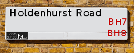
We have found 61 postcodes for Holdenhurst Road
Location Details
| Holdenhurst Road | |
|---|---|

| |
| Latitude | 50.729807 |
| Longitude | -1.855591 |
| OS Easting (X): | 410190 |
| OS Northing (Y): | 92316 |
| OS Grid Reference: | SZ102923 |
Neighbourhood Policing |
| Police Force: Dorset |
 View Neighbourhood Crime and Policing View Neighbourhood Crime and Policing |
| Find a Local Neighbourhood Watch Scheme |
Frequently asked Questions for Holdenhurst Road
What Council (Local Authority) is Holdenhurst Road in?
Holdenhurst Road is located within the local authority area of Bournemouth &Christchurch and Poole Council which is a Unitary Authority.
What Parish Council is Holdenhurst Road in?
Holdenhurst Road is in an unparished area.
What Electoral Ward is Holdenhurst Road in?
Holdenhurst Road is located within the ward of Bournemouth Central &East Cliff & Springbourne.
What County is Holdenhurst Road in?
Holdenhurst Road is located within the ceremonial county of Dorset.
What Constituency is Holdenhurst Road in?
Holdenhurst Road is located within the constituency of Bournemouth West &Bournemouth East.
What Part of the UK is Holdenhurst Road in?
Holdenhurst Road is located within the Array region of the United Kingdom.
What County Council area is Holdenhurst Road in?
Holdenhurst Road is located within the Bournemouth Council area.
What Police Force area is Holdenhurst Road in?
Holdenhurst Road is located within the Dorset Police area.
Roads that have a Junction with Holdenhurst Road
| Street | Junction Type |
|---|---|
| Cotlands Road | junction |
| Lansdowne Crescent | junction |
| St Pauls Road (A35) | roundabout |
| St Swithun's Road South (A35) | roundabout |
| St Swithun's Road | junction |
| Northcote Road | junction |
| Wellington Road | roundabout |
| St Mary's Road | junction |
| Washington Avenue | junction |
| Capstone Place | junction |
| Lincoln Avenue | junction |
| Garfield Avenue | junction |
| Shelbourne Close | junction |
| Cleveland Road | junction |
| Malmesbury Park Place | junction |
| Victoria Place | junction |
| Stewart Close | junction |
| Lowther Gardens | junction |
| Methuen Close | junction |
| Windham Road | junction |
| Elwyn Road | junction |
| Lytton Road | junction |
| Portchester Place | junction |
| King's Park Drive | roundabout |
| Hayes Avenue | junction |
| Buchanan Avenue | junction |
| Ashley Road (A3049) | junction |
| Bethia Close | junction |
| Harrison Avenue | junction |
| St Ledger's Place | junction |
| Madison Avenue | junction |
| Egerton Gardens | junction |
| Jefferson Avenue | junction |
| Richmond Park Close | junction |
| Curzon Road | junction |
Sunset and Sunrise times for Holdenhurst Road
| Sunrise | 05:20 |
|---|---|
| Sunset | 20:47 |
Latest Weather Conditions for Holdenhurst Road
| Observed at Weather Station: | Bournemouth Airport 12 May 2024 at 15:00 (3.52 miles away) |
|---|---|
| Current Weather: | Sunny day |
| Temperature and Humidity: | 18.6°C (68.8%) |
| Wind Direction and Speed: | SSE (8 mph) |
Population Statistics
| ONS Area Code | E00077257, E00077301, E00077299, E00077300, E00172753, E00077290, E00077285, E00172750, E00172739, E00172745, E00077297, E00077314 & E00077313 |
|---|---|
| ONS Area Name | Multicultural Student Neighbourhoods, Students and Professionals, Students and Commuters, Young Families and Students, Social Renting New Arrivals, Migrant Families, Constrained Neighbourhoods & Delayed Retirement |
| Average Age | 34.49, 33.66, 42.06, 33.00, 35.44 & 34.46 |
| Area Population | 2671.00, 1877.00, 1826.00, 1949.00, 1696.00 & 2229.00 |
| Male Population | 1439.00, 999.00, 1030.00, 1022.00, 881.00 & 1131.00 (53%) |
| Female Population | 1232.00, 878.00, 796.00, 927.00, 815.00 & 1098.00 (47%) |
| Benefit Claimants | 71, 73, 59, 48, 39 & 12 (2%) |
| LSOA Code: | E01015285, E01015288, E01015290, E01015294, E01015292 &E01015287 |
|---|---|
| LSOA Name: | Bournemouth 021A, Bournemouth 021B, Bournemouth 021D, Bournemouth 015C, Bournemouth 015A &Bournemouth 017D |
| SOA Code: | 1a, 7a &3d |
| SOA Name: | |
| MSOA Code: | E02003192, E02003186 &E02003188 |
| MSOA Name: | Bournemouth 021, Bournemouth 015 &Bournemouth 017 |
Nearest Supermarkets
| Tesco Holdenhurst Rd Express |
|---|
| 316 Holdenhurst Rd, Bournemouth, BH8 8AY |
| 0345 610 2790 |
| Distance: 0.08 Miles |
| Directions from Holdenhurst Road to Tesco Holdenhurst Rd Express |
| Asda Bournemouth |
|---|
| St Pauls Road, Bournemouth, BH8 8DL |
| 01202 298900 |
| Distance: 0.45 Miles |
| Directions from Holdenhurst Road to Asda Bournemouth |
| Tesco Bournemouth Holden Rd Express |
|---|
| 69-89 Holdenhurst Rd, Lyme Regis House, Bournemouth, BH8 8FT |
| 0345 674 6375 |
| Distance: 0.55 Miles |
| Directions from Holdenhurst Road to Tesco Bournemouth Holden Rd Express |
| Iceland Boscombe |
|---|
| 521 Christchurch Road, Boscombe, Dorset, BH1 4AG |
| 01202395433 |
| Distance: 0.63 Miles |
| Directions from Holdenhurst Road to Iceland Boscombe |
Telephone Information
| Dialling Code | Telephone Exchange | Telephone Cabinet | Fibre to the Cabinet or Fibre to the Premises |
|---|---|---|---|
| 01202 | BOSCOMBE - STBOSMB | P5 | FTTC |
Broadband Information
| Speed | Average Speed | Median Speed | Maximum Speed | Next-generation access (NGA) | Number of Connections |
|---|---|---|---|---|---|
| Greater than 2 Mbps | 23.5 | 17.4 | >=30 | Y | 18 |
Local Government
| Local Council Details |
|---|
| Within the area of Bournemouth &Christchurch and Poole |
| Local Member of Parliament |
|---|
| Within the Westminster Parliamentary Constituency of Bournemouth West &Bournemouth East |
| The Member of Parliament is Conor Burns &Tobias Ellwood |
| Details for the MP Conor Burns &Tobias Ellwood on parliament.uk |
| Details for the MP Conor Burns &Tobias Ellwood on theyworkforyou.com |
| In the 2019 General Election Conor Burns &Tobias Ellwood won with a majority of 10,150 the result was Con hold. The total electorate was 74,205 |
| Wards, Parish Councils and County Councils |
|---|
| Ward: Bournemouth Central &East Cliff & Springbourne Ward |
| Ceremonial County: Dorset |
Nearest Schools
England Primary Schools
St James' Church of England Primary Academy
Address: St James' Church of England Primary Academy, Pokesdown Hill, Christchurch Road, Bournemouth, Dorset, BH7 6DW
Distance: 1.42 miles
Contact: 01202426696
Corpus Christi Catholic Primary School
Address: Corpus Christi Catholic Primary School, St James's Square, Boscombe, Bournemouth, Dorset, BH5 2BX
Distance: 1.12 miles
Contact: 01202427544
King's Park Academy
Address: King's Park Academy, Ashley Road, Bournemouth, Dorset, BH1 4NB
Distance: 0.77 miles
Contact: 01202395138
St Clement's and St John's Church of England Infant School
Address: St Clement's and St John's Church of England Infant School, St Clement's Road, Boscombe, Bournemouth, Dorset, BH1 4DZ
Distance: 0.33 miles
Contact: 01202393570
Bethany Church of England Junior School
Address: Bethany Church of England Junior School, Knole Road, Boscombe, Bournemouth, Dorset, BH1 4DJ
Distance: 0.25 miles
Contact: 01202393570
Malmesbury Park Primary School
Address: Malmesbury Park Primary School, Lowther Road, Bournemouth, Dorset, BH8 8LU
Distance: 0.29 miles
Contact: 01202291227
St Luke's Church of England Primary School
Address: St Luke's Church of England Primary School, Bemister Road, Winton, Bournemouth, Dorset, BH9 1LG
Distance: 1.22 miles
Contact: 01202514396
St Michael's Church of England Primary School
Address: St Michael's Church of England Primary School, Somerville Road, Bournemouth, Dorset, BH2 5LH
Distance: 1.64 miles
Contact: 01202290497
St Michael's Church of England Primary School
Address: St Michael's Church of England Primary School, Somerville Road, Bournemouth, Dorset, BH2 5LH
Distance: 1.64 miles
Contact:
England Secondary Schools
Avonbourne Girls Academy
Address: Avonbourne Girls Academy, Harewood Avenue, Bournemouth, Dorset, BH7 6NY
Distance: 1.37 miles
Contact: 01202398451
Harewood College
Address: Harewood College, Harewood Avenue, Bournemouth, Dorset, BH7 6NZ
Distance: 1.39 miles
Contact:
Nearest Hospitals
| Name | Address | Postcode | Distance | Map |
|---|
Nearest Dentists
Dentists near Holdenhurst Road
| Name | Address | Postcode | Distance | Map |
|---|
Nearest GP Surgeries
Doctors near Holdenhurst Road
HOLDENHURST BRANCH
Address: 199 HOLDENHURST ROAD, BOURNEMOUTH, DORSET, BH8 8DE
Distance: 0.12 miles
Contact: :
ST LEONARDS ROAD SURGERY
Address: 20 ST LEONARDS ROAD, CHARMINSTER, BOURNEMOUTH, DORSET, BH8 8QN
Distance: 0.45 miles
Contact: :
CRESCENT PROVIDENCE SURGERY
Address: CRESCENT PROVIDENCE SURG., 12-14 WALPOLE ROAD, BOURNEMOUTH, DORSET, BH1 4HA
Distance: 0.49 miles
Contact: tel: 01202 395195
ST PAUL'S HOSTEL
Address: 10 ST. PAULS LANE, BOURNEMOUTH, DORSET, BH8 8AJ
Distance: 0.55 miles
Contact: :
THE PANTON PRACTICE
Address: 14 GERVIS ROAD, BOURNEMOUTH, DORSET, BH1 3EG
Distance: 0.69 miles
Contact: tel: 01202 411700
ST ALBANS MEDICAL CENTRE
Address: 26-28 ST. ALBANS CRESCENT, CHARMINSTER, BOURNEMOUTH, DORSET, BH8 9EW
Distance: 0.85 miles
Contact: tel: 01202 517333
Nearest Dispensing Chemists
Pharmacies near Holdenhurst Road
| Name | Address | Postcode | Telephone | Map | Distance in Km |
|---|
Nearest Opticians
Opticians near Holdenhurst Road
4159 BOURNEMOUTH
Address: ASDA STORES LTD, ST. PAULS ROAD, BOURNEMOUTH, DORSET, BH8 8DL
Distance: 0.48 miles
Contact: :
J & M VISION SERVICES
Address: 35 KENSINGTON COURT, 43 KNYVETON ROAD, BOURNEMOUTH, DORSET, BH1 3QT
Distance: 0.48 miles
Contact: :
BOURNEMOUTH 1 DOMICILIARY SPECSAVERS LIMITED
Address: 594-598 CHRISTCHURCH ROAD, BOURNEMOUTH, BH1 4BH
Distance: 0.72 miles
Contact: :
SPECSAVERS (BOSCOMBE, BOURNEMOUTH)
Address: 654 CHRISTCHURCH ROAD, BOSCOMBE, BOURNEMOUTH, DORSET, BH1 4BP
Distance: 0.81 miles
Contact: :
SPECSAVERS (OLD CHRISTCHURCH ROAD, BOURNEMOUTH)
Address: 80 OLD CHRISTCHURCH ROAD, BOURNEMOUTH, DORSET, BH1 1LR
Distance: 1.04 miles
Contact: :
OPTICAL EXPRESS [BOURNEMOUTH]
Address: RICHMOND HOUSE, RICHMOND HILL, BOURNEMOUTH, DORSET, BH2 6EZ
Distance: 1.12 miles
Contact: :
Transport
Nearest Rail Stations
Bournemouth Station is 0.40 miles away.
Address: Bournemouth station, Holdenhurst Road, Bournemouth, Dorset, BH8 8HX
Bournemouth is situated on the Portsmouth Direct line|South Western Main Line and is managed by South Western Railway.
Bournemouth Station is staffed on a full time basis.
Directions from Holdenhurst Road to Bournemouth Rail Station
Pokesdown Station is 1.34 miles away.
Address: Pokesdown station, Christchurch Road, Pokesdown, Dorset, BH7 6DL
Pokesdown is situated on the Portsmouth Direct line|South Western Main Line and is managed by South Western Railway.
Pokesdown Station is staffed on a part time basis.