The BH9 1 postcode sector is within the county of Dorset.
Did you know? According to the 2021 Census, the BH9 1 postcode sector is home to a bustling 12,673 residents!
Given that each sector allows for 400 unique postcode combinations. Letters C, I, K, M, O and V are not allowed in the last two letters of a postcode. With 229 postcodes already in use, this leaves 171 units available.
The BH9 1 postal code covers the settlement of BOURNEMOUTH.
The BH9 1 Postcode shares a border with BH8 9 (BOURNEMOUTH), BH3 7 (BOURNEMOUTH), BH9 2 (BOURNEMOUTH) and BH9 3 (BOURNEMOUTH).
The sector is within the post town of BOURNEMOUTH.
BH9 1 is a postcode sector within the BH8 postcode district which is within the BH Bournemouth postcode area.
The Royal Mail delivery office for the BH9 1 postal sector is the unknown.
The area of the BH9 1 postcode sector is 0.57 square miles which is 1.48 square kilometres or 365.10 square acres.

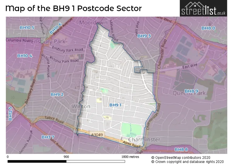
Map of the BH9 1 Postcode Sector
Explore the BH9 1 postcode sector by using our free interactive map.
| B | H | 9 | - | 1 | X | X |
| B | H | 9 | Space | 1 | Letter | Letter |
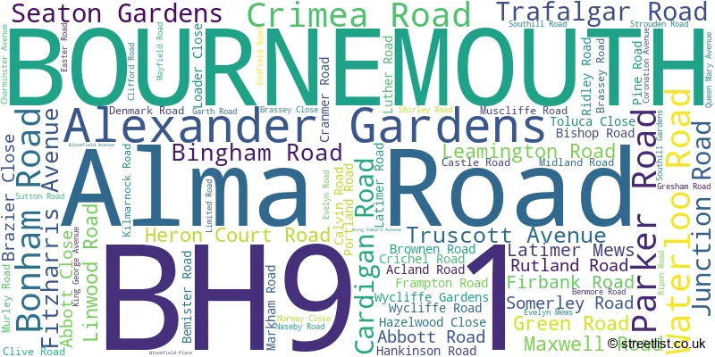
Official List of Streets
BOURNEMOUTH (78 Streets)
Unofficial Streets or Alternative Spellings
House Prices in the BH9 1 Postcode Sector
| Type of Property | 2018 Average | 2018 Sales | 2017 Average | 2017 Sales | 2016 Average | 2016 Sales | 2015 Average | 2015 Sales |
|---|---|---|---|---|---|---|---|---|
| Detached | £330,668 | 94 | £318,860 | 94 | £290,471 | 96 | £272,688 | 124 |
| Semi-Detached | £280,021 | 45 | £276,205 | 48 | £248,249 | 37 | £221,093 | 37 |
| Terraced | £253,846 | 13 | £232,375 | 6 | £249,333 | 9 | £215,355 | 11 |
| Flats | £178,061 | 53 | £164,217 | 50 | £161,492 | 54 | £148,904 | 57 |
Important Postcodes BH9 1 in the Postcode Sector
BH9 1AJ is the postcode for Linwood School, Alma Road, BLOCK B &G, Linwood School, Alma Road, Steve Brown Building C, Linwood School, Alma Road, BLOCK B, Linwood School, Alma Road, and BLOCK A, Linwood School, Alma Road
BH9 1BP is the postcode for Alma Partnership, Alma Medical Centre, 31 Alma Road
BH9 1DL is the postcode for St. Lukes C of E Infant School, Maxwell Road
BH9 1LG is the postcode for St. Lukes C of E School, Bemister Road
| The BH9 1 Sector is within these Local Authorities |
|
|---|---|
| The BH9 1 Sector is within these Counties |
|
| The BH9 1 Sector is within these Water Company Areas |
|