Map of Bryony Gardens
| Postcodes | ||
|---|---|---|
| Icon | Postcodes for Bryony Gardens | |
| Walking Distances | ||
| Distance Info | Green Circle = 10 Minutes Walk (800 metres) | |
About Bryony Gardens
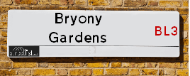
Bryony Gardens is a street located in the town of Bolton. It uses the postcode BL3 4FQ. The street has a length of approximately 53 metres.
Bryony Gardens is located within the Bolton Council's jurisdiction. They provide various services, like refuse collection, and manage council tax collection. It's situated in the North West region of the UK.
Bryony Gardens is located within the county of Greater Manchester, situated in the North West region of the UK. It's 174.23 miles North West from central London., 11.25 miles North West from Manchester, 23.92 miles North East from Liverpool and 31.29 miles North East from Chester.

Do you know why this road is called Bryony Gardens?
What's it like to live here?
Ask the community a question about Bryony Gardens.
Do you have any questions, memories to share or know any facts about Bryony Gardens? We'd love to know more.
Also on streetlist.co.uk, can you help?
Swing Swang Lane
28th April 2024
I am trying to find out why the lane is named Swing Swang?
It has been known known this since at least 1905 when hedge making contents used to be held here.
Swing Swang is often used to describe a fairground ride. I remember Swing Boats. Were they a bit like this or is Swing Swang another name for swings?
Swing Swangs are also mentioned in connection to orchards. Or were orchards just good places to have swings?
Eldroth Road
15th April 2024
I wondered if anyone has any old pictures of Wenning Bank House in the 1940’s and also Lane Side before of the same era .. we visited today with my Mum in law as she used to live at both these properties. Also any photos of the schools around that time .. thank you.
Can You Help?Napps Way
15th April 2024
Why is the road called Napps Way (belonging to Napp, but minus an
apostrophe as is usual with such nomenclature)? Moreover, who or
what is, or was, “Napp” in the respective, possessive case?
Several years ago, I met an elderly man (probably in his late-eighties)
who lives on Bentham Drive, Liverpool 16, and during a conversation
with him whilst in a Northwest Passenger Transport Ambulance on the
way to the former RLUH (Royal Liverpool University Hospital), he told
me that he could remember (when he was a boy, living in Childwall,
Liverpool 16) that, “Where Napps Way is now, during WW2, there was
a two-man gun emplacement on the, then, open land to protect the
railway line passing over Childwall Valley Road - next to the railway
bridge - when suddenly, as they were loading a live “shell” into the gun’s
breach, the aforementioned “shell” accidentally exploded in the gun’s
breach killing both of the two soldiers, that had been manning the gun,
instantly! (Very sad, of course, but could - perhaps - two ghosts relating
to those two, very unfortunately and prematurely-killed soldiers have
haunted that place of their deaths ever since - and have any residents
of Napps Way - formerly and in its latest incarnation - seen two, WW2
(uniformed) soldiers unexpectedly appear in or near their homes?)
Estate Agents near Bryony Gardens
| Name | Address | Website |
|---|---|---|
| Josephs Estates | 272 - 276 Wigan Road, Bolton, BL3 5QT | Visit Website |
| Your Housing Group Ltd - Eldercot Park | Eldercot Road, Daubhill,BL3 4JJ | |
| Roe & Co Residential Sales | 315 Chorley New Road Bolton BL1 5BP |
We have found 1 postcode for Bryony Gardens
Location Details
| Bryony Gardens | |
|---|---|

| |
| Latitude | 53.567876 |
| Longitude | -2.472814 |
| OS Easting (X): | 368690 |
| OS Northing (Y): | 408049 |
| OS Grid Reference: | SD687080 |
Neighbourhood Policing |
| Police Force: Greater Manchester |
 View Neighbourhood Crime and Policing View Neighbourhood Crime and Policing |
| Find a Local Neighbourhood Watch Scheme |
Frequently asked Questions for Bryony Gardens
What Council (Local Authority) is Bryony Gardens in?
Bryony Gardens is located within the local authority area of Bolton Council which is a Metropolitan District.
What Parish Council is Bryony Gardens in?
Bryony Gardens is in an unparished area.
What Electoral Ward is Bryony Gardens in?
Bryony Gardens is located within the ward of Heaton and Lostock.
What County is Bryony Gardens in?
Bryony Gardens is located within the ceremonial county of Greater Manchester.
What Constituency is Bryony Gardens in?
Bryony Gardens is located within the constituency of Bolton West.
What Part of the UK is Bryony Gardens in?
Bryony Gardens is located within the North West (England) region of the United Kingdom.
What County Council area is Bryony Gardens in?
Bryony Gardens is located within the Greater Manchester Council area.
What Police Force area is Bryony Gardens in?
Bryony Gardens is located within the Greater Manchester Police area.
Roads that have a Junction with Bryony Gardens
| Street | Junction Type |
|---|---|
| Junction Road | junction |
Sunset and Sunrise times for Bryony Gardens , BL3 4FQ
| Sunrise | 05:16 |
|---|---|
| Sunset | 20:56 |
Latest Weather Conditions for Bryony Gardens, BL3 4FQ
| Observed at Weather Station: | Rostherne No 2 8 May 2024 at 22:00 (14.87 miles away) |
|---|---|
| Current Weather: | Overcast |
| Temperature and Humidity: | 12.3°C (83.9%) |
| Wind Direction and Speed: | ENE (1 mph) |
Population Statistics
| ONS Area Code | E00024497 |
|---|---|
| ONS Area Name | Indian Tech Achievers |
| Average Age | 45.73 |
| Area Population | 1491.00 |
| Male Population | 712.00 (48%) |
| Female Population | 779.00 (52%) |
| Benefit Claimants | 17 (1%) |
| LSOA Code: | E01004836 |
|---|---|
| LSOA Name: | Bolton 020B |
| SOA Code: | 8a |
| SOA Name: | |
| MSOA Code: | E02001003 |
| MSOA Name: | Bolton 020 |
Nearest Supermarkets
| Tesco Bolton Wigan Rd Esso Express |
|---|
| Wigan Rd, Haslam Park, Bolton, BL3 5PX |
| 0345 026 9934 |
| Distance: 0.86 Miles |
| Directions from Bryony Gardens to Tesco Bolton Wigan Rd Esso Express |
| Asda Daubhill |
|---|
| St Helens Road, Daubhill, Bolton, BL3 4EB |
| 01204 512300 |
| Distance: 0.87 Miles |
| Directions from Bryony Gardens to Asda Daubhill |
| Morrisons Bolton - Atlas Mills |
|---|
| Mornington Road, Bolton BL1 4EU |
| 01204 848687 |
| Distance: 1.51 Miles |
| Directions from Bryony Gardens to Morrisons Bolton - Atlas Mills |
| Tesco Westhoughton Express |
|---|
| Manchester Rd, Westhoughton, Bolton, BL5 3JS |
| 0345 674 6531 |
| Distance: 1.73 Miles |
| Directions from Bryony Gardens to Tesco Westhoughton Express |
Telephone Information
| Area Code |
|---|
| Area Code: 01204 - Bolton |
| Area Code: 01942 - Wigan |
| Area Code: 01257 - Coppull |
Local Government
| Local Council Details |
|---|
| Within the area of Bolton |
| Visit the Council's Website |
| Town Hall, Victoria Square, Bolton, Lancashire &BL1 1RU |
| Send email |
| Telephone Number: 01204 333 333 |
| Local Member of Parliament |
|---|
| Within the Westminster Parliamentary Constituency of Bolton West |
| The Member of Parliament is Chris Green |
| Details for the MP Chris Green on parliament.uk |
| Details for the MP Chris Green on theyworkforyou.com |
| In the 2019 General Election Chris Green won with a majority of 8,855 the result was Con hold. The total electorate was 73,191 |
| Wards, Parish Councils and County Councils |
|---|
| Ward: Heaton and Lostock Ward |
| Ceremonial County: Greater Manchester |
Nearest Schools
England Secondary Schools
Bolton Muslim Girls School
Address: Bolton Muslim Girls School, Swan Lane, Bolton, Greater Manchester, BL3 6TQ
Distance: 1.31 miles
Contact: 01204361103
Bolton Muslim Girls School
Address: Bolton Muslim Girls School, Swan Lane, Bolton, Greater Manchester, BL3 6TQ
Distance: 1.31 miles
Contact:
Essa Academy
Address: Essa Academy, Lever Edge Lane, Bolton, Greater Manchester, BL3 3HH
Distance: 1.33 miles
Contact: 01204333222
King's Leadership Academy Bolton
Address: King's Leadership Academy Bolton, Lever Edge Lane, Great Lever, Bolton, Greater Manchester, BL3 3LA
Distance: 1.27 miles
Contact: 01204937130
University Collegiate School
Address: University Collegiate School, Deane Road, Bolton, Greater Manchester, BL3 5AG
Distance: 1.38 miles
Contact: 01204928700
Ladybridge High School
Address: Ladybridge High School, New York, Junction Road, Deane, Bolton, Lancashire, BL3 4NG
Distance: 0.06 miles
Contact: 01204656569
England Primary Schools
Essa Primary School
Address: Essa Primary School, Lever Edge Lane, BOLTON, Lancashire, BL3 3HH
Distance: 1.33 miles
Contact: 01204201310
Sunning Hill Primary School
Address: Sunning Hill Primary School, Goldsmith Street, Bolton, Lancashire, BL3 6TR
Distance: 1.20 miles
Contact: 01204333588
The Olive Tree Primary School Bolton
Address: The Olive Tree Primary School Bolton, Adelaide Street, Daubhill, Bolton, Lancashire, BL3 3NY
Distance: 1.15 miles
Contact: 01204322370
St Peter and St Paul RC Primary School
Address: St Peter and St Paul RC Primary School, Pilkington Street, Bolton, Lancashire, BL3 6HP
Distance: 1.59 miles
Contact: 01204333030
St Bede Academy
Address: St Bede Academy, Morris Green Lane, Bolton, Lancashire, BL3 3LJ
Distance: 1.06 miles
Contact: 0120461899
St Bede CofE Primary School, Morris Green
Address: St Bede CofE Primary School, Morris Green, Morris Green Lane, Bolton, Lancashire, BL3 3LJ
Distance: 1.06 miles
Contact:
Pikes Lane Primary School
Address: Pikes Lane Primary School, Gibraltar Street, Bolton, Lancashire, BL3 5HU
Distance: 1.18 miles
Contact: 01204333633
Brandwood Primary School
Address: Brandwood Primary School, Brandwood Street, Bolton, Lancashire, BL3 4BG
Distance: 0.87 miles
Contact: 01204333444
St Ethelbert's RC Primary School
Address: St Ethelbert's RC Primary School, Melbourne Road, Deane, Bolton, Lancashire, BL3 5RL
Distance: 0.72 miles
Contact: 01204333036
Haslam Park Primary School
Address: Haslam Park Primary School, Wigan Road, Bolton, Lancashire, BL3 5QL
Distance: 0.66 miles
Contact: 01204333393
Heathfield Primary School
Address: Heathfield Primary School, Henniker Road, Heathfield Primary School, Bolton, Lancashire, BL3 3TP
Distance: 0.86 miles
Contact: 01204333595
Ladybridge Community Primary School
Address: Ladybridge Community Primary School, Broadford Road, Deane, Bolton, Lancashire, BL3 4NB
Distance: 0.17 miles
Contact: 01204333646
St Mary's CofE Primary School, Deane
Address: St Mary's CofE Primary School, Deane, Edale Road, Deane, St Mary's CE Primary School, Bolton, Lancashire, BL3 4QP
Distance: 0.19 miles
Contact: 01204333494
St Andrew's CofE Primary School, Over Hulton
Address: St Andrew's CofE Primary School, Over Hulton, Crescent Avenue, Over Hulton, Bolton, Lancashire, BL5 1EN
Distance: 1.48 miles
Contact: 01204332606
St Bernard's RC Primary School, Bolton
Address: St Bernard's RC Primary School, Bolton, Wendover Drive, Ladybridge, Bolton, Lancashire, BL3 4RX
Distance: 0.36 miles
Contact: 01204652147
Beaumont Primary School
Address: Beaumont Primary School, Wendover Drive, Ladybridge, Beaumont Primary School, Wendover Drive, BOLTON, Lancashire, BL3 4RX
Distance: 0.36 miles
Contact: 01204652149
Lostock Primary School
Address: Lostock Primary School, Glengarth Drive, Lostock, Bolton, Lancashire, BL6 4PS
Distance: 0.98 miles
Contact: 01204333733
England Higher Schools
Bolton College
Address: Bolton College, Deane Road, Bolton, Lancashire, BL3 5BG
Distance: 1.54 miles
Contact: 01204482000
Bolton Sixth Form College
Address: Bolton Sixth Form College, Town Centre Campus, Deane Road, Bolton, Lancashire, BL3 5BU
Distance: 1.59 miles
Contact: 01204846215
Nearest Hospitals
| Name | Address | Postcode | Distance | Map |
|---|
Nearest Dentists
Dentists near Bryony Gardens
| Name | Address | Postcode | Distance | Map |
|---|
Nearest GP Surgeries
Doctors near Bryony Gardens
BOLTON COMMUNITY PRACTICE CIC - LADYBRIDGE SURGERY
Address: LADYBRIDGE SURGERY, 10-12 BROADGATE, BOLTON, LANCASHIRE, BL3 4PZ
Distance: 0.23 miles
Contact: :
DEANE CLINIC 1
Address: HORSFIELD STREET, DEANE, BOLTON, LANCASHIRE, BL3 4LU
Distance: 0.35 miles
Contact: tel: 01204 64089
ORIENT HOUSE MEDICAL CENTRE
Address: 216 WIGAN ROAD, BOLTON, LANCASHIRE, BL3 5QE
Distance: 0.50 miles
Contact: tel: 01204 462198
ST HELENS ROAD PRACTICE
Address: GARNET FOLD PRACTICE, 374-376 ST. HELENS ROAD, BOLTON, LANCASHIRE, BL3 3RR
Distance: 0.84 miles
Contact: tel: 01204 665588
SHANTI MEDICAL CENTRE
Address: 160 ST. HELENS ROAD, BOLTON, LANCASHIRE, BL3 3PH
Distance: 0.93 miles
Contact: tel: 01204 665354
DR M DAKSHINA-MURTHI
Address: DEANE ROAD, BOLTON, LANCASHIRE, BL3 5HP
Distance: 1.14 miles
Contact: tel: 01204 463646
Nearest Dispensing Chemists
Pharmacies near Bryony Gardens
| Name | Address | Postcode | Telephone | Map | Distance in Km |
|---|
Nearest Opticians
Opticians near Bryony Gardens
CLEAR VISION
Address: 22 ST. HELENS ROAD, BOLTON, BL3 3NH
Distance: 1.09 miles
Contact: :
EYESITE EXPRESS (BOLTON)
Address: 22 ST. HELENS ROAD, BOLTON, LANCASHIRE, BL3 3NH
Distance: 1.09 miles
Contact: :
J.W CALDICOTT OPTICIANS
Address: 50 ST. HELENS ROAD, BOLTON, LANCASHIRE, BL3 3NH
Distance: 1.09 miles
Contact: :
EYE ZONE
Address: 378 DERBY STREET, BOLTON, LANCASHIRE, BL3 6LS
Distance: 1.16 miles
Contact: :
DEANE EYE CLINIC
Address: 222 DEANE ROAD, BOLTON, LANCASHIRE, BL3 5DP
Distance: 1.24 miles
Contact: :
VISIONSAVE (BOLTON)
Address: 155 DEANE ROAD, BOLTON, LANCASHIRE, BL3 5AH
Distance: 1.31 miles
Contact: :
Transport
Nearest Rail Stations
Lostock Station is 0.93 miles away.
Address: Lostock station, Rumworth Road, Lostock, Greater Manchester, BL6 4JP
Lostock is situated on the Manchester to Preston line and is managed by Northern.
Lostock Station is staffed on a full time basis.
Bolton Station is 1.98 miles away.
Address: Bolton station, Trinity Street, Bolton, Lancashire, BL2 1BE
Bolton is situated on the Manchester to Preston line|Ribble Valley line and is managed by Northern.
Bolton Station is staffed on a full time basis.