The BN18 postcode district is a postal district located in the BN Brighton postcode area with a population of 14,259 residents according to the 2021 England and Wales Census.
The area of the BN18 postcode district is 39.30 square miles which is 101.79 square kilometres or 25,152.00 acres.
Currently, the BN18 district has about 487 postcode units spread across 2 geographic postcode sectors.
Given that each sector allows for 400 unique postcode combinations, the district has a capacity of 800 postcodes. With 487 postcodes already in use, this leaves 313 units available.
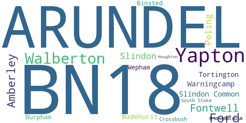
The largest settlement in the BN18 postal code is Yapton followed by ARUNDEL, and Walberton.
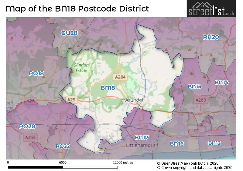
The BN18 Postcode shares a border with GU28 (PETWORTH, Northchapel, Graffham), BN13 (WORTHING, Patching, Clapham), RH20 (Storrington, PULBOROUGH, West Chiltington), PO22 (BOGNOR REGIS, Barnham, Felpham), BN17 (LITTLEHAMPTON, Wick, Climping) and BN16 (Rustington, East Preston, Angmering).
In the BN18 postcode district in West Sussex, the primary settlement is Arundel. Other significant settlements include Binsted, Fontwell, Ford, Madehurst, Slindon Common, Tortington, Walberton, and Yapton. The most significant post town in this district is Arundel.
For the district BN18, we have data on 3 postcode sectors. Here's a breakdown: The sector BN18 0, covers Yapton and Walberton and Ford in West Sussex. The sector BN18 8 is non-geographic. It's often designated for PO Boxes, large organisations, or special services. The sector BN18 9, covers Arundel and Amberley in West Sussex.

Map of the BN18 Postcode District
Explore the BN18 postcode district by using our free interactive map.
When it comes to local government, postal geography often disregards political borders. However, for a breakdown in the BN18 District: the district mostly encompasses the Arun District (515 postcodes), and finally, the Horsham District area (29 postcodes).
Weather Forecast for BN18
Press Button to Show Forecast for Arundel
| Time Period | Icon | Description | Temperature | Rain Probability | Wind |
|---|---|---|---|---|---|
| 09:00 to 12:00 | Cloudy | 10.0°C (feels like 8.0°C) | 6.00% | NE 9 mph | |
| 12:00 to 15:00 | Cloudy | 13.0°C (feels like 11.0°C) | 8.00% | ESE 7 mph | |
| 15:00 to 18:00 | Cloudy | 13.0°C (feels like 12.0°C) | 13.00% | E 7 mph | |
| 18:00 to 21:00 | Light rain | 11.0°C (feels like 10.0°C) | 53.00% | NE 9 mph | |
| 21:00 to 00:00 | Heavy rain | 10.0°C (feels like 7.0°C) | 89.00% | NE 11 mph |
Press Button to Show Forecast for Arundel
| Time Period | Icon | Description | Temperature | Rain Probability | Wind |
|---|---|---|---|---|---|
| 00:00 to 03:00 | Heavy rain | 9.0°C (feels like 7.0°C) | 85.00% | NE 11 mph | |
| 03:00 to 06:00 | Heavy rain | 9.0°C (feels like 7.0°C) | 90.00% | NE 9 mph | |
| 06:00 to 09:00 | Heavy rain | 9.0°C (feels like 7.0°C) | 87.00% | N 9 mph | |
| 09:00 to 12:00 | Heavy rain | 9.0°C (feels like 6.0°C) | 77.00% | W 13 mph | |
| 12:00 to 15:00 | Overcast | 10.0°C (feels like 7.0°C) | 25.00% | W 13 mph | |
| 15:00 to 18:00 | Cloudy | 11.0°C (feels like 9.0°C) | 16.00% | W 11 mph | |
| 18:00 to 21:00 | Partly cloudy (day) | 10.0°C (feels like 8.0°C) | 5.00% | WSW 11 mph | |
| 21:00 to 00:00 | Partly cloudy (night) | 8.0°C (feels like 6.0°C) | 2.00% | SW 7 mph |
Press Button to Show Forecast for Arundel
| Time Period | Icon | Description | Temperature | Rain Probability | Wind |
|---|---|---|---|---|---|
| 00:00 to 03:00 | Partly cloudy (night) | 7.0°C (feels like 5.0°C) | 2.00% | SW 7 mph | |
| 03:00 to 06:00 | Clear night | 6.0°C (feels like 4.0°C) | 1.00% | SW 7 mph | |
| 06:00 to 09:00 | Sunny day | 8.0°C (feels like 7.0°C) | 1.00% | S 7 mph | |
| 09:00 to 12:00 | Partly cloudy (day) | 12.0°C (feels like 10.0°C) | 1.00% | S 11 mph | |
| 12:00 to 15:00 | Sunny day | 13.0°C (feels like 11.0°C) | 2.00% | S 11 mph | |
| 15:00 to 18:00 | Partly cloudy (day) | 13.0°C (feels like 11.0°C) | 3.00% | S 11 mph | |
| 18:00 to 21:00 | Sunny day | 12.0°C (feels like 11.0°C) | 1.00% | SSE 7 mph | |
| 21:00 to 00:00 | Clear night | 9.0°C (feels like 7.0°C) | 1.00% | SE 7 mph |
Press Button to Show Forecast for Arundel
| Time Period | Icon | Description | Temperature | Rain Probability | Wind |
|---|---|---|---|---|---|
| 00:00 to 03:00 | Clear night | 9.0°C (feels like 7.0°C) | 2.00% | ESE 9 mph | |
| 03:00 to 06:00 | Clear night | 9.0°C (feels like 7.0°C) | 4.00% | ESE 9 mph | |
| 06:00 to 09:00 | Sunny day | 10.0°C (feels like 8.0°C) | 5.00% | SE 9 mph | |
| 09:00 to 12:00 | Partly cloudy (day) | 13.0°C (feels like 12.0°C) | 6.00% | SE 11 mph | |
| 12:00 to 15:00 | Partly cloudy (day) | 15.0°C (feels like 13.0°C) | 9.00% | SE 11 mph | |
| 15:00 to 18:00 | Partly cloudy (day) | 16.0°C (feels like 14.0°C) | 8.00% | SE 11 mph | |
| 18:00 to 21:00 | Cloudy | 14.0°C (feels like 13.0°C) | 10.00% | SE 9 mph | |
| 21:00 to 00:00 | Partly cloudy (night) | 11.0°C (feels like 10.0°C) | 9.00% | ESE 7 mph |
Where is the BN18 Postcode District?
The postcode district for BN18 is located in Arundel, a district town in West Sussex. Arundel is surrounded by several nearby towns, including Littlehampton to the south (4.5 miles away), Bognor Regis to the southwest (6.9 miles away), Pulborough to the northeast (7.7 miles away), Worthing to the east (8.5 miles away), Petworth to the north (9.3 miles away), Chichester to the west (10.2 miles away), and Midhurst to the northwest (11.5 miles away). The distance between Arundel and London is approximately 48.3 miles.
The district is within the post town of ARUNDEL.
The sector has postcodes within the nation of England.
The BN18 Postcode District is covers the following regions.
- West Sussex (South West) - Surrey, East and West Sussex - South East (England)
- West Sussex (North East) - Surrey, East and West Sussex - South East (England)
| Postcode Sector | Delivery Office |
|---|---|
| BN18 0 | Arundel Delivery Office |
| BN18 9 | Arundel Delivery Office |
| B | N | 1 | 8 | - | X | X | X |
| B | N | 1 | 8 | Space | Numeric | Letter | Letter |
Tourist Attractions within the Postcode Area
We found 2 visitor attractions within the BN18 postcode area
| Arundel Museum |
|---|
| Museums & Art Galleries |
| Museum and / or Art Gallery |
| View Arundel Museum on Google Maps |
| Arundel Wetland Centre |
| Wildlife |
| Nature Reserve / Wetlands / Wildlife Trips |
| View Arundel Wetland Centre on Google Maps |
Current Monthly Rental Prices
| # Bedrooms | Min Price | Max Price | Avg Price |
|---|---|---|---|
| 1 | £1,500 | £1,500 | £1,500 |
| 2 | £1,075 | £1,395 | £1,223 |
| 3 | £1,500 | £2,500 | £2,020 |
| 5 | £2,250 | £3,500 | £3,000 |
| 6 | £7,500 | £7,500 | £7,500 |
Current House Prices
| # Bedrooms | Min Price | Max Price | Avg Price |
|---|---|---|---|
| 2 | £850,000 | £850,000 | £850,000 |
| 3 | £799,950 | £1,150,000 | £969,993 |
| 4 | £799,950 | £2,250,000 | £1,195,550 |
| 5 | £1,450,000 | £1,650,000 | £1,550,000 |
| 6 | £930,000 | £1,695,000 | £1,436,250 |
| 8 | £2,250,000 | £3,000,000 | £2,625,000 |
Estate Agents who Operate in the BN18 District
| Logo | Name | Brand Name | Address | Contact Number | Total Properties |
|---|---|---|---|---|---|
 | Arundel | Cubitt & West | 49 High Street, Arundel, West Sussex, BN18 9AG | 01903 497273 | 32 |
 | Arundel | Sims Williams | 8A High Street, Arundel, BN18 9AB | 01903 947065 | 28 |
 | Walberton | Sims Williams | 5 Maple Parade, The Street, Walberton, BN18 0PR | 020 3893 8759 | 25 |
 | Yapton | Glyn-Jones & Co | Brow Cottage Woodlands Park, Main Road, Yapton, BN18 0EZ | 01243 973418 | 9 |
 | Barnham | Pegasus Properties | 39 Barnham Road, Barnham, PO22 0ER | 01243 215659 | 9 |
| Type of Property | 2018 Average | 2018 Sales | 2017 Average | 2017 Sales | 2016 Average | 2016 Sales | 2015 Average | 2015 Sales |
|---|---|---|---|---|---|---|---|---|
| Detached | £566,429 | 72 | £631,312 | 81 | £519,979 | 95 | £431,465 | 88 |
| Semi-Detached | £370,323 | 48 | £313,237 | 52 | £287,010 | 93 | £314,553 | 98 |
| Terraced | £353,222 | 81 | £324,356 | 70 | £340,449 | 79 | £341,340 | 74 |
| Flats | £241,411 | 35 | £330,257 | 29 | £262,240 | 39 | £229,794 | 31 |