Map of Birling Street
| Postcodes | ||
|---|---|---|
| Icon | Postcodes for Birling Street | |
| Walking Distances | ||
| Distance Info | Green Circle = 10 Minutes Walk (800 metres) | |
About Birling Street
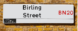
Birling Street is a street located in the town of Eastbourne. It uses the postcode BN21 1RL. The street has a length of approximately 168 metres.
Birling Street is located within the Eastbourne District (B) Council's jurisdiction. They provide various services, like refuse collection, and manage council tax collection. It's situated in the South East region of the UK.
Birling Street has been assigned the Unique Street Reference Number of 13200556 in the National Street Gazetteer.
Birling Street is located within the county of East Sussex, situated in the South East region of the UK. It's 52.52 miles South from central London., 12.54 miles South East from Lewes, 17.82 miles East from Brighton and 36.28 miles South from Maidstone.

Do you know why this road is called Birling Street?
What's it like to live here?
Ask the community a question about Birling Street.
Do you have any questions, memories to share or know any facts about Birling Street? We'd love to know more.
Also on streetlist.co.uk, can you help?
Swing Swang Lane
28th April 2024
I am trying to find out why the lane is named Swing Swang?
It has been known known this since at least 1905 when hedge making contents used to be held here.
Swing Swang is often used to describe a fairground ride. I remember Swing Boats. Were they a bit like this or is Swing Swang another name for swings?
Swing Swangs are also mentioned in connection to orchards. Or were orchards just good places to have swings?
Estate Agents near Birling Street
| Name | Address | Website |
|---|---|---|
| Rager & Roberts | 117 Green Street, Old Town, Eastbourne, BN21 1RS | Visit Website |
| Brook Gamble Estate Agents | 4 Albert Parade Old Town Eastbourne BN21 1SD | Visit Website |
| Hashtag Properties | 5 Albert Parade, Green Street, Eastbourne, BN21 1SD | Visit Website |
We have found 1 postcode for Birling Street
Location Details
| Birling Street | |
|---|---|

| |
| Latitude | 50.775698 |
| Longitude | 0.257928 |
| OS Easting (X): | 559177 |
| OS Northing (Y): | 99839 |
| OS Grid Reference: | TV592998 |
Neighbourhood Policing |
| Police Force: Sussex |
 View Neighbourhood Crime and Policing View Neighbourhood Crime and Policing |
| Find a Local Neighbourhood Watch Scheme |
Frequently asked Questions for Birling Street
What Council (Local Authority) is Birling Street in?
Birling Street is located within the local authority area of Eastbourne Council which is a District Council.
What Parish Council is Birling Street in?
Birling Street is in an unparished area.
What Electoral Ward is Birling Street in?
Birling Street is located within the ward of Old Town.
What County is Birling Street in?
Birling Street is located within the ceremonial county of East Sussex.
What Constituency is Birling Street in?
Birling Street is located within the constituency of Eastbourne.
What Part of the UK is Birling Street in?
Birling Street is located within the South East (England) region of the United Kingdom.
What County Council area is Birling Street in?
Birling Street is located within the East Sussex Council area.
What Police Force area is Birling Street in?
Birling Street is located within the Sussex Police area.
Roads that have a Junction with Birling Street
| Street | Junction Type |
|---|---|
| Victoria Drive | junction |
| Green Street | junction |
Sunset and Sunrise times for Birling Street , BN21 1RL
| Sunrise | 05:11 |
|---|---|
| Sunset | 20:39 |
Latest Weather Conditions for Birling Street, BN21 1RL
| Observed at Weather Station: | Herstmonceux West End 12 May 2024 at 05:00 (8.34 miles away) |
|---|---|
| Current Weather: | Mist |
| Temperature and Humidity: | 12.6°C (91.2%) |
| Wind Direction and Speed: | NE (5 mph) |
Population Statistics
| ONS Area Code | E00106300 |
|---|---|
| ONS Area Name | White Professionals |
| Average Age | 40.58 |
| Area Population | 1577.00 |
| Male Population | 741.00 (47%) |
| Female Population | 836.00 (53%) |
| Benefit Claimants | 11 (1%) |
| LSOA Code: | E01020939 |
|---|---|
| LSOA Name: | Eastbourne 009B |
| SOA Code: | 3a |
| SOA Name: | |
| MSOA Code: | E02004364 |
| MSOA Name: | Eastbourne 009 |
Nearest Supermarkets
| Sainsburys Eastbourne Victoria Drive Local |
|---|
| 153 Victoria Drive, Eastbourne, England, BN20 8NH |
| 1323736656 |
| Distance: 0.19 Miles |
| Directions from Birling Street to Sainsburys Eastbourne Victoria Drive Local |
| Waitrose Eastbourne |
|---|
| High Street, Old Town, Eastbourne, East Sussex, BN21 1HR |
| 01323 644505 |
| Distance: 0.47 Miles |
| Directions from Birling Street to Waitrose Eastbourne |
| Tesco Eastbourne Grove Express |
|---|
| Grove Rd, Eastbourne, BN21 4UJ |
| 0345 610 2873 |
| Distance: 1.09 Miles |
| Directions from Birling Street to Tesco Eastbourne Grove Express |
| Sainsburys Eastbourne Arndale Centre |
|---|
| 63 The Beacon, Eastbourne, England, BN21 3NW |
| 01323 639344 |
| Distance: 1.24 Miles |
| Directions from Birling Street to Sainsburys Eastbourne Arndale Centre |
Telephone Information
| Dialling Code | Telephone Exchange | Telephone Cabinet | Fibre to the Cabinet or Fibre to the Premises |
|---|---|---|---|
| 01323 | EASTBOURNE - SDESTBR | P45 | FTTC |
Broadband Information
| Speed | Average Speed | Median Speed | Maximum Speed | Next-generation access (NGA) | Number of Connections |
|---|---|---|---|---|---|
| Greater than 2 Mbps | 14.4 | 8.1 | >=30 | Y | 30 |
Local Government
| Local Council Details |
|---|
| Within the area of Eastbourne |
| Visit the Council's Website |
| Town Hall, Grove Road, Eastbourne &BN21 4UG |
| Send email |
| Telephone Number: 01323 410 000 |
| Local Member of Parliament |
|---|
| Within the Westminster Parliamentary Constituency of Eastbourne |
| The Member of Parliament is Caroline Ansell |
| Details for the MP Caroline Ansell on parliament.uk |
| Details for the MP Caroline Ansell on theyworkforyou.com |
| In the 2019 General Election Caroline Ansell won with a majority of 4,331 the result was Con gain from LD. The total electorate was 79,307 |
| Wards, Parish Councils and County Councils |
|---|
| Ward: Old Town Ward |
| Ceremonial County: East Sussex |
Nearest Schools
England Primary Schools
Bourne Primary School
Address: Bourne Primary School, Melbourne Road, Eastbourne, East Sussex, BN22 8BD
Distance: 1.50 miles
Contact: 01323724729
Roselands Infants' School
Address: Roselands Infants' School, Woodgate Road, Eastbourne, East Sussex, BN22 8PD
Distance: 1.65 miles
Contact:
St Thomas A Becket Catholic Primary School
Address: St Thomas A Becket Catholic Primary School, 3 Tutts Barn Lane, Eastbourne, East Sussex, BN22 8XT
Distance: 0.94 miles
Contact: 01323737221
Ocklynge Junior School
Address: Ocklynge Junior School, Victoria Drive, Eastbourne, East Sussex, BN20 8XN
Distance: 0.71 miles
Contact:
Pashley Down Infant School
Address: Pashley Down Infant School, Beechy Avenue, Pashley Down Infant School, Eastbourne, East Sussex, BN20 8NX
Distance: 0.33 miles
Contact: 01323730719
Motcombe Infants' School
Address: Motcombe Infants' School, Macmillan Drive, Eastbourne, East Sussex, BN21 1SN
Distance: 0.17 miles
Contact: 01323728901
St John's Meads Church of England Primary School
Address: St John's Meads Church of England Primary School, Rowsley Road, Eastbourne, East Sussex, BN20 7XS
Distance: 1.53 miles
Contact:
England Higher Schools
East Sussex College Group
Address: East Sussex College Group, Cross Levels Way, Eastbourne, East Sussex, BN21 2UF
Distance: 1.10 miles
Contact: 03030039400
England Secondary Schools
Ratton School
Address: Ratton School, Park Avenue, Eastbourne, East Sussex, BN21 2XR
Distance: 1.06 miles
Contact: 01323504011
The Cavendish School
Address: The Cavendish School, Eldon Road, Eastbourne, East Sussex, BN21 1UE
Distance: 0.35 miles
Contact: 01323731340
Gildredge House
Address: Gildredge House, Compton Place Road, Eastbourne, East Sussex, BN20 8AB
Distance: 0.65 miles
Contact: 01323400650
Nearest Hospitals
| Name | Address | Postcode | Distance | Map |
|---|
Nearest Dentists
Dentists near Birling Street
| Name | Address | Postcode | Distance | Map |
|---|
Nearest GP Surgeries
Doctors near Birling Street
VICTORIA MEDICAL CENTRE
Address: 153A VICTORIA DRIVE, EASTBOURNE, BN20 8NH
Distance: 0.16 miles
Contact: tel: 01323 407900
VICTORIA MEDICAL CENTRE - COVID LOCAL VACCINATION SERVICE 2
Address: 153A VICTORIA DRIVE, EASTBOURNE, BN20 8NH
Distance: 0.16 miles
Contact: :
ARLINGTON ROAD SURGERY
Address: 1 ARLINGTON ROAD, EASTBOURNE, EAST SUSSEX, BN21 1DH
Distance: 1.00 miles
Contact: tel: 01323 727531
GROVE ROAD SURGERY
Address: 59-63 GROVE ROAD, EASTBOURNE, EAST SUSSEX, BN21 4TX
Distance: 1.07 miles
Contact: tel: 01323 720606
THE LIGHTHOUSE MEDICAL PRACTICE
Address: 6 COLLEGE ROAD, EASTBOURNE, EAST SUSSEX, BN21 4HY
Distance: 1.24 miles
Contact: tel: 01323 735044
THE BEACON PRACTICE
Address: 21-22 THE BEACON CENTRE, EASTBOURNE, EAST SUSSEX, BN21 3NW
Distance: 1.25 miles
Contact: :
Nearest Dispensing Chemists
Pharmacies near Birling Street
| Name | Address | Postcode | Telephone | Map | Distance in Km |
|---|
Nearest Opticians
Opticians near Birling Street
GREEN & ELLIOTT OPTOMETRISTS (EASTBOURNE)
Address: 10 ALBERT PARADE, GREEN STREET, EASTBOURNE, EAST SUSSEX, BN21 1SD
Distance: 0.14 miles
Contact: :
BOTTS OPTICIANS (GROVE ROAD)
Address: 4A GROVE ROAD, EASTBOURNE, EAST SUSSEX, BN21 4TJ
Distance: 1.07 miles
Contact: :
SPECSAVERS (EASTBOURNE)
Address: 8B ARNDALE CENTRE, TERMINUS ROAD, EASTBOURNE, EAST SUSSEX, BN21 3QL
Distance: 1.18 miles
Contact: :
BOOTS OPTICIANS - EASTBOURNE
Address: 15 THE BEACON, EASTBOURNE, EAST SUSSEX, BN21 3NL
Distance: 1.26 miles
Contact: :
VISION EXPRESS (EASTBOURNE)
Address: 134 TERMINUS ROAD, EASTBOURNE, BN21 3AN
Distance: 1.34 miles
Contact: :
BARRACLOUGH & STILES OPTICIANS (EASTBOURNE)
Address: 194 TERMINUS ROAD, EASTBOURNE, EAST SUSSEX, BN21 3BB
Distance: 1.44 miles
Contact: :
Transport
Nearest Rail Stations
Eastbourne Station is 1.11 miles away.
Address: Eastbourne station, Terminus Road, Eastbourne, East Sussex, BN21 3QJ
Eastbourne is situated on the East Coastway Line and is managed by Southern.
Eastbourne Station is staffed on a part time basis.
Hampden Park (Sussex) Station is 1.71 miles away.
Address: Hampden Park station, Station Approach, Eastbourne, East Sussex, BN22 9ND
Hampden Park (Sussex) is situated on the East Coastway Line and is managed by Southern.
Hampden Park (Sussex) Station is staffed on a part time basis.
Directions from Birling Street to Hampden Park (Sussex) Rail Station