Map of Sessingham Lane
| Postcodes | ||
|---|---|---|
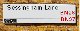
| Icon | Postcodes for Sessingham Lane | |
| Walking Distances | ||
| Distance Info | Green Circle = 10 Minutes Walk (800 metres) | |
About Sessingham Lane
Sessingham Lane is a street located near Arlington. It uses the postcode BN26 6TP. The street has a length of approximately 659 metres.
Sessingham Lane is located within the Wealden District Council's jurisdiction. They provide various services, like refuse collection, and manage council tax collection. It's situated in the South East region of the UK.
Sessingham Lane has been assigned the Unique Street Reference Number of 42701273 in the National Street Gazetteer.
Sessingham Lane is located within the county of East Sussex, situated in the South East region of the UK. It's 46.31 miles South from central London., 7.59 miles East from Lewes, 14.66 miles East from Brighton and 32.29 miles South West from Maidstone.

Do you know why this road is called Sessingham Lane?
What's it like to live here?
Ask the community a question about Sessingham Lane.
Do you have any questions, memories to share or know any facts about Sessingham Lane? We'd love to know more.
Also on streetlist.co.uk, can you help?
Swing Swang Lane
28th April 2024
I am trying to find out why the lane is named Swing Swang?
It has been known known this since at least 1905 when hedge making contents used to be held here.
Swing Swang is often used to describe a fairground ride. I remember Swing Boats. Were they a bit like this or is Swing Swang another name for swings?
Swing Swangs are also mentioned in connection to orchards. Or were orchards just good places to have swings?
Estate Agents near Sessingham Lane
| Name | Address | Website |
|---|---|---|
| Bees Homes | Upper Grain Store Berwick Court Farm Alfriston Road Alfriston BN26 5QS | Visit Website |
| KLA Properties | 3B & 3C Burfield Park, South Road, Hailsham,BN27 3JL | Visit Website |
| Roland Dunn Property Rentals | 13 Station Road, Hailsham, BN27 2BE |
We have found 1 postcode for Sessingham Lane
Location Details
| Sessingham Lane | |
|---|---|

| |
| Latitude | 50.856278 |
| Longitude | 0.188019 |
| OS Easting (X): | 553983 |
| OS Northing (Y): | 108650 |
| OS Grid Reference: | TQ540087 |
Neighbourhood Policing |
| Police Force: Sussex |
 View Neighbourhood Crime and Policing View Neighbourhood Crime and Policing |
| Find a Local Neighbourhood Watch Scheme |
Frequently asked Questions for Sessingham Lane
What Council (Local Authority) is Sessingham Lane in?
Sessingham Lane is located within the local authority area of Wealden Council which is a District Council.
What Parish Council is Sessingham Lane in?
Sessingham Lane is located within the area of Arlington Parish Council.
What Electoral Ward is Sessingham Lane in?
Sessingham Lane is located within the ward of Arlington.
What County is Sessingham Lane in?
Sessingham Lane is located within the ceremonial county of East Sussex.
What Constituency is Sessingham Lane in?
Sessingham Lane is located within the constituency of Wealden.
What Part of the UK is Sessingham Lane in?
Sessingham Lane is located within the South East (England) region of the United Kingdom.
What County Council area is Sessingham Lane in?
Sessingham Lane is located within the East Sussex Council area.
What Police Force area is Sessingham Lane in?
Sessingham Lane is located within the Sussex Police area.
Roads that have a Junction with Sessingham Lane
| Street | Junction Type |
|---|---|
| Wick Street | junction |
Sunset and Sunrise times for Sessingham Lane , BN26 6TP
| Sunrise | 05:08 |
|---|---|
| Sunset | 20:42 |
Latest Weather Conditions for Sessingham Lane, BN26 6TP
| Observed at Weather Station: | Herstmonceux West End 14 May 2024 at 08:00 (6.17 miles away) |
|---|---|
| Current Weather: | Light rain |
| Temperature and Humidity: | 13.2°C (97.4%) |
| Wind Direction and Speed: | S (3 mph) |
Population Statistics
| ONS Area Code | E00107668 |
|---|---|
| ONS Area Name | Established Farming Communities |
| Average Age | 38.58 |
| Area Population | 2043.00 |
| Male Population | 1029.00 (50%) |
| Female Population | 1014.00 (50%) |
| Benefit Claimants | 13 (1%) |
| LSOA Code: | E01021197 |
|---|---|
| LSOA Name: | Wealden 018F |
| SOA Code: | 2a |
| SOA Name: | |
| MSOA Code: | E02004420 |
| MSOA Name: | Wealden 018 |
Nearest Supermarkets
| Tesco Hailsham South Rd Express |
|---|
| South Rd, Hailsham, BN27 3JJ |
| 0345 610 2861 |
| Distance: 2.81 Miles |
| Directions from Sessingham Lane to Tesco Hailsham South Rd Express |
| Tesco Hailsham Superstore |
|---|
| North St, Hailsham, BN27 1DN |
| 0345 026 9537 |
| Distance: 3.05 Miles |
| Directions from Sessingham Lane to Tesco Hailsham Superstore |
| Asda Hailsham |
|---|
| 3 The Quintins, North Street, Hailsham, BN27 1DP |
| 01323 534500 |
| Distance: 3.1 Miles |
| Directions from Sessingham Lane to Asda Hailsham |
| Iceland Hailsham |
|---|
| 17 High Street, Hailsham, Sussex, BN27 1AL |
| 01323846630 |
| Distance: 3.16 Miles |
| Directions from Sessingham Lane to Iceland Hailsham |
Telephone Information
| Area Code |
|---|
| Area Code: 01323 - Eastbourne |
| Area Code: 01435 - Heathfield |
| Area Code: 01825 - Uckfield |
Local Government
| Local Council Details |
|---|
| Within the area of Wealden |
| Visit the Council's Website |
| Vicarage Lane, Hailsham, East Sussex &BN27 2AX |
| Send email |
| Telephone Number: 01323 443 322 or 01892 653 311 |
| Local Member of Parliament |
|---|
| Within the Westminster Parliamentary Constituency of Wealden |
| The Member of Parliament is Nusrat Ghani |
| Details for the MP Nusrat Ghani on parliament.uk |
| Details for the MP Nusrat Ghani on theyworkforyou.com |
| In the 2019 General Election Nusrat Ghani won with a majority of 25,655 the result was Con hold. The total electorate was 82,998 |
| Wards, Parish Councils and County Councils |
|---|
| Ward: Arlington Ward |
| Ceremonial County: East Sussex |
Nearest Schools
England Primary Schools
Park Mead Primary School
Address: Park Mead Primary School, Michelham Priory Road, Upper Dicker, Hailsham, East Sussex, BN27 3QP
Distance: 0.96 miles
Contact: 01323844247
Nearest Hospitals
| Name | Address | Postcode | Distance | Map |
|---|
Nearest Dentists
Dentists near Sessingham Lane
| Name | Address | Postcode | Distance | Map |
|---|
Nearest GP Surgeries
Doctors near Sessingham Lane
DEANLAND WOOD BRANCH SURGERY
Address: QUINTIN MEDICAL CENTRE, GOLDEN CROSS, HAILSHAM, EAST SUSSEX, BN27 3RN
Distance: 2.01 miles
Contact: tel: 01323 845669
BRIDGESIDE SURGERY
Address: 1 WESTERN ROAD, HAILSHAM, EAST SUSSEX, BN27 3DG
Distance: 2.99 miles
Contact: tel: 01323 441234
VICARAGE FIELD SURGERY
Address: VICARAGE FIELD, HAILSHAM, EAST SUSSEX, BN27 1BE
Distance: 3.19 miles
Contact: :
HAILSHAM MEDICAL GROUP
Address: VICARAGE LANE, HAILSHAM, EAST SUSSEX, BN27 1BH
Distance: 3.27 miles
Contact: tel: 01323 848494
DOWNLANDS MEDICAL CENTRE
Address: 77 HIGH STREET, POLEGATE, EAST SUSSEX, BN26 6AE
Distance: 3.36 miles
Contact: tel: 01323 482323
BATTLE ROAD MEDICAL CENTRE
Address: 85 BATTLE ROAD, HAILSHAM, BN27 1UA
Distance: 3.39 miles
Contact: :
Nearest Dispensing Chemists
Pharmacies near Sessingham Lane
| Name | Address | Postcode | Telephone | Map | Distance in Km |
|---|
Nearest Opticians
Opticians near Sessingham Lane
THE SPECTACLE SHOWROOM
Address: UNIT A3, ROPEMAKER PARK, DIPLOCKS WAY, HAILSHAM, BN27 3GU
Distance: 2.71 miles
Contact: :
MARK SOPER OPTICIANS LIMITED
Address: 72 HIGH STREET, HAILSHAM, EAST SUSSEX, BN27 1AU
Distance: 3.08 miles
Contact: :
SPECSAVERS (HAILSHAM)
Address: 16 THE QUINTINS, NORTH STREET, HAILSHAM, EAST SUSSEX, BN27 1DP
Distance: 3.12 miles
Contact: :
FOCUS MEDICAL EYE CENTRE
Address: 18 HIGH STREET, HAILSHAM, EAST SUSSEX, BN27 1BJ
Distance: 3.17 miles
Contact: :
BOOTS OPTICIANS (HAILSHAM)
Address: UNIT 1, VICARAGE FIELD, HAILSHAM, EAST SUSSEX, BN27 1BG
Distance: 3.17 miles
Contact: :
BOOTS OPTICIANS (VICARAGE FIELD)
Address: 1 VICARAGE FIELD, HAILSHAM, EAST SUSSEX, BN27 1BE
Distance: 3.19 miles
Contact: :
Transport
Nearest Rail Stations
Berwick (Sussex) Station is 1.46 miles away.
Address: Berwick station, Berwick Station Approach, Berwick, East Sussex, BN26 6TB
Berwick (Sussex) is situated on the East Coastway Line and is managed by Southern.
Berwick (Sussex) Station is staffed on a part time basis.
Directions from Sessingham Lane to Berwick (Sussex) Rail Station
Polegate Station is 3.49 miles away.
Address: Polegate station, High Street, Polegate, East Sussex, BN26 6EH
Polegate is situated on the East Coastway Line and is managed by Southern.
Polegate Station is staffed on a part time basis.