Map of Henfield Road
| Postcodes | ||
|---|---|---|
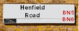
| Icon | Postcodes for Henfield Road | |
| Walking Distances | ||
| Distance Info | Green Circle = 10 Minutes Walk (800 metres) | |
About Henfield Road
Henfield Road is a street located in the village of Castle Town and in the village of Small Dole and near the village of Small Dole and near the village of Upper Beeding. The street has a length of approximately 4,238 metres.
Henfield Road is located within the Horsham District Council's jurisdiction. They provide various services, like refuse collection, and manage council tax collection. It's situated in the South East region of the UK.
Henfield Road has been assigned the Unique Street Reference Number of 17602823 and 17600175 in the National Street Gazetteer.
Henfield Road is located within the county of West Sussex, situated in the South East region of the UK. It's 42.98 miles South from central London., 7.71 miles North West from Brighton, 13.19 miles West from Lewes and 21.88 miles East from Chichester.

Do you know why this road is called Henfield Road?
What's it like to live here?
Ask the community a question about Henfield Road.
Do you have any questions, memories to share or know any facts about Henfield Road? We'd love to know more.
Also on streetlist.co.uk, can you help?
Swing Swang Lane
28th April 2024
I am trying to find out why the lane is named Swing Swang?
It has been known known this since at least 1905 when hedge making contents used to be held here.
Swing Swang is often used to describe a fairground ride. I remember Swing Boats. Were they a bit like this or is Swing Swang another name for swings?
Swing Swangs are also mentioned in connection to orchards. Or were orchards just good places to have swings?
Estate Agents near Henfield Road
| Name | Address | Website |
|---|---|---|
| Hamilton Graham | 38 High Street, Steyning, BN44 3YE | Visit Website |
| King & Chasemore | 29 High Street, Steyning, West Sussex, BN44 3YE | Visit Website |
| Osborn Frankling | 39 High Street, Steyning, BN44 3YE |
We have found 9 postcodes for Henfield Road
Location Details
| Henfield Road | |
|---|---|

| |
| Latitude | 50.888097 |
| Longitude | -0.284212 |
| OS Easting (X): | 520670 |
| OS Northing (Y): | 111309 |
| OS Grid Reference: | TQ207113 |
Neighbourhood Policing |
| Police Force: Sussex |
 View Neighbourhood Crime and Policing View Neighbourhood Crime and Policing |
| Find a Local Neighbourhood Watch Scheme |
Frequently asked Questions for Henfield Road
What Council (Local Authority) is Henfield Road in?
Henfield Road is located within the local authority area of Horsham Council which is a District Council.
What Parish Council is Henfield Road in?
Henfield Road is located within the area of Upper Beeding Parish Council.
What Electoral Ward is Henfield Road in?
Henfield Road is located within the ward of Bramber &Upper Beeding & Woodmancote.
What County is Henfield Road in?
Henfield Road is located within the ceremonial county of West Sussex.
What Constituency is Henfield Road in?
Henfield Road is located within the constituency of Arundel and South Downs.
What Part of the UK is Henfield Road in?
Henfield Road is located within the South East (England) region of the United Kingdom.
What County Council area is Henfield Road in?
Henfield Road is located within the West Sussex Council area.
What Police Force area is Henfield Road in?
Henfield Road is located within the Sussex Police area.
Roads that have a Junction with Henfield Road
| Street | Junction Type |
|---|---|
| Shoreham Road (A2037) | junction |
| Tottington Drive | junction |
| Sands Lane | junction |
| Hillside Lane | junction |
| The Bostal | junction |
| Hyde Street | junction |
| High Street | junction |
Sunset and Sunrise times for Henfield Road
| Sunrise | 05:11 |
|---|---|
| Sunset | 20:43 |
Latest Weather Conditions for Henfield Road
| Observed at Weather Station: | Shoreham 13 May 2024 at 15:00 (3.62 miles away) |
|---|---|
| Current Weather: | Clear night |
| Temperature and Humidity: | 15.1°C (81.1%) |
| Wind Direction and Speed: | ESE (15 mph) |
Population Statistics
| ONS Area Code | E00161240, E00161243 & E00161241 |
|---|---|
| ONS Area Name | Communal Retirement, Ageing Rural Flat Tenants & Rural White-Collar Workers |
| Average Age | 45.45 & 45.72 |
| Area Population | 2375.00 & 1339.00 |
| Male Population | 1160.00 & 650.00 (49%) |
| Female Population | 1215.00 & 689.00 (51%) |
| Benefit Claimants | 10 & 5 (0%) |
| LSOA Code: | E01031617 &E01031618 |
|---|---|
| LSOA Name: | Horsham 016B &Horsham 014A |
| SOA Code: | 2b |
| SOA Name: | |
| MSOA Code: | E02006603 &E02006601 |
| MSOA Name: | Horsham 016 &Horsham 014 |
Nearest Supermarkets
| Tesco Shoreham-by-sea Extra |
|---|
| Holmbush Centre, Upper Shoreham Rd, Shoreham-By-Sea, BN43 6TD |
| 0345 677 9618 |
| Distance: 3.35 Miles |
| Directions from Henfield Road to Tesco Shoreham-by-sea Extra |
| Tesco Upper Shoreham Express |
|---|
| 225 Upper Shoreham Rd, Shoreham By Sea, Shoreham, BN43 6BE |
| 0345 671 9631 |
| Distance: 3.46 Miles |
| Directions from Henfield Road to Tesco Upper Shoreham Express |
| Asda Lancing |
|---|
| South Street, Lancing, Brighton, BN15 8AG |
| 01903 855220 |
| Distance: 4.58 Miles |
| Directions from Henfield Road to Asda Lancing |
| Sainsburys West Hove |
|---|
| 361-367 Old Shoreham Rd, Hove, England, BN3 7GD |
| 01273 439257 |
| Distance: 4.69 Miles |
| Directions from Henfield Road to Sainsburys West Hove |
Telephone Information
| Area Code |
|---|
| Area Code: 01903 - Worthing |
| Area Code: 01273 - Brighton |
Broadband Information
| Speed | Average Speed | Median Speed | Maximum Speed | Next-generation access (NGA) | Number of Connections |
|---|---|---|---|---|---|
| Less than 2 Mbps | 4.2 | 4.1 | 6.9 | N | 4 |
Local Government
| Local Council Details |
|---|
| Within the area of Horsham |
| Visit the Council's Website |
| Park North, North Street, Horsham, West Sussex &RH12 1RL |
| Send email |
| Telephone Number: 01403 215 100 |
| Local Member of Parliament |
|---|
| Within the Westminster Parliamentary Constituency of Arundel and South Downs |
| The Member of Parliament is Andrew Griffith |
| Details for the MP Andrew Griffith on parliament.uk |
| Details for the MP Andrew Griffith on theyworkforyou.com |
| In the 2019 General Election Andrew Griffith won with a majority of 22,521 the result was Con hold. The total electorate was 81,726 |
| Wards, Parish Councils and County Councils |
|---|
| Ward: Bramber &Upper Beeding & Woodmancote Ward |
| Ceremonial County: West Sussex |
Nearest Schools
England Primary Schools
Upper Beeding Primary School
Address: Upper Beeding Primary School, School Road, Upper Beeding, Steyning, West Sussex, BN44 3HY
Distance: 0.82 miles
Contact: 01903812288
Nearest Hospitals
| Name | Address | Postcode | Distance | Map |
|---|
Nearest Dentists
Dentists near Henfield Road
| Name | Address | Postcode | Distance | Map |
|---|
Nearest GP Surgeries
Doctors near Henfield Road
14 DAWN CLOSE, UPPER BEEDING
Address: 14 DAWN CLOSE, UPPER BEEDING, STEYNING, WEST SUSSEX, BN44 3WG
Distance: 0.90 miles
Contact: tel: 01903 816107
STEYNING HEALTH CENTRE
Address: TANYARD LANE, STEYNING, WEST SUSSEX, BN44 3RJ
Distance: 2.00 miles
Contact: tel: 01903 497227
LANCING COLLEGE SANATORIUM
Address: LANCING COLLEGE, LANCING, WEST SUSSEX, BN15 0RW
Distance: 3.08 miles
Contact: :
HENFIELD MEDICAL CENTRE- COVID LOCAL VACCINATION SERVICE 2
Address: DEER PARK, HENFIELD, BN5 9JQ
Distance: 3.34 miles
Contact: :
HENFIELD MEDICAL CENTRE - COVID LOCAL VACCINATION SERVICE 3
Address: DEER PARK, HENFIELD, BN5 9JQ
Distance: 3.34 miles
Contact: :
HENFIELD MEDICAL CENTRE
Address: DEER PARK, HENFIELD, WEST SUSSEX, BN5 9JQ
Distance: 3.34 miles
Contact: tel: 01273 492255
Nearest Dispensing Chemists
Pharmacies near Henfield Road
| Name | Address | Postcode | Telephone | Map | Distance in Km |
|---|
Nearest Opticians
Opticians near Henfield Road
ROBINSON OPTICIANS
Address: 78 HIGH STREET, STEYNING, WEST SUSSEX, BN44 3RD
Distance: 2.00 miles
Contact: :
HENFIELD EYECARE
Address: 3 BISHOP CROFT, HIGH STREET, HENFIELD, WEST SUSSEX, BN5 9DA
Distance: 2.97 miles
Contact: :
SHOREHAM EXTRA
Address: HOLMBUSH CENTRE, UPPER SHOREHAM ROAD, SHOREHAM-BY-SEA, WEST SUSSEX, BN43 6TD
Distance: 3.48 miles
Contact: :
M&S OPTICIANS - SHOREHAM-BY-SEA
Address: HOLMBUSH CENTRE, UPPER SHOREHAM ROAD, SHOREHAM-BY-SEA, BN43 6TD
Distance: 3.48 miles
Contact: :
THOMAS H COLLISON LTD (SHOREHAM)
Address: 33 BRUNSWICK ROAD, SHOREHAM-BY-SEA, WEST SUSSEX, BN43 5WA
Distance: 3.78 miles
Contact: :
EDMINSON BUTLER DISPENSING OPTICIAN
Address: 2 THE VINERY, ST. MARYS ROAD, SHOREHAM-BY-SEA, WEST SUSSEX, BN43 5ZA
Distance: 3.82 miles
Contact: :
Transport
Nearest Rail Stations
Shoreham-by-Sea Station is 3.75 miles away.
Address: Shoreham-by-sea station, Station Approach, Shoreham-by-sea, West Sussex, BN43 5WX
Shoreham-by-Sea is situated on the West Coastway Line and is managed by Southern.
Shoreham-by-Sea Station is staffed on a part time basis.
Directions from Henfield Road to Shoreham-by-Sea Rail Station
Southwick Station is 4.36 miles away.
Address: Southwick station, Station Road, Southwick, West Sussex, BN42 4AE
Southwick is situated on the West Coastway Line and is managed by Southern.
Southwick Station is staffed on a part time basis.