The BS32 0 postcode sector is within the county of Gloucestershire.
Did you know? According to the 2021 Census, the BS32 0 postcode sector is home to a bustling 7,413 residents!
Given that each sector allows for 400 unique postcode combinations. Letters C, I, K, M, O and V are not allowed in the last two letters of a postcode. With 76 postcodes already in use, this leaves 324 units available.
The BS32 0 postal code covers the settlement of Bradley Stoke.
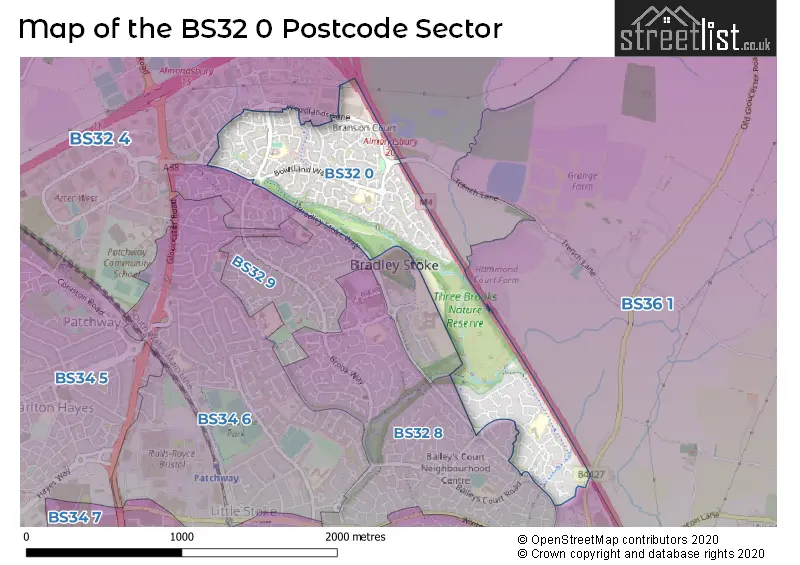
The BS32 0 Postcode shares a border with BS32 4 (Almondsbury, Bradley Stoke, Tockington), BS32 8 (Bradley Stoke), BS32 9 (Bradley Stoke), BS36 1 (Winterbourne, Winterbourne Down) and BS16 1 (BRISTOL, Stapleton, Hambrook).
The sector is within the post town of BRISTOL.
BS32 0 is a postcode sector within the BS32 postcode district which is within the BS Bristol postcode area.
The Royal Mail delivery office for the BS32 0 postal sector is the Patchway Delivery Office.
The area of the BS32 0 postcode sector is 0.57 square miles which is 1.48 square kilometres or 365.75 square acres.
The BS32 0 postcode sector is crossed by the M4 motorway.

Map of the BS32 0 Postcode Sector
Explore the BS32 0 postcode sector by using our free interactive map.
| B | S | 3 | 2 | - | 0 | X | X |
| B | S | 3 | 2 | Space | 0 | Letter | Letter |
Official List of Streets
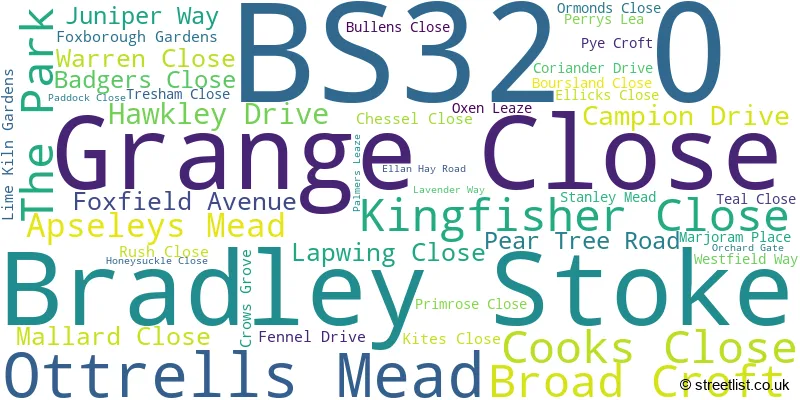
Bradley Stoke (43 Streets)
Unofficial Streets or Alternative Spellings
Bradley Stoke
BAILEYS COURT ROAD WEBBS WOOD ROAD WOODLANDS LANEAlmondsbury
TRENCH LANE WOODLANDS PARKFrenchay
OLD GLOUCESTER ROAD BOWSLAND BOWSLAND WAY BRADLEY STOKE WAY CHEQUERS COURT GREAT MEADOW PATCHWAY BROOK WEBBS WOODSchools and Places of Education Within the BS32 0 Postcode Sector
Holy Trinity Primary School
Voluntary aided school
Broad Croft, Bristol, , BS32 0BD
Head: Mr Stuart McClelland
Ofsted Rating: Good
Inspection: 2019-10-25 (1663 days ago)
Website: Visit Holy Trinity Primary School Website
Phone: 01454866735
Number of Pupils: 194
House Prices in the BS32 0 Postcode Sector
| Type of Property | 2018 Average | 2018 Sales | 2017 Average | 2017 Sales | 2016 Average | 2016 Sales | 2015 Average | 2015 Sales |
|---|---|---|---|---|---|---|---|---|
| Detached | £356,426 | 48 | £349,985 | 46 | £338,864 | 33 | £322,808 | 39 |
| Semi-Detached | £254,768 | 26 | £252,725 | 36 | £241,381 | 29 | £234,412 | 25 |
| Terraced | £219,460 | 51 | £209,676 | 44 | £203,426 | 46 | £193,912 | 60 |
| Flats | £159,167 | 9 | £140,587 | 15 | £135,800 | 5 | £131,499 | 8 |
Important Postcodes BS32 0 in the Postcode Sector
BS32 0BD is the postcode for Holy Trinity Primary School, Broad Croft, Bradley Stoke, and Holy Trinity Primary School, Broad Croft
BS32 0ES is the postcode for Bowsland Green Primary School, Ellicks Close, and Bowsland Green Primary School, Ellicks Close, Bradley Stoke
| The BS32 0 Sector is within these Local Authorities |
|
|---|---|
| The BS32 0 Sector is within these Counties |
|
| The BS32 0 Sector is within these Water Company Areas |
|