The CH41 7 postcode sector is within the county of Merseyside.
Did you know? According to the 2021 Census, the CH41 7 postcode sector is home to a bustling 2,345 residents!
Given that each sector allows for 400 unique postcode combinations. Letters C, I, K, M, O and V are not allowed in the last two letters of a postcode. With 54 postcodes already in use, this leaves 346 units available.
The CH41 7 postal code covers the settlement of BIRKENHEAD.
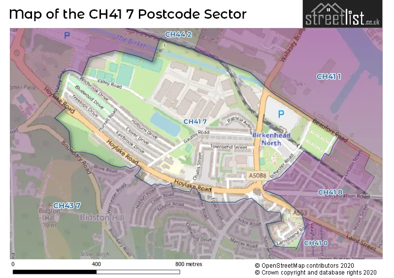
The CH41 7 Postcode shares a border with CH41 0 (BIRKENHEAD), CH41 8 (BIRKENHEAD), CH43 7 (PRENTON), CH41 1 (BIRKENHEAD) and CH44 2 (WALLASEY).
The sector is within the post town of BIRKENHEAD.
CH41 7 is a postcode sector within the CH41 postcode district which is within the CH Chester postcode area.
The Royal Mail delivery office for the CH41 7 postal sector is the Birkenhead Delivery Office.
The area of the CH41 7 postcode sector is 0.27 square miles which is 0.69 square kilometres or 170.43 square acres.

Map of the CH41 7 Postcode Sector
Explore the CH41 7 postcode sector by using our free interactive map.
| C | H | 4 | 1 | - | 7 | X | X |
| C | H | 4 | 1 | Space | 7 | Letter | Letter |
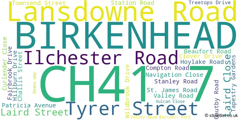
Official List of Streets
BIRKENHEAD (26 Streets)
Unofficial Streets or Alternative Spellings
BIRKENHEAD
CORPORATION ROAD DEAKIN STREET FAIRWATER AVENUE RIBBLE STREET SHANNON STREET WALLASEY BRIDGE ROAD WAYPOINT ROAD BLUEWOOD DRIVE BUCCLEUGH STREET HURRELL ROAD MIRIAM PLACE VULCAN STREETPRENTON
ARKLE ROAD BOUNDARY ROAD COLLIN ROAD EGAN ROAD HOBLYN ROAD MERCER ROAD SUMNER ROAD WORCESTER ROADBIRKENHEAD,
LANSDOWNE ROAD TOLLEMACHE ROADWeather Forecast for CH41 7
Press Button to Show Forecast for Seacombe
| Time Period | Icon | Description | Temperature | Rain Probability | Wind |
|---|---|---|---|---|---|
| 15:00 to 18:00 | Cloudy | 10.0°C (feels like 8.0°C) | 8.00% | N 9 mph | |
| 18:00 to 21:00 | Cloudy | 9.0°C (feels like 7.0°C) | 15.00% | NNE 7 mph | |
| 21:00 to 00:00 | Cloudy | 8.0°C (feels like 6.0°C) | 10.00% | E 7 mph |
Press Button to Show Forecast for Seacombe
| Time Period | Icon | Description | Temperature | Rain Probability | Wind |
|---|---|---|---|---|---|
| 00:00 to 03:00 | Cloudy | 7.0°C (feels like 5.0°C) | 6.00% | E 9 mph | |
| 03:00 to 06:00 | Cloudy | 6.0°C (feels like 4.0°C) | 5.00% | E 9 mph | |
| 06:00 to 09:00 | Partly cloudy (day) | 6.0°C (feels like 3.0°C) | 2.00% | E 9 mph | |
| 09:00 to 12:00 | Cloudy | 8.0°C (feels like 6.0°C) | 5.00% | E 9 mph | |
| 12:00 to 15:00 | Overcast | 10.0°C (feels like 9.0°C) | 10.00% | ENE 7 mph | |
| 15:00 to 18:00 | Overcast | 10.0°C (feels like 8.0°C) | 46.00% | NE 7 mph | |
| 18:00 to 21:00 | Overcast | 9.0°C (feels like 7.0°C) | 14.00% | NE 9 mph | |
| 21:00 to 00:00 | Cloudy | 9.0°C (feels like 6.0°C) | 8.00% | NE 9 mph |
Press Button to Show Forecast for Seacombe
| Time Period | Icon | Description | Temperature | Rain Probability | Wind |
|---|---|---|---|---|---|
| 00:00 to 03:00 | Cloudy | 7.0°C (feels like 5.0°C) | 4.00% | NE 9 mph | |
| 03:00 to 06:00 | Cloudy | 6.0°C (feels like 4.0°C) | 4.00% | NNE 9 mph | |
| 06:00 to 09:00 | Cloudy | 7.0°C (feels like 4.0°C) | 8.00% | N 11 mph | |
| 09:00 to 12:00 | Cloudy | 8.0°C (feels like 6.0°C) | 11.00% | NNW 11 mph | |
| 12:00 to 15:00 | Partly cloudy (day) | 9.0°C (feels like 7.0°C) | 9.00% | NW 13 mph | |
| 15:00 to 18:00 | Sunny day | 10.0°C (feels like 7.0°C) | 8.00% | WNW 13 mph | |
| 18:00 to 21:00 | Sunny day | 10.0°C (feels like 8.0°C) | 3.00% | W 11 mph | |
| 21:00 to 00:00 | Clear night | 9.0°C (feels like 7.0°C) | 2.00% | SW 11 mph |
Press Button to Show Forecast for Seacombe
| Time Period | Icon | Description | Temperature | Rain Probability | Wind |
|---|---|---|---|---|---|
| 00:00 to 03:00 | Partly cloudy (night) | 8.0°C (feels like 5.0°C) | 1.00% | SSW 9 mph | |
| 03:00 to 06:00 | Cloudy | 7.0°C (feels like 4.0°C) | 4.00% | S 11 mph | |
| 06:00 to 09:00 | Partly cloudy (day) | 7.0°C (feels like 4.0°C) | 4.00% | SSE 13 mph | |
| 09:00 to 12:00 | Partly cloudy (day) | 10.0°C (feels like 8.0°C) | 2.00% | SSE 13 mph | |
| 12:00 to 15:00 | Cloudy | 13.0°C (feels like 10.0°C) | 7.00% | S 16 mph | |
| 15:00 to 18:00 | Cloudy | 13.0°C (feels like 10.0°C) | 9.00% | S 16 mph | |
| 18:00 to 21:00 | Cloudy | 13.0°C (feels like 10.0°C) | 8.00% | SSE 16 mph | |
| 21:00 to 00:00 | Partly cloudy (night) | 11.0°C (feels like 9.0°C) | 3.00% | SSE 13 mph |
Press Button to Show Forecast for Seacombe
| Time Period | Icon | Description | Temperature | Rain Probability | Wind |
|---|---|---|---|---|---|
| 00:00 to 03:00 | Partly cloudy (night) | 10.0°C (feels like 7.0°C) | 4.00% | SE 16 mph | |
| 03:00 to 06:00 | Cloudy | 9.0°C (feels like 6.0°C) | 6.00% | SE 13 mph | |
| 06:00 to 09:00 | Partly cloudy (day) | 9.0°C (feels like 6.0°C) | 3.00% | SE 13 mph | |
| 09:00 to 12:00 | Partly cloudy (day) | 12.0°C (feels like 9.0°C) | 4.00% | SE 16 mph | |
| 12:00 to 15:00 | Partly cloudy (day) | 14.0°C (feels like 11.0°C) | 5.00% | SE 16 mph | |
| 15:00 to 18:00 | Cloudy | 15.0°C (feels like 12.0°C) | 14.00% | SE 13 mph | |
| 18:00 to 21:00 | Partly cloudy (day) | 15.0°C (feels like 12.0°C) | 6.00% | ESE 11 mph | |
| 21:00 to 00:00 | Cloudy | 13.0°C (feels like 11.0°C) | 8.00% | ESE 11 mph |
Schools and Places of Education Within the CH41 7 Postcode Sector
Holy Cross Catholic Primary School
Voluntary aided school
Gautby Road, Birkenhead, Merseyside, CH41 7DU
Head: Mrs Clare Higgins
Ofsted Rating: Good
Inspection: 2022-10-21 (553 days ago)
Website: Visit Holy Cross Catholic Primary School Website
Phone: 01516528454
Number of Pupils: 158
House Prices in the CH41 7 Postcode Sector
| Type of Property | 2018 Average | 2018 Sales | 2017 Average | 2017 Sales | 2016 Average | 2016 Sales | 2015 Average | 2015 Sales |
|---|---|---|---|---|---|---|---|---|
| Detached | £139,495 | 2 | £131,995 | 1 | £0 | 0 | £0 | 0 |
| Semi-Detached | £128,646 | 20 | £102,998 | 7 | £81,100 | 5 | £70,000 | 3 |
| Terraced | £74,375 | 12 | £78,218 | 16 | £53,130 | 10 | £53,416 | 7 |
| Flats | £48,567 | 3 | £45,650 | 3 | £40,811 | 9 | £37,520 | 5 |
Important Postcodes CH41 7 in the Postcode Sector
CH41 7AL is the postcode for St. James Neighbourhood College, St. James Centre, 344 Laird Street
CH41 7DU is the postcode for Holy Cross Catholic Primary School, Gautby Road
CH41 7EJ is the postcode for Wirral Tennis Centre, Valley Road
| The CH41 7 Sector is within these Local Authorities |
|
|---|---|
| The CH41 7 Sector is within these Counties |
|
| The CH41 7 Sector is within these Water Company Areas |
|