The CH44 4 postcode sector is within the county of Merseyside.
Did you know? According to the 2021 Census, the CH44 4 postcode sector is home to a bustling 4,186 residents!
Given that each sector allows for 400 unique postcode combinations. Letters C, I, K, M, O and V are not allowed in the last two letters of a postcode. With 104 postcodes already in use, this leaves 296 units available.
The CH44 4 postal code covers the settlement of WALLASEY.
The CH44 4 Postcode shares a border with CH44 7 (WALLASEY), CH44 9 (WALLASEY), CH41 1 (BIRKENHEAD) and CH44 5 (WALLASEY).
The sector is within the post town of WALLASEY.
CH44 4 is a postcode sector within the CH44 postcode district which is within the CH Chester postcode area.
The Royal Mail delivery office for the CH44 4 postal sector is the Wallasey Delivery Office.
The area of the CH44 4 postcode sector is 0.29 square miles which is 0.74 square kilometres or 182.89 square acres.

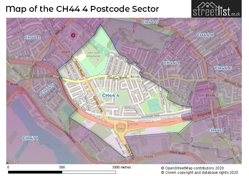
Map of the CH44 4 Postcode Sector
Explore the CH44 4 postcode sector by using our free interactive map.
| C | H | 4 | 4 | - | 4 | X | X |
| C | H | 4 | 4 | Space | 4 | Letter | Letter |
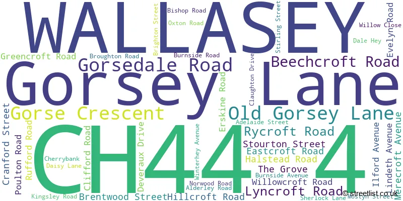
Official List of Streets
WALLASEY (44 Streets)
Unofficial Streets or Alternative Spellings
Weather Forecast for CH44 4
Press Button to Show Forecast for Seacombe
| Time Period | Icon | Description | Temperature | Rain Probability | Wind |
|---|---|---|---|---|---|
| 00:00 to 03:00 | Cloudy | 7.0°C (feels like 5.0°C) | 5.00% | ESE 9 mph | |
| 03:00 to 06:00 | Partly cloudy (night) | 6.0°C (feels like 4.0°C) | 3.00% | E 7 mph | |
| 06:00 to 09:00 | Partly cloudy (day) | 5.0°C (feels like 3.0°C) | 2.00% | E 7 mph | |
| 09:00 to 12:00 | Partly cloudy (day) | 7.0°C (feels like 5.0°C) | 2.00% | E 7 mph | |
| 12:00 to 15:00 | Overcast | 9.0°C (feels like 8.0°C) | 9.00% | NE 7 mph | |
| 15:00 to 18:00 | Cloudy | 10.0°C (feels like 8.0°C) | 7.00% | N 7 mph | |
| 18:00 to 21:00 | Cloudy | 10.0°C (feels like 8.0°C) | 8.00% | NNE 9 mph | |
| 21:00 to 00:00 | Cloudy | 8.0°C (feels like 6.0°C) | 10.00% | ENE 9 mph |
Press Button to Show Forecast for Seacombe
| Time Period | Icon | Description | Temperature | Rain Probability | Wind |
|---|---|---|---|---|---|
| 00:00 to 03:00 | Cloudy | 7.0°C (feels like 5.0°C) | 11.00% | E 9 mph | |
| 03:00 to 06:00 | Cloudy | 6.0°C (feels like 4.0°C) | 9.00% | ESE 9 mph | |
| 06:00 to 09:00 | Cloudy | 6.0°C (feels like 3.0°C) | 8.00% | E 9 mph | |
| 09:00 to 12:00 | Cloudy | 8.0°C (feels like 6.0°C) | 9.00% | E 9 mph | |
| 12:00 to 15:00 | Overcast | 10.0°C (feels like 8.0°C) | 15.00% | ENE 9 mph | |
| 15:00 to 18:00 | Overcast | 11.0°C (feels like 8.0°C) | 21.00% | NE 9 mph | |
| 18:00 to 21:00 | Cloudy | 10.0°C (feels like 8.0°C) | 16.00% | NE 11 mph | |
| 21:00 to 00:00 | Cloudy | 9.0°C (feels like 6.0°C) | 16.00% | NE 11 mph |
Press Button to Show Forecast for Seacombe
| Time Period | Icon | Description | Temperature | Rain Probability | Wind |
|---|---|---|---|---|---|
| 00:00 to 03:00 | Cloudy | 8.0°C (feels like 5.0°C) | 18.00% | NE 11 mph | |
| 03:00 to 06:00 | Cloudy | 8.0°C (feels like 5.0°C) | 17.00% | NE 11 mph | |
| 06:00 to 09:00 | Heavy rain | 8.0°C (feels like 5.0°C) | 68.00% | NE 11 mph | |
| 09:00 to 12:00 | Cloudy | 9.0°C (feels like 6.0°C) | 18.00% | NNE 11 mph | |
| 12:00 to 15:00 | Light rain | 10.0°C (feels like 8.0°C) | 50.00% | NNE 11 mph | |
| 15:00 to 18:00 | Heavy rain shower (day) | 11.0°C (feels like 8.0°C) | 57.00% | N 13 mph | |
| 18:00 to 21:00 | Partly cloudy (day) | 11.0°C (feels like 8.0°C) | 14.00% | N 13 mph | |
| 21:00 to 00:00 | Clear night | 10.0°C (feels like 7.0°C) | 13.00% | WNW 11 mph |
Schools and Places of Education Within the CH44 4 Postcode Sector
Somerville Nursery School
Local authority nursery school
Brentwood Street, Wallasey, Merseyside, CH44 4BB
Head: Mr Phillip Dickson
Ofsted Rating: Good
Inspection: 2018-09-12 (2053 days ago)
Website: Visit Somerville Nursery School Website
Phone: 01516381567
Number of Pupils: 76
House Prices in the CH44 4 Postcode Sector
| Type of Property | 2018 Average | 2018 Sales | 2017 Average | 2017 Sales | 2016 Average | 2016 Sales | 2015 Average | 2015 Sales |
|---|---|---|---|---|---|---|---|---|
| Detached | £117,000 | 1 | £110,000 | 1 | £0 | 0 | £103,500 | 2 |
| Semi-Detached | £85,892 | 19 | £86,472 | 20 | £78,000 | 12 | £87,636 | 19 |
| Terraced | £81,381 | 51 | £80,553 | 38 | £73,705 | 38 | £71,000 | 28 |
| Flats | £79,500 | 4 | £90,000 | 1 | £57,500 | 2 | £55,333 | 3 |
Important Postcodes CH44 4 in the Postcode Sector
CH44 4AA is the postcode for Somerville Medical Centre, 69 Gorsey Lane
CH44 4ES is the postcode for Poulton Primary School, Alderley Road
| The CH44 4 Sector is within these Local Authorities |
|
|---|---|
| The CH44 4 Sector is within these Counties |
|
| The CH44 4 Sector is within these Water Company Areas |
|