The CH60 1 postcode sector is within the county of Merseyside.
Did you know? According to the 2021 Census, the CH60 1 postcode sector is home to a bustling 1,780 residents!
Given that each sector allows for 400 unique postcode combinations. Letters C, I, K, M, O and V are not allowed in the last two letters of a postcode. With 51 postcodes already in use, this leaves 349 units available.
The largest settlements in the CH60 1 postal code are Heswall and WIRRAL.
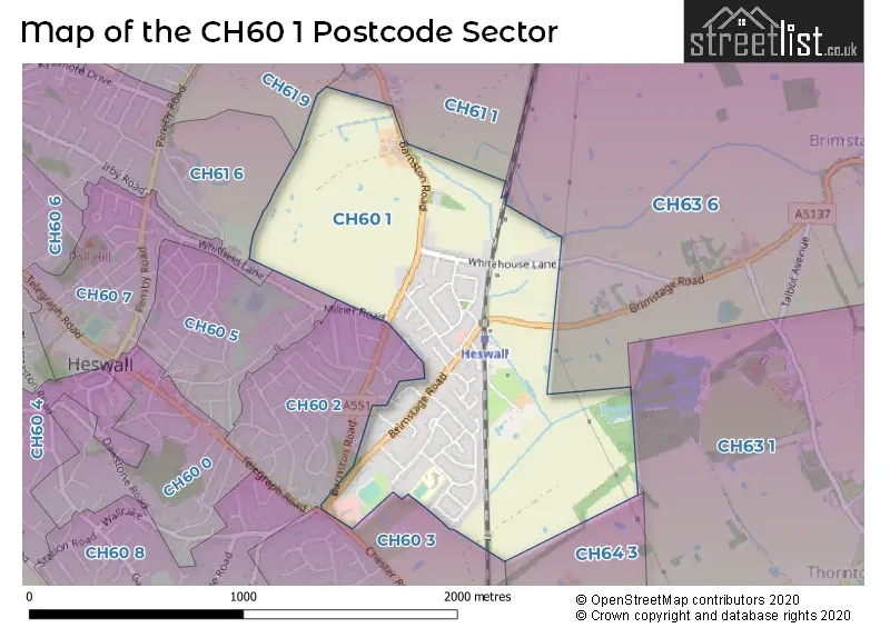
The CH60 1 Postcode shares a border with CH60 3 (WIRRAL, Heswall), CH63 1 (WIRRAL, Thornton Hough), CH63 6 (WIRRAL, Higher Bebington, Brimstage), CH64 3 (NESTON, Clayhill Light Industrial Park, Parkgate), CH60 2 (WIRRAL, Heswall), CH60 5 (WIRRAL, Heswall), CH60 7 (Heswall, WIRRAL), CH61 1 (WIRRAL, Heswall, Thingwall), CH61 6 (WIRRAL, Heswall) and CH61 9 (WIRRAL, Heswall, Thingwall).
The sector is within the post town of WIRRAL.
CH60 1 is a postcode sector within the CH6 postcode district which is within the CH Chester postcode area.
The Royal Mail delivery office for the CH60 1 postal sector is the unknown.
The area of the CH60 1 postcode sector is 0.79 square miles which is 2.06 square kilometres or 508.02 square acres.

Map of the CH60 1 Postcode Sector
Explore the CH60 1 postcode sector by using our free interactive map.
| C | H | 6 | 0 | - | 1 | X | X |
| C | H | 6 | 0 | Space | 1 | Letter | Letter |
Official List of Streets
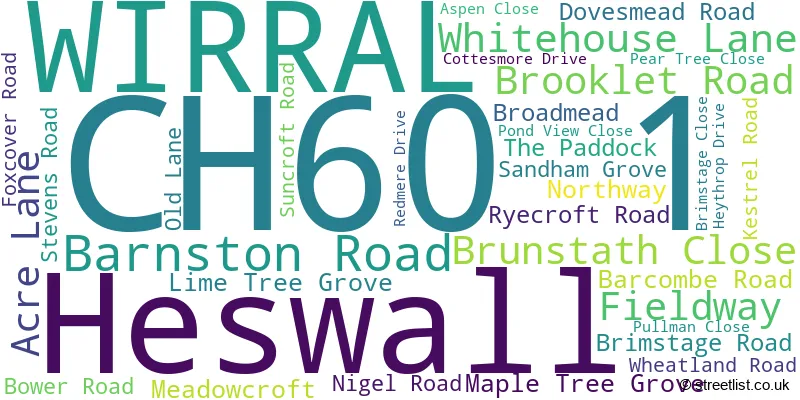
Heswall (12 Streets)
WIRRAL (21 Streets)
Unofficial Streets or Alternative Spellings
Bebington
BRIMSTAGE ROADHeswall
CHESTER ROAD TELEGRAPH ROADWIRRAL
BARNSTON TOWERS CLOSE CAROL DRIVE MILNER ROAD SPEEDWELL DRIVEBrimstage
WHITEHOUSE LANE BRIMSTAGE GREEN FOX COVER ROADSchools and Places of Education Within the CH60 1 Postcode Sector
Barnston Primary School
Community school
Sandham Grove, Wirral, Merseyside, CH60 1XW
Head: Mrs Jill Pearson
Ofsted Rating: Good
Inspection: 2021-07-01 (1064 days ago)
Website: Visit Barnston Primary School Website
Phone: 01513425229
Number of Pupils: 309
House Prices in the CH60 1 Postcode Sector
| Type of Property | 2018 Average | 2018 Sales | 2017 Average | 2017 Sales | 2016 Average | 2016 Sales | 2015 Average | 2015 Sales |
|---|---|---|---|---|---|---|---|---|
| Detached | £412,633 | 15 | £361,450 | 11 | £382,566 | 12 | £370,179 | 28 |
| Semi-Detached | £273,333 | 6 | £287,663 | 12 | £293,099 | 5 | £249,308 | 13 |
| Terraced | £206,000 | 2 | £0 | 0 | £0 | 0 | £0 | 0 |
| Flats | £126,500 | 2 | £122,333 | 3 | £127,500 | 2 | £109,625 | 4 |
Important Postcodes CH60 1 in the Postcode Sector
CH60 1XW is the postcode for Barnston Primary School, Sandham Grove, and Barnston Primary School, 85 Sandham Grove
| The CH60 1 Sector is within these Local Authorities |
|
|---|---|
| The CH60 1 Sector is within these Counties |
|
| The CH60 1 Sector is within these Water Company Areas |
|