The CH62 1 postcode sector is within the county of Merseyside.
Did you know? According to the 2021 Census, the CH62 1 postcode sector is home to a bustling 3,113 residents!
Given that each sector allows for 400 unique postcode combinations. Letters C, I, K, M, O and V are not allowed in the last two letters of a postcode. With 80 postcodes already in use, this leaves 320 units available.
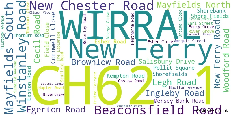
The largest settlements in the CH62 1 postal code are WIRRAL and New Ferry.
The CH62 1 Postcode shares a border with CH42 1 (BIRKENHEAD), CH62 4 (WIRRAL, Bromborough Pool, Port Sunlight) and CH62 5 (WIRRAL, New Ferry, Port Sunlight).
The sector is within the post town of WIRRAL.
CH62 1 is a postcode sector within the CH6 postcode district which is within the CH Chester postcode area.
The Royal Mail delivery office for the CH62 1 postal sector is the unknown.
The area of the CH62 1 postcode sector is 0.29 square miles which is 0.74 square kilometres or 183.70 square acres.

Map of the CH62 1 Postcode Sector
Explore the CH62 1 postcode sector by using our free interactive map.
| C | H | 6 | 2 | - | 1 | X | X |
| C | H | 6 | 2 | Space | 1 | Letter | Letter |
Official List of Streets
WIRRAL (45 Streets)
New Ferry (2 Streets)
Unofficial Streets or Alternative Spellings
WIRRAL
GROVE STREET SEFTON ROAD WILLOWBANK ROAD APSLEY ROAD CORNWALL CLOSE ELMBANK ROAD NEW FERRY BY-PASS ROCK FERRY BY-PASS THORBURN CRESCENTHooton
NEW CHESTER ROADNew Ferry
STANLEY ROADBIRKENHEAD
THE DELLBebington
BEBINGTON ROAD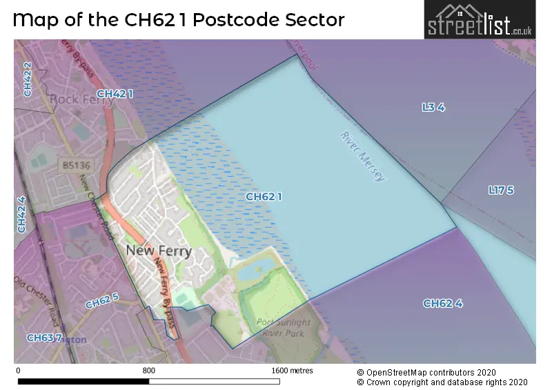
House Prices in the CH62 1 Postcode Sector
| Type of Property | 2018 Average | 2018 Sales | 2017 Average | 2017 Sales | 2016 Average | 2016 Sales | 2015 Average | 2015 Sales |
|---|---|---|---|---|---|---|---|---|
| Detached | £189,995 | 1 | £113,000 | 1 | £143,667 | 3 | £114,500 | 2 |
| Semi-Detached | £126,347 | 18 | £121,805 | 21 | £101,182 | 19 | £118,371 | 7 |
| Terraced | £77,942 | 43 | £81,830 | 33 | £83,799 | 36 | £79,176 | 33 |
| Flats | £82,500 | 4 | £92,750 | 2 | £57,167 | 3 | £0 | 0 |
| The CH62 1 Sector is within these Local Authorities |
|
|---|---|
| The CH62 1 Sector is within these Counties |
|
| The CH62 1 Sector is within these Water Company Areas |
|