The CH62 5 postcode sector is within the county of Merseyside.
Did you know? According to the 2021 Census, the CH62 5 postcode sector is home to a bustling 2,560 residents!
Given that each sector allows for 400 unique postcode combinations. Letters C, I, K, M, O and V are not allowed in the last two letters of a postcode. With 82 postcodes already in use, this leaves 318 units available.
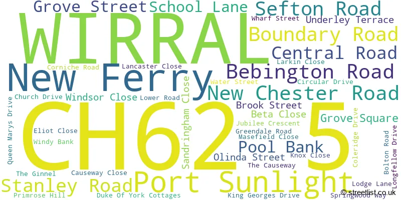
The largest settlement in the CH62 5 postal code is WIRRAL followed by New Ferry, and Port Sunlight.
The CH62 5 Postcode shares a border with CH42 1 (BIRKENHEAD), CH62 4 (WIRRAL, Bromborough Pool, Port Sunlight), CH42 4 (BIRKENHEAD), CH62 1 (WIRRAL, New Ferry) and CH63 7 (WIRRAL, Bebington).
The sector is within the post town of WIRRAL.
CH62 5 is a postcode sector within the CH6 postcode district which is within the CH Chester postcode area.
The Royal Mail delivery office for the CH62 5 postal sector is the Flint Delivery Office.
The area of the CH62 5 postcode sector is 0.27 square miles which is 0.71 square kilometres or 175.24 square acres.

Map of the CH62 5 Postcode Sector
Explore the CH62 5 postcode sector by using our free interactive map.
| C | H | 6 | 2 | - | 5 | X | X |
| C | H | 6 | 2 | Space | 5 | Letter | Letter |
Official List of Streets
New Ferry (5 Streets)
Port Sunlight (5 Streets)
WIRRAL (34 Streets)
Unofficial Streets or Alternative Spellings
WIRRAL
BEACONSFIELD ROAD EARL STREET EGERTON ROAD ESHER ROAD THORBURN CLOSE WINSTANLEY ROADHooton
NEW CHESTER ROADPort Sunlight
BRIDGE STREET CROSS STREETNew Ferry
LEGH ROADBebington
BEBINGTON ROAD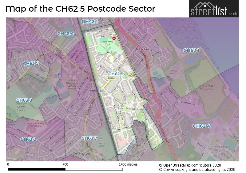
House Prices in the CH62 5 Postcode Sector
| Type of Property | 2018 Average | 2018 Sales | 2017 Average | 2017 Sales | 2016 Average | 2016 Sales | 2015 Average | 2015 Sales |
|---|---|---|---|---|---|---|---|---|
| Detached | £146,050 | 4 | £141,625 | 4 | £0 | 0 | £258,300 | 3 |
| Semi-Detached | £108,199 | 5 | £142,083 | 6 | £131,666 | 9 | £170,800 | 5 |
| Terraced | £163,914 | 24 | £134,304 | 26 | £144,153 | 16 | £149,458 | 26 |
| Flats | £108,009 | 11 | £154,714 | 7 | £148,500 | 9 | £121,611 | 9 |
Important Postcodes CH62 5 in the Postcode Sector
CH62 5BA is the postcode for Metropolitan Borough of Wirral, Grove Street Community Primary School, Grove Street
CH62 5EF is the postcode for Church Drive Primary School, Church Drive
CH62 5EQ is the postcode for Lady Lever Art Gallery, Lower Road
CH62 5HS is the postcode for Parkfield Medical Centre, Sefton Road
| The CH62 5 Sector is within these Local Authorities |
|
|---|---|
| The CH62 5 Sector is within these Counties |
|
| The CH62 5 Sector is within these Water Company Areas |
|
Tourist Attractions within the CH62 5 Postcode Area
We found 2 visitor attractions within the CH6 postcode area
| Lady Lever Art Gallery |
|---|
| Museums & Art Galleries |
| Museum and / or Art Gallery |
| View Lady Lever Art Gallery on Google Maps |
| Port Sunlight Museum & Garden Village |
| Museums & Art Galleries |
| Museum and / or Art Gallery |
| View Port Sunlight Museum & Garden Village on Google Maps |