The CH62 7 postcode sector is within the county of Merseyside.
Did you know? According to the 2021 Census, the CH62 7 postcode sector is home to a bustling 3,676 residents!
Given that each sector allows for 400 unique postcode combinations. Letters C, I, K, M, O and V are not allowed in the last two letters of a postcode. With 118 postcodes already in use, this leaves 282 units available.
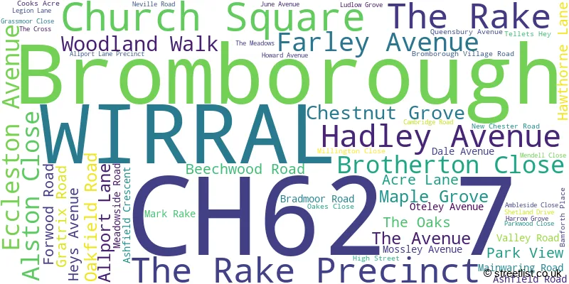
The largest settlements in the CH62 7 postal code are WIRRAL and Bromborough.
The CH62 7 Postcode shares a border with CH62 2 (WIRRAL, Bromborough), CH62 3 (WIRRAL, Bromborough, Old Hall Industrial Estate), CH62 6 (WIRRAL, Bromborough), CH63 0 (WIRRAL, Bromborough, Raby Mere) and CH63 9 (WIRRAL, Bebington).
The sector is within the post town of WIRRAL.
CH62 7 is a postcode sector within the CH6 postcode district which is within the CH Chester postcode area.
The Royal Mail delivery office for the CH62 7 postal sector is the unknown.
The area of the CH62 7 postcode sector is 0.33 square miles which is 0.85 square kilometres or 211.17 square acres.

Map of the CH62 7 Postcode Sector
Explore the CH62 7 postcode sector by using our free interactive map.
| C | H | 6 | 2 | - | 7 | X | X |
| C | H | 6 | 2 | Space | 7 | Letter | Letter |
Official List of Streets
Bromborough (24 Streets)
WIRRAL (35 Streets)
Unofficial Streets or Alternative Spellings
WIRRAL
ATHELSTAN CLOSE GLYN AVENUEBromborough
DAWPOOL DRIVE TEBAY ROADHooton
NEW CHESTER ROADEastham
GREEN LANEOld Hall Industrial Estate
WRYNOSE ROAD CHURCH LANE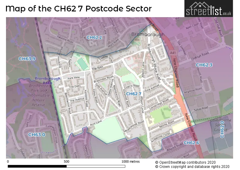
House Prices in the CH62 7 Postcode Sector
| Type of Property | 2018 Average | 2018 Sales | 2017 Average | 2017 Sales | 2016 Average | 2016 Sales | 2015 Average | 2015 Sales |
|---|---|---|---|---|---|---|---|---|
| Detached | £253,250 | 8 | £188,563 | 8 | £250,125 | 4 | £244,828 | 9 |
| Semi-Detached | £161,181 | 27 | £149,717 | 27 | £148,394 | 27 | £138,523 | 19 |
| Terraced | £122,318 | 14 | £123,866 | 19 | £119,159 | 22 | £113,827 | 23 |
| Flats | £108,333 | 3 | £86,708 | 6 | £90,167 | 3 | £96,688 | 4 |
Important Postcodes CH62 7 in the Postcode Sector
CH62 7HN is the postcode for Mendell Primary School, Allport Lane
CH62 7HR is the postcode for Metropolitan Borough of Wirral, Bromborough Library, Allport Lane Precinct
CH62 7JG is the postcode for Merseyside Police, Bromborough Village Road
| The CH62 7 Sector is within these Local Authorities |
|
|---|---|
| The CH62 7 Sector is within these Counties |
|
| The CH62 7 Sector is within these Water Company Areas |
|