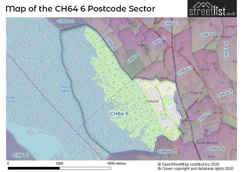
The CH64 6 postcode sector stands on the Cheshire and Merseyside border.
Did you know? According to the 2021 Census, the CH64 6 postcode sector is home to a bustling 2,947 residents!
Given that each sector allows for 400 unique postcode combinations. Letters C, I, K, M, O and V are not allowed in the last two letters of a postcode. With 95 postcodes already in use, this leaves 305 units available.
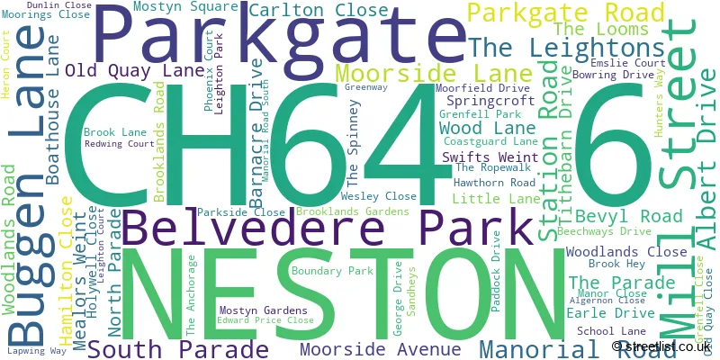
The largest settlements in the CH64 6 postal code are Parkgate and NESTON.
The CH64 6 Postcode shares a border with CH60 8 (WIRRAL, Heswall), CH64 9 (NESTON, Little Neston), CH64 0 (NESTON, Little Neston, Burton) and CH64 3 (NESTON, Clayhill Light Industrial Park, Parkgate).
The sector is within the post town of NESTON.
CH64 6 is a postcode sector within the CH6 postcode district which is within the CH Chester postcode area.
The Royal Mail delivery office for the CH64 6 postal sector is the Flint Delivery Office.
The area of the CH64 6 postcode sector is 2.86 square miles which is 7.40 square kilometres or 1,828.53 square acres.

Map of the CH64 6 Postcode Sector
Explore the CH64 6 postcode sector by using our free interactive map.
| C | H | 6 | 4 | - | 6 | X | X |
| C | H | 6 | 4 | Space | 6 | Letter | Letter |
Official List of Streets
NESTON (9 Streets)
Parkgate (60 Streets)
Unofficial Streets or Alternative Spellings
House Prices in the CH64 6 Postcode Sector
| Type of Property | 2018 Average | 2018 Sales | 2017 Average | 2017 Sales | 2016 Average | 2016 Sales | 2015 Average | 2015 Sales |
|---|---|---|---|---|---|---|---|---|
| Detached | £437,696 | 46 | £369,558 | 41 | £389,919 | 26 | £357,914 | 40 |
| Semi-Detached | £222,180 | 11 | £216,935 | 13 | £218,882 | 17 | £276,692 | 19 |
| Terraced | £263,344 | 11 | £205,600 | 5 | £190,744 | 8 | £277,900 | 6 |
| Flats | £192,857 | 7 | £220,417 | 6 | £147,278 | 9 | £251,708 | 42 |
Important Postcodes CH64 6 in the Postcode Sector
CH64 6QE is the postcode for Cheshire West and Chester Council, Neston Library, Parkgate Road
CH64 6SW is the postcode for Parkgate Cp School, Brooklands Road, Parkgate Pre School, Brooklands Road, Parkgate, and Parkgate Cp School, Brooklands Road, Parkgate
| The CH64 6 Sector is within these Local Authorities |
|
|---|---|
| The CH64 6 Sector is within these Counties |
|
| The CH64 6 Sector is within these Water Company Areas |
|