The CH64 7 postcode sector stands on the Cheshire and Merseyside border.
Did you know? According to the 2021 Census, the CH64 7 postcode sector is home to a bustling 408 residents!
Given that each sector allows for 400 unique postcode combinations. Letters C, I, K, M, O and V are not allowed in the last two letters of a postcode. With 25 postcodes already in use, this leaves 375 units available.
The CH64 7 postal code covers the settlement of NESTON.
The CH64 7 Postcode shares a border with CH64 9 (NESTON, Little Neston), CH63 1 (WIRRAL, Thornton Hough), CH63 4 (WIRRAL, Thornton Hough), CH64 3 (NESTON, Clayhill Light Industrial Park, Parkgate), CH64 1 (Willaston), CH64 2 (Willaston), CH64 4 (Little Neston, Ness) and CH64 8 (Burton, Ness).
The sector is within the post town of NESTON.
CH64 7 is a postcode sector within the CH6 postcode district which is within the CH Chester postcode area.
The Royal Mail delivery office for the CH64 7 postal sector is the unknown.
The area of the CH64 7 postcode sector is 1.39 square miles which is 3.59 square kilometres or 887.37 square acres.

Map of the CH64 7 Postcode Sector
Explore the CH64 7 postcode sector by using our free interactive map.
| C | H | 6 | 4 | - | 7 | X | X |
| C | H | 6 | 4 | Space | 7 | Letter | Letter |
Official List of Streets
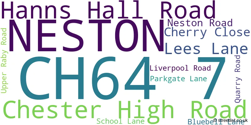
NESTON (11 Streets)
Unofficial Streets or Alternative Spellings
Willaston
HANNS HALL ROADNESTON
HINDERTON ROAD RABY PARK ROADNESTON,
UPPER RABY ROADLittle Neston
LEES LANEBurton
CHESTER HIGH ROADThornton Hough
NESTON ROAD ASHFIELD LANE BURTON LANE COMMON LANE CUCKOO LANE DIRTY LANE DOLLY WELLS LANE PADMANS WAY RABY LANE RAKE END LANE WIRRAL WAY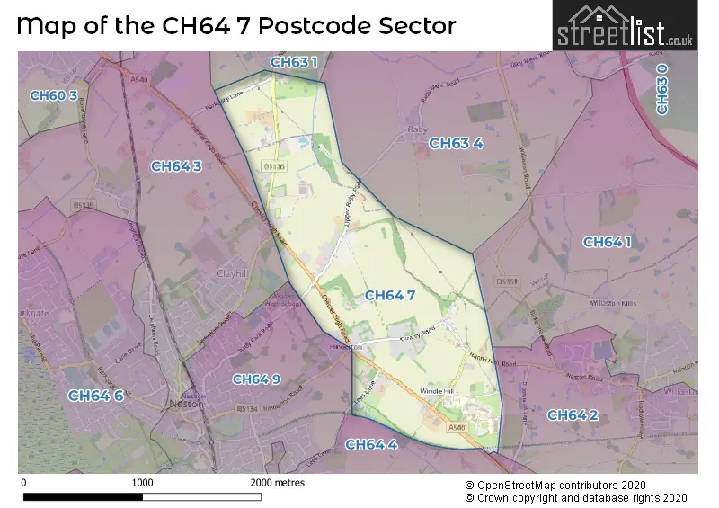
House Prices in the CH64 7 Postcode Sector
| Type of Property | 2018 Average | 2018 Sales | 2017 Average | 2017 Sales | 2016 Average | 2016 Sales | 2015 Average | 2015 Sales |
|---|---|---|---|---|---|---|---|---|
| Detached | £590,833 | 6 | £527,833 | 3 | £523,333 | 3 | £548,500 | 2 |
| Semi-Detached | £406,500 | 2 | £340,000 | 2 | £486,875 | 2 | £510,000 | 1 |
| Terraced | £425,000 | 2 | £385,000 | 1 | £0 | 0 | £0 | 0 |
| Flats | £0 | 0 | £0 | 0 | £0 | 0 | £0 | 0 |
Important Postcodes CH64 7 in the Postcode Sector
CH64 7TE is the postcode for BUILDING NO. 690 LEAHURST HOUSE, University of Liverpool, Veterinary Field Station Leahurst, Chester High Road, BUILDING NO. 902 HENRY EDWARDS LEARING CENTRE, University of Liverpool, Veterinary Field Station Leahurst, Chester High Road, SMALL ANIMAL TEACHING HOSPITAL, University of Liverpool, Veterinary Field Station Leahurst, Chester High Road, BUILDING NO. 693 LEAHURST NATIONAL ZOONOSIS CENTRE, University of Liverpool, Veterinary Field Station Leahurst, Chester High Road, BARRIE EDWARDS BUILDING, University of Liverpool, Veterinary Field Station Leahurst, Chester High Road, LEAHURST LARGE ANIMAL HOSPITAL AND DIAGNOSTIC UNIT, Leahurst Large Animal Hospital, University of Liverpool, BUILDING 912 Leahurst BIU Building, University of Liverpool, BUILDING NO. 901, University of Liverpool, Veterinary Field Station Leahurst, Chester High Road, Leahurst BIU Building, University of Liverpool, 912b Chester High Road, BUILDING NO 692 RITCHIE HOUSE, University of Liverpool, Veterinary Field Station Leahurst, Chester High Road, and Leahurst BIU Building, University of Liverpool
| The CH64 7 Sector is within these Local Authorities |
|
|---|---|
| The CH64 7 Sector is within these Counties |
|
| The CH64 7 Sector is within these Water Company Areas |
|