The CH65 0 postcode sector is within the county of Cheshire.
Did you know? According to the 2021 Census, the CH65 0 postcode sector is home to a bustling 1,002 residents!
Given that each sector allows for 400 unique postcode combinations. Letters C, I, K, M, O and V are not allowed in the last two letters of a postcode. With 54 postcodes already in use, this leaves 346 units available.
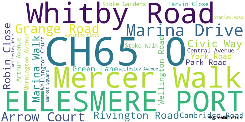
The CH65 0 postal code covers the settlement of ELLESMERE PORT.
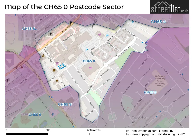
The CH65 0 Postcode shares a border with CH65 5 (ELLESMERE PORT), CH65 6 (Whitby, ELLESMERE PORT), CH65 4 (ELLESMERE PORT), CH65 8 (ELLESMERE PORT) and CH65 9 (ELLESMERE PORT, Whitby).
The sector is within the post town of ELLESMERE PORT.
CH65 0 is a postcode sector within the CH6 postcode district which is within the CH Chester postcode area.
The Royal Mail delivery office for the CH65 0 postal sector is the unknown.
The area of the CH65 0 postcode sector is 0.13 square miles which is 0.34 square kilometres or 84.37 square acres.

Map of the CH65 0 Postcode Sector
Explore the CH65 0 postcode sector by using our free interactive map.
| C | H | 6 | 5 | - | 0 | X | X |
| C | H | 6 | 5 | Space | 0 | Letter | Letter |
Official List of Streets
ELLESMERE PORT (24 Streets)
Unofficial Streets or Alternative Spellings
House Prices in the CH65 0 Postcode Sector
| Type of Property | 2018 Average | 2018 Sales | 2017 Average | 2017 Sales | 2016 Average | 2016 Sales | 2015 Average | 2015 Sales |
|---|---|---|---|---|---|---|---|---|
| Detached | £0 | 0 | £0 | 0 | £0 | 0 | £0 | 0 |
| Semi-Detached | £197,500 | 1 | £107,750 | 4 | £94,500 | 2 | £97,750 | 4 |
| Terraced | £85,375 | 4 | £0 | 0 | £82,000 | 2 | £104,000 | 1 |
| Flats | £0 | 0 | £0 | 0 | £0 | 0 | £0 | 0 |
Important Postcodes CH65 0 in the Postcode Sector
CH65 0AP is the postcode for Unit 1-3, Mercer Walk
CH65 0AZ is the postcode for CIVIC HALL, CIVIC WAY, Cheshire West & Chester Borough Council, Civic Hall, and Ellesmere Port & Neston Borough Council, Civic Hall, Civic Way
CH65 0BA is the postcode for The Portal, Wellington Road
CH65 0BE is the postcode for Cheshire West and Chester Council, Council Offices, and Cheshire West and Chester Council, Council Offices, 4 Civic Way
CH65 0BG is the postcode for ELLESMERE PORT LIBRARY, CIVIC WAY, ELLESMERE PORT, Cheshire West and Chester Borough Council, Ellesmere Port Library, Civic Way, Cheshire West and Chester Borough Council, Ellesmere Port Library, and Cheshire County Council, Ellesmere Port Library, Civic Way
CH65 0BY is the postcode for CHERRYBANK HOUSE, 85, Wellington Road
CH65 0BZ is the postcode for Ellesmere Port Market, Wellington Road
CH65 0DB is the postcode for Unity House, York Road
CH65 0DW is the postcode for Stoke Lodge, Stoke Gardens
CH65 0EZ is the postcode for Fire Station, Wellington Road
| The CH65 0 Sector is within these Local Authorities |
|
|---|---|
| The CH65 0 Sector is within these Counties |
|
| The CH65 0 Sector is within these Water Company Areas |
|