The CH65 4 postcode sector is within the county of Cheshire.
Did you know? According to the 2021 Census, the CH65 4 postcode sector is home to a bustling 2,192 residents!
Given that each sector allows for 400 unique postcode combinations. Letters C, I, K, M, O and V are not allowed in the last two letters of a postcode. With 85 postcodes already in use, this leaves 315 units available.
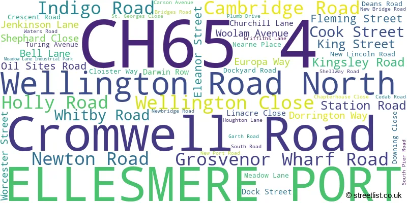
The CH65 4 postal code covers the settlement of ELLESMERE PORT.
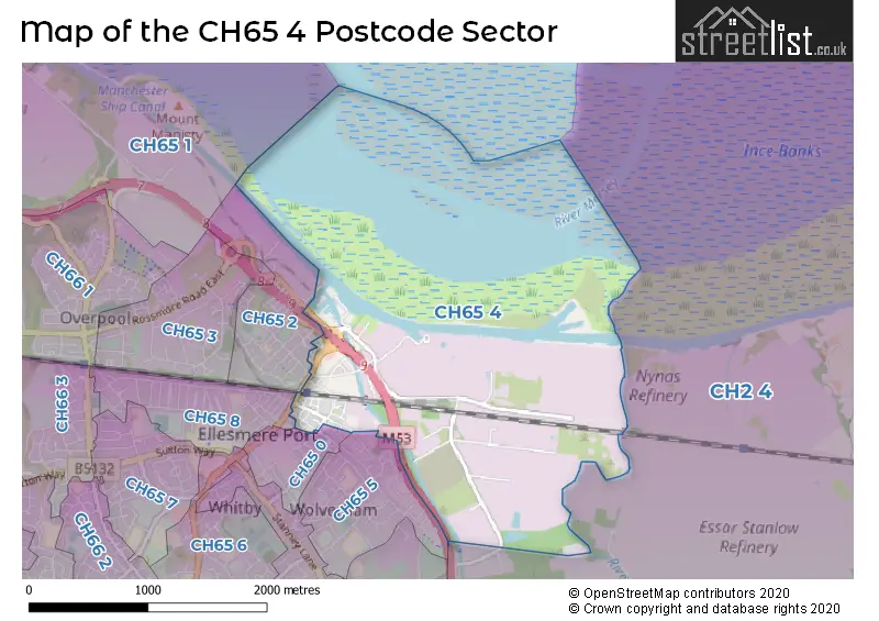
The CH65 4 Postcode shares a border with CH2 4 (Elton, Mickle Trafford, Ince), CH65 5 (ELLESMERE PORT), CH65 0 (ELLESMERE PORT), CH65 2 (ELLESMERE PORT), CH65 8 (ELLESMERE PORT) and CH65 1 (ELLESMERE PORT, Hooton).
The sector is within the post town of ELLESMERE PORT.
CH65 4 is a postcode sector within the CH6 postcode district which is within the CH Chester postcode area.
The Royal Mail delivery office for the CH65 4 postal sector is the unknown.
The area of the CH65 4 postcode sector is 2.10 square miles which is 5.43 square kilometres or 1,342.19 square acres.
The CH65 4 postcode sector is crossed by the M53 motorway.
Waterways within the CH65 4 postcode sector include the River Gowy, Shropshire Union Canal, Manchester Ship Canal.

Map of the CH65 4 Postcode Sector
Explore the CH65 4 postcode sector by using our free interactive map.
| C | H | 6 | 5 | - | 4 | X | X |
| C | H | 6 | 5 | Space | 4 | Letter | Letter |
Official List of Streets
ELLESMERE PORT (52 Streets)
Unofficial Streets or Alternative Spellings
ELLESMERE PORT
EXETER ROAD LOWER MERSEY STREET MERSEYTON ROAD PRINCES ROAD WELLINGTON ROAD WESTMINSTER ROAD WORCESTER WALKLittle Stanney
NEWBRIDGE ROADWhitby
WHITBY ROADSchools and Places of Education Within the CH65 4 Postcode Sector
Cambridge Road Community Primary and Nursery School
Community school
Cambridge Road, Ellesmere Port, Cheshire, CH65 4AQ
Head: Mr Darryl Pickering
Ofsted Rating: Good
Inspection: 2023-10-11 (232 days ago)
Website: Visit Cambridge Road Community Primary and Nursery School Website
Phone: 01513551735
Number of Pupils: 249
House Prices in the CH65 4 Postcode Sector
| Type of Property | 2018 Average | 2018 Sales | 2017 Average | 2017 Sales | 2016 Average | 2016 Sales | 2015 Average | 2015 Sales |
|---|---|---|---|---|---|---|---|---|
| Detached | £196,724 | 26 | £185,245 | 4 | £0 | 0 | £0 | 0 |
| Semi-Detached | £164,613 | 55 | £130,997 | 7 | £71,750 | 1 | £0 | 0 |
| Terraced | £119,053 | 18 | £79,095 | 23 | £70,500 | 7 | £68,773 | 11 |
| Flats | £93,800 | 5 | £112,500 | 5 | £96,100 | 5 | £88,557 | 7 |
Important Postcodes CH65 4 in the Postcode Sector
CH65 4AQ is the postcode for Cambridge Road Cp School, Cambridge Road, Cambridge Road Community Primary And Nursery School, Cambridge Road, and CAMBRIDGE ROAD COMMUNITY PRIMARY AND NURSERY SCHOOL, CAMBRIDGE ROAD, ELLESMERE PORT
| The CH65 4 Sector is within these Local Authorities |
|
|---|---|
| The CH65 4 Sector is within these Counties |
|
| The CH65 4 Sector is within these Water Company Areas |
|