The CH65 9 postcode sector is within the county of Cheshire.
Did you know? According to the 2021 Census, the CH65 9 postcode sector is home to a bustling 5,601 residents!
Given that each sector allows for 400 unique postcode combinations. Letters C, I, K, M, O and V are not allowed in the last two letters of a postcode. With 134 postcodes already in use, this leaves 266 units available.
The largest settlements in the CH65 9 postal code are ELLESMERE PORT and Whitby.
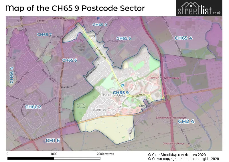
The CH65 9 Postcode shares a border with CH1 6 (Saughall, Mollington, Backford), CH2 4 (Elton, Mickle Trafford, Ince), CH65 5 (ELLESMERE PORT), CH65 0 (ELLESMERE PORT), CH65 6 (Whitby, ELLESMERE PORT) and CH66 2 (Great Sutton, Whitby).
The sector is within the post town of ELLESMERE PORT.
CH65 9 is a postcode sector within the CH6 postcode district which is within the CH Chester postcode area.
The Royal Mail delivery office for the CH65 9 postal sector is the unknown.
The area of the CH65 9 postcode sector is 1.06 square miles which is 2.74 square kilometres or 677.35 square acres.
The CH65 9 postcode sector is crossed by the M53 motorway.

Map of the CH65 9 Postcode Sector
Explore the CH65 9 postcode sector by using our free interactive map.
| C | H | 6 | 5 | - | 9 | X | X |
| C | H | 6 | 5 | Space | 9 | Letter | Letter |
Official List of Streets
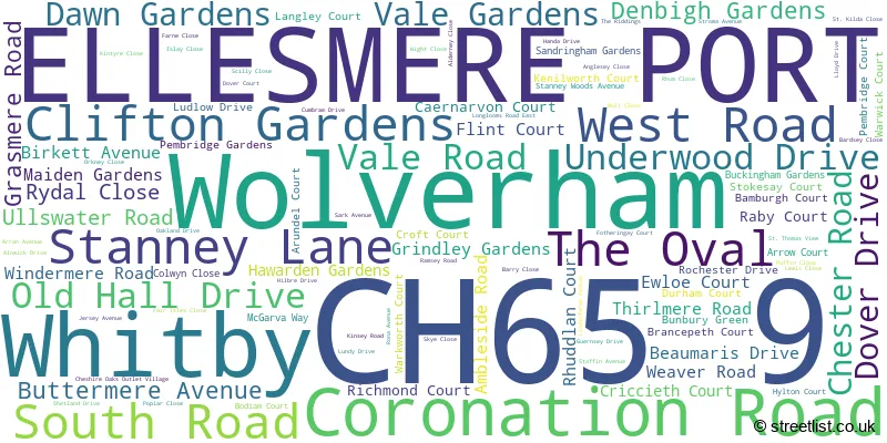
ELLESMERE PORT (90 Streets)
Whitby (8 Streets)
Wolverham (1 Streets)
Unofficial Streets or Alternative Spellings
ELLESMERE PORT
AVONDALE DOUNE COURT MALVERN AVENUE RUGBY ROAD RUTHIN COURT SHERBOURNE ROAD THORNTON ROAD WELLINGTON ROAD WOLVERHAM ROADWhitby
PARK DRIVE PEMBROKE DRIVE THAMESDALEChorlton-by-Backford
RAKE LANELittle Stanney
STANNEY LANEBackford
STRAWBERRY WAY EASTSchools and Places of Education Within the CH65 9 Postcode Sector
The Oaks Community Primary School
Community school
Rochester Drive, Ellesmere Port, Cheshire, CH65 9EX
Head: Ms Nicola Dowling
Ofsted Rating: Good
Inspection: 2019-02-07 (1939 days ago)
Website: Visit The Oaks Community Primary School Website
Phone: 01513055940
Number of Pupils: 171
House Prices in the CH65 9 Postcode Sector
| Type of Property | 2018 Average | 2018 Sales | 2017 Average | 2017 Sales | 2016 Average | 2016 Sales | 2015 Average | 2015 Sales |
|---|---|---|---|---|---|---|---|---|
| Detached | £253,832 | 22 | £239,190 | 21 | £229,300 | 25 | £215,918 | 19 |
| Semi-Detached | £153,231 | 27 | £157,112 | 35 | £139,780 | 23 | £135,207 | 27 |
| Terraced | £109,333 | 15 | £107,659 | 17 | £103,853 | 17 | £99,692 | 13 |
| Flats | £62,000 | 5 | £75,500 | 4 | £58,780 | 5 | £59,700 | 5 |
Important Postcodes CH65 9 in the Postcode Sector
CH65 9AA is the postcode for Social Services, Coronation Road
CH65 9AD is the postcode for Old Hall Surgery, 24-26 Stanney Lane
CH65 9AE is the postcode for Stanney Lane Clinic, Ellesmere Port Clinic, Stanney Lane
CH65 9AF is the postcode for Whitby Hall, Stanney Lane
CH65 9DB is the postcode for Cheshire Oaks High School, Stanney Lane
CH65 9EP is the postcode for 18-22, Dover Drive
CH65 9ER is the postcode for Ellesmere Port Police Station, 4 Stanney Lane
CH65 9EX is the postcode for THE OAKS COMMUNITY PRIMARY SCHOOL, ROCHESTER DRIVE, ELLESMERE PORT, The Oaks Cp School, Rochester Drive, and The Oaks Community Primary School, Rochester Drive
CH65 9HE is the postcode for STANLAW ABBEY CHILDRENS CENTRE, ALNWICK DRIVE, ELLESMERE PORT, Stanney Grange Community Centre, Alnwick Drive, and Stanlaw Abbey Childrens Centre, Alnwick Drive
CH65 9HH is the postcode for Epic Leisure Centre, McGarva Way
CH65 9LB is the postcode for ELLESMERE PORT SPORTS VILLAGE, STANNEY LANE, ELLESMERE PORT, and Ellesmere Port Sports Village, Stanney Lane
| The CH65 9 Sector is within these Local Authorities |
|
|---|---|
| The CH65 9 Sector is within these Counties |
|
| The CH65 9 Sector is within these Water Company Areas |
|