The DE73 7 postcode sector is within the county of Derbyshire.
Did you know? According to the 2021 Census, the DE73 7 postcode sector is home to a bustling 1,921 residents!
Given that each sector allows for 400 unique postcode combinations. Letters C, I, K, M, O and V are not allowed in the last two letters of a postcode. With 81 postcodes already in use, this leaves 319 units available.
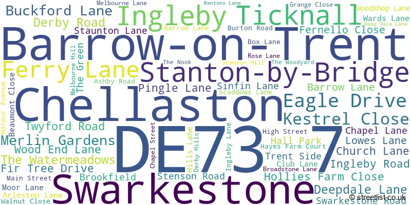
The largest settlement in the DE73 7 postal code is Ticknall followed by Barrow-on-Trent, and Stanton-by-Bridge.
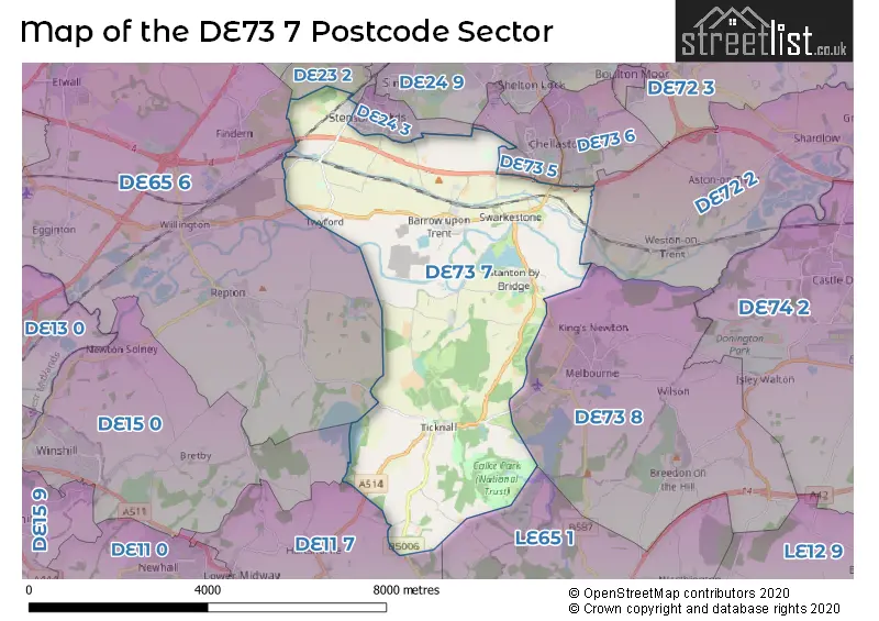
The DE73 7 Postcode shares a border with DE11 7 (Woodville, Hartshorne, Midway), DE15 0 (BURTON-ON-TRENT, Bretby, Newton Solney), DE23 1 (Littleover, DERBY, Sunnyhill), DE65 6 (Willington, Etwall, Repton), DE72 2 (Shardlow, Aston-on-Trent, Weston-on-Trent), DE23 2 (Littleover), DE24 3 (Stenson Fields, Sinfin, DERBY), DE73 5 (Chellaston), DE73 6 (Chellaston), DE73 8 (Melbourne, Breedon-on-the-Hill) and LE65 1 (ASHBY-DE-LA-ZOUCH, Packington, Worthington).
The sector is within the post town of DERBY.
DE73 7 is a postcode sector within the DE73 postcode district which is within the DE Derby postcode area.
The Royal Mail delivery office for the DE73 7 postal sector is the unknown.
The area of the DE73 7 postcode sector is 15.04 square miles which is 38.96 square kilometres or 9,627.52 square acres.
The DE73 7 postcode sector is crossed by the A50 Major A road.
Waterways within the DE73 7 postcode sector include the River Trent, Trent & Mersey Canal.

Map of the DE73 7 Postcode Sector
Explore the DE73 7 postcode sector by using our free interactive map.
| D | E | 7 | 3 | - | 7 | X | X |
| D | E | 7 | 3 | Space | 7 | Letter | Letter |
Official List of Streets
Barrow-on-Trent (20 Streets)
Ticknall (23 Streets)
Swarkestone (9 Streets)
Stanton-by-Bridge (7 Streets)
Unofficial Streets or Alternative Spellings
Melbourne
BREACH LANE THE COMMONCalke
STAUNTON LANESmisby
DERBY ROADHartshorne
COAL LANEStenson Fields
CHARTLEY ROAD MEREVALE WAYWeather Forecast for DE73 7
Press Button to Show Forecast for Melbourne
| Time Period | Icon | Description | Temperature | Rain Probability | Wind |
|---|---|---|---|---|---|
| 03:00 to 06:00 | Partly cloudy (night) | 2.0°C (feels like 1.0°C) | 1.00% | ENE 4 mph | |
| 06:00 to 09:00 | Partly cloudy (day) | 3.0°C (feels like 2.0°C) | 1.00% | ENE 4 mph | |
| 09:00 to 12:00 | Partly cloudy (day) | 7.0°C (feels like 5.0°C) | 2.00% | ENE 7 mph | |
| 12:00 to 15:00 | Overcast | 9.0°C (feels like 8.0°C) | 9.00% | E 4 mph | |
| 15:00 to 18:00 | Cloudy | 10.0°C (feels like 9.0°C) | 8.00% | ENE 4 mph | |
| 18:00 to 21:00 | Cloudy | 9.0°C (feels like 7.0°C) | 10.00% | ENE 7 mph | |
| 21:00 to 00:00 | Partly cloudy (night) | 6.0°C (feels like 4.0°C) | 7.00% | ENE 7 mph |
Press Button to Show Forecast for Melbourne
| Time Period | Icon | Description | Temperature | Rain Probability | Wind |
|---|---|---|---|---|---|
| 00:00 to 03:00 | Partly cloudy (night) | 4.0°C (feels like 2.0°C) | 8.00% | ENE 7 mph | |
| 03:00 to 06:00 | Cloudy | 4.0°C (feels like 2.0°C) | 13.00% | ENE 7 mph | |
| 06:00 to 09:00 | Cloudy | 5.0°C (feels like 2.0°C) | 12.00% | ENE 7 mph | |
| 09:00 to 12:00 | Overcast | 8.0°C (feels like 5.0°C) | 17.00% | ENE 11 mph | |
| 12:00 to 15:00 | Overcast | 9.0°C (feels like 7.0°C) | 23.00% | ENE 11 mph | |
| 15:00 to 18:00 | Overcast | 10.0°C (feels like 8.0°C) | 23.00% | ENE 11 mph | |
| 18:00 to 21:00 | Cloudy | 10.0°C (feels like 7.0°C) | 20.00% | ENE 11 mph | |
| 21:00 to 00:00 | Cloudy | 8.0°C (feels like 5.0°C) | 18.00% | NE 11 mph |
Press Button to Show Forecast for Melbourne
| Time Period | Icon | Description | Temperature | Rain Probability | Wind |
|---|---|---|---|---|---|
| 00:00 to 03:00 | Light rain | 7.0°C (feels like 4.0°C) | 51.00% | NE 9 mph | |
| 03:00 to 06:00 | Overcast | 7.0°C (feels like 4.0°C) | 25.00% | NE 9 mph | |
| 06:00 to 09:00 | Heavy rain | 7.0°C (feels like 5.0°C) | 72.00% | NE 9 mph | |
| 09:00 to 12:00 | Heavy rain | 9.0°C (feels like 7.0°C) | 77.00% | NNE 9 mph | |
| 12:00 to 15:00 | Heavy rain | 11.0°C (feels like 8.0°C) | 75.00% | ENE 9 mph | |
| 15:00 to 18:00 | Light rain | 11.0°C (feels like 9.0°C) | 54.00% | NE 9 mph | |
| 18:00 to 21:00 | Heavy rain shower (day) | 11.0°C (feels like 9.0°C) | 54.00% | ENE 9 mph | |
| 21:00 to 00:00 | Cloudy | 8.0°C (feels like 7.0°C) | 12.00% | ESE 7 mph |
House Prices in the DE73 7 Postcode Sector
| Type of Property | 2018 Average | 2018 Sales | 2017 Average | 2017 Sales | 2016 Average | 2016 Sales | 2015 Average | 2015 Sales |
|---|---|---|---|---|---|---|---|---|
| Detached | £581,577 | 13 | £396,708 | 19 | £434,045 | 20 | £528,905 | 11 |
| Semi-Detached | £347,600 | 5 | £385,000 | 3 | £230,000 | 3 | £175,600 | 5 |
| Terraced | £192,500 | 1 | £227,500 | 1 | £469,300 | 2 | £341,238 | 4 |
| Flats | £0 | 0 | £128,750 | 2 | £0 | 0 | £103,500 | 2 |
Important Postcodes DE73 7 in the Postcode Sector
DE73 7HA is the postcode for Sale & Davys C of E Controlled Primary School, Twyford Road
| The DE73 7 Sector is within these Local Authorities |
|
|---|---|
| The DE73 7 Sector is within these Counties |
|
| The DE73 7 Sector is within these Water Company Areas |
|
Tourist Attractions within the DE73 7 Postcode Area
We found 1 visitor attractions within the DE73 postcode area
| Calke Abbey |
|---|
| Historic Properties |
| Historic House / House and Garden / Palace |
| View Calke Abbey on Google Maps |