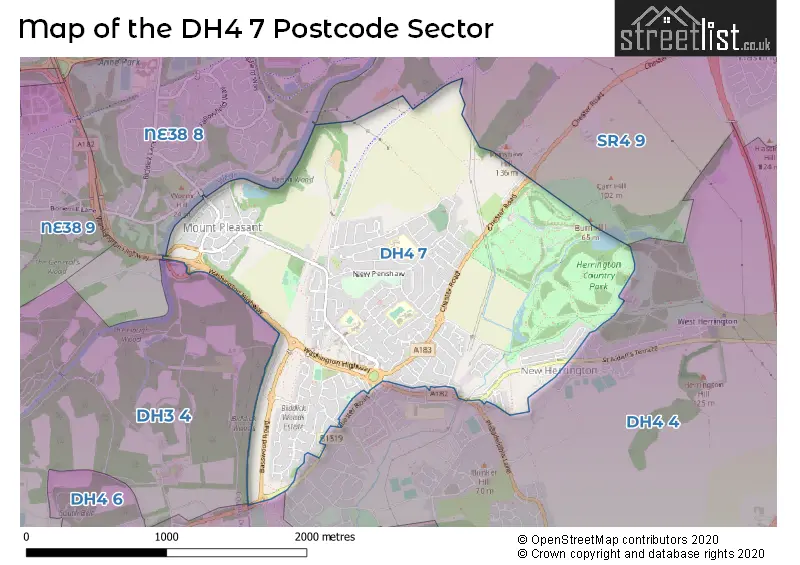
The DH4 7 postcode sector stands on the Durham and Tyne & Wear border.
Did you know? According to the 2021 Census, the DH4 7 postcode sector is home to a bustling 9,383 residents!
Given that each sector allows for 400 unique postcode combinations. Letters C, I, K, M, O and V are not allowed in the last two letters of a postcode. With 215 postcodes already in use, this leaves 185 units available.
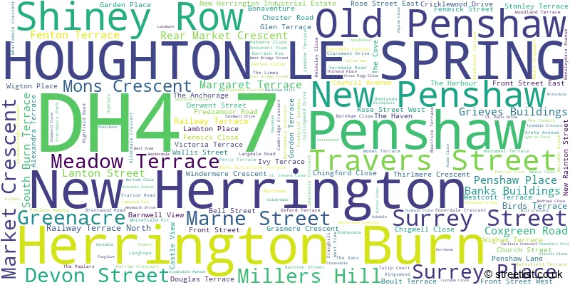
The largest settlement in the DH4 7 postal code is HOUGHTON LE SPRING followed by Penshaw, and Shiney Row.
The DH4 7 Postcode shares a border with DH3 4 (Great Lumley, CHESTER LE STREET, Lambton Park), DH4 6 (HOUGHTON LE SPRING, West Rainton, Fencehouses), NE38 8 (WASHINGTON, Pattinson Industrial Estate), SR4 9 (SUNDERLAND) and DH4 4 (HOUGHTON LE SPRING, Philadelphia, Shiney Row).
The sector is within the post town of HOUGHTON LE SPRING.
DH4 7 is a postcode sector within the DH4 postcode district which is within the DH Durham postcode area.
The Royal Mail delivery office for the DH4 7 postal sector is the Houghton Le Spring Delivery Office.
The area of the DH4 7 postcode sector is 1.94 square miles which is 5.02 square kilometres or 1,240.11 square acres.
Waterways within the DH4 7 postcode sector include the Wear.

Map of the DH4 7 Postcode Sector
Explore the DH4 7 postcode sector by using our free interactive map.
| D | H | 4 | - | 7 | X | X |
| D | H | 4 | Space | 7 | Letter | Letter |
Official List of Streets
Penshaw (29 Streets)
Shiney Row (21 Streets)
HOUGHTON LE SPRING (109 Streets)
Herrington Burn (1 Streets)
Old Penshaw (2 Streets)
New Herrington (6 Streets)
New Penshaw (1 Streets)
Unofficial Streets or Alternative Spellings
HOUGHTON LE SPRING
LADY BEATRICE TERRACE MILL PIT OFFICE ROWShiney Row
MILL TERRACEWeather Forecast for DH4 7
Press Button to Show Forecast for Washington
| Time Period | Icon | Description | Temperature | Rain Probability | Wind |
|---|---|---|---|---|---|
| 00:00 to 03:00 | Overcast | 9.0°C (feels like 8.0°C) | 20.00% | NNW 7 mph | |
| 03:00 to 06:00 | Overcast | 9.0°C (feels like 8.0°C) | 19.00% | NW 4 mph | |
| 06:00 to 09:00 | Overcast | 10.0°C (feels like 9.0°C) | 18.00% | WNW 4 mph | |
| 09:00 to 12:00 | Overcast | 12.0°C (feels like 11.0°C) | 10.00% | SW 4 mph | |
| 12:00 to 15:00 | Overcast | 14.0°C (feels like 14.0°C) | 13.00% | S 4 mph | |
| 15:00 to 18:00 | Cloudy | 16.0°C (feels like 15.0°C) | 14.00% | SSW 7 mph | |
| 18:00 to 21:00 | Cloudy | 15.0°C (feels like 14.0°C) | 10.00% | SSW 7 mph | |
| 21:00 to 00:00 | Cloudy | 12.0°C (feels like 11.0°C) | 7.00% | S 4 mph |
Press Button to Show Forecast for Washington
| Time Period | Icon | Description | Temperature | Rain Probability | Wind |
|---|---|---|---|---|---|
| 00:00 to 03:00 | Partly cloudy (night) | 11.0°C (feels like 10.0°C) | 5.00% | SSW 4 mph | |
| 03:00 to 06:00 | Cloudy | 9.0°C (feels like 8.0°C) | 8.00% | SSW 4 mph | |
| 06:00 to 09:00 | Cloudy | 10.0°C (feels like 9.0°C) | 9.00% | S 7 mph | |
| 09:00 to 12:00 | Cloudy | 14.0°C (feels like 13.0°C) | 8.00% | SSE 7 mph | |
| 12:00 to 15:00 | Partly cloudy (day) | 15.0°C (feels like 14.0°C) | 8.00% | SE 9 mph | |
| 15:00 to 18:00 | Partly cloudy (day) | 15.0°C (feels like 13.0°C) | 7.00% | SE 9 mph | |
| 18:00 to 21:00 | Partly cloudy (day) | 14.0°C (feels like 12.0°C) | 6.00% | SE 9 mph | |
| 21:00 to 00:00 | Cloudy | 11.0°C (feels like 10.0°C) | 10.00% | SE 7 mph |
Schools and Places of Education Within the DH4 7 Postcode Sector
Barnwell Academy
Academy converter
Whitefield Estate, Houghton le Spring, Tyne and Wear, DH4 7RT
Head: Mrs Ashley Emmerson
Ofsted Rating: Outstanding
Inspection: 2023-06-21 (318 days ago)
Website: Visit Barnwell Academy Website
Phone: 01915844440
Number of Pupils: 282
New Penshaw Academy
Academy sponsor led
Langdale Road, Houghton le Spring, Tyne and Wear, DH4 7HY
Head: Mrs Stephanie Johnson
Ofsted Rating: Good
Inspection: 2019-02-13 (1907 days ago)
Website: Visit New Penshaw Academy Website
Phone: 01913854298
Number of Pupils: 150
Our Lady Queen of Peace Catholic Primary School, Penshaw
Academy converter
Station Road, Houghton le Spring, Tyne and Wear, DH4 7JZ
Head: Mrs Claire Garbutt
Ofsted Rating: Requires improvement
Inspection: 2022-05-19 (716 days ago)
Website: Visit Our Lady Queen of Peace Catholic Primary School, Penshaw Website
Phone: 01913854545
Number of Pupils: 342
House Prices in the DH4 7 Postcode Sector
| Type of Property | 2018 Average | 2018 Sales | 2017 Average | 2017 Sales | 2016 Average | 2016 Sales | 2015 Average | 2015 Sales |
|---|---|---|---|---|---|---|---|---|
| Detached | £258,082 | 42 | £243,033 | 30 | £237,787 | 31 | £234,680 | 36 |
| Semi-Detached | £114,748 | 50 | £112,217 | 43 | £106,467 | 39 | £107,086 | 50 |
| Terraced | £77,604 | 28 | £81,066 | 45 | £86,558 | 33 | £70,474 | 44 |
| Flats | £62,188 | 8 | £51,667 | 3 | £42,000 | 2 | £61,888 | 4 |
Important Postcodes DH4 7 in the Postcode Sector
DH4 7HY is the postcode for NEW PENSHAW ACADEMY, LANGDALE ROAD, PENSHAW, and New Penshaw Academy, Langdale Road
DH4 7JZ is the postcode for Our Lady Queen of Peace RC Primary School, Station Road, and Our Lady Queen of Peace RC Primary School, Station Road, Penshaw
DH4 7LB is the postcode for Doric View, Station Road, and Monument View, Penshaw Stables, Penshaw
DH4 7RT is the postcode for The Monument Centre, New Penshaw, and Barnwell Academy, New Penshaw
| The DH4 7 Sector is within these Local Authorities |
|
|---|---|
| The DH4 7 Sector is within these Counties |
|
| The DH4 7 Sector is within these Water Company Areas |
|