The DN38 6 postcode sector is within the county of Lincolnshire.
Did you know? According to the 2021 Census, the DN38 6 postcode sector is home to a bustling 2,885 residents!
Given that each sector allows for 400 unique postcode combinations. Letters C, I, K, M, O and V are not allowed in the last two letters of a postcode. With 103 postcodes already in use, this leaves 297 units available.
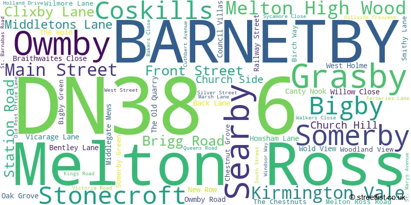
The largest settlement in the DN38 6 postal code is BARNETBY followed by Grasby, and Melton Ross.
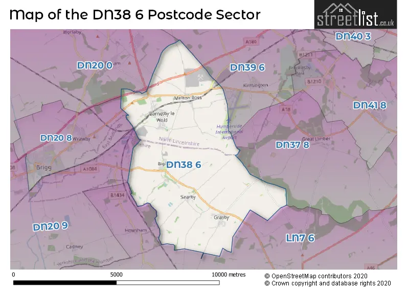
The DN38 6 Postcode shares a border with DN20 9 (Hibaldstow, Scawby, Scawby Brook), DN37 8 (Limber, Riby), DN39 6 (ULCEBY, Wootton, Kirmington), LN7 6 (Caistor, North Kelsey, Nettleton), DN20 0 (Broughton, Worlaby, Bonby) and DN20 8 (BRIGG, Wrawby).
The sector is within the post town of BARNETBY.
DN38 6 is a postcode sector within the DN3 postcode district which is within the DN Doncaster postcode area.
The Royal Mail delivery office for the DN38 6 postal sector is the unknown.
The area of the DN38 6 postcode sector is 17.64 square miles which is 45.69 square kilometres or 11,290.40 square acres.
The DN38 6 postcode sector is crossed by the M180 motorway.
The DN38 6 postcode sector is crossed by the A180 Major A road.

Map of the DN38 6 Postcode Sector
Explore the DN38 6 postcode sector by using our free interactive map.
| D | N | 3 | 8 | - | 6 | X | X |
| D | N | 3 | 8 | Space | 6 | Letter | Letter |
Official List of Streets
BARNETBY (31 Streets)
Searby (5 Streets)
Grasby (14 Streets)
Melton Ross (4 Streets)
Somerby (1 Streets)
Unofficial Streets or Alternative Spellings
North Kelsey Moor
GRASBY ROAD OWMBY LANECaistor
BRIGG ROADBRIGG
BIGBY HIGH ROADElsham Wolds
MIDDLEGATE LANEWrawby
MELTON ROADSchools and Places of Education Within the DN38 6 Postcode Sector
Grasby All Saints Church of England Primary School
Voluntary controlled school
Vicarage Lane, Barnetby, Lincolnshire, DN38 6AU
Head: Mrs Zoe Hyams
Ofsted Rating: Good
Inspection: 2023-06-20 (338 days ago)
Website: Visit Grasby All Saints Church of England Primary School Website
Phone: 01652628343
Number of Pupils: 69
St Barnabas CofE Primary School, Barnetby
Voluntary controlled school
St Barnabas Road, Barnetby, Lincolnshire, DN38 6JD
Head: Mr Marc Grinhaff
Ofsted Rating: Requires improvement
Inspection: 2023-05-05 (384 days ago)
Website: Visit St Barnabas CofE Primary School, Barnetby Website
Phone: 01652688248
Number of Pupils: 158
House Prices in the DN38 6 Postcode Sector
| Type of Property | 2018 Average | 2018 Sales | 2017 Average | 2017 Sales | 2016 Average | 2016 Sales | 2015 Average | 2015 Sales |
|---|---|---|---|---|---|---|---|---|
| Detached | £264,775 | 18 | £236,454 | 34 | £272,052 | 28 | £226,105 | 19 |
| Semi-Detached | £140,073 | 13 | £140,808 | 13 | £116,606 | 9 | £125,385 | 13 |
| Terraced | £80,062 | 8 | £116,500 | 4 | £84,650 | 10 | £91,840 | 5 |
| Flats | £0 | 0 | £0 | 0 | £0 | 0 | £0 | 0 |
Important Postcodes DN38 6 in the Postcode Sector
DN38 6AU is the postcode for Grasby All Saints C of E Primary School, Vicarage Lane
DN38 6JD is the postcode for St. Barnabas C of E Primary School, St. Barnabas Road
| The DN38 6 Sector is within these Local Authorities |
|
|---|---|
| The DN38 6 Sector is within these Counties |
|
| The DN38 6 Sector is within these Water Company Areas |
|