The DN39 6 postcode sector is within the county of Lincolnshire.
Did you know? According to the 2021 Census, the DN39 6 postcode sector is home to a bustling 2,891 residents!
Given that each sector allows for 400 unique postcode combinations. Letters C, I, K, M, O and V are not allowed in the last two letters of a postcode. With 108 postcodes already in use, this leaves 292 units available.
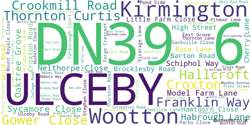
The largest settlement in the DN39 6 postal code is ULCEBY followed by Wootton, and Kirmington.
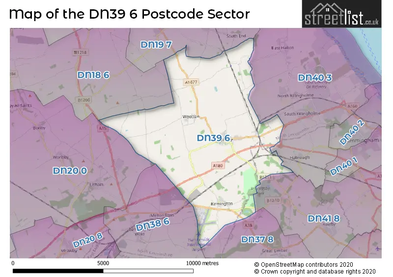
The DN39 6 Postcode shares a border with DN18 6 (BARTON-UPON-HUMBER, South Ferriby, Horkstow), DN19 7 (BARROW-UPON-HUMBER, Goxhill, New Holland), DN37 8 (Limber, Riby), DN38 6 (BARNETBY, Grasby, Melton Ross), DN40 3 (South Killingholme, North Killingholme, East Halton), DN41 8 (Stallingborough, Keelby, Brocklesby) and DN20 0 (Broughton, Worlaby, Bonby).
The sector is within the post town of ULCEBY.
DN39 6 is a postcode sector within the DN3 postcode district which is within the DN Doncaster postcode area.
The Royal Mail delivery office for the DN39 6 postal sector is the unknown.
The area of the DN39 6 postcode sector is 21.51 square miles which is 55.72 square kilometres or 13,768.16 square acres.
The DN39 6 postcode sector is crossed by the A160 Major A road.
The DN39 6 postcode sector is crossed by the A180 Major A road.

Map of the DN39 6 Postcode Sector
Explore the DN39 6 postcode sector by using our free interactive map.
| D | N | 3 | 9 | - | 6 | X | X |
| D | N | 3 | 9 | Space | 6 | Letter | Letter |
Official List of Streets
ULCEBY (44 Streets)
Wootton (16 Streets)
Kirmington (17 Streets)
Thornton Curtis (7 Streets)
Croxton (1 Streets)
Unofficial Streets or Alternative Spellings
South Killingholme
ULCEBY ROADHabrough
BROCKLESBY ROAD NEWSHAM LANELimber
HIGH STREETGoxhill
THORNTON ROADEast Halton
COLLEGE ROADSchools and Places of Education Within the DN39 6 Postcode Sector
Kirmington CofE Primary School
Voluntary controlled school
Kirmington, Ulceby, Lincolnshire, DN39 6YP
Head: Mr Marc Grinhaff
Ofsted Rating: Good
Inspection: 2019-03-07 (1904 days ago)
Website: Visit Kirmington CofE Primary School Website
Phone: 01652688451
Number of Pupils: 59
Ulceby St Nicholas Church of England Primary School
Academy sponsor led
Church Lane, Ulceby, Lincolnshire, DN39 6TB
Head: Mrs Holly Atkinson
Ofsted Rating: Good
Inspection: 2018-10-04 (2058 days ago)
Website: Visit Ulceby St Nicholas Church of England Primary School Website
Phone: 01469588219
Number of Pupils: 124
Wootton St Andrew's CofE Primary School
Voluntary aided school
6 High Street, Ulceby, Lincolnshire, DN39 6SG
Head: Mrs Ruth Zaitschenko
Ofsted Rating: Good
Inspection: 2019-11-27 (1639 days ago)
Website: Visit Wootton St Andrew's CofE Primary School Website
Phone: 01469588361
Number of Pupils: 60
House Prices in the DN39 6 Postcode Sector
| Type of Property | 2018 Average | 2018 Sales | 2017 Average | 2017 Sales | 2016 Average | 2016 Sales | 2015 Average | 2015 Sales |
|---|---|---|---|---|---|---|---|---|
| Detached | £215,392 | 19 | £241,613 | 38 | £202,800 | 23 | £217,425 | 20 |
| Semi-Detached | £143,935 | 24 | £121,553 | 19 | £128,656 | 16 | £124,904 | 8 |
| Terraced | £89,500 | 4 | £111,438 | 8 | £94,500 | 4 | £67,700 | 5 |
| Flats | £0 | 0 | £0 | 0 | £0 | 0 | £22,760 | 1 |
Important Postcodes DN39 6 in the Postcode Sector
DN39 6SG is the postcode for Wootton St. Andrew C E Primary School, 6 High Street
DN39 6TB is the postcode for St. Nicholas C of E School, Church Lane
DN39 6YH is the postcode for Humberside International Airport, Grimsby Road, Heliport, Franklin Way, Humberside Airport, FIRE SERVICES, Humberside International Airport, Grimsby Road, HELIPORT BUILDING, Humberside International Airport, Grimsby Road, Terminal Building, Franklin Way, Humberside Airport, and Humberside International Airport, Grimsby Road, Humberside International Airport, Kirmington
DN39 6YP is the postcode for Kirmington St HelenaG��s C of E Primary School, High Street, Kirmington
DN39 6YW is the postcode for Kirmington C of E Primary School, Main Street
| The DN39 6 Sector is within these Local Authorities |
|
|---|---|
| The DN39 6 Sector is within these Counties |
|
| The DN39 6 Sector is within these Water Company Areas |
|