The DN40 2 postcode sector is within the county of Lincolnshire.
Did you know? According to the 2021 Census, the DN40 2 postcode sector is home to a bustling 4,256 residents!
Given that each sector allows for 400 unique postcode combinations. Letters C, I, K, M, O and V are not allowed in the last two letters of a postcode. With 149 postcodes already in use, this leaves 251 units available.
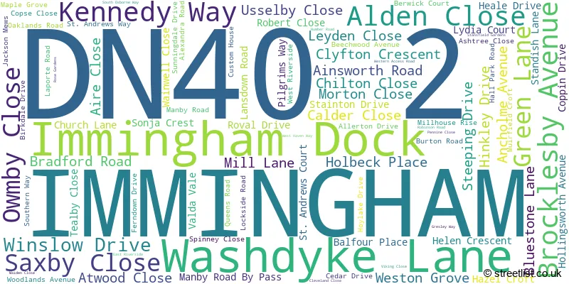
The largest settlements in the DN40 2 postal code are IMMINGHAM and Immingham Dock.
The DN40 2 Postcode shares a border with DN40 3 (South Killingholme, North Killingholme, East Halton), DN41 8 (Stallingborough, Keelby, Brocklesby) and DN40 1 (IMMINGHAM).
The sector is within the post town of IMMINGHAM.
DN40 2 is a postcode sector within the DN4 postcode district which is within the DN Doncaster postcode area.
The Royal Mail delivery office for the DN40 2 postal sector is the unknown.
The area of the DN40 2 postcode sector is 2.89 square miles which is 7.50 square kilometres or 1,852.64 square acres.

Map of the DN40 2 Postcode Sector
Explore the DN40 2 postcode sector by using our free interactive map.
| D | N | 4 | 0 | - | 2 | X | X |
| D | N | 4 | 0 | Space | 2 | Letter | Letter |
Official List of Streets
IMMINGHAM (75 Streets)
Unofficial Streets or Alternative Spellings
IMMINGHAM
KINGS ROAD MIDDLEPLATT ROADImmingham Dock
HUMBER ROAD ALEXANDRA ROAD SOUTH ASH TREE CLOSE ATHERTON WAY HABROUGH ROAD MINERAL QUAY ROAD NORTH WALL PARK CLOSE PUBLIC RIGHT OF WAY SONIA CREST SOUTH OSBOURNE WAY ST ANDREWS LANEStallingborough
LAPORTE ROADSouth Killingholme
MANBY ROADHabrough
MILL LANE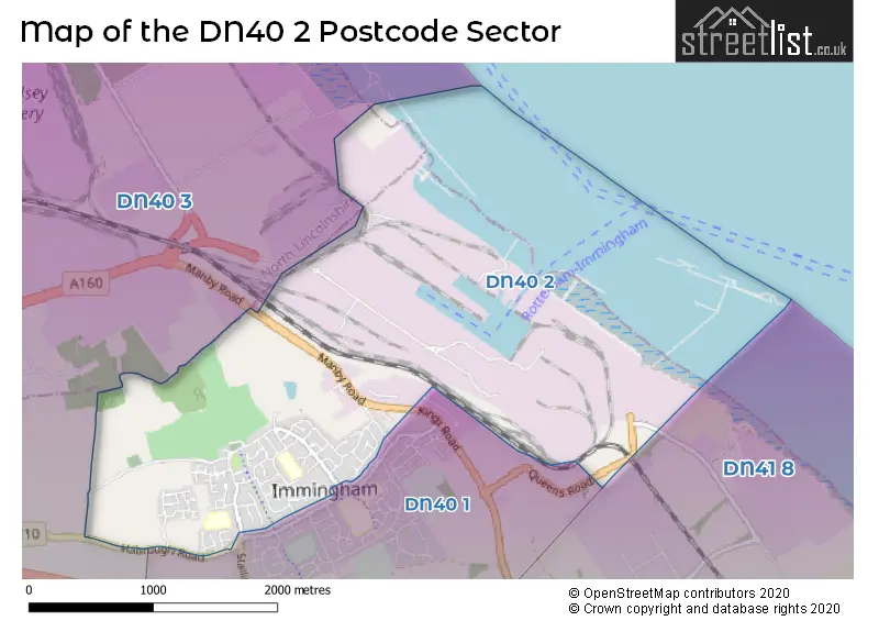
House Prices in the DN40 2 Postcode Sector
| Type of Property | 2018 Average | 2018 Sales | 2017 Average | 2017 Sales | 2016 Average | 2016 Sales | 2015 Average | 2015 Sales |
|---|---|---|---|---|---|---|---|---|
| Detached | £153,979 | 28 | £165,027 | 30 | £141,522 | 32 | £137,587 | 50 |
| Semi-Detached | £103,497 | 32 | £102,628 | 39 | £101,858 | 32 | £100,372 | 35 |
| Terraced | £69,375 | 4 | £84,357 | 7 | £83,833 | 6 | £77,857 | 7 |
| Flats | £42,875 | 4 | £55,250 | 4 | £29,000 | 1 | £0 | 0 |
Important Postcodes DN40 2 in the Postcode Sector
DN40 2DY is the postcode for Coomb Briggs Primary School, Roval Drive
DN40 2HP is the postcode for PILGRIM ACADEMY, ALLERTON DRIVE,, and Pilgrim Academy, Allerton Drive
DN40 2NA is the postcode for H M Revenue & Customs, Custom House
| The DN40 2 Sector is within these Local Authorities |
|
|---|---|
| The DN40 2 Sector is within these Counties |
|
| The DN40 2 Sector is within these Water Company Areas |
|