E5 9DF is a postal code used within the United Kingdom for delivering mail.
Postcodes are made up of two parts. The part before the space (E5) is called the outward code. The part after the space (9DF) is called the inward code. The letters C, I, K, M, O and V are not allowed in the inward code. In addition to the inward and outward code, the postcode can be broken up into four parts:
- Postal Area. In our case E which means London - E.
- Postal District. In our case E5.
- Postal Sector. In our case E5 9.
- Postcode Unit. The last two letters. In our case DF.
The regional mail center for the post area E is the Princess Royal Distribution Centre, which is located at Blackmore Drive, North Circular, LONDON , NW10 7RH.
The final port of call for any post addressed to the E5 9DF postcode is the local delivery office (DO) which is CLAPTON SDO. Here the post will be sorted ready for delivery.
The properties in the E5 9DF postcode have the street address of Jessam Avenue
A close-knit community! The 2021 Census indicates that only 17 individuals call the E5 9DF postcode their home.
It is situated within the post town of LONDON within the old postal county of Middlesex.
E5 9DF is within Upper Clapton.
Our data shows that E5 9DF is a residential postcode.
The E5 9DF postcode area is composed of 100% residential properties, 0% commercial properties, and 0% public properties.
According to our data. Most dwellings in E5 9DF are flats. Of these flats, most are mid-terraced. The remainder are end-terraced, semi-detached, enclosed mid-terrace and detached.
Most properties in E5 9DF are social housing with the rest being owned by the occupiers.

Interactive Mapping Showing UPRNs within the E5 9DF Postcode Boundaries
Use the search box to search for other postcodes or places.
Map of the E5 9DF Postcode

| Property Type | Percentage |
|---|---|
| Residential | 100% |
| Commercial | 0% |
| Public | 0% |
Telephone Area Code for E5 9DF
The telephone area code for E5 9DF is 020 London.
Map Coordinates for E5 9DF
| Latitude | 51.5679290732 |
|---|---|
| Longitude | -0.0570884626969 |
Ordnance Survey Maps for E5 9DF
| Map Series | Amazon | Ordnance Survey |
| Explorer 1:25,000 173 London North, The City, West End, Enfield, Ealing, Harrow & Watford | Check Price on Amazon | Buy Direct from the Ordnance Survey |
| Explorer 1:25,000 174 Epping Forest & Lee Valley | Check Price on Amazon | Buy Direct from the Ordnance Survey |
| Landranger 1:50,000 176 West London | Check Price on Amazon | Buy Direct from the Ordnance Survey |
| Landranger 1:50,000 177 East London | Check Price on Amazon | Buy Direct from the Ordnance Survey |

Weather Forecast for E5 9DF
Sat 27th Apr
Press Button to Show Forecast for Hackney
| Time Period | Icon | Description | Temperature | Rain Probability | Wind |
|---|---|---|---|---|---|
| 21:00 to 00:00 | Heavy rain | 9.0°C (feels like 7.0°C) | 92.00% | NE 11 mph |
Sun 28th Apr
Press Button to Show Forecast for Hackney
| Time Period | Icon | Description | Temperature | Rain Probability | Wind |
|---|---|---|---|---|---|
| 00:00 to 03:00 | Heavy rain | 9.0°C (feels like 7.0°C) | 91.00% | NNE 9 mph | |
| 03:00 to 06:00 | Heavy rain | 10.0°C (feels like 9.0°C) | 89.00% | E 7 mph | |
| 06:00 to 09:00 | Cloudy | 10.0°C (feels like 8.0°C) | 54.00% | SSW 7 mph | |
| 09:00 to 12:00 | Light rain | 10.0°C (feels like 8.0°C) | 57.00% | WSW 9 mph | |
| 12:00 to 15:00 | Light rain | 8.0°C (feels like 5.0°C) | 58.00% | W 13 mph | |
| 15:00 to 18:00 | Cloudy | 9.0°C (feels like 6.0°C) | 54.00% | WSW 11 mph | |
| 18:00 to 21:00 | Cloudy | 11.0°C (feels like 9.0°C) | 8.00% | SW 9 mph | |
| 21:00 to 00:00 | Clear night | 9.0°C (feels like 8.0°C) | 1.00% | SW 7 mph |
Mon 29th Apr
Press Button to Show Forecast for Hackney
| Time Period | Icon | Description | Temperature | Rain Probability | Wind |
|---|---|---|---|---|---|
| 00:00 to 03:00 | Clear night | 8.0°C (feels like 7.0°C) | 0.00% | SSW 7 mph | |
| 03:00 to 06:00 | Clear night | 7.0°C (feels like 5.0°C) | 0.00% | SSW 7 mph | |
| 06:00 to 09:00 | Sunny day | 8.0°C (feels like 6.0°C) | 0.00% | S 7 mph | |
| 09:00 to 12:00 | Partly cloudy (day) | 12.0°C (feels like 10.0°C) | 2.00% | SSW 9 mph | |
| 12:00 to 15:00 | Partly cloudy (day) | 15.0°C (feels like 12.0°C) | 3.00% | S 11 mph | |
| 15:00 to 18:00 | Partly cloudy (day) | 15.0°C (feels like 13.0°C) | 3.00% | S 13 mph | |
| 18:00 to 21:00 | Sunny day | 14.0°C (feels like 12.0°C) | 3.00% | S 9 mph | |
| 21:00 to 00:00 | Clear night | 11.0°C (feels like 10.0°C) | 1.00% | SSE 7 mph |
Tue 30th Apr
Press Button to Show Forecast for Hackney
| Time Period | Icon | Description | Temperature | Rain Probability | Wind |
|---|---|---|---|---|---|
| 00:00 to 03:00 | Clear night | 10.0°C (feels like 9.0°C) | 1.00% | SE 7 mph | |
| 03:00 to 06:00 | Clear night | 9.0°C (feels like 8.0°C) | 1.00% | ESE 4 mph | |
| 06:00 to 09:00 | Partly cloudy (day) | 10.0°C (feels like 8.0°C) | 1.00% | ESE 7 mph | |
| 09:00 to 12:00 | Partly cloudy (day) | 14.0°C (feels like 13.0°C) | 6.00% | SE 7 mph | |
| 12:00 to 15:00 | Light rain shower (day) | 16.0°C (feels like 14.0°C) | 33.00% | SE 9 mph | |
| 15:00 to 18:00 | Light rain shower (day) | 17.0°C (feels like 15.0°C) | 31.00% | SE 9 mph | |
| 18:00 to 21:00 | Light rain shower (day) | 16.0°C (feels like 15.0°C) | 33.00% | SE 7 mph | |
| 21:00 to 00:00 | Partly cloudy (night) | 14.0°C (feels like 13.0°C) | 11.00% | ESE 4 mph |
Wed 1st May
Press Button to Show Forecast for Hackney
| Time Period | Icon | Description | Temperature | Rain Probability | Wind |
|---|---|---|---|---|---|
| 00:00 to 03:00 | Cloudy | 12.0°C (feels like 12.0°C) | 15.00% | ESE 4 mph | |
| 03:00 to 06:00 | Overcast | 11.0°C (feels like 11.0°C) | 13.00% | ESE 4 mph | |
| 06:00 to 09:00 | Fog | 11.0°C (feels like 11.0°C) | 19.00% | ESE 4 mph | |
| 09:00 to 12:00 | Cloudy | 14.0°C (feels like 14.0°C) | 15.00% | ENE 4 mph | |
| 12:00 to 15:00 | Partly cloudy (day) | 17.0°C (feels like 16.0°C) | 11.00% | E 4 mph | |
| 15:00 to 18:00 | Cloudy | 19.0°C (feels like 18.0°C) | 14.00% | ENE 7 mph | |
| 18:00 to 21:00 | Cloudy | 18.0°C (feels like 17.0°C) | 11.00% | SSE 7 mph | |
| 21:00 to 00:00 | Cloudy | 15.0°C (feels like 14.0°C) | 11.00% | S 7 mph |
What are the Broadband Speeds like in the E5 9DF Postcode?
Download Speeds For E5 9DF

| Average Mbps | 40.400 |
|---|---|
| Median Mbps | 23.400 |
| Maximum Mbps | 78.120 |
E5 9DF has an average download speed of 40.4 Megabits per second (Mbps).
1,150 other postcode units have the same broadband speed.
16% of postcodes (185,651) have slower broadband speeds.
84% of postcodes (997,840) have faster broadband speeds.
Upload Speeds For E5 9DF
| Average Mbps | 8.400 |
|---|---|
| Median Mbps | 1.200 |
| Maximum Mbps | 19.530 |
E5 9DF has an average upload speed of 8.4 Megabits per second (Mbps).
4,614 other postcode units have the same upload speed.
16% of postcodes (193,621) have slower upload speeds.
83% of postcodes (986,406) have faster upload speeds.
Schools within a five minute drive of E5 9DF Postcode
England Higher Schools
The Brooke House Sixth Form College
Address: The Brooke House Sixth Form College, Kenninghall Road, London, E5 8BP
Distance: 0.60 miles
Contact: 02031375320
England Primary Schools
Springfield Community Primary School
Address: Springfield Community Primary School, Castlewood Road, Hackney, London, N16 6DH
Distance: 0.59 miles
Contact: 02088009007
Crowland Primary School
Address: Crowland Primary School, Crowland Road, London, N15 6UX
Distance: 0.96 miles
Contact: 02088004553
William Patten Primary School
Address: William Patten Primary School, Stoke Newington Church St, London, N16 0NX
Distance: 0.88 miles
Contact: 02072544014
Benthal Primary School
Address: Benthal Primary School, Benthal Road, Hackney, London, N16 7AU
Distance: 0.75 miles
Contact: 02089859310
St Scholastica's Catholic Primary School
Address: St Scholastica's Catholic Primary School, Kenninghall Road, Clapton, London, E5 8BS
Distance: 0.66 miles
Contact: 02089853466
Millfields Community School
Address: Millfields Community School, Hilsea Street, Hackney, London, E5 0SH
Distance: 0.87 miles
Contact: 02089857898
Baden-Powell School
Address: Baden-Powell School, Ferron Road, London, E5 8DN
Distance: 0.70 miles
Contact: 02089856176
Southwold Primary School
Address: Southwold Primary School, Detmold Road, Clapton, Hackney, E5 9NL
Distance: 0.34 miles
Contact: 02088065201
Harrington Hill Primary School
Address: Harrington Hill Primary School, Mount Pleasant Lane, London, E5 9JG
Distance: 0.14 miles
Contact: 02088067275
Oldhill Community School
Address: Oldhill Community School, Oldhill Street, London, N16 6LR
Distance: 0.40 miles
Contact: 02088064130
Jubilee Primary School
Address: Jubilee Primary School, Filey Avenue, London, N16 6NR
Distance: 0.40 miles
Contact: 02088065446
Simon Marks Jewish Primary School
Address: Simon Marks Jewish Primary School, 75 Cazenove Road, Stoke Newington, Hackney, London, N16 6PD
Distance: 0.56 miles
Contact: 02088066048
Holmleigh Primary School
Address: Holmleigh Primary School, Dunsmure Road, London, N16 5PU
Distance: 0.75 miles
Contact: 02088027420
Sir Thomas Abney School
Address: Sir Thomas Abney School, Fairholt Road, Stoke Newington, London, N16 5ED
Distance: 1.06 miles
Contact: 02088001411
Northwold Primary School
Address: Northwold Primary School, Northwold Road, Clapton, London, E5 8RN
Distance: 0.50 miles
Contact: 02088066352
Lubavitch Junior Boys
Address: Lubavitch Junior Boys, 135 Clapton Common, Hackney, London, E5 9AE
Distance: 0.70 miles
Contact:
Lubavitch Ruth Lunzer Girls Primary School
Address: Lubavitch Ruth Lunzer Girls Primary School, 107-115 Stamford Hill, London, N16 5RP
Distance: 0.76 miles
Contact:
St Ignatius RC Primary School
Address: St Ignatius RC Primary School, St Ann's Road, Tottenham, London, N15 6ND
Distance: 0.90 miles
Contact: 02088002771
England Secondary Schools
Gladesmore Community School
Address: Gladesmore Community School, Crowland Road, Tottenham, London, N15 6EB
Distance: 0.91 miles
Contact: 02088000884
Yesodey Hatorah Senior Girls School
Address: Yesodey Hatorah Senior Girls School, Egerton Road, Stamford Hill, London, N16 6UB
Distance: 0.62 miles
Contact: 02088265500
Our Lady's Catholic High School
Address: Our Lady's Catholic High School, 6-16 Amhurst Park, Stamford Hill, London, N16 5AF
Distance: 0.89 miles
Contact: 02088002158
Clapton Girls' Academy
Address: Clapton Girls' Academy, Laura Place, Lower Clapton Road, London, E5 0RB
Distance: 0.94 miles
Contact: 02089856641
Lubavitch House School (Senior Girls)
Address: Lubavitch House School (Senior Girls), 107-115 Stamford Hill, London, N16 5RP
Distance: 0.76 miles
Contact:
Nearest Dentists
Dentists near E5 9DF
CLAPTON DENTAL SURGERY
Address: 77 UPPER CLAPTON ROAD, LONDON, GREATER LONDON, E5 9BU
Distance: 0.31 miles
Contact: :
B DAVIDOFF DENTAL SURGERY
Address: 103 STAMFORD HILL, LONDON, GREATER LONDON, N16 5TR
Distance: 0.74 miles
Contact: :
ABNEY DENTAL PRACTICE
Address: UNIT 4, 230 STOKE NEWINGTON HIGH STREET, LONDON, GREATER LONDON, N16 7HU
Distance: 0.77 miles
Contact: :
NFDC LTD
Address: NORTHFEILD DENTAL CLINIC, 2A NORTHFIELD ROAD, LONDON, GREATER LONDON, N16 5RN
Distance: 0.85 miles
Contact: :
STOKE NEWINGTON DENTAL PRACTICE
Address: 121 STOKE NEWINGTON HIGH STREET, LONDON, GREATER LONDON, N16 0PH
Distance: 0.91 miles
Contact: :
TRINITY DENTAL CARE
Address: 167 CLARENCE ROAD, LONDON, GREATER LONDON, E5 8EE
Distance: 0.92 miles
Contact: :
Nearest Chemists
Pharmacies near E5 9DF
HACKNEY PHARMACY
Address: 15A URBAN HIVE, THEYDON ROAD, LONDON, E5 9BQ
Distance: 0.31 miles
Contact: tel: 02088 066215
ASVACARE LTD
Address: 97 UPPER CLAPTON ROAD, UPPER CLAPTON, LONDON, E5 9BU
Distance: 0.31 miles
Contact: tel: 02088 065140
GREEN LIGHT PHARMACY
Address: 51 OLDHILL STREET, STOKE NEWINGTON, LONDON, GREATER LONDON, N16 6LU
Distance: 0.35 miles
Contact: tel: 02088 024488
DAY LEWIS PHARMACY
Address: UNITS 1&2, MILLENIUM PH 3, 14 KENNINGHALL ROAD, LONDON, GREATER LONDON, E5 8BY
Distance: 0.71 miles
Contact: tel: 02089 851873
MORRISONS PHARMACY
Address: 47-49 STAMFORD HILL, STOKE NEWINGTON, LONDON, GREATER LONDON, N16 5SR
Distance: 0.72 miles
Contact: tel: 02088 093369
GREEN LIGHT PHARMACY
Address: 170-172 STAMFORD HILL, LONDON, GREATER LONDON, N16 6QX
Distance: 0.72 miles
Contact: tel: 02088 006166
Nearest Opticians
Opticians near E5 9DF
AUSTIN EYEWARE OPTICIANS
Address: 74 OLDHILL STREET, LONDON, GREATER LONDON, N16 6NA
Distance: 0.37 miles
Contact: :
COPEC LTD
Address: 1 STATION PARADE, UPPER CLAPTON ROAD, LONDON, GREATER LONDON, E5 8BD
Distance: 0.52 miles
Contact: :
ILIFE OPTICIANS (STAMFORD HILL)
Address: 62A STAMFORD HILL, LONDON, GREATER LONDON, N16 6XS
Distance: 0.67 miles
Contact: :
SILVERMAN OPTICIANS
Address: 176 CLAPTON COMMON, LONDON, E5 9AG
Distance: 0.69 miles
Contact: :
CHARLES LEDSHAM OPTICIANS
Address: 202 STAMFORD HILL, LONDON, GREATER LONDON, N16 6RA
Distance: 0.73 miles
Contact: :
AUSTIN EYEWEAR (MANOR PARADE)
Address: 5 MANOR PARADE, MANOR ROAD, LONDON, GREATER LONDON, N16 5SG
Distance: 0.75 miles
Contact: :
Nearest GP Surgeries
Doctors near E5 9DF
HEALY MEDICAL CENTRE
Address: 200 UPPER CLAPTON ROAD, LONDON, GREATER LONDON, E5 9DH
Distance: 0.14 miles
Contact: tel: 020 88061550
THE RIVERSIDE PRACTICE
Address: 14 URBAN HIVE, THEYDON ROAD, LONDON, GREATER LONDON, E5 9BQ
Distance: 0.31 miles
Contact: tel: 020 88061928
THE CLAPTON SURGERY
Address: THEYDON ROAD HEALTH CTR, 14 URBAN HIVE, THEYDON RD, LONDON, GREATER LONDON, E5 9BQ
Distance: 0.31 miles
Contact: tel: 020 88067735
FOUNTAYNE ROAD HEALTH CENTRE
Address: 1A FOUNTAYNE ROAD, LONDON, N16 7EA
Distance: 0.42 miles
Contact: tel: 020 39280777
THE ELM PRACTICE
Address: 1A FOUNTAYNE ROAD, LONDON, GREATER LONDON, N16 7EA
Distance: 0.42 miles
Contact: tel: 020 76834839
ROSEWOOD PRACTICE
Address: 1A FOUNTAYNE ROAD, LONDON, GREATER LONDON, N16 7EA
Distance: 0.42 miles
Contact: tel: 020 76834847
Transport Links near E5 9DF
Train Stations
Nearest stations for postcode: E5 9DF
- Clapton
Clapton station, Upper Clapton Road, Clapton, Greater London, E5 9JPDistance: 0.59 milesDriving Time: 1.91 minutes - Stoke Newington
Stoke Newington station, Stamford Hill, Stoke Newington, Greater London, N16 6YADistance: 0.89 milesDriving Time: 2.74 minutes - Stamford Hill
Stamford Hill station, Amhurst Park, Stamford Hill, London, N16 5AGDistance: 1.03 milesDriving Time: 3.22 minutes - Rectory Road
Rectory Road station, Evering Road, Stoke Newington, Greater London, N16 7SJDistance: 1.13 milesDriving Time: 3.41 minutes - Lea Bridge
Lea Bridge station, Argall Way, Lee Valley, Greater London, E10 7PGDistance: 2.00 milesDriving Time: 6.42 minutes
Distances represent the quickest route by car.
Motorway Junctions near E5 9DF
Train Stations
Motorway Junctions near E5 9DF
Distances represent the quickest route by car.
Who are my Elected Representatives in the E5 9DF Postcode?
| Westminster Constituency | Hackney North and Stoke Newington Boro Const |
|---|---|
| Member or Parliament | 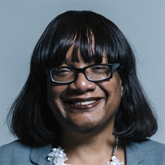 |
| Contact Details | Contact Ms Diane Abbott |
| Political Party | Labour |
What Council is the E5 9DF Postcode in?
The Local Council for this Postcode is Hackney London Boro Council and the County Council is Greater London Authority Council.
Greater London Authority Council is responsible for providing education, libraries and maintaining highways.
Hackney London Boro Council is responsible for duties such as council tax, rubbish collection, housing, environmental health and planning.
You can visit the website for Hackney London Boro at the following link Hackney London Boro.How much is the Council Tax?
Hackney London Boro Council is responsible for collecting council tax. This will vary depending on which council tax band the property falls within. You can check the council tax band at the gov.uk website.
Once you know the council tax band you can view how much Hackney London Boro charge for that band by visiting the The Council Tax section of their website.
Planning Applications
When moving house to a new post code it is worth checking out what will be built in the neighbourhood.
Few people want to live next door to a building site, have their garden overlooked or have the views from their property ruined.
Visit the local planning department and search for planning applications in this postcode granted within the last three years or still awaiting a decision. This will give an indication of what could still be built.
Where can I find out where the nearest Library to the E5 9DF Postcode is?
Libraries are the responsibility of Hackney council
Visit the link for more information. Please note that some councils outsource library services to private companies and community groups ran by volunteers.
Libraries | Hackney CouncilPostcodes near the E5 9DF Postcode
What Popular Supermarkets are near the E5 9DF Postcode?
| Supermarket | Distance | Directions |
|---|---|---|
| Asda, Clapton Common, Hackney, LONDON, E5 9AG | 1.10 miles | Directions from E5 9DF to Asda |
| Morrisons, Stamford Hill, Hackney, LONDON, N16 5TB | 1.16 miles | Directions from E5 9DF to Morrisons |
| Sainsburys, Amhurst Park, Hackney, LONDON, N16 5LW | 1.27 miles | Directions from E5 9DF to Sainsburys |
| Iceland, Stoke Newington High Street, Hackney, LONDON, N16 7JL | 1.36 miles | Directions from E5 9DF to Iceland |
| Aldi, Heybridge Way, Lea Bridge Road, Waltham Forest, LONDON, E10 7NQ | 1.80 miles | Directions from E5 9DF to Aldi |
What Popular Restaurants are near the E5 9DF Postcode?
| Burger King | Distance | Directions |
|---|---|---|
| Unit C5, Tottenham Hale Retail Park, London, N15 4QD | 1.37 miles | Directions from E5 9DF to Unit C5, Tottenham Hale Retail Park |
| Unit F, Leyton Mills Retail Park, London, E10 5QF | 2.26 miles | Directions from E5 9DF to Unit F, Leyton Mills Retail Park |
| The Mall Wood Green Food Court, Wood Green, N22 6YQ | 2.89 miles | Directions from E5 9DF to The Mall Wood Green Food Court |
| K1, Stratford Shopping Centre, London, E15 1BB | 3.00 miles | Directions from E5 9DF to K1, Stratford Shopping Centre |
| Mcdonald's | Distance | Directions |
|---|---|---|
| McDonald's, Mare Street, Hackney, LONDON, E8 1HY | 1.34 miles | Directions from E5 9DF to McDonald's, Mare Street, Hackney, LONDON, E8 1HY |
| McDonald's, Kingsland High Street, Hackney, LONDON, E8 2JP | 1.66 miles | Directions from E5 9DF to McDonald's, Kingsland High Street, Hackney, LONDON, E8 2JP |
| McDonald's, High Road, Haringey, LONDON, N17 9JF | 1.84 miles | Directions from E5 9DF to McDonald's, High Road, Haringey, LONDON, N17 9JF |
| McDonald's, Green Lanes, Haringey, LONDON, N4 1DR | 1.87 miles | Directions from E5 9DF to McDonald's, Green Lanes, Haringey, LONDON, N4 1DR |
| Restaurant | Distance | Directions |
|---|---|---|
| KFC, Stoke Newington High Street, Hackney, LONDON, N16 7JD | 0.81 miles | Directions from E5 9DF to KFC Stoke Newington - High Street |
| KFC, Kingsland High Street, Hackney, LONDON, E8 2NS | 1.49 miles | Directions from E5 9DF to KFC Dalston - Kingsland High Street |
| KFC, Mare Street, Hackney, LONDON, E8 1EJ | 1.51 miles | Directions from E5 9DF to KFC Hackney - Mare Street |
| KFC, Lea Bridge Road, Waltham Forest, LONDON, E10 7DN | 1.91 miles | Directions from E5 9DF to KFC Leyton - Lea Bridge Road |
| KFC, Seven Sisters Road, Hackney, LONDON, N4 2AA | 2.02 miles | Directions from E5 9DF to KFC Finsbury Park - Seven Sisters Road |