E8 2NH is a postal code used within the United Kingdom for delivering mail.
Postcodes are made up of two parts. The part before the space (E8) is called the outward code. The part after the space (2NH) is called the inward code. The letters C, I, K, M, O and V are not allowed in the inward code. In addition to the inward and outward code, the postcode can be broken up into four parts:
- Postal Area. In our case E which means London - E.
- Postal District. In our case E8.
- Postal Sector. In our case E8 1.
- Postcode Unit. The last two letters. In our case NH.
The regional mail center for the post area E is the Princess Royal Distribution Centre, which is located at Blackmore Drive, North Circular, LONDON , NW10 7RH.
The final port of call for any post addressed to the E8 2NH postcode is the local delivery office (DO) which is HACKNEY SDO. Here the post will be sorted ready for delivery.
The properties in the E8 2NH postcode have the street address of Ridley Road
Did you know? According to the 2021 Census, the E8 2NH postcode is home to a bustling 113 residents!
It is situated within the post town of LONDON within the old postal county of Middlesex.
E8 2NH is within Dalston.
Looking at our data the E8 2NH is mostly residential but does contain some commercial properties.
The E8 2NH postcode area is composed of 93.88% residential properties, 6.12% commercial properties, and 0% public properties.
According to our data. Most dwellings in E8 2NH are flats. The remainder of residential properties consist of maisonettes. Of these flats, most are mid-terraced. The remainder are end-terraced, semi-detached, unknown and detached. Of these maisonettes, most are mid-terraced. The remainder are unknown, detached and end-terraced. Of these houses, most are mid-terraced. The remainder are end-terraced.
Most properties in E8 2NH are privately rented with the rest being social housing.
None Domestic Buildings in E8 2NH fall under these categories: Shops and Food And Drink.
Shops include 208, 204, 212, 214, 210, and 216, Ridley Road.
Food And Drink include 206, and 216, Ridley Road.

Interactive Mapping Showing UPRNs within the E8 2NH Postcode Boundaries
Use the search box to search for other postcodes or places.
Map of the E8 2NH Postcode

E8 2NH: Points of Interest
Jim's Butchers
Jim's Butchers is a retail outlet located at 164-166 Ridley Road, London, E8 2NH.
TFC Dalston Ltd
TFC Dalston Ltd is a retail outlet located at 89 Ridley Road, London, E8 2NH.
A B Tropical Foods
A B Tropical Foods is a retail outlet located at 212 Ridley Road, Hackney, London, E8 2NH.
Low Cost Tropical Shop
Low Cost Tropical Shop is a retail outlet located at 208 Ridley Road, Hackney, London, E8 2NH.
Kwaso Trading
Kwaso Trading is a retail outlet located at 204 Ridley Road, Hackney, London, E8 2NH.
Fill Me In Food Services Ltd
Fill Me In Food Services Ltd is an establishment offering meals and refreshments located at First Floor, 89 Ridley Road, Hackney, London, E8 2NH.
K T Restaurant
K T Restaurant is an establishment offering meals and refreshments located at 206 Ridley Road, Hackney, London, E8 2NH.
| Property Type | Percentage |
|---|---|
| Residential | 93.88% |
| Commercial | 6.12% |
| Public | 0% |
Telephone Area Code for E8 2NH
The telephone area code for E8 2NH is 020 London.
Map Coordinates for E8 2NH
| Latitude | 51.5482327008 |
|---|---|
| Longitude | -0.0699999740529 |

Weather Forecast for E8 2NH
Thu 16th May
Press Button to Show Forecast for Hackney
| Time Period | Icon | Description | Temperature | Rain Probability | Wind |
|---|---|---|---|---|---|
| 03:00 to 06:00 | Cloudy | 12.0°C (feels like 11.0°C) | 6.00% | SSE 2 mph | |
| 06:00 to 09:00 | Cloudy | 13.0°C (feels like 13.0°C) | 8.00% | ESE 2 mph | |
| 09:00 to 12:00 | Cloudy | 16.0°C (feels like 16.0°C) | 8.00% | SSE 2 mph | |
| 12:00 to 15:00 | Cloudy | 18.0°C (feels like 18.0°C) | 13.00% | S 2 mph | |
| 15:00 to 18:00 | Cloudy | 17.0°C (feels like 17.0°C) | 15.00% | S 4 mph | |
| 18:00 to 21:00 | Cloudy | 17.0°C (feels like 17.0°C) | 15.00% | SSE 4 mph | |
| 21:00 to 00:00 | Cloudy | 15.0°C (feels like 14.0°C) | 14.00% | SW 4 mph |
Fri 17th May
Press Button to Show Forecast for Hackney
| Time Period | Icon | Description | Temperature | Rain Probability | Wind |
|---|---|---|---|---|---|
| 00:00 to 03:00 | Clear night | 13.0°C (feels like 12.0°C) | 7.00% | WSW 4 mph | |
| 03:00 to 06:00 | Partly cloudy (night) | 12.0°C (feels like 11.0°C) | 5.00% | WSW 4 mph | |
| 06:00 to 09:00 | Sunny day | 13.0°C (feels like 12.0°C) | 6.00% | WSW 4 mph | |
| 09:00 to 12:00 | Cloudy | 16.0°C (feels like 16.0°C) | 10.00% | WSW 4 mph | |
| 12:00 to 15:00 | Cloudy | 19.0°C (feels like 18.0°C) | 13.00% | W 7 mph | |
| 15:00 to 18:00 | Cloudy | 20.0°C (feels like 19.0°C) | 20.00% | W 7 mph | |
| 18:00 to 21:00 | Light rain shower (day) | 19.0°C (feels like 18.0°C) | 41.00% | W 4 mph | |
| 21:00 to 00:00 | Cloudy | 15.0°C (feels like 15.0°C) | 15.00% | WSW 4 mph |
Sat 18th May
Press Button to Show Forecast for Hackney
| Time Period | Icon | Description | Temperature | Rain Probability | Wind |
|---|---|---|---|---|---|
| 00:00 to 03:00 | Cloudy | 14.0°C (feels like 13.0°C) | 10.00% | W 4 mph | |
| 03:00 to 06:00 | Cloudy | 12.0°C (feels like 12.0°C) | 10.00% | W 4 mph | |
| 06:00 to 09:00 | Cloudy | 13.0°C (feels like 13.0°C) | 10.00% | WNW 4 mph | |
| 09:00 to 12:00 | Cloudy | 16.0°C (feels like 16.0°C) | 12.00% | NNW 4 mph | |
| 12:00 to 15:00 | Cloudy | 18.0°C (feels like 17.0°C) | 12.00% | NW 7 mph | |
| 15:00 to 18:00 | Light rain shower (day) | 19.0°C (feels like 17.0°C) | 34.00% | NW 9 mph | |
| 18:00 to 21:00 | Light rain shower (day) | 18.0°C (feels like 17.0°C) | 37.00% | NNW 7 mph | |
| 21:00 to 00:00 | Clear night | 15.0°C (feels like 14.0°C) | 7.00% | N 7 mph |
What are the Broadband Speeds like in the E8 2NH Postcode?
Download Speeds For E8 2NH

| Average Mbps | 99.000 |
|---|---|
| Median Mbps | 54.800 |
| Maximum Mbps | 1096.000 |
E8 2NH has an average download speed of 99 Megabits per second (Mbps).
743 other postcode units have the same broadband speed.
67% of postcodes (787,881) have slower broadband speeds.
33% of postcodes (396,017) have faster broadband speeds.
Upload Speeds For E8 2NH

| Average Mbps | 10.100 |
|---|---|
| Median Mbps | 10.000 |
| Maximum Mbps | 49.000 |
E8 2NH has an average upload speed of 10.1 Megabits per second (Mbps).
6,632 other postcode units have the same upload speed.
24% of postcodes (283,253) have slower upload speeds.
76% of postcodes (894,756) have faster upload speeds.
Schools within a five minute drive of E8 2NH Postcode
England Primary Schools
Rushmore Primary School
Address: Rushmore Primary School, Elderfield Road, Hackney, London, E5 0LE
Distance: 1.12 miles
Contact: 02089853175
St John and St James CofE Primary School
Address: St John and St James CofE Primary School, Isabella Road, Hackney, London, E9 6DX
Distance: 0.86 miles
Contact: 02089852045
William Patten Primary School
Address: William Patten Primary School, Stoke Newington Church St, London, N16 0NX
Distance: 0.96 miles
Contact: 02072544014
Gayhurst Community School
Address: Gayhurst Community School, Gayhurst Road, Hackney, London, E8 3EN
Distance: 0.52 miles
Contact: 02072546138
Benthal Primary School
Address: Benthal Primary School, Benthal Road, Hackney, London, N16 7AU
Distance: 0.73 miles
Contact: 02089859310
Berger Primary School
Address: Berger Primary School, Anderson Road, Hackney, London, E9 6HB
Distance: 1.08 miles
Contact: 02089856280
St Scholastica's Catholic Primary School
Address: St Scholastica's Catholic Primary School, Kenninghall Road, Clapton, London, E5 8BS
Distance: 0.83 miles
Contact: 02089853466
Millfields Community School
Address: Millfields Community School, Hilsea Street, Hackney, London, E5 0SH
Distance: 0.97 miles
Contact: 02089857898
Morningside Primary School
Address: Morningside Primary School, Chatham Place, Hackney, Morningside Primary School, London, E9 6LL
Distance: 0.86 miles
Contact: 02089855382
Baden-Powell School
Address: Baden-Powell School, Ferron Road, London, E5 8DN
Distance: 0.83 miles
Contact: 02089856176
Nightingale Primary School
Address: Nightingale Primary School, Tiger Way, Hackney, London, E5 8NA
Distance: 0.67 miles
Contact: 02089854259
London Fields Primary School
Address: London Fields Primary School, Westgate Street, Hackney, London, E8 3RL
Distance: 0.88 miles
Contact: 02072544330
St. Paul's With St. Michael's CofE Primary School
Address: St. Paul's With St. Michael's CofE Primary School, 57a Brougham Rd, Hackney, E8 4PB
Distance: 0.75 miles
Contact: 02072541927
Sebright School
Address: Sebright School, Audrey Street, Goldsmiths Row, London, E2 8QH
Distance: 1.05 miles
Contact: 02077396531
Queensbridge Primary School
Address: Queensbridge Primary School, Queensbridge Road, Haggerston, Hackney, London, E8 4ET
Distance: 0.62 miles
Contact: 02072541186
Mossbourne Parkside Academy
Address: Mossbourne Parkside Academy, Sigdon Road, Hackney, London, E8 1AS
Distance: 0.33 miles
Contact: 02086181300
Simon Marks Jewish Primary School
Address: Simon Marks Jewish Primary School, 75 Cazenove Road, Stoke Newington, Hackney, London, N16 6PD
Distance: 1.19 miles
Contact: 02088066048
Columbia Primary School
Address: Columbia Primary School, Columbia Road, Bethnal Green, London, Avon, E2 7RG
Distance: 1.31 miles
Contact: 02077393835
Randal Cremer Primary School
Address: Randal Cremer Primary School, Ormsby Street, Shoreditch, Randal Cremer Primary School, Ormsby Street, London, E2 8JG
Distance: 1.05 miles
Contact: 02077398162
St Matthias Church of England Primary School
Address: St Matthias Church of England Primary School, Wordsworth Road, London, N16 8DD
Distance: 0.50 miles
Contact: 02072541148
Colvestone Primary School
Address: Colvestone Primary School, Colvestone Crescent, Hackney, London, E8 2LG
Distance: 0.13 miles
Contact: 02072541143
Princess May Primary School
Address: Princess May Primary School, Princess May Road, London, N16 8DF
Distance: 0.45 miles
Contact: 02072541589
Shacklewell Primary School
Address: Shacklewell Primary School, Shacklewell Row, Hackney, London, E8 2EA
Distance: 0.32 miles
Contact: 02072541415
Halley House School
Address: Halley House School, 52-58 Arcola Street, Hackney, London, E8 2DJ
Distance: 0.31 miles
Contact: 02075040548
Hackney New Primary School
Address: Hackney New Primary School, 2 Downham Road, London, N1 5FR
Distance: 0.69 miles
Contact: 02030193470
Holy Trinity Church of England Primary School
Address: Holy Trinity Church of England Primary School, Beechwood Road, London, E8 3DY
Distance: 0.30 miles
Contact: 02072541010
De Beauvoir Primary School
Address: De Beauvoir Primary School, 80 Tottenham Road, Hackney, London, N1 4BS
Distance: 0.45 miles
Contact: 02072542517
Grasmere Primary School
Address: Grasmere Primary School, 92 Albion Road, London, N16 9PD
Distance: 0.78 miles
Contact: 02072544564
St Jude and St Paul's CofE Primary School
Address: St Jude and St Paul's CofE Primary School, 10 Kingsbury Road, Islington, London, N1 4AZ
Distance: 0.39 miles
Contact: 02072545598
Our Lady and St Joseph Catholic Primary School
Address: Our Lady and St Joseph Catholic Primary School, Buckingham Road, Hackney, London, N1 4JB
Distance: 0.50 miles
Contact: 02072547353
The Olive School Hackney
Address: The Olive School Hackney, 32 St Johns Church Road, Hackney, London, E9 6EJ
Distance: 0.78 miles
Contact: 02076837436
Northwold Primary School
Address: Northwold Primary School, Northwold Road, Clapton, London, E5 8RN
Distance: 1.02 miles
Contact: 02088066352
Betty Layward Primary School
Address: Betty Layward Primary School, Clissold Road, Hackney, London, N16 9EX
Distance: 0.92 miles
Contact: 02072497111
Newington Green Primary School
Address: Newington Green Primary School, Matthias Road, Newington Green, London, N16 8NP
Distance: 0.64 miles
Contact: 02072543092
England Higher Schools
The Brooke House Sixth Form College
Address: The Brooke House Sixth Form College, Kenninghall Road, London, E5 8BP
Distance: 0.95 miles
Contact: 02031375320
England Secondary Schools
The Bridge Academy
Address: The Bridge Academy, Laburnum Street, Hackney, London, E2 8BA
Distance: 0.88 miles
Contact: 02077495240
Hackney New School
Address: Hackney New School, Kingsland Road, 317-319, Hackney, E8 4DL
Distance: 0.73 miles
Contact:
Cardinal Pole Catholic School
Address: Cardinal Pole Catholic School, 205 Morning Lane, Hackney, London, E9 6LG
Distance: 1.01 miles
Contact: 02089855150
The Urswick School - A Church of England Secondary School
Address: The Urswick School - A Church of England Secondary School, Paragon Road, Hackney, London, E9 6NR
Distance: 0.79 miles
Contact: 02089852430
Mossbourne Community Academy
Address: Mossbourne Community Academy, 100 Downs Park Road, Hackney, London, E5 8JY
Distance: 0.39 miles
Contact: 02085255200
Haggerston School
Address: Haggerston School, Weymouth Terrace, Hackney, London, E2 8LS
Distance: 1.10 miles
Contact:
The Excelsior Academy
Address: The Excelsior Academy, Shacklewell Lane, Hackney, London, E8 2EY
Distance: 0.25 miles
Contact: 02072751500
Stoke Newington School and Sixth Form
Address: Stoke Newington School and Sixth Form, Clissold Road, Hackney, London, N16 9EX
Distance: 0.92 miles
Contact: 02072419600
Clapton Girls' Academy
Address: Clapton Girls' Academy, Laura Place, Lower Clapton Road, London, E5 0RB
Distance: 0.89 miles
Contact: 02089856641
Nearest Dentists
Dentists near E8 2NH
DALSTON LANE (DENTAL SURGERY)
Address: 72 DALSTON LANE, LONDON, E8 3AH
Distance: 0.15 miles
Contact: :
DENTAL SURGERY
Address: 33 KINGSLAND HIGH STREET, LONDON, GREATER LONDON, E8 2JS
Distance: 0.26 miles
Contact: :
DENTAL & ORAL SURGERY
Address: 18 BRADBURY STREET, DALSTON, LONDON, GREATER LONDON, N16 8JN
Distance: 0.27 miles
Contact: :
BRADBURY STREET (DENTAL SURGERY)
Address: 18 BRADBURY STREET, LONDON, GREATER LONDON, N16 8JN
Distance: 0.27 miles
Contact: :
BALLS POND ROAD (DENTAL SURGERY)
Address: 1 BALLS POND ROAD, LONDON, GREATER LONDON, N1 4AX
Distance: 0.32 miles
Contact: :
KINGSLAND DENTAL SURGERY
Address: 535-537 KINGSLAND ROAD, LONDON, GREATER LONDON, E8 4AR
Distance: 0.32 miles
Contact: :
Nearest Chemists
Pharmacies near E8 2NH
DEVS CHEMIST
Address: 103A DALSTON LANE, HACKNEY, LONDON, GREATER LONDON, E8 1NH
Distance: 0.09 miles
Contact: tel: 020 72498060
SUPERDRUG PHARMACY
Address: 10-11 DALSTON CROSS SHOPPING CENTRE, KINGSLAND, LONDON, GREATER LONDON, E8 2LX
Distance: 0.19 miles
Contact: tel: 020 72492599
BOOTS
Address: 82-84 KINGSLAND HIGH STREET, DALSTON, LONDON, GREATER LONDON, E8 2NS
Distance: 0.22 miles
Contact: tel: 020 72545067
J EDMUNDS PHARMACY
Address: 47 KINGSLAND HIGH STREET, LONDON, GREATER LONDON, E8 2JS
Distance: 0.26 miles
Contact: tel: 02072 540732
GUARDIAN PHARMACY
Address: 448 KINGSLAND ROAD, DALSTON, LONDON, GREATER LONDON, E8 4AE
Distance: 0.42 miles
Contact: tel: 02072 548211
DAY LEWIS PHARMACY
Address: 77 STOKE NEWINGTON ROAD, LONDON, GREATER LONDON, N16 8AD
Distance: 0.43 miles
Contact: tel: 02072 410486
Nearest Opticians
Opticians near E8 2NH
SPECSAVERS (DALSTON CROSS, LONDON)
Address: UNIT 18A, KINGSLAND SHOPPING CENTRE, DALSTON CROSS, LONDON, GREATER LONDON, E8 2LX
Distance: 0.19 miles
Contact: :
EYES ONLY OPTICIANS
Address: 87 KINGSLAND HIGH STREET, LONDON, GREATER LONDON, E8 2PB
Distance: 0.25 miles
Contact: :
EYE CLOUD OPTICIANS
Address: 15 KINGSLAND HIGH STREET, LONDON, GREATER LONDON, E8 2JS
Distance: 0.26 miles
Contact: :
EYE SEE (STOKE NEWINGTON ROAD)
Address: 93 STOKE NEWINGTON ROAD, LONDON, N16 8AA
Distance: 0.46 miles
Contact: :
ZAK & ADAM EYECARE LTD
Address: 163 STOKE NEWINGTON ROAD, LONDON, N16 8BP
Distance: 0.63 miles
Contact: :
EYE LONDON OPTICIANS
Address: 312 MARE STREET, HACKNEY, LONDON, GREATER LONDON, E8 1EJ
Distance: 0.64 miles
Contact: :
Nearest GP Surgeries
Doctors near E8 2NH
THE DALSTON PRACTICE
Address: 1B MADINAH ROAD, LONDON, GREATER LONDON, E8 1PG
Distance: 0.12 miles
Contact: tel: 020 72750077
SANDRINGHAM PRACTICE
Address: THE MEDICAL CENTRE, 1A MADINAH ROAD, HACKNEY, LONDON, GREATER LONDON, E8 1PG
Distance: 0.12 miles
Contact: tel: 020 72750022
BEECHWOOD MEDICAL CENTRE
Address: 86A DALSTON LANE, LONDON, GREATER LONDON, E8 3AH
Distance: 0.15 miles
Contact: tel: 020 72542855
SOMERFORD GROVE HEALTH CENTRE - COVID LOCAL VACCINATION SERVICE
Address: THE HEALTH CENTRE, SOMERFORD GROVE, LONDON, N16 7UA
Distance: 0.40 miles
Contact: :
SOMERFORD GROVE PRACTICE
Address: SOMERFORD GROVE, STOKE NEWINGTON, LONDON, GREATER LONDON, N16 7UA
Distance: 0.40 miles
Contact: tel: 02080 492549
RICHMOND ROAD MEDICAL CENTRE - COVID LOCAL VACCINATION SERVICE
Address: 136 RICHMOND ROAD, LONDON, E8 3HN
Distance: 0.41 miles
Contact: :
Transport Links near E8 2NH
Train Stations
Nearest stations for postcode: E8 2NH
- Dalston Kingsland
Dalston Kingsland station, Kingsland High Road, Dalston, Greater London, E8 2JSDistance: 0.44 milesDriving Time: 1.42 minutes - Dalston Junction
Dalston Junction station, Dalston Lane, Dalston, London, E8 3DEDistance: 0.56 milesDriving Time: 1.81 minutes - Hackney Downs
Hackney Downs station, Dalston Lane, Hackney, Greater London, E8 1LADistance: 0.56 milesDriving Time: 1.82 minutes - Hackney Central
Hackney Central station, off Amhurst Road, Hackney, Greater London, E8 1LLDistance: 0.75 milesDriving Time: 2.43 minutes - Haggerston
Haggerston station, Lee Street, Haggerston, London, E8 4DYDistance: 0.94 milesDriving Time: 3.01 minutes
Distances represent the quickest route by car.
Motorway Junctions near E8 2NH
Train Stations
Motorway Junctions near E8 2NH
Distances represent the quickest route by car.
Who are my Elected Representatives in the E8 2NH Postcode?
| Westminster Constituency | Hackney North and Stoke Newington Boro Const |
|---|---|
| Member or Parliament | 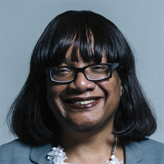 |
| Contact Details | Contact Ms Diane Abbott |
| Political Party | Labour |
What Council is the E8 2NH Postcode in?
The Local Council for this Postcode is Hackney London Boro Council and the County Council is Greater London Authority Council.
Greater London Authority Council is responsible for providing education, libraries and maintaining highways.
Hackney London Boro Council is responsible for duties such as council tax, rubbish collection, housing, environmental health and planning.
You can visit the website for Hackney London Boro at the following link Hackney London Boro.How much is the Council Tax?
Hackney London Boro Council is responsible for collecting council tax. This will vary depending on which council tax band the property falls within. You can check the council tax band at the gov.uk website.
Once you know the council tax band you can view how much Hackney London Boro charge for that band by visiting the The Council Tax section of their website.
Planning Applications
When moving house to a new post code it is worth checking out what will be built in the neighbourhood.
Few people want to live next door to a building site, have their garden overlooked or have the views from their property ruined.
Visit the local planning department and search for planning applications in this postcode granted within the last three years or still awaiting a decision. This will give an indication of what could still be built.
Where can I find out where the nearest Library to the E8 2NH Postcode is?
Libraries are the responsibility of Hackney council
Visit the link for more information. Please note that some councils outsource library services to private companies and community groups ran by volunteers.
Libraries | Hackney CouncilHouse Sales in E8 2NH
| Year | High | Low | Average | Sales |
|---|---|---|---|---|
| 2011 | £300,000 | £300,000 | £300,000 | 1 |
| 2012 | £285,000 | £285,000 | £285,000 | 1 |
| 2013 | £335,000 | £790,150 | £515,050 | 3 |
| 2014 | £409,000 | £409,000 | £409,000 | 1 |
| 2015 | £625,000 | £975,000 | £800,000 | 2 |
| 2017 | £455,000 | £455,000 | £455,000 | 1 |
| 2018 | £370,000 | £370,000 | £370,000 | 1 |
| 2019 | £825,000 | £426,000 | £586,200 | 5 |
| 2020 | £500,000 | £500,000 | £500,000 | 1 |
| 2021 | £485,000 | £360,000 | £422,500 | 2 |
| 2023 | £525,000 | £840,000 | £682,500 | 2 |
Contains HM Land Registry data © Crown copyright and database right 2024. This data is licensed under the Open Government Licence v3.0.
Postcodes near the E8 2NH Postcode
What Popular Supermarkets are near the E8 2NH Postcode?
| Supermarket | Distance | Directions |
|---|---|---|
| Sainsburys, Kingsland High Street, Hackney, LONDON, E8 2LX | 0.30 miles | Directions from E8 2NH to Sainsburys |
| Iceland, Kingsland High Street, Hackney, LONDON, E8 2LX | 0.30 miles | Directions from E8 2NH to Iceland |
| Aldi, Kingsland High Street, Hackney, LONDON, E8 2LX | 0.30 miles | Directions from E8 2NH to Aldi |
| Iceland, Mare Street, Hackney, LONDON, E8 1HY | 1.01 miles | Directions from E8 2NH to Iceland |
| Tesco, Morning Lane, Hackney, LONDON, E9 6ND | 1.20 miles | Directions from E8 2NH to Tesco |
What Popular Restaurants are near the E8 2NH Postcode?
| Burger King | Distance | Directions |
|---|---|---|
| 90 Whitechapel High Street, London, E1 7RA | 2.24 miles | Directions from E8 2NH to 90 Whitechapel High Street |
| Fenchurch St Station, London, EC3M 4AJ | 2.55 miles | Directions from E8 2NH to Fenchurch St Station |
| 27-29 Euston Road, London, NW1 2SD | 2.65 miles | Directions from E8 2NH to 27-29 Euston Road |
| Unit F, Leyton Mills Retail Park, London, E10 5QF | 2.69 miles | Directions from E8 2NH to Unit F, Leyton Mills Retail Park |
| Mcdonald's | Distance | Directions |
|---|---|---|
| McDonald's, Kingsland High Street, Hackney, LONDON, E8 2JP | 0.25 miles | Directions from E8 2NH to McDonald's, Kingsland High Street, Hackney, LONDON, E8 2JP |
| McDonald's, Mare Street, Hackney, LONDON, E8 1HY | 0.63 miles | Directions from E8 2NH to McDonald's, Mare Street, Hackney, LONDON, E8 1HY |
| McDonald's, Upper Street, Islington, LONDON, N1 1RU | 1.45 miles | Directions from E8 2NH to McDonald's, Upper Street, Islington, LONDON, N1 1RU |
| McDonald's, Bethnal Green Road, Tower Hamlets, LONDON, E2 0DJ | 1.54 miles | Directions from E8 2NH to McDonald's, Bethnal Green Road, Tower Hamlets, LONDON, E2 0DJ |
| Restaurant | Distance | Directions |
|---|---|---|
| KFC, Kingsland High Street, Hackney, LONDON, E8 2NS | 0.23 miles | Directions from E8 2NH to KFC Dalston - Kingsland High Street |
| KFC, Mare Street, Hackney, LONDON, E8 1EJ | 0.64 miles | Directions from E8 2NH to KFC Hackney - Mare Street |
| KFC, Stoke Newington High Street, Hackney, LONDON, N16 7JD | 0.96 miles | Directions from E8 2NH to KFC Stoke Newington - High Street |
| KFC, Upper Street, Islington, LONDON, N1 1RU | 1.45 miles | Directions from E8 2NH to KFC Highbury - Upper Street |
| KFC, Bethnal Green Road, Tower Hamlets, LONDON, E2 0DJ | 1.54 miles | Directions from E8 2NH to KFC Bethnal Green |